 Trail
TrailEast Zion Adventures
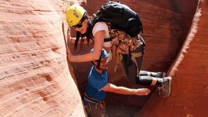
Slot canyon expedition from Orderville: scrambling, wading, and rappelling options—4–8 hours, guided.
900 ft elev. gain
View details →
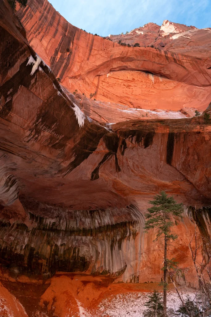
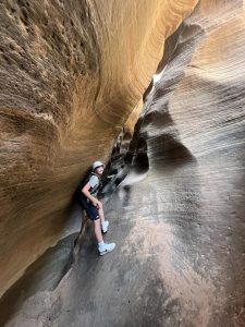
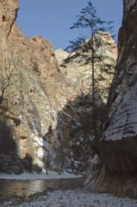
Taylor Creek Trail descends into a narrow box canyon where you'll scramble over boulder steps up to 26 inches high and cross the creek multiple times—spring and winter crossings are cold. The 5.2-mile round trip gains 800 feet and tests scrambling confidence; the payoff is the Double Arch Alcove, a natural sandstone formation sculpted by erosion. Historic homestead cabins from the 1930s mark the wilderness transition. This is not a walk in the park; this is grit.
Moderate with technical scrambling challenges
Double Arch Alcove features natural rock openings carved by erosion in towering Navajo sandstone walls—dramatic frame and shelter from sun. Two historic homestead cabins built in the early 1930s appear 0.3 miles before the alcove, marking the wilderness boundary. The narrow canyon provides visual drama and periods of shade relief.
• Fill your water bottle completely at the Visitor Center before starting—don't underestimate thirst on the climb out. • Boulder steps require careful foot placement; don't rush. Stop and plan each step before committing weight. • Spring water is shockingly cold (40-50°F); neoprene socks make creek crossings tolerable. Without them, your feet will be numb for the rest of the hike. • The homestead cabins appear around Mile 2.3 (one way)—they signal you're close to the alcove payoff. • Turn back immediately if dark clouds develop; flash flood risk in the narrow canyon is real and fast. • The descent through boulder fields is harder on knees than the ascent; use trekking poles, go slow. • Bring a headlamp even for day hikes—getting delayed in the canyon at dusk is dangerous. • The Kanarraville Fold geologic feature is visible partway up; it's an easy landmark for pacing yourself.
Late spring through early fall (May through October). Winter crossings are icy; summer heat is intense at lower elevations. Autumn (September-October) offers most stable weather and comfortable temperatures.
Boulder steps up to 26 inches high demand careful footing and scrambling confidence—challenging for children under 10. Cold creek crossings can be shocking for young hikers; spring water runs 40-50°F. Group size limit of 12 people. Older kids (12+) with solid hiking experience and scrambling skills may enjoy this if closely supervised on technical sections. Not recommended for families wanting a casual walk.
Hikers report this trail as genuinely moderate difficulty but with serious technical challenges that separate casual walkers from committed hikers. Boulder scrambling and mandatory creek crossings are not trivial. Those who complete it consistently praise the Double Arch Alcove payoff and wilderness solitude; they say wet feet and burning quads are worth the effort.
No permit required. Wilderness Rules apply: Group size strictly limited to maximum 12 people that share the same affiliation (family, friends, club, school, colleagues, or combination thereof). Groups exceeding this limit cannot split up and hike the same drainage on the same day.
No shuttle service in Kolob Canyons. Self-drive required. Parking at Taylor Creek Trailhead. Kolob Canyons section is separate from Zion Canyon with no connecting shuttle service; allow 1 hour travel time between the two areas.
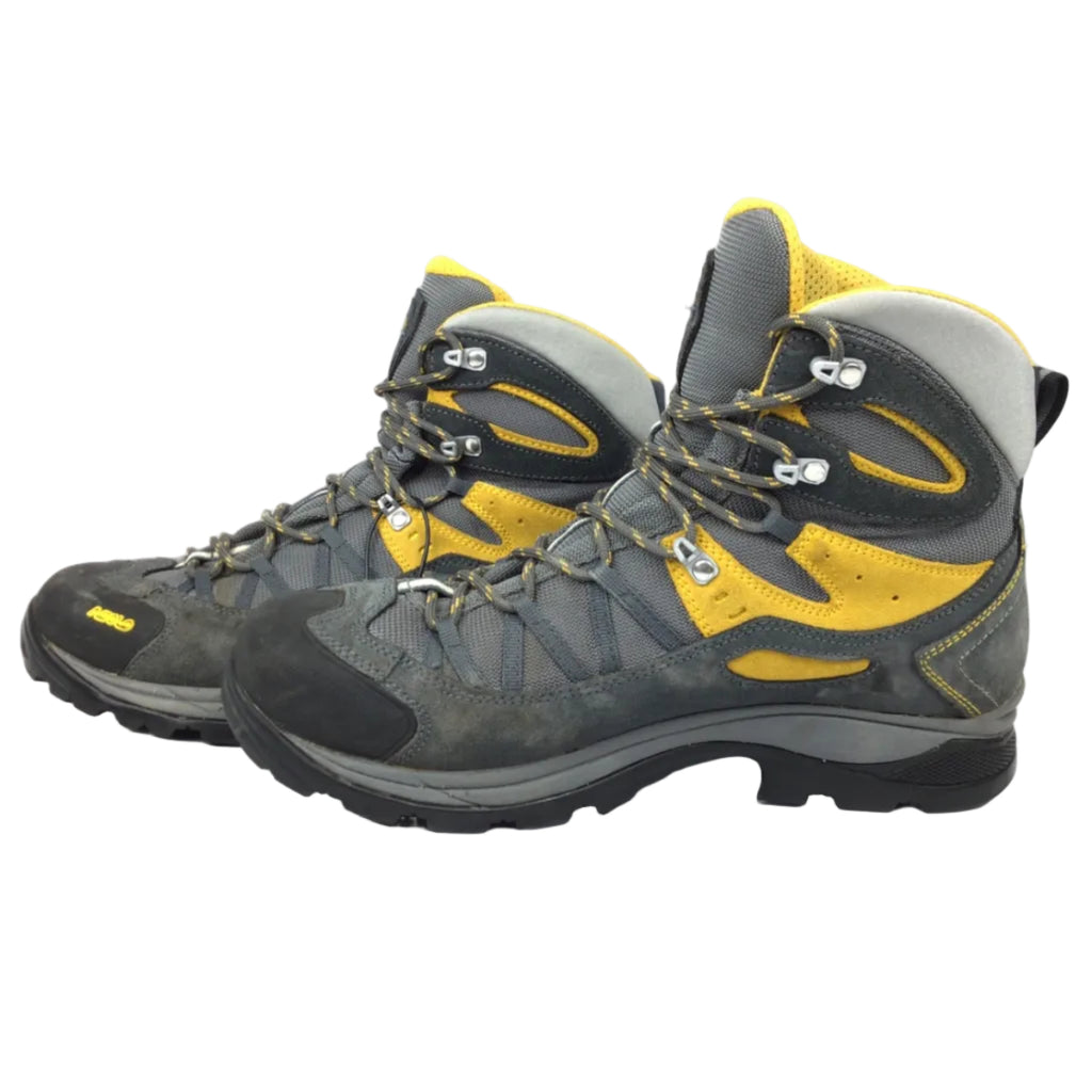
Boulder obstructions create steps up to 26 inches tall with gaps up to 7 inches wide—requires scrambling confidence and careful foot placement. Creek crossings are mandatory and frequent; water depth changes seasonally. Spring and early summer water is cold (40-50°F) and will soak your feet. Steep grades reach 55%, with 31% of trail exceeding 10%—demands trekking poles for descent. Tread width narrows to 12 inches in places; exposed edges exist. Rock is slippery when wet. Flash flood risk is real in the narrow canyon during heavy rain. Upper sections have zero shade; sun exposure is significant. Cross-slopes reach 25.7%.
Rooty and steep. Boulder steps (26-inch maximum with 7-inch gaps), narrow tread (minimum 12 inches in places), cross-slopes up to 25.7%, grades to 55%. Not wheelchair or even crutch-friendly. Scrambling ability and confidence on exposed rock required.
Boulder steps up to 26 inches high demand careful footing and scrambling confidence—challenging for children under 10. Cold creek crossings can be shocking for young hikers; spring water runs 40-50°F. Group size limit of 12 people. Older kids (12+) with solid hiking experience and scrambling skills may enjoy this if closely supervised on technical sections. Not recommended for families wanting a casual walk.
Kolob Canyons Visitor Center provides water, restrooms, and maps. Pit toilets at Taylor Creek Trailhead, South Fork parking, and Kolob Canyons Viewpoint. No food, lodging, or supplies at trailhead. Nearest town services: New Harmony, Utah (15 minutes by car) offers grocery stores, gas, and lodging.
Hikers report this trail as genuinely moderate difficulty but with serious technical challenges that separate casual walkers from committed hikers. Boulder scrambling and mandatory creek crossings are not trivial. Those who complete it consistently praise the Double Arch Alcove payoff and wilderness solitude; they say wet feet and burning quads are worth the effort.
" Hikers report this trail as genuinely moderate difficulty but with serious technical challenges that separate casual walkers from committed hikers. Boulder scrambling and mandatory creek crossings are not trivial. Those who complete it consistently praise the Double Arch Alcove payoff and wilderness solitude; they say wet feet and burning quads are worth the effort."
Yes, moderate difficulty with technical challenges. The 800-foot gain and boulder scrambling aren't extreme, but they're not trivial. If you've done Angels Landing or similar scrambles, you can handle this. If you're a first-time hiker, start with easier trails like Pa'rus Trail in main Zion Canyon first.
Mandatory and frequent. In spring and early summer, water is cold (40-50°F) and knee-deep. You will get wet feet. Wear neoprene socks or accept the cold. Fall and late summer crossings are shallower and warmer. Winter crossings are icy and require crampons or serious caution.
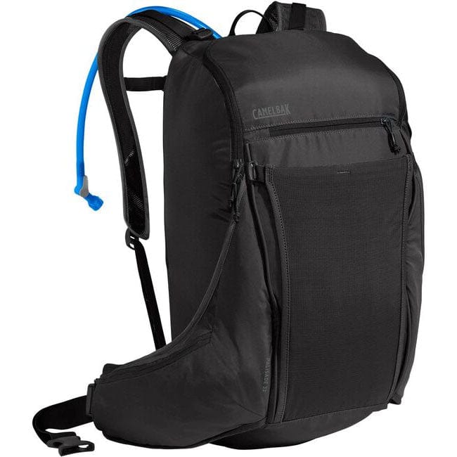
Highly recommended, almost mandatory. The boulder descent is tough on knees and ankles. Poles reduce impact and help with balance on slippery rock. Don't skip them.
Yes, but not recommended for safety. If you do solo, tell someone your exact plan and expected return time, carry a whistle, and start early. Cell service is spotty; assume you're on your own if injured.
Late September through October (autumn) is ideal: stable weather, cooler temperatures, manageable water levels, and solitude. May is good but busier and water is cold. Avoid winter (icy crossings) and summer heat. Spring is beautiful but creek water is shocking.
Yes. The trail is established and marked with cairns, but a topographic map or downloaded GPS track is smart for wilderness hiking. Zion paper maps are available at the visitor center. Don't rely only on memory or guidebook descriptions.
6 listings
4 listings
Information is compiled from official sources, verified traveler reviews, and editorial research. Learn how YourNPGuide works →
Notifications