+2 more
1 / 5
Olympic National Park
Last Updated: March 2026
Overview
About This Park
Olympic National Park spans coast, rainforest, and alpine terrain and operates year-round, but expect seasonal road closures and limited services. The park requires standard passes (no timed-entry) and printed digital passes; roads and weather can change plans in an instant. The main rule: carry a valid pass, monitor road conditions, and keep wildlife (and pets) in check.
Why Visit
The park is a triad of environments: temperate rainforest on the western side, rugged alpine terrain in the interior, and a wild coast with beaches along the Olympic coastline. It demands you plan around variable weather and seasonal road openings, then execute with precision to experience its scale. It is not about novelty; it is about confronting differences in climate, terrain, and isolation within a single basin.
Highlights
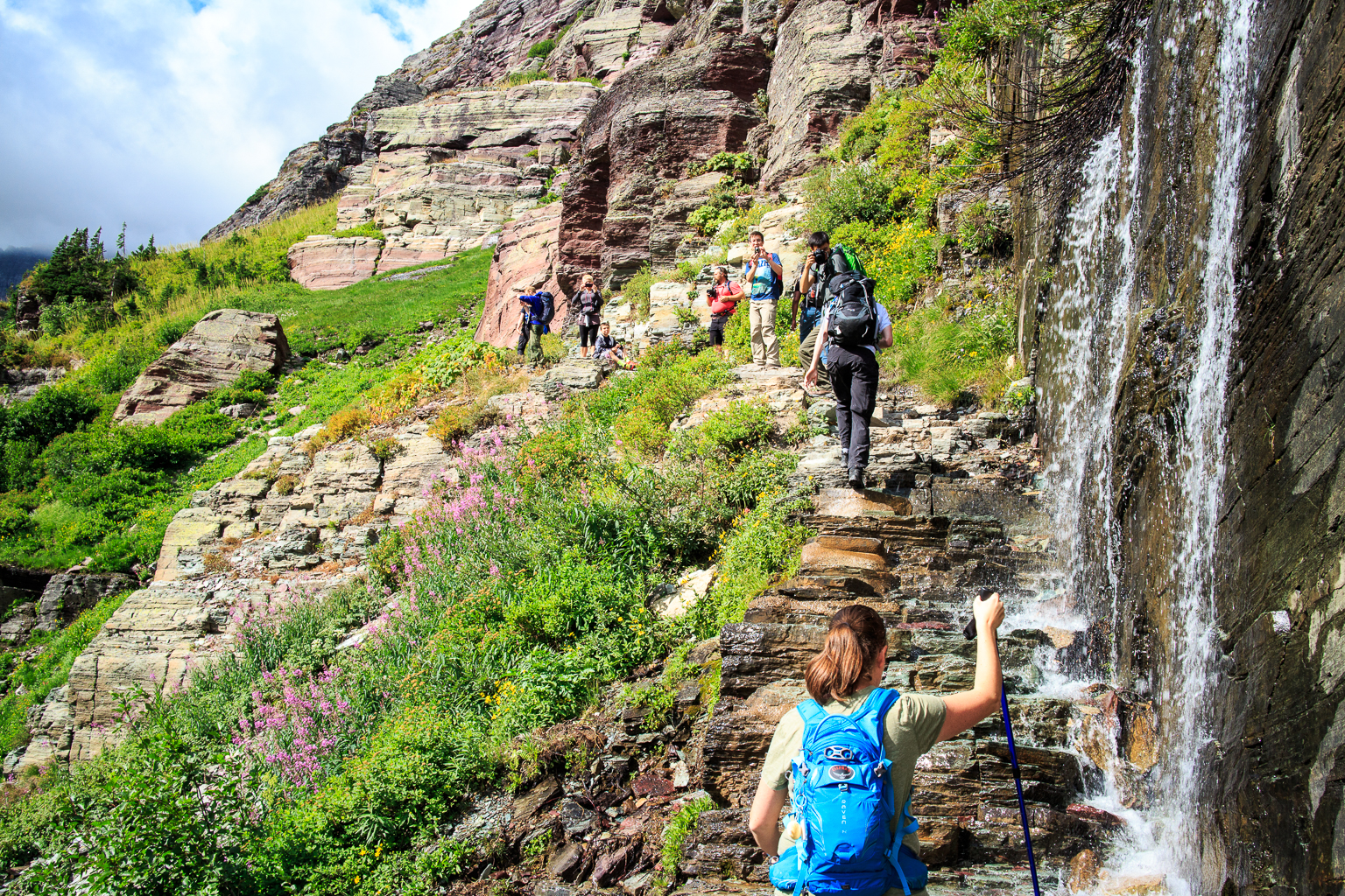
Top Things to Do
Rialto Beach and Second Beach coast walks; Hurricane Ridge summit drive for views; Hoh Rain Forest Hall of Mosses trail; Lake Crescent and Marymere Falls; Sol Duc Falls trail; Olympic Discovery Trail sections
Family Friendly
Junior Ranger programs available; easy walks on boardwalks exist in some areas; plan for stroller-accessible segments around visitor centers
Accessibility
Visitor centers offer ADA-accessible facilities; some trails and facilities are accessible, but not all park areas are fully accessible
Photography Tips
Keep roads clear; pull off only at designated overlooks; respect closed areas; dawn/dusk light in coastal and rainforest zones
Best Time to Visit
Sensible windows: late spring to early fall for broad access; anticipate closures in winter, especially coastal routes
Nearby Services
Gas stations, medical facilities, groceries in Port Angeles and gateway towns
Tips & Advice
- Buy pass online; print it
- Shuttles not mandatory
- Don’t feed wildlife
- Arrive early for popular trailheads
Park Strategy
The 3-Day Plan
Day 1: Hurricane Ridge; Day 2: Hoh Rain Forest + Ruby Beach; Day 3: Lake Crescent + Sol Duc; Week: combine coastal and rainforest routes with backcountry permit planning
Traffic Beater
Main parking fills early; use alternate trailheads and plan for longer drives between sections; check road closures daily
Where to Sleep
WEST SIDE offers more dining options and more rain; EAST SIDE has longer views and wind; plan to split your stay if possible
The Timing
July is busiest; September becomes quieter; June can be snowy on some roads; plan ahead for closure durations
ℹ️ Data Sources
nps.gov youtube.com alibaba.com myolympicpark.com allolympicpark.com outdoorsy.com cruiseamerica.com iucn.org terravistachalet.com thekalalochlodge.com wikipedia.org recreation.gov olympicparkadvocates.org rvshare.com wnpf.org Google Reviews National Park Service YourNPGuide Editorial
Information is compiled from official sources, verified traveler reviews, and editorial research. Learn how YourNPGuide works →