Mountains & Peaks of Glacier National Park
Glacier National Park holds more than 150 named peaks above 8,000 feet across three mountain ranges — the Lewis Range, the Livingston Range, and the Clark Range. From the sacred isolated butte of Chief Mountain to the park’s highest summit at 10,466 feet, each peak tells a distinct story of geology, culture, and adventure.
This guide covers the 9 most notable mountains in the park — ranked by visitor interest and landmark significance, from iconic roadside landmarks to serious technical summits. Entrance fees are $35 per vehicle per NPS.gov (valid 7 days). Note (March 2026): Going-to-the-Sun Road is currently under its seasonal closure — check current conditions before visiting Logan Pass.
- Mount Cleveland (10,466 ft) is the highest peak in the park and requires a multi-day backcountry permit to attempt.
- Chief Mountain is the most culturally significant — a sacred site for the Blackfeet Nation for thousands of years.
- Reynolds Mountain is the most accessible summit: a Class 2–3 day hike starting from Logan Pass Visitor Center.
- Most peaks are visible from park roads — you don’t need to climb to appreciate them.
- Backcountry permits are required for any overnight stay; reserve at Recreation.gov.
Chief Mountain (Nínaiistáko)
Isolated Butte
Visible from US-89
Chief Mountain (Blackfeet: Nínaiistáko) stands apart from the main Lewis Range as a solitary limestone butte on the park’s eastern border. Its abrupt 5,000-foot rise directly from the Great Plains creates a silhouette visible for miles across the Blackfeet Indian Reservation.
Per Wikipedia, the mountain has been sacred to the Blackfeet Nation for hundreds of years as a site for vision quests, prayer, and ceremonial offerings. Researchers have identified over 50 ancient structures on surrounding mountaintops. The Piikáni regard it as the holiest mountain in their territory — a source of great spiritual power.
Most visitors view Chief Mountain from the Chief Mountain International Highway (US-89 north toward the Canadian border crossing). A roadside pullout offers the classic isolated profile view. The mountain is not a standard visitor hike — all routes require serious off-trail navigation and technical fitness.
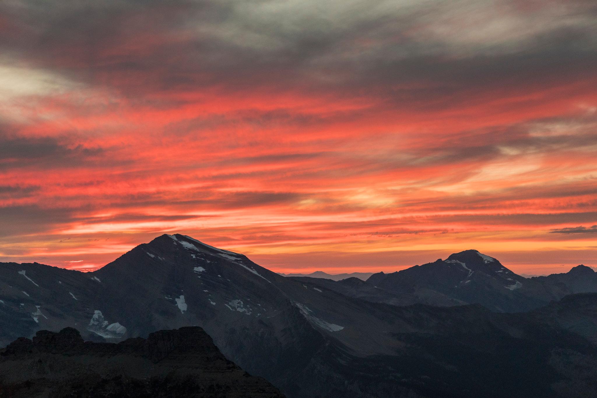
Heavens Peak
Historic Fire Lookout
First Ascent 1924
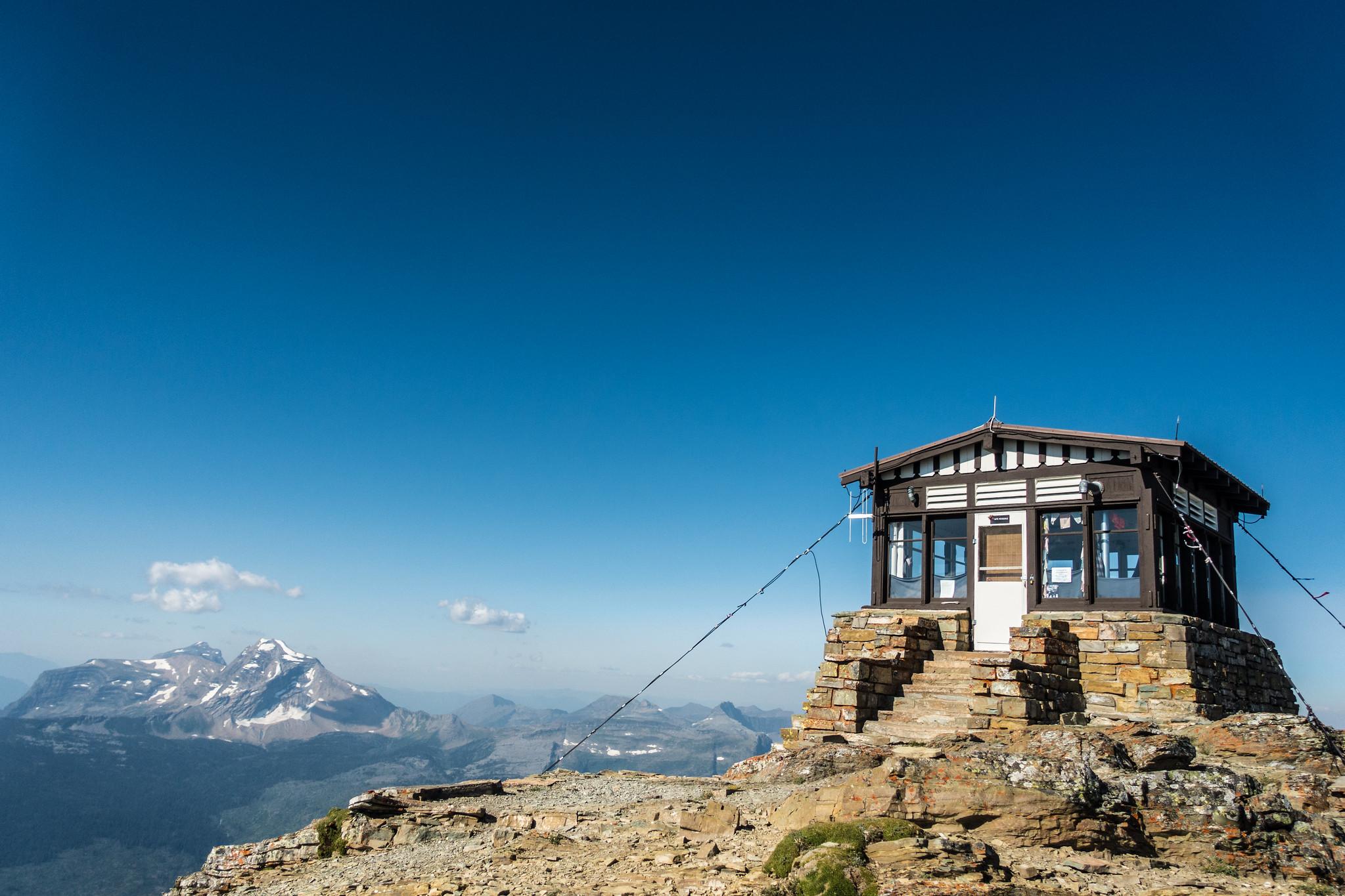
Per SummitPost, Heavens Peak (8,991 ft) was first summited on July 15, 1924 by legendary mountaineer Norman Clyde alongside Fred Herz and Lee Stopple. A historic fire lookout sits near the summit, accessible only by an unmaintained, brutally steep route.
All routes to the summit involve 5,000+ feet of elevation gain and Class 4 terrain — not a casual hike by any measure. However, the peak is impossible to miss from the Loop trailhead area on Going-to-the-Sun Road, where it rises nearly a vertical mile above the valley in one dramatic sweep.

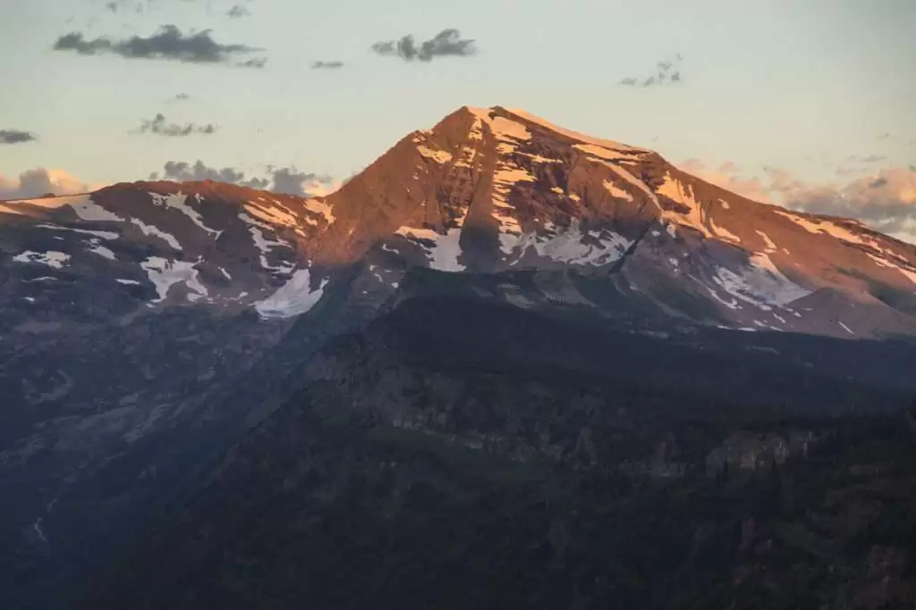
St. Mary Views
Lewis Range
The mountain’s name originates from a Blackfeet legend of Sour Spirit, a supernatural being who descended from the sun to teach the Blackfeet people. That name was applied to the road in the 1930s, making this arguably the most mythologized peak name in any U.S. national park.
Per NPS.gov, the park’s mountains were formed from sedimentary rocks over 1.5 billion years old — among the oldest exposed rocks in North America. Going-to-the-Sun Mountain is a serious technical objective, but its visual presence is accessible to every visitor who drives the road’s east side.
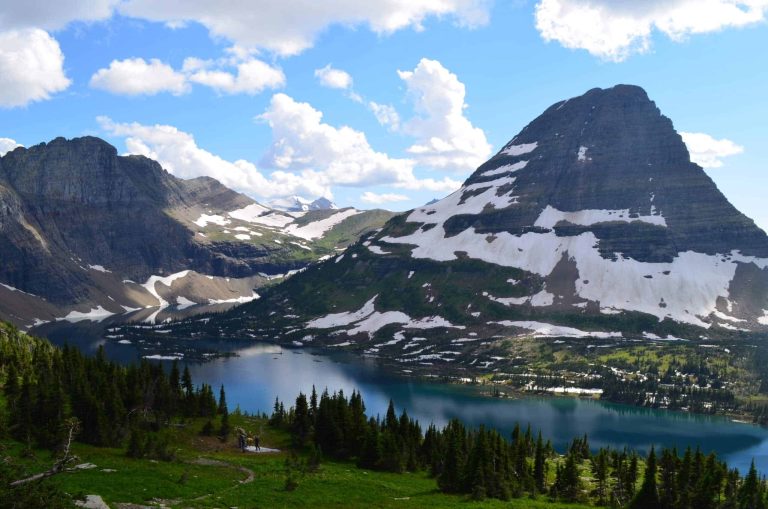
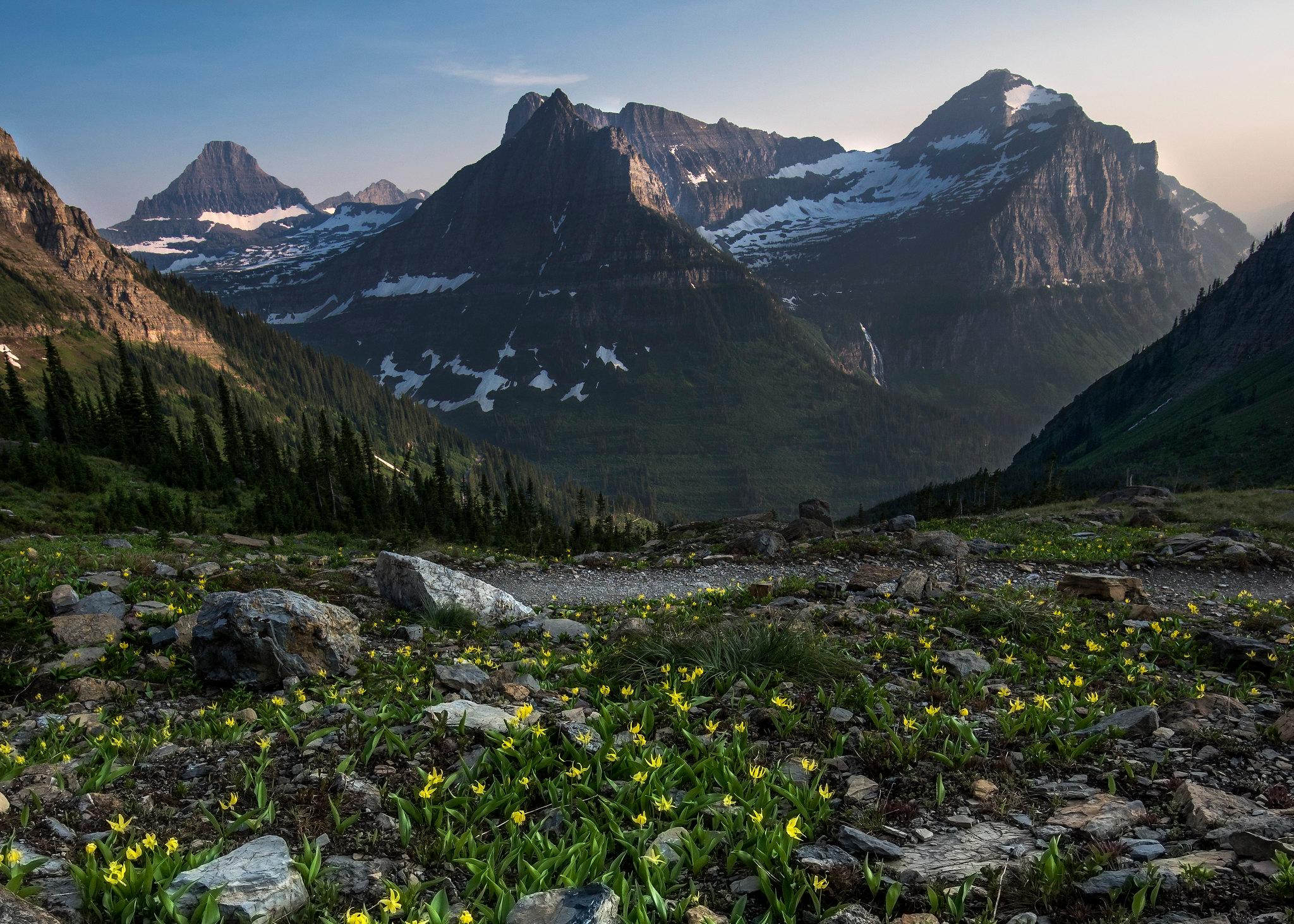
Reynolds Mountain
Logan Pass Start
5.5 mi one-way
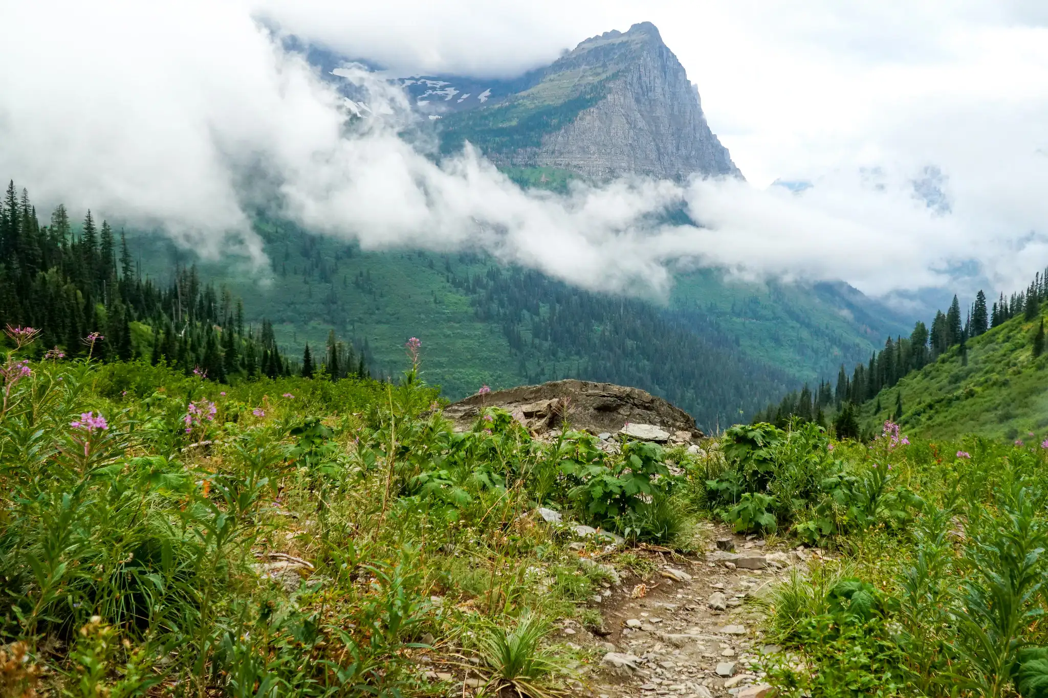
Per AllTrails, the route begins at the Logan Pass Visitor Center and follows the Hidden Lake Trail before departing cross-country across talus and alpine terrain. The one-way distance is approximately 5.5 miles with 2,700+ feet of elevation gain.
The summit ridge sits directly above Hidden Lake, offering views of the lake below, Clements Mountain to the north, and the Garden Wall ridge. The route involves Class 2–3 talus scrambling — sturdy boots and basic route-finding skills are required. Logan Pass parking fills before 9 AM in peak season; arrive before 7 AM or use the park’s free shuttle service.
Bearhat Mountain
Day Hike
First Ascent 1923
Bearhat Mountain (8,684 ft) was first summited by Norman Clyde in 1923. Per Flathead Beacon, the standard climbing route is Class 2–3 with approximately 2,600 feet of elevation gain from Logan Pass, ascending from the far shore of Hidden Lake.
Even without summiting, the Hidden Lake Overlook trail — a 1.5-mile walk from Logan Pass Visitor Center — frames Bearhat Mountain above the turquoise lake perfectly. Mountain goats frequently graze on the slopes visible from this trail, making it one of the park’s highest-reward short hikes.

Clements Mountain
Highline Trail Views
Logan Pass Area
Clements Mountain (8,760 ft) flanks the west side of Logan Pass and is one of the defining shapes in the park’s most-visited corridor. The summit is a technical climb with mixed rock terrain — not a casual scramble — but its visual dominance from Logan Pass makes it one of the most-seen summits in the entire park.
From the Highline Trail — which traverses the Garden Wall north of Logan Pass — Clements and Reynolds mountains bracket the pass below, offering a dramatically different perspective than the road-level view. The west side of Glacier concentrates many of the park’s most visitor-accessible peaks within a compact area.
Mount Cleveland
Class 3
Backcountry Permit Required
Per Wikipedia, Mount Cleveland (10,466 ft / 3,190 m) is the highest mountain in the Lewis Range and the park’s tallest summit. It sits in the remote far north of the park near Waterton Lakes National Park in Canada.
Access from the U.S. typically begins at the Chief Mountain Customs trailhead via the Belly River Trail. The route involves approximately 30 km round-trip with over 2,000 m of cumulative elevation gain, and only two of the eight miles from Goat Haunt follow established trails. Per SummitPost, successful attempts require multi-day backpacking experience, advanced route-finding, and serious physical preparation.
Mount Stimson
Class 3–4
SW Backcountry
Per Wikipedia, Mount Stimson (10,147 ft / 3,093 m) lies approximately 12 miles west of the Continental Divide in the park’s remote southwest section. The approach involves roughly 21 miles with over 6,000 feet of elevation gain — plus multiple water crossings that are dangerous during snowmelt season (May through June).
The standard climbing route follows the Class 3 Southeast Ridge from the saddle between Stimson and Mount Pinchot. The west face offers an alternate Class 3–4 line. Per SummitPost, most parties plan 4–6 days for the full expedition given the approach length and technical demands.
Kintla Peak
Class 4
Northwest Backcountry
Per Wikipedia, Kintla Peak (10,106 ft / 3,080 m) lies in the park’s northwest corner, requiring approximately 15 miles of travel from the nearest road just to reach the mountain’s base. The standard Southeast Ridge Route from the Agassiz Glacier basin involves Class 4 rock scrambling plus snow climbing depending on season.
The peak shares a backcountry zone with Kinnerly Peak (another 10,000-foot Livingston Range summit) and offers one of the most remote wilderness experiences in any national park in the contiguous U.S. Round-trip is typically 30+ miles over 4–5 days. Per SummitPost, experienced mountaineers who make the commitment are rewarded with glaciated views that almost no other park visitors ever see.
Some links below are affiliate links.
Glacier’s Three Mountain Ranges: Quick Reference
Per NPS.gov, Glacier’s mountains were carved from sedimentary rock over 1.5 billion years old — among the oldest exposed rock surfaces in North America. Three distinct ranges define the park’s terrain:
| Range | Location in Park | Notable Peaks | Highest Summit |
|---|---|---|---|
| Lewis Range | Central — includes GTTS Road corridor and Logan Pass | Reynolds, Bearhat, Clements, Mt. Cleveland, Mt. Stimson | Mount Cleveland (10,466 ft) |
| Livingston Range | Western — west of North Fork of Flathead River | Kintla Peak, Kinnerly Peak, Heavens Peak, Going-to-the-Sun Mtn | Kintla Peak (10,106 ft) |
| Clark Range | Southern boundary area | Various boundary ridgelines and unnamed summits | ~9,000 ft range |
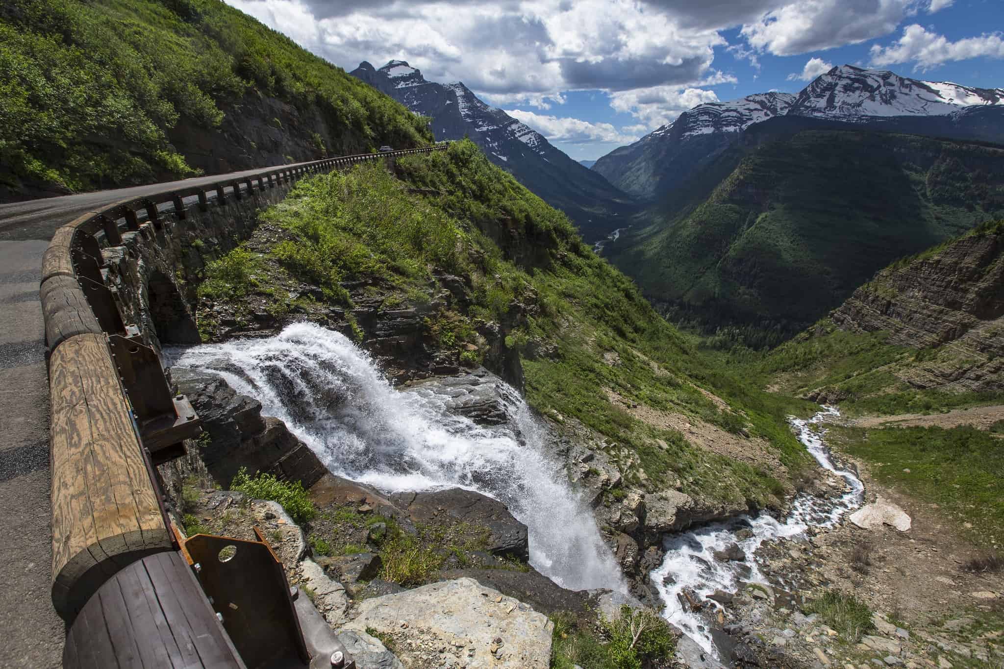
Glacial erosion over two million years carved the dramatic cirques, arêtes, and U-shaped valleys visible from every major viewpoint in the park. The Continental Divide runs through the Lewis Range, with Logan Pass (6,646 ft) as the highest road crossing — a key staging point for most visitor peak-viewing experiences.


Frequently Asked Questions
What is the highest mountain in Glacier National Park?
Which mountains in Glacier National Park can regular hikers summit?
Which mountains are visible from Going-to-the-Sun Road?
Why is Chief Mountain considered sacred?
How many named peaks are in Glacier National Park?
How We Researched This Guide
- NPS.gov — Glacier National Park official mountains overview, entrance fees, and road conditions
- Wikipedia — Peak elevations, mountain range assignments, and first ascent history
- SummitPost — Climbing route descriptions, difficulty ratings, and approach details for all technical peaks
- AllTrails — Trail distances and community-verified conditions for Logan Pass routes
- Flathead Beacon — Local reporting on Bearhat Mountain and Hidden Lake access
- Peakbagger.com — Comprehensive peak lists and prominence data for Glacier National Park
Elevation figures may vary slightly between measurement sources (USGS vs GPS). Climbing difficulty ratings reflect standard conditions — actual difficulty varies significantly by season and snowpack. Always verify current NPS alerts before backcountry travel.
Ready to explore Glacier’s mountains? Check the official NPS Glacier page for current road conditions, permit availability, and seasonal alerts…