4-Day Glacier National Park Itinerary
Four days west to east: cross Glacier's wildest passes, turquoise lakes, and alpine summits via the legendary Going-to-the-Sun Road.
Glacier spans 1.01 million acres across Montana's northern border, a jagged spine of 175 named peaks dropping into 131 pristine lakes. The landscape pivots from temperate cedar forests on the west to windswept alpine tundra on the east, all linked by a single ribbon of asphalt.
- 1M Acres
- 745 Miles of trails
- 131 Named lakes
- 26 Glaciers
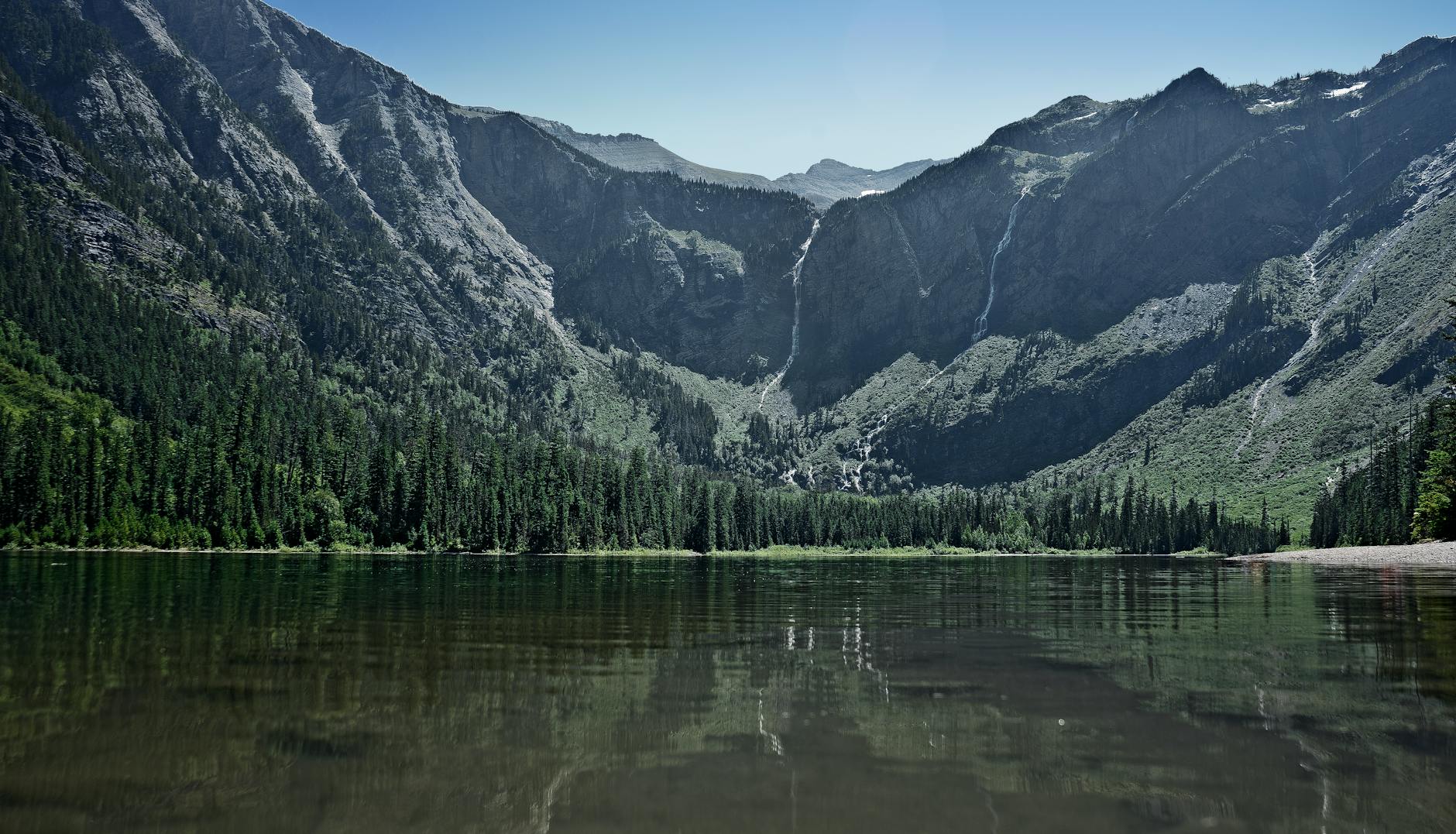
Day 1: West Glacier & Avalanche Lake
Stay: Lake McDonald Lodge (opens May 15) or Apgar Village Lodge on the scenic west side.
These iconic west-side trails ease you into Glacier, from peaceful old-growth forest to stunning turquoise alpine lake and cascading waterfalls.
- Start with the 0.9-mile boardwalk on Trail of the Cedars, winding through old-growth western hemlock and cedar forest along Avalanche Creek's roaring gorge.
- Then tackle the 2.3-mile ascent to Avalanche Lake, a pristine glacial-fed turquoise basin ringed by 2,000-foot cliff walls and fed by waterfalls from the surrounding cirque.
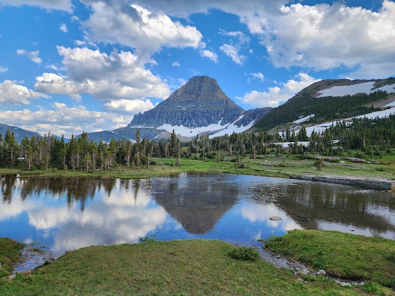
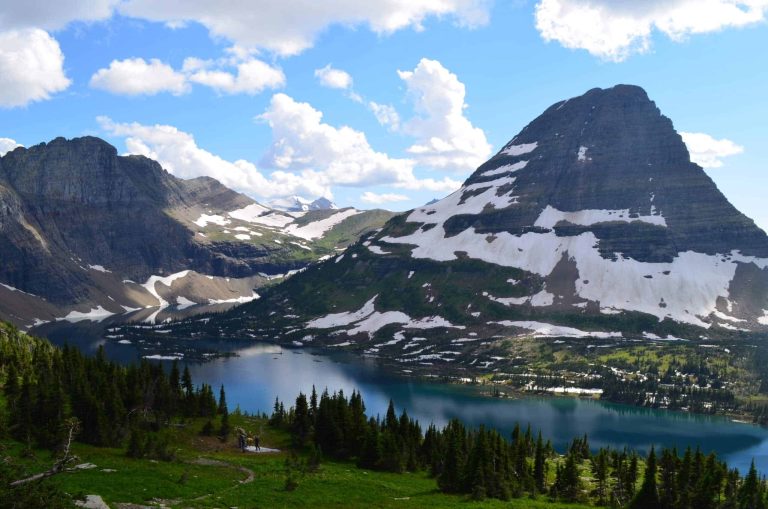
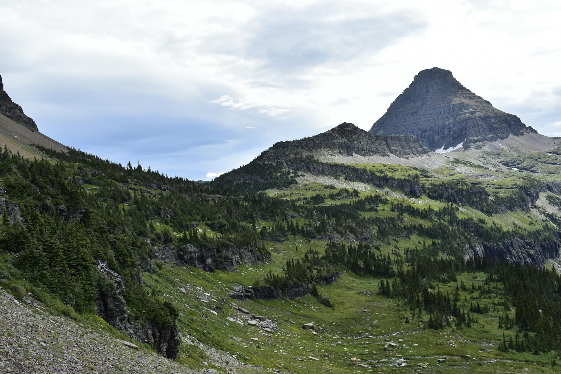
Day 2: Going-to-the-Sun & Hidden Lake Overlook
Stay: Many Glacier Hotel (opens June 5) on the east side, the hub for alpine hiking and boat tours.
Going-to-the-Sun Road is Glacier's most celebrated drive, and Hidden Lake Overlook is the park's quickest alpine payoff—sweeping views of turquoise lakes and windswept tundra within 2 hours.
- Drive the full 52-mile Going-to-the-Sun Road from Apgar to Rising Sun, climbing 3,200 feet over 25 miles to Logan Pass at 6,646 feet.
- The road winds through dense forest, past turquoise lakes, and through wild subalpine terrain.
- At Logan Pass, hike the 1.3-mile Hidden Lake Overlook trail, a steep alpine tundra walk with views down to Hidden Lake's turquoise expanse and frequent sightings of mountain goats.
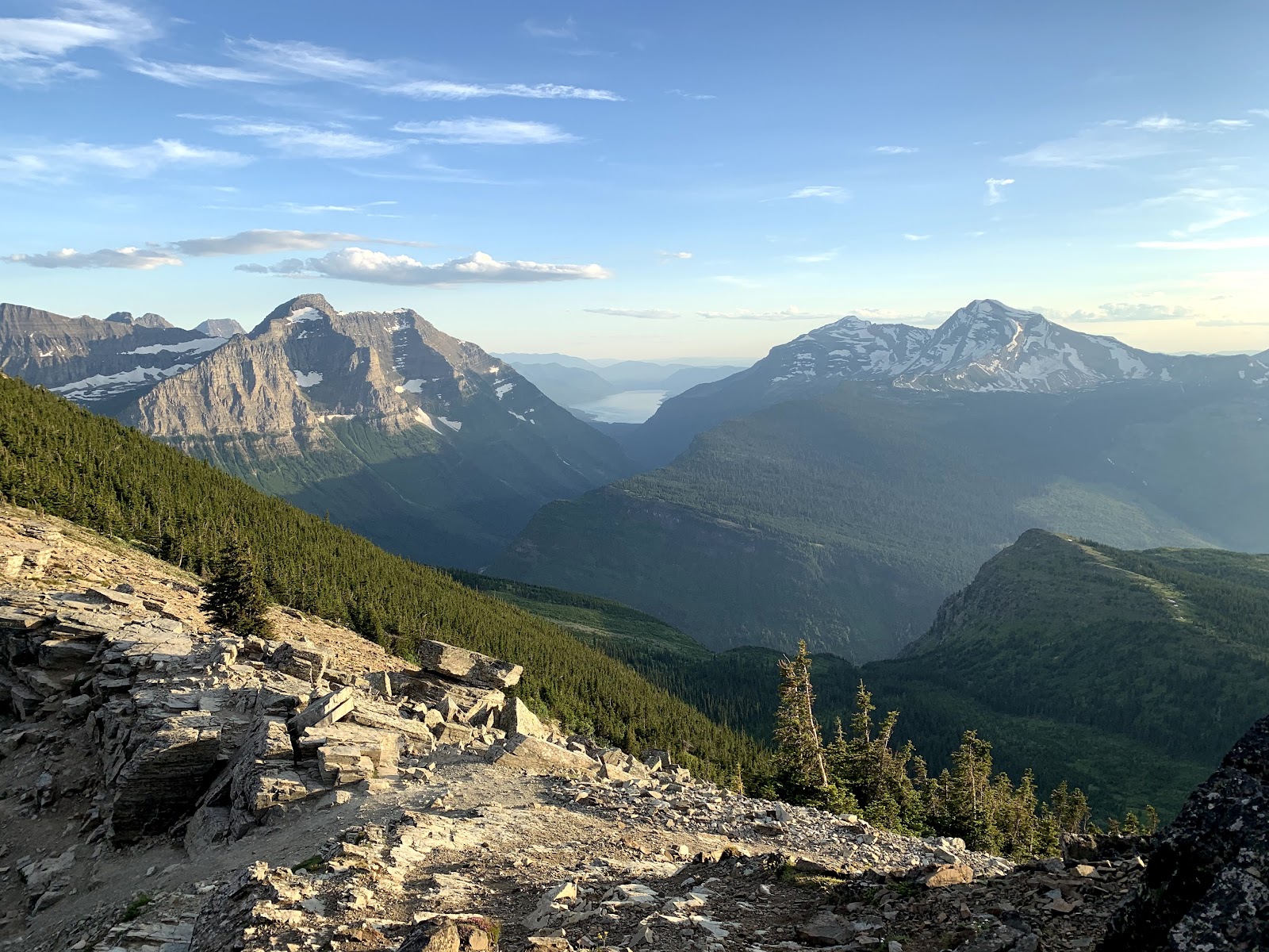
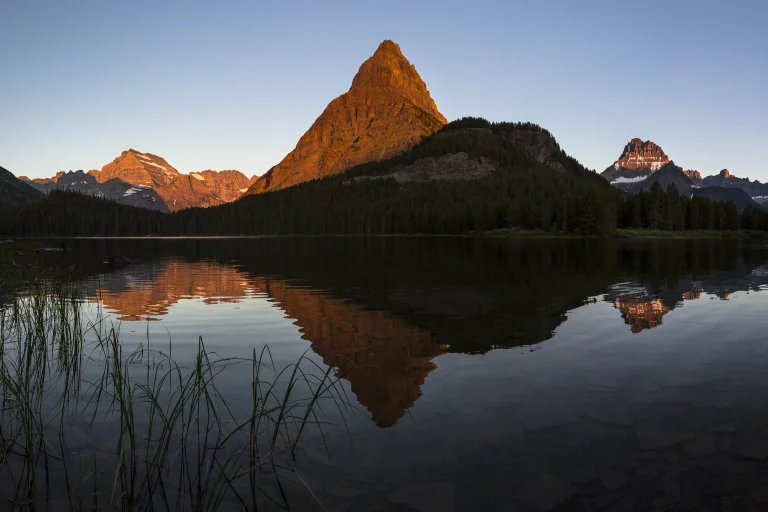
Day 3: Many Glacier & Grinnell Glacier
Stay: Stay at Many Glacier Hotel, the park's largest lodge, immersed in the alpine hiking hub.
Historic boat shuttles across two glacial lakes cut your hike in half and deliver you to views of an active glacier—one of Glacier's most dramatic day routes.
- Start at Many Glacier Hotel and board the historic wooden "Chief Two Guns" boat across turquoise Swiftcurrent Lake (25 minutes), then walk 400 yards to board the "Morning Eagle" across Lake Josephine (15 minutes).
- From the dock, hike 3.7 miles and 2,461 feet to Grinnell Glacier, passing turquoise Grinnell Lake and climbing a rocky cirque to views of blue glacier ice and subalpine wildflower basin.
- The boat shortcut saves 1.3 miles each way versus hiking from the trailhead.
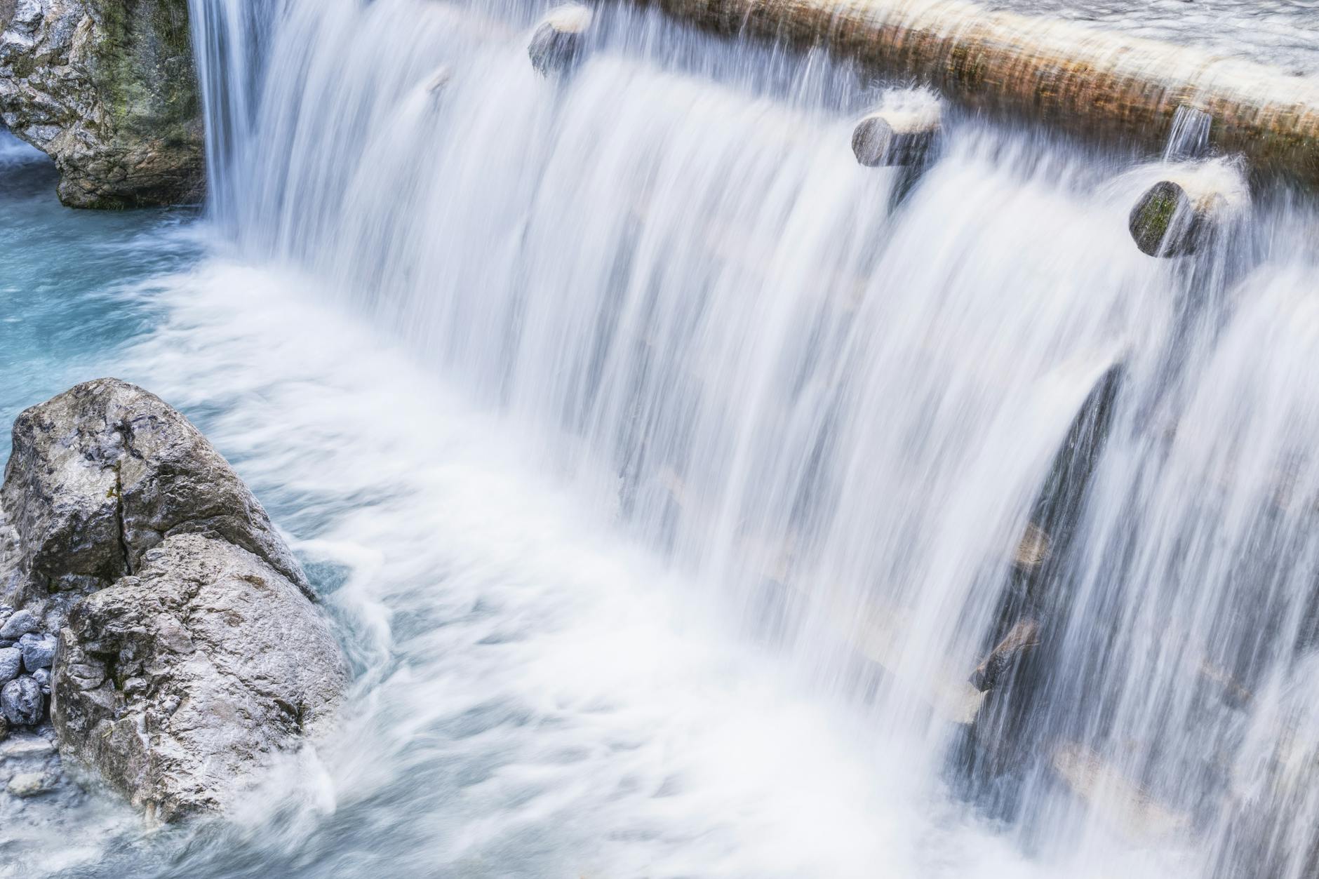
Day 4: St. Mary Waterfalls & Departure
Stay: If extending, St. Mary Village (outside the park) offers lodging; otherwise, head to your exit highway.
These short, powerful waterfall hikes on the east side are perfect for a final morning before departure, showcasing the park's water features and canyon geology.
- Start your final Glacier morning at St. Mary Falls, either from the convenient shuttle stop (0.8 mi one-way) or the main St. Mary Falls Trailhead (1.2 mi one-way), descending 260 feet through lodgepole forest to a narrow gorge where the falls crash through glacier-carved rock.
- If time allows, continue to Virginia Falls (1.8 mi total) for a second cascade.
- Both hikes lose elevation, making them perfect easy finales before the drive home.
Common Questions
When can I drive the full Going-to-the-Sun Road?
Going-to-the-Sun Road typically opens mid-June to early July, but the exact opening date cannot be predicted by NPS and depends entirely on snow conditions. For guaranteed full-road access, plan your trip for July–September. Even after the road opens, alpine trail sections like Hidden Lake Overlook and Highline may remain snow-covered until late July.
Do I need a shuttle ticket for Logan Pass?
Starting July 1, 2026, yes. A $1 shuttle ticket per person is required for any vehicle parking at Logan Pass. Parking is limited to 3 hours. Tickets release 60 days in advance on recreation.gov (May 2 for the first batch). Without a ticket, park rangers will ask you to move your vehicle after 3 hours.
Can I hike Grinnell Glacier without the boat tour?
Yes, but the boat saves 2.6 miles of hiking and 1,040 feet of elevation gain. Boats run June 10–September 19 (tickets $15–18). Without the boat, the full hike is 10.6 miles round-trip with 4,000+ ft gain—a full 8–9 hour day instead of 5–6 hours with the shuttle.
What's the easiest way to see waterfalls in Glacier?
St. Mary Falls (0.8 mi one-way, downhill) on Day 4 is the easiest. Baring Falls (0.3 mi, very easy) is even shorter if you stop at the Sunrift Gorge pullout on your way out of the park.
Are campgrounds easier to book than lodges?
No. All lodging—campgrounds and hotels—books 13 months in advance. Many Glacier Campground and popular west-side sites (Apgar, Avalanche) fill immediately. Sites open January 2 for the full year; reserve the same day to secure peak-season dates.
Sources & Further Reading
- Plan Your Visit - Glacier National Park — National Park Service
- Going-to-the-Sun Road General Info — National Park Service
- Logan Pass Shuttle Service 2026 — National Park Service
- Vehicle Reservations in 2026 — National Park Service
- Fees & Passes - Glacier National Park — National Park Service
- Fact Sheet - Glacier National Park — National Park Service
- Avalanche Lake Trail — National Park Service
- Trail of the Cedars — National Park Service
- Hidden Lake Trailhead — National Park Service
- Grinnell Glacier Trailhead — National Park Service
- Iceberg Lake Trailhead — National Park Service
- Highline Trailhead — National Park Service
- Swiftcurrent Lake Trail — National Park Service
- St. Mary Falls Trail — National Park Service
- Directions, Transportation, & Road Conditions — National Park Service
- Stay at Lake McDonald Lodge — Glacier National Park Lodges
- Stay at Many Glacier Hotel — Glacier National Park Lodges
- Many Glacier Boat Tours — Glacier Park Boat Company
- Glacier National Park - Recreation.gov — Recreation.gov
- Logan Pass Shuttle Tickets - Recreation.gov — Recreation.gov
- St. Mary Village Lodging — Glacier Park Collection
- Village Inn at Apgar — National Park Service