Geology of Glacier National Park: Billion-Year-Old Rocks
Glacier National Park preserves some of Earth’s oldest exposed sedimentary rock — Belt Supergroup layers deposited in a shallow inland sea between 800 million and 1.6 billion years ago. This Precambrian rock record, combined with the Lewis Overthrust fault and dramatic Pleistocene glaciation, makes Glacier one of the most geologically significant landscapes in North America.
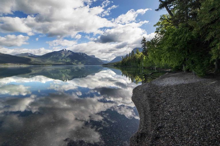
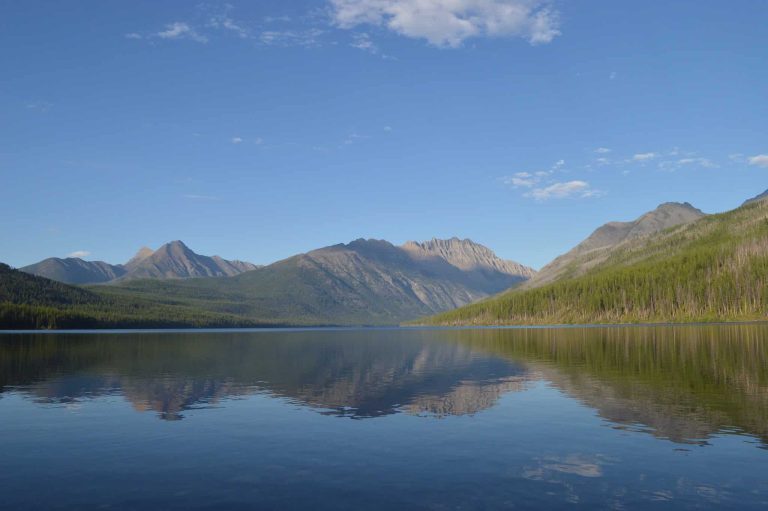
The park’s billion-year-old rocks tell a story in three acts: an ancient seabed, a continental collision, and rivers of ice that carved today’s iconic peaks and valleys. Every colored pebble on Lake McDonald’s shore and every jagged ridgeline on the Glacier National Park skyline is a chapter in that story.
- Rocks in the park are 800 million to 1.6 billion years old — Precambrian Belt Supergroup sedimentary layers up to 14,000 feet thick.
- The Lewis Overthrust pushed ancient rock 50 miles eastward over 1.3-billion-years-younger Cretaceous shale — one of Earth’s largest thrust faults.
- Chief Mountain is a textbook klippe: an erosionally isolated block of ancient rock sitting atop young Cretaceous shale.
- Ice Age glaciers (peak ~20,000 years ago) carved the U-shaped valleys, cirques, aretes, and paternoster lakes visible today.
- Colored rocks (red, green, purple) reflect ancient oxygen levels during deposition — readable even by non-geologists at Lake McDonald’s shore.
- Approximately 26 named glaciers remain today, down from ~150 in the late 1800s.
The Belt Supergroup: Earth’s Ancient Seabed
Most of the rock in Glacier National Park belongs to the Belt Supergroup — a massive sequence of Precambrian sedimentary layers deposited between 800 million and 1.6 billion years ago, per NPS.gov. The stack reaches nearly 14,000 feet thick, representing one of the best-preserved Precambrian sedimentary records on Earth.
The sediment was laid down in a shallow, inland sea basin that fluctuated over millions of years. Fine silts, muds, and sands accumulated in layers that were eventually compressed into mudstone, argillite, quartzite, and dolostone. Because this was before the Cambrian explosion of animal life, no burrowing creatures disturbed the sediment — so original structures are preserved with extraordinary fidelity.
| Formation | Age (approx.) | Rock Type | Color |
|---|---|---|---|
| Altyn | ~1.5 billion years | Dolostone, limestone | Gray-buff |
| Appekunny | ~1.45 billion years | Argillite (mudstone) | Green |
| Grinnell | ~1.42 billion years | Argillite, quartzite | Red, maroon |
| Empire | ~1.40 billion years | Argillite, limestone | Green-gray |
| Helena (Siyeh) | ~1.35 billion years | Dolostone, limestone | Gray with dark band |
The Helena (Siyeh) Formation contains a striking dark horizontal band — the Purcell Sill, a layer of igneous rock intruded between the sedimentary layers about 1.1 billion years ago when magma from below squeezed between beds. This dark stripe is visible on peaks throughout the park, including on the Going-to-the-Sun Road corridor.
Some links below are affiliate links.

Remarkably, the Belt Supergroup contains fossilized stromatolites — domed, layered structures built by ancient cyanobacteria mats, among the earliest evidence of life on Earth. They’re visible in outcrop at multiple locations including Ptarmigan Tunnel and along the Siyeh Pass Trail, per USGS.gov.
The Lewis Overthrust: Old Rock Over New
Glacier’s mountains don’t sit where they originally formed. The Lewis Overthrust — one of Earth’s largest and most famous thrust faults — pushed a massive slab of ancient Belt Supergroup rock roughly 50 miles (80 km) eastward, riding over Cretaceous shale that is 1.3 billion years younger, per Wikipedia (Lewis Overthrust).
This collision occurred during the Laramide Orogeny, a period of intense tectonic plate compression between 59 and 75 million years ago. As the North American plate was squeezed, deeply buried rock fractured along a nearly horizontal fault plane. The entire upper plate — miles thick — slowly slid northeast, carrying the future mountains of Glacier with it.
The fault plane itself is exposed in several locations. At the base of Chief Mountain, gray Cretaceous shale lies directly beneath bright red and green Precambrian argillite, creating a visible geological contact zone that researchers travel from around the world to study. This angular unconformity is one of the park’s most important scientific landmarks.
Chief Mountain: A Klippe Standing Alone
Chief Mountain (elevation 9,080 ft / 2,767 m) is a textbook example of a klippe — an isolated erosional remnant of the upper plate of a thrust fault, completely surrounded by younger rock below, per Wikipedia (Chief Mountain). The same process that formed the Matterhorn in the Alps created this landmark.
Standing apart from the main mountain front near the eastern park boundary, Chief Mountain represents the far-eastern edge of the Lewis Overthrust. Glaciers eroded away the surrounding overthrust material, leaving this ancient block isolated. The 1.45-billion-year-old Altyn Formation at its base rests directly on gray Cretaceous shale — a 1.3-billion-year gap in the rock record compressed into a visible geological contact.
Chief Mountain is sacred to the Blackfeet Nation (Blackfoot Confederacy), who call it Ninastako. Access to the peak for climbing involves crossing Blackfeet tribal lands — the tribe may issue permits for this. The peak appears in geology textbooks worldwide as one of the planet’s finest examples of klippe structure.
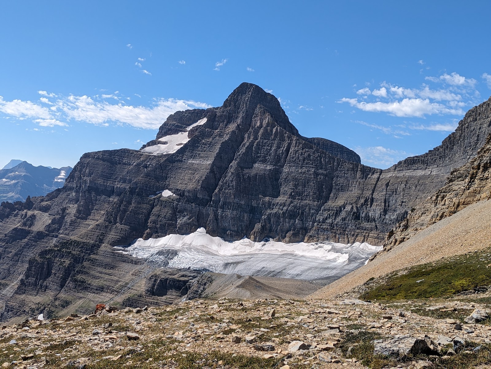

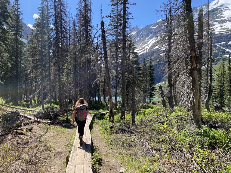
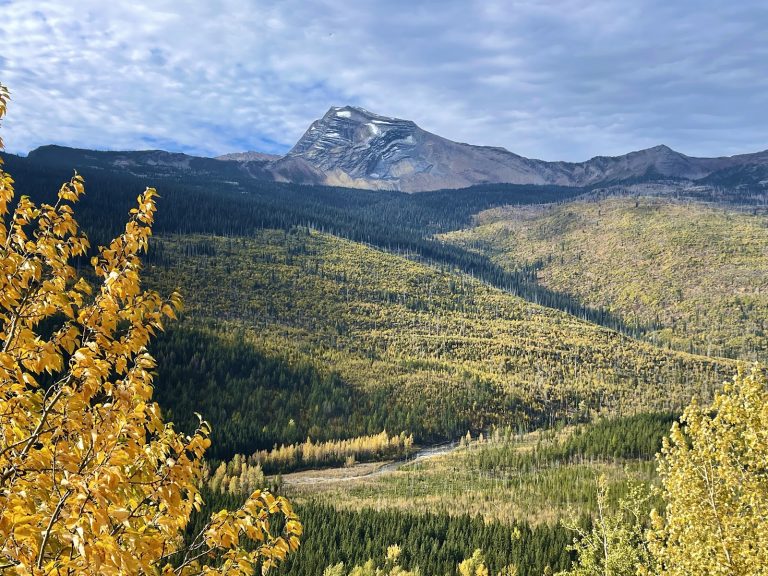
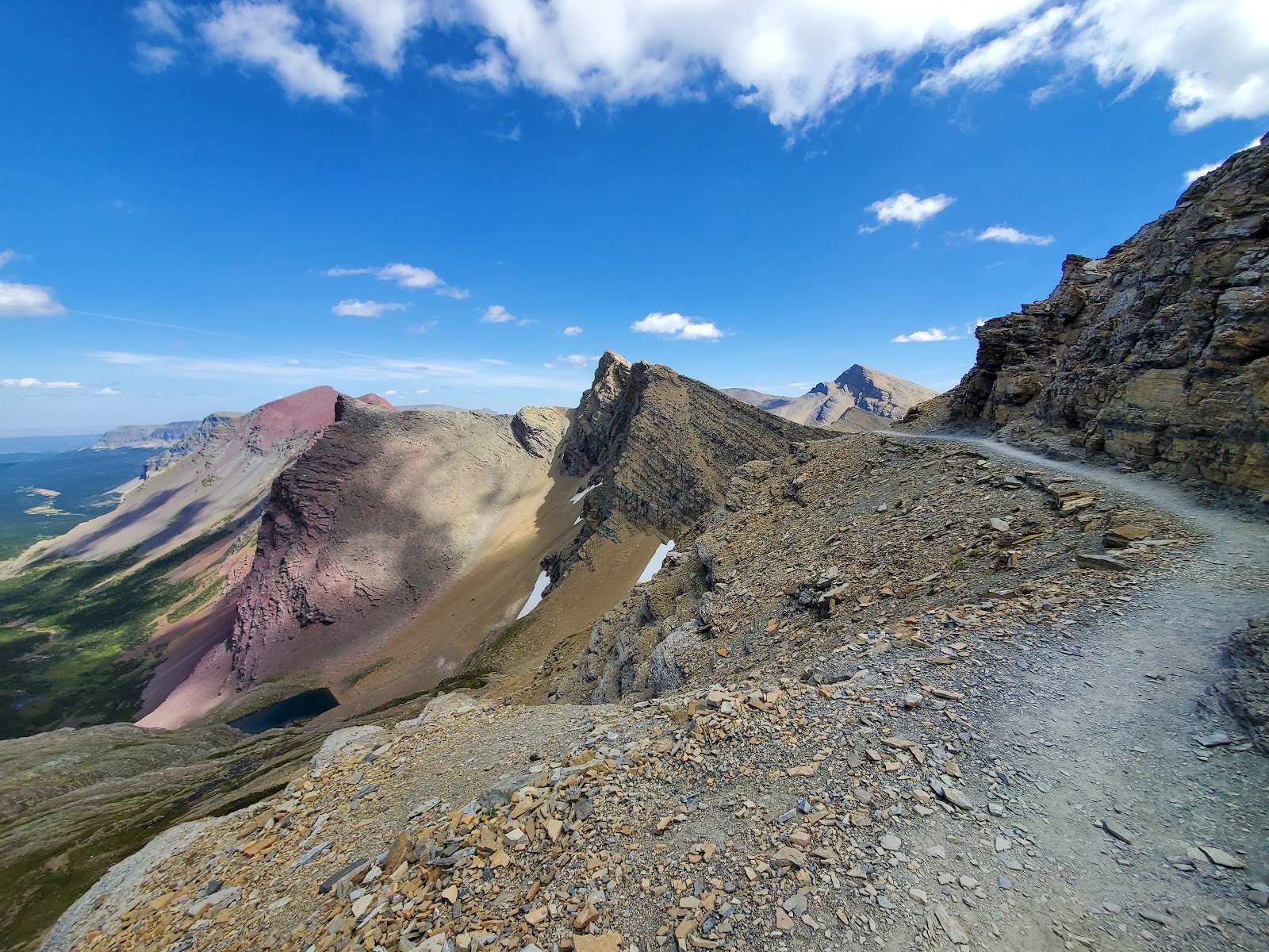
Ice Age Glaciation: How the Landscape Was Carved
About 20,000 years ago, Glacier National Park was entirely buried under thick sheets of ice. The Pleistocene glaciation sculpted the raw material of the Belt Supergroup — already uplifted and faulted — into the dramatic landscape visible today, per NPS.gov (Glacial Geology).
| Glacial Feature | What It Is | Where to See It |
|---|---|---|
| U-shaped valley | Broad, flat-bottomed valley carved by glacier | McDonald Valley, St. Mary Valley |
| Cirque | Bowl-shaped hollow where glacier originated | Grinnell Glacier basin, Iceberg Lake |
| Arete | Knife-edged ridge between two cirques | The Garden Wall (along Going-to-the-Sun Road) |
| Tarn | Lake occupying a cirque depression | Iceberg Lake, Hidden Lake, Avalanche Lake |
| Paternoster lakes | Chain of tarns descending a glacial trough | Upper McDonald Valley |
| Moraine | Ridge of rock debris left by retreating glacier | Grinnell Glacier area, Two Medicine Lake |
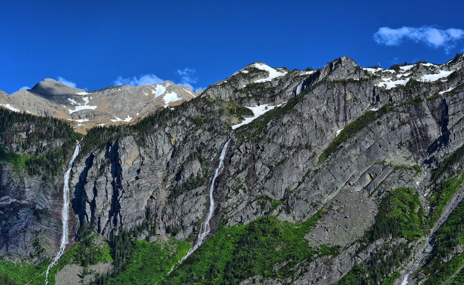
| Hanging valley | Tributary valley left high above main valley floor | Bird Woman Falls, Virginia Falls |
The Garden Wall — the dramatic arete visible from Going-to-the-Sun Road — formed when glaciers eroded from both sides of a ridge simultaneously. Each glacier scooped out its own cirque, and the ridge between them was sharpened to a knife-edge. Some sections of the Garden Wall are only a few feet wide at the crest.
Hanging valleys, visible as waterfalls pouring from high on cliff walls, mark where tributary glaciers once flowed into the main glacier. When the ice melted, the smaller valleys were left “hanging” hundreds of feet above the main valley floor. Fire lookout hikes in the park often ascend these glacially carved ridge systems.
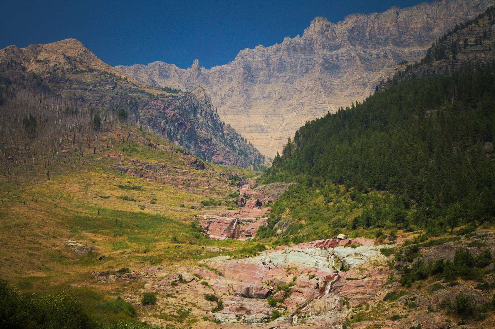
The Colors in the Rock: Red, Green, and Purple
Glacier’s most accessible geology lesson is the color of the rocks — and it tells a story about ancient oxygen levels. The park’s iconic red, green, and purple argillite layers reflect the atmospheric chemistry of an Earth more than a billion years old, per NPS.gov.
| Rock Color | Formation | Why That Color |
|---|---|---|
| Red / maroon | Grinnell Formation | Iron oxidized in high-oxygen environment (like rust) |
| Green | Appekunny Formation | Iron reduced in low-oxygen environment; chlorite mineral present |
| Gray-buff | Altyn Formation | Dolostone (magnesium-rich carbonate); minimal iron |
| Gray with dark band | Helena/Siyeh + Purcell Sill | Carbonate rock with intruded igneous dike (1.1 billion years old) |
This geology explains the famous rainbow pebbles of Lake McDonald. Centuries of glacial meltwater and stream action have tumbled and polished fragments of different formations together, producing the striking multicolored stone beach. Red, green, purple, black, and white stones all represent different Belt Supergroup layers. See our Lake McDonald rainbow rocks photography guide for when and where to see them best.

Where to See Geology in the Park
You don’t need a geology degree to experience Glacier’s rock record. The park offers geology-rich stops accessible from the road, on short walks, and on strenuous hikes. The east and west sides of the park showcase different formations and glacial features.
| Location | Geology Feature | Difficulty |
|---|---|---|
| Lake McDonald shore (west entrance) | Rainbow argillite pebbles (Grinnell + Appekunny) | Easy — roadside |
| Going-to-the-Sun Road cliffs | Exposed Belt Supergroup strata, Purcell Sill dark band | Easy — drive-by |
| Logan Pass visitor area | Continental Divide on Lewis Overthrust; classic arete (Garden Wall) | Easy walk |
| Siyeh Pass Trail | Full Belt Supergroup stratigraphic section; stromatolites | Strenuous (10.3 mi) |
| Grinnell Glacier Trail | Active glacier remnant; glacial moraine; tarn; cirque | Moderate-strenuous (7.6 mi) |
| Chief Mountain (Hwy 17 east) | Lewis Overthrust klippe visible from roadside | Easy — roadside |
| Two Medicine area | Clear moraines, glacially carved valleys, rock striations | Easy-moderate |
| Iceberg Lake Trail | Cirque lake, hanging valleys, frost-shattered cliff faces | Moderate (9.6 mi) |
The Logan Pass visitor center has ranger programs covering geology throughout summer. Geology walks and talks are offered most mornings, free with your park entrance fee ($35/vehicle in 2026, per NPS.gov). Check the daily schedule posted at the visitor center upon arrival.
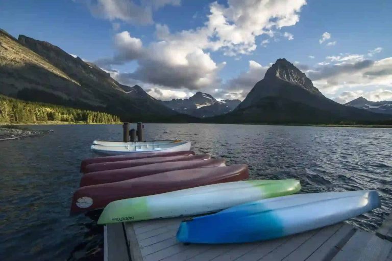
Today’s Glaciers: Living Ice Under Pressure
Approximately 26 named glaciers remain in Glacier National Park as of 2023 — down dramatically from roughly 150 in the late 19th century, per the USGS. Since 1966, park glaciers have shrunk an average of 39 percent in area.
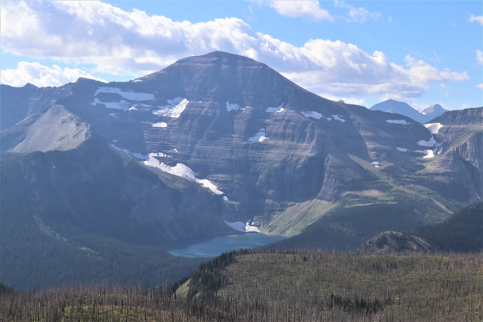
The largest remaining glaciers — Blackfoot, Jackson, Sperry, and Grinnell — are accessible by trail. Grinnell Glacier (reachable via a 7.6-mile round-trip trail from Many Glacier) shows the clearest recession evidence: a marked shoreline around the lake below indicates where the glacier extended as recently as the 1930s.
Despite accelerating retreat, the glaciers that remain are the same geologic agents that shaped this landscape 20,000 years ago. They continue to transport sediment, produce glacial rock flour (the fine silt that gives meltwater its turquoise color), and supply cold meltwater to streams throughout summer — sustaining ecosystems adapted to that cold-water pulse.
Frequently Asked Questions
How old are the rocks in Glacier National Park?
What is the Lewis Overthrust in Glacier National Park?
Why are the rocks at Lake McDonald so colorful?
What is a klippe, and where can I see one at Glacier?
How many glaciers are left in Glacier National Park?
Can I see fossils in Glacier National Park?
How We Researched This Guide
- NPS.gov Glacier — Geologic Formations and Glacial Geology pages (primary reference for Belt Supergroup formation descriptions)
- USGS — “Geology of Glacier National Park” overview and “Status of Glaciers in Glacier National Park” (glacier count and recession data)
- Wikipedia — Lewis Overthrust and Chief Mountain articles (structural geology detail)
- USGS Open File Report 93-510 — “Glaciers and Glaciation in Glacier National Park, Montana” (Pleistocene glaciation features)
- OpenGeology.org — Virtual Field Experience, Glacier National Park (stratigraphy and structural geology detail)
Glacier counts and retreat rates reflect published USGS data through 2023; on-the-ground conditions may have changed. Trail distances and hiking details should be verified with the NPS visitor center before your visit.
Ready to explore Glacier National Park’s billion-year-old landscape? Plan your visit with our complete park guide