Cloudy Day Activities at Mount Rainier
Last Updated: June 2026
Overview
About This Trail
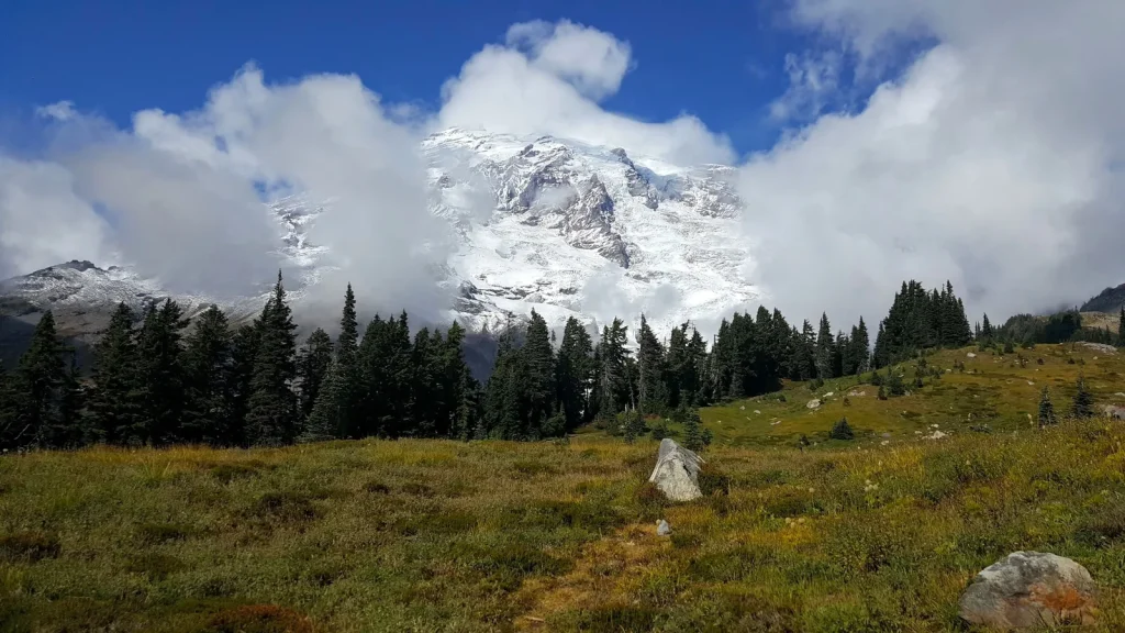
Cloudy days aren't rest days at Mount Rainier—they're tactical advantages. This ranger-curated guide covers 9 activities across the park designed specifically for when the summit is hidden: river soundscape walks, waterfall chases, and forest hikes without peak-bagging crowds. Options span Easy (0.2 miles) to Strenuous (7 miles, 1,800 feet gain). The angle: clouds mean lower crowds, full waterfall flow, and audible glacial rivers reshaping the mountain. The catch: Mount Rainier makes its own weather. Conditions change fast and snow closes seasonal trails.
Highlights
Difficulty Level
Mixed: Easy to Strenuous (depends on activity selection)
Trail Highlights
Glacier Vista offers closest proximity to Nisqually Glacier on a day hike (2.2 miles, 1,000 feet gain). Myrtle Falls is accessible and elegant in old-growth setting (1 mile). Nisqually Suspension Bridge provides immersive glacial river soundscape (2-minute stop). Waterfall intensity peaks on rainy/cloudy days. Palisades Lakes delivers true alpine solitude with six pristine lakes and minimal crowds (7 miles, 1,800 feet, strenuous).
Insider Tips
• Nisqually Suspension Bridge is a quiet, lightly visited spot for sound immersion—stand on the bridge and feel the glacial river's power. It's a 2-minute stop, not a hike. • Rainy mornings are YOUR advantage. Most casual visitors skip clouds and head to summit-view trails. Waterfall trails see 40–60% lower crowds. • Bench and Snow Lakes are moody and gorgeous in clouds—the alpine environment feels primordial when visibility is limited. • Comet Falls (320-foot drop) is ONLY hikeable early season (July–September). Winter/spring snow makes the slopes hazardous. Check with a ranger first. • Palisades Lakes is strenuous and remote—the payoff is alpine solitude and pristine lakes. Go early in season; afternoon thunderstorms build fast. • Extend Myrtle Falls to the Skyline Trail loop for a broader meadow circuit—an extra 0.5 miles with more views.
Best Season to Hike
Year-round with seasonal variations. Summer (June–Sept) offers full access. Spring/Fall: check closures. Winter: low-elevation trails only.
Hiking Tips
- Cloudy days = lower crowds and zero mountain FOMO. Use this to focus on soundscapes, waterfalls, and glacial dynamics.
- Check conditions with a ranger before leaving. Mount Rainier makes its own weather; forecasts change in hours.
- Carry the 10 Essentials: map, compass, headlamp, first-aid kit, fire-starter, extra layers, food, water (2L minimum), sun protection, and navigation tool.
- Layer aggressively: base layer, insulation, waterproof shell. Clouds trap moisture. Temperature drops sharply with elevation.
- Tighten your boots. Wet roots and loose rock are ankle-twisters.
- Use trekking poles for stability on slippery terrain and descents.
- Make noise while hiking. Black bears are present year-round.
- Assume no cell service. Carry a satellite communicator for strenuous/remote trails (Palisades Lakes).
Family Info
Easy, short trails work for kids: Narada Falls (0.2 miles), Myrtle Falls (1 mile), Trail of Shadows (0.7 miles, flat). Waterfall viewpoints are safe but slippery—supervise closely. Strenuous options (Glacier Vista, Comet Falls, Palisades Lakes) are tough for young kids but doable for teens (10+) with fitness and supervision. Pack extra snacks, water, and planned breaks. Steep drop-offs at some viewpoints require hand-holding and vigilance.
ℹ️ Data Sources
National Park Service YourNPGuide Editorial
Information is compiled from official sources, verified traveler reviews, and editorial research. Learn how YourNPGuide works →