Golden Canyon Hike Stop 1- Old Road
Last Updated: June 2026
Overview
About This Trail
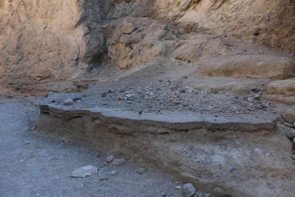
This is a short geological observation stop on the Golden Canyon Hike, not a standalone trail. You'll examine a real-world erosion lesson: a flat, dark tan rock (knee height, 10 feet long) with a hard conglomerate top layer and a softer sandy layer underneath slowly crumbling away. It takes 5-10 minutes to study and understand what Death Valley's geology is showing you. Minimal physical demand, maximum geological insight—this is Death Valley's classroom.
Highlights
Difficulty Level
Walk in the park
Trail Highlights
Observe real-time geological erosion: a hard conglomerate cap layer slowly undermined by softer sand. This is how Death Valley's canyons form.
Insider Tips
• Bring a magnifying glass to see fine detail of erosion • This stop is part of a series (Stops 1-5)—observe the geological progression • Visit shortly after sunrise (by 7am) before rock becomes too hot to touch • The sandy base is actively eroding; observe but don't contribute to it
Best Season to Hike
October-April
Hiking Tips
- Carry minimum 2 liters water—exposed terrain, zero shade
- Sunscreen and hat are not optional; reapply after sweating
- Bring a hand lens to examine the conglomerate layers and erosion detail
- Never touch or dislodge the rock; it's a protected geological feature
- Never hike Death Valley solo; tell someone your exact route and return time
Family Info
This stop itself is family-friendly and short. However, getting to it requires tolerance for heat exposure. Manage children's water intake carefully.
ℹ️ Data Sources
National Park Service YourNPGuide Editorial
Information is compiled from official sources, verified traveler reviews, and editorial research. Learn how YourNPGuide works →