Slickrock Trail
Last Updated: June 2026
Overview
About This Trail
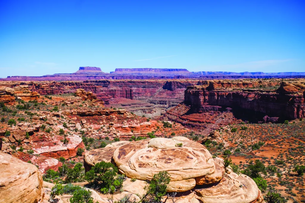
Slickrock Trail delivers panoramic 360-degree canyon views in just 2.4 miles—a moderate, short route suitable for most fitness levels. You'll traverse bare rock formations with expansive vistas into Big Spring Canyon and Little Spring Canyon, backed by the La Sal and Abajo Mountains. The terrain is rough and uneven; constant attention to footing is non-negotiable. This is a scenic payoff with tactical demands: exposed rock, zero shade, and unforgiving surface.
Highlights
Difficulty Level
Moderate
Trail Highlights
Expansive 360-degree views into Big Spring Canyon and Little Spring Canyon, with the La Sal Mountains and Abajo Mountains in the background.
Insider Tips
• The geology guide available at the Visitor Center explains the slickrock formations—essential context before you hike. • Start early; the Needles District parking fills on weekends and holidays. • The false-summit effect is real—the views intensify as you continue deeper toward the far overlooks. • Tighten your boot laces; your ankles need stability on uneven slickrock. • If rain has fallen in the past 24 hours, this trail becomes dangerously slippery; postpone your visit.
Best Season to Hike
Spring (April-May) and Fall (September-October)
Hiking Tips
- Carry 2L water minimum; the exposed slickrock offers zero shade.
- Traction devices (microspikes or yaktrax) are mandatory if snow, ice, or wet conditions present.
- Start early to avoid peak solar exposure in afternoon.
- Study your footing constantly—the rough, uneven surface is unforgiving.
- Bring trekking poles for stability on slickrock.
- Consult the geology guide at the Visitor Center before you hike—it explains the formations and why they matter.
Family Info
Suitable for active families with older children (ages 8+). Younger children may struggle with the rough, uneven surface and exposed drop-offs. Hand-holding on narrow sections with drop-offs is mandatory.
ℹ️ Data Sources
National Park Service YourNPGuide Editorial
Information is compiled from official sources, verified traveler reviews, and editorial research. Learn how YourNPGuide works →