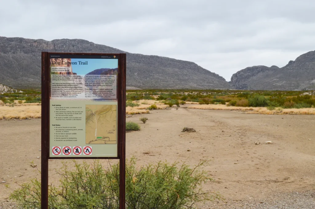
Dog Canyon Trail
Last Updated: June 2026
Overview
About This Trail
Dog Canyon Trail is a straightforward 4-mile round-trip that approaches a limestone canyon splitting the Deadhorse Mountains. The elevation gain is trivial, but the open desert exposure is relentless—this is a heat and hydration challenge, not a fitness one. Most hikers can complete this trail, but only those prepared for extreme sun and carrying adequate water will enjoy it. The geological payoff—vertical rock strata folded by tectonic forces—rewards those who reach the canyon's interior.
Highlights
Difficulty Level
Easy to Moderate
Trail Highlights
The limestone canyon with high walls and vertically folded rock strata created by tectonic forces. The geological drama is visible in the canyon's interior—300-million-year-old rocks contorted by mountain-building forces.
Insider Tips
• The dry wash junction at 1.5 miles has a metal sign but is easily missed on return—use GPS to mark it or tie a bright object there. • The canyon's limestone walls narrow quickly, providing unexpected relief from sun—linger here if you're overheating. • Walk to the far end of the canyon to see the most dramatic folded rock strata; most hikers stop short of the full payoff. • Early morning light on canyon walls is ideal for photography. • Clay mud after rain is severe—wait 24 hours or pick a different trail. • The trail is cairn-marked but don't add rocks to the cairns; stacked rocks can lure hikers off the correct path.
Best Season to Hike
Year-round, but best October-May when daytime temperatures are cooler and heat stress is reduced.
Hiking Tips
- Carry 1 liter of water per person per hour—non-negotiable. Bring electrolyte replacements; the dry climate means sweat evaporates before you feel it.
- Start before 6am or after 3pm to avoid peak heat.
- Apply sunscreen liberally and wear a wide-brimmed hat.
- Wear lightweight, breathable, long-sleeved shirts and pants to protect from sun exposure.
- Trekking poles ease descent on the rocky final section.
- Mark the dry wash junction at 1.5 miles with a waypoint or bright object—it's the only place to get turned around on return.
- Make noise and keep distance from snakes and wildlife.
- Don't stack rocks; cairns mark the true trail.
Family Info
Suitable for families with older children (8+) who can tolerate heat and hiking duration. Young children may struggle with 2-3 hour exposure to full sun. The rocky final section requires careful footing but is not dangerous with adult supervision.
ℹ️ Data Sources
National Park Service YourNPGuide Editorial
Information is compiled from official sources, verified traveler reviews, and editorial research. Learn how YourNPGuide works →