Burro Spring Trail
Last Updated: June 2026
Overview
About This Trail
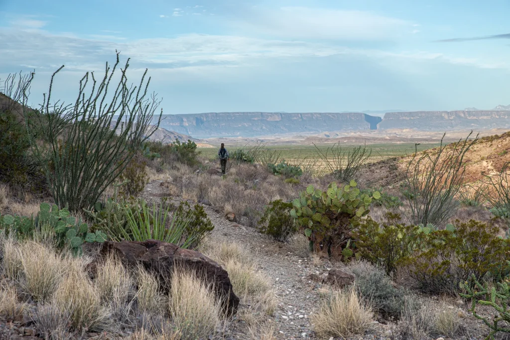
A 2.4-mile desert test where hydration management is everything. You'll cross white volcanic ash and red rhyolite boulder fields to an overlook of Burro Spring's cottonwoods and palms—a geological snapshot of what water means in the Chihuahuan Desert. The overlook is well-marked and achievable; the scramble down to the spring itself is technical and unmarked. Not a casual stroll: 1.5 hours minimum, full sun, and sweat evaporates so fast you won't know you're dehydrating.
Highlights
Difficulty Level
Moderate. Short distance and modest elevation gain, but desert heat and hydration demands elevate the actual challenge.
Trail Highlights
The overlook view of Burro Spring's oasis marks a geological anomaly—where water surfaces in an unforgiving desert, supported by towering cottonwoods and a remnant palm tree from early 20th-century ranching. A rare green pocket in the Chihuahuan Desert.
Insider Tips
• The overlook is the real payoff—don't miss it, but recognize it as a legitimate turnaround point. Most hikers end here. • The descent to the spring requires scrambling over boulder fields and following sandy washes. It's unmarked and easy to get lost. • Fill every water container at the trailhead if possible. You will drink more than you think. • The white volcanic ash reflects heat and UV radiation—the sun is stronger here than it feels. • Hike with a partner, not alone. If dehydration hits, you need a backup.
Best Season to Hike
November through April. Daytime temperatures are warm but manageable. Avoid June through August when afternoon heat exceeds 100°F.
Hiking Tips
- Hydration is your primary mission: carry 1 liter of water per person per hour minimum. Most hikers need 2-3L for this trail.
- Tighten your boots. Loose rocks and small hills demand stable footing.
- Sunscreen and hat are not optional—the sun reflects off white volcanic ash. Reapply liberally.
- Eat salty snacks. Desert sweat evaporates invisibly; your body is losing electrolytes without you realizing it.
- Bring a topographic map if attempting the descent to the spring. The route is unmarked.
- Make noise if you see wildlife. Maintain distance—snakes are present.
- The overlook is the natural turnaround point. The descent beyond is steep, rocky, and requires scrambling.
Family Info
Doable for fit families who can manage the heat. The 2.4-mile distance is short, but hydration is non-negotiable. Carry 2L minimum for children. Loose rocks demand good footing. The descent beyond the overlook is not suitable for young children—steep, exposed, and technical.
ℹ️ Data Sources
National Park Service YourNPGuide Editorial
Information is compiled from official sources, verified traveler reviews, and editorial research. Learn how YourNPGuide works →