10 Most Scenic Drives in Great Smoky Mountains National Park
Ten scenic drives from misty ridge roads to lakeshore loops—ranked by vista quality.
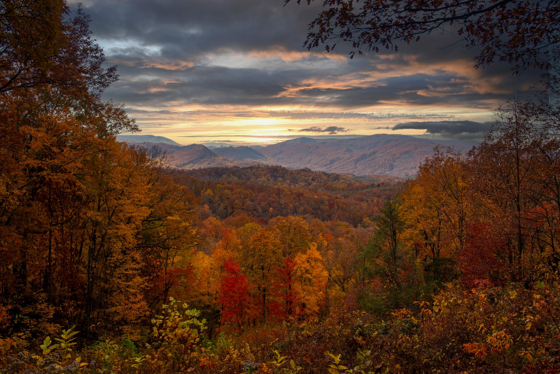
Ridge upon ridge of ancient mountains span North Carolina and Tennessee, their slopes cloaked in old-growth forest and their valleys teeming with elk, deer, and black bears. Great Smoky Mountains captures this wild terrain at its most accessible—on roads that climb through five distinct forest ecosystems, past centuries-old log cabins, and into meadows where wildlife grazes at dawn.
- Free Entrance fee
- 6,643 ft Highest point
- 24/7 access Primary roads
- No permit required Scenic drives
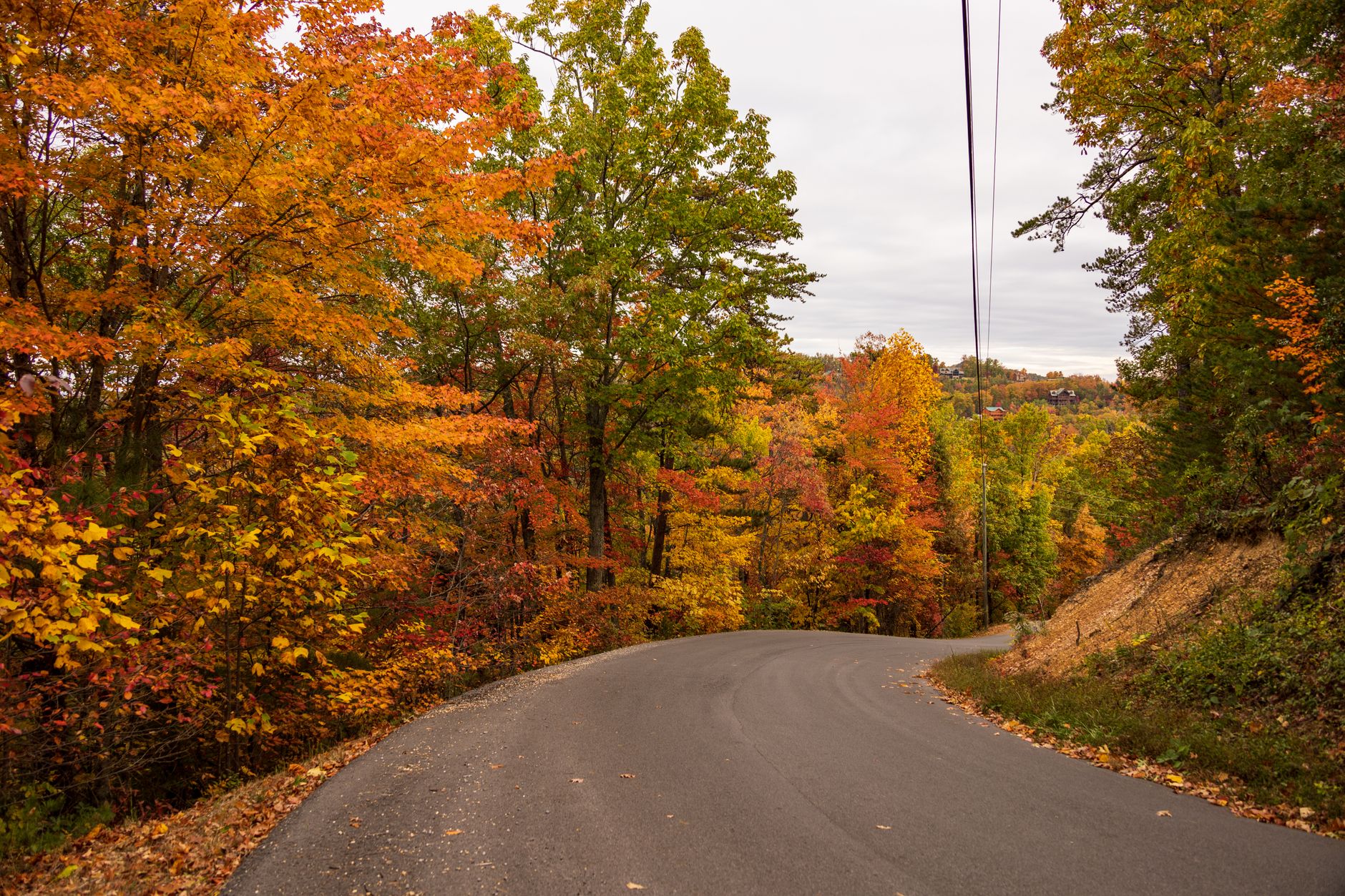
Newfound Gap Road — Central Park
The only paved road through park's heart crosses the state line at 5,056 feet with unobstructed crest views.
- 33-mile drive through five forest ecosystems
- Newfound Gap overlook at Tennessee-North Carolina state line (5,056 ft)
- Appalachian Trail crossing with access points
- 10–15 degree temperature drop from base to summit
- President FDR dedicated the park here in 1940
THE ROUTE
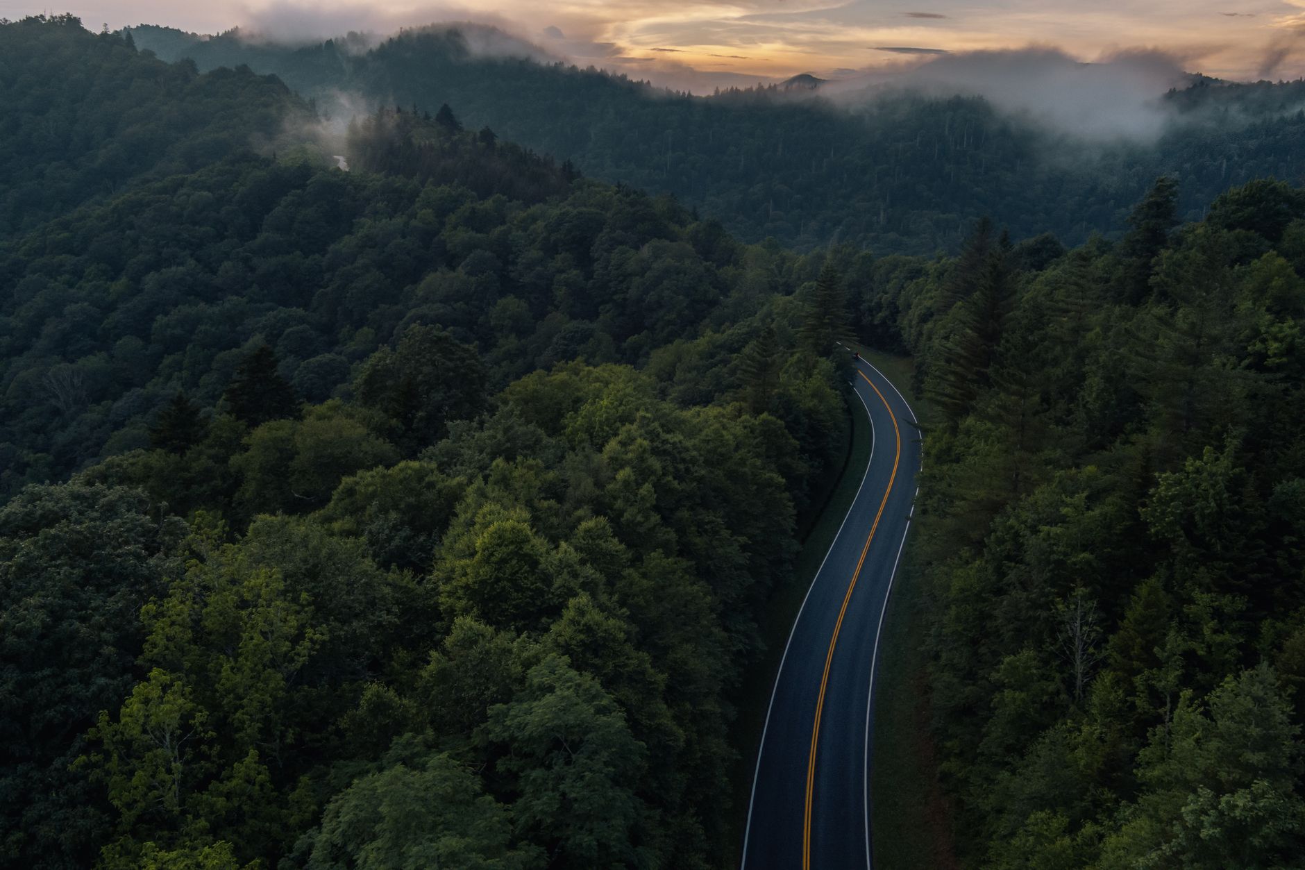
Newfound Gap Road (US-441) is the only fully paved road through the park's center. It connects Gatlinburg, Tennessee, to Cherokee, North Carolina, climbing 3,000 feet over 33 miles. You'll pass through five distinct forest types: cove hardwood, pine-oak, northern hardwood, and spruce-fir ecosystems. Multiple scenic pullouts and hiking trailheads line the route.
WHAT YOU'LL SEE
The road's iconic centerpiece is Newfound Gap Overlook at 5,056 feet, where the state line runs. On clear days, sweeping vistas extend north and south along the mountain crest. The Appalachian Trail crosses here; hikers frequent the overlook. Temperature drops 10–15°F from base to summit, creating visible transitions in forest composition as you climb.
BEST TIME
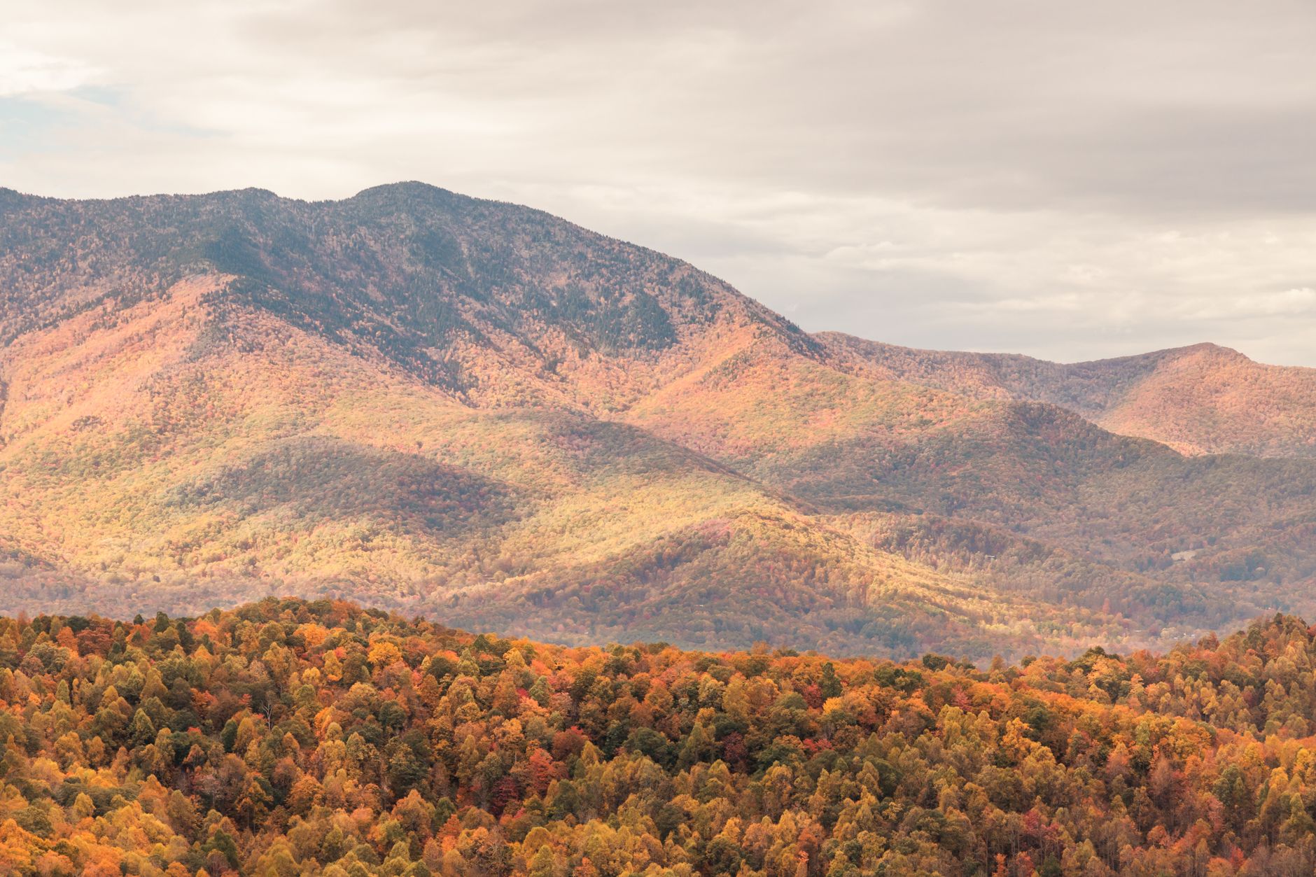
Open 24/7 year-round, weather permitting. Spring brings wildflowers and budding hardwoods. Summer offers green canopy and cool high-elevation temps. Fall showcases the most dramatic foliage. Winter can bring icing but rarely closes the road; check NPS alerts before driving.
ACCESS & PARKING
Newfound Gap Overlook fills by 10 AM in peak season. Several other pullouts offer solitude and equally stunning views. The road has no tolls and no entrance fee. Expect 1–1.5 hours for a leisurely drive; allow more time if stopping at overlooks and short walks.
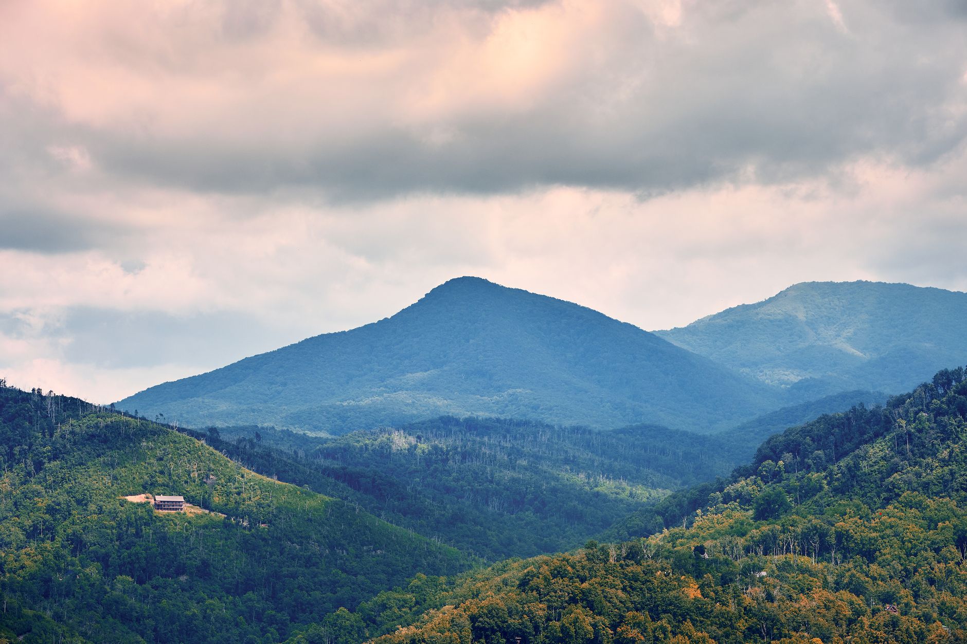
Clingmans Dome Road (Kuwohi) — Central Park
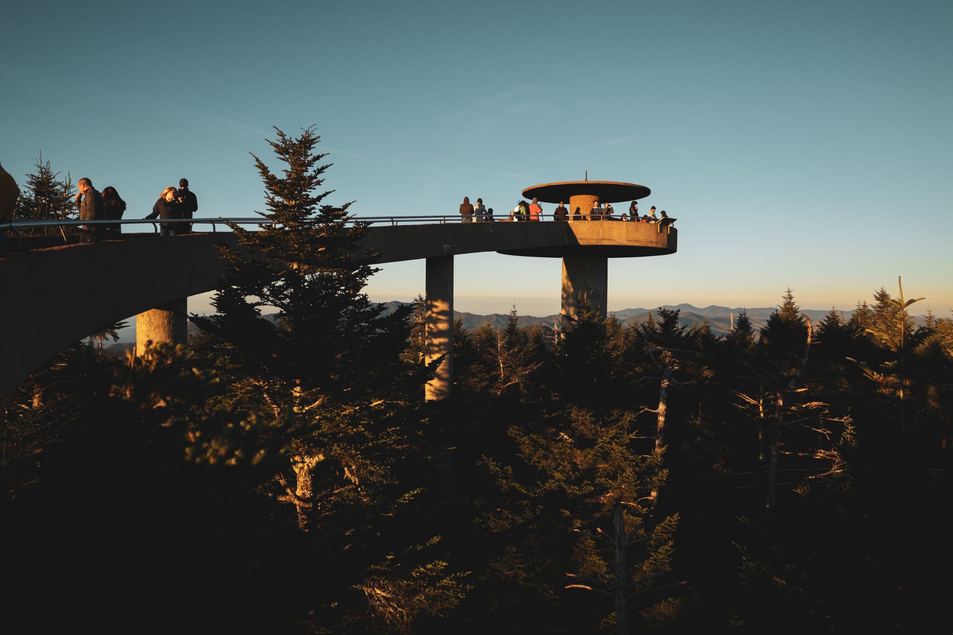
A 7-mile climb to America's highest Appalachian peak delivers a 360-degree tower with seven-state vistas.
- Highest peak in Great Smoky Mountains: 6,643 feet
- 360-degree stone tower summit with panoramic views
- See 100+ miles and at least 7 states on clear days
- 15–25 degree temperature drop at summit
- Renamed Kuwohi (2024), honoring Cherokee heritage
THE ROUTE
Clingmans Dome Road is a narrow, winding 7-mile climb off Newfound Gap Road, gaining over 1,000 feet of elevation. The road is paved and well-maintained but steep in sections. Allow 1.5 hours for the drive round-trip plus a 30-minute walk to the summit tower.
AT THE SUMMIT
A half-mile paved walkway leads to the 54-foot stone tower atop the peak. The 360-degree platform reveals the Smoky Mountains crest, forested valleys, and on exceptionally clear days, ridgelines seven states away. The Appalachian Trail passes near the parking area.
SEASONAL ACCESS
Open April through November. Snow and ice close the road in winter; it reopens when conditions permit. Afternoon fog and low clouds are common even in summer—morning visits offer the clearest vistas. Temperature at the summit is typically 15–25°F cooler than the valley.
WHAT TO BRING
Layers are essential. A warm jacket, hat, and gloves are advisable even in summer. Wear sturdy shoes for the paved summit walk. On clear days, bring a camera and binoculars to identify distant mountain peaks and wildlife.
Foothills Parkway West — Western Park
A pristine 33-mile ridge road with unobstructed wildflower and foliage displays framing the Tennessee River Valley.
- 33 miles along Chilhowee Mountain backbone
- Spring wildflowers and fall foliage panoramas
- Tennessee River Valley vistas
- Multiple scenic overlooks with no commercial development
- New missing-link section completed 2018 (Walland–Wears Valley)
THE ROUTE
Foothills Parkway West travels 33 miles between Walland and Townsend, running along the Chilhowee Mountain ridge. The road is pristine and well-maintained, with a slow speed limit that encourages sightseeing. No billboards or roadside development intrude. Multiple overlooks and pull-off areas reward exploration.
SEASONAL HIGHLIGHTS
Spring brings wildflowers dotting the ridge and the valley below. Summer offers verdant canopy and long evening light for sunset drives. Fall showcases dramatic foliage in shades of red, orange, and gold. Winter reveals bare mountain silhouettes and distant vistas usually obscured by summer haze.
WHY IT'S LESS KNOWN
Foothills Parkway West doesn't connect to a major town like Gatlinburg and receives far fewer visitors than Newfound Gap Road or Clingmans Dome. This isolation is its virtue: you'll encounter tranquility and pristine panoramas without crowds.
NEARBY OPTIONS
The parkway links to Cades Cove Loop at its western end, allowing a scenic loop drive combining three parks. Hiking trails access Gregory Bald (flame azaleas) and other high-elevation meadows from the ridge.
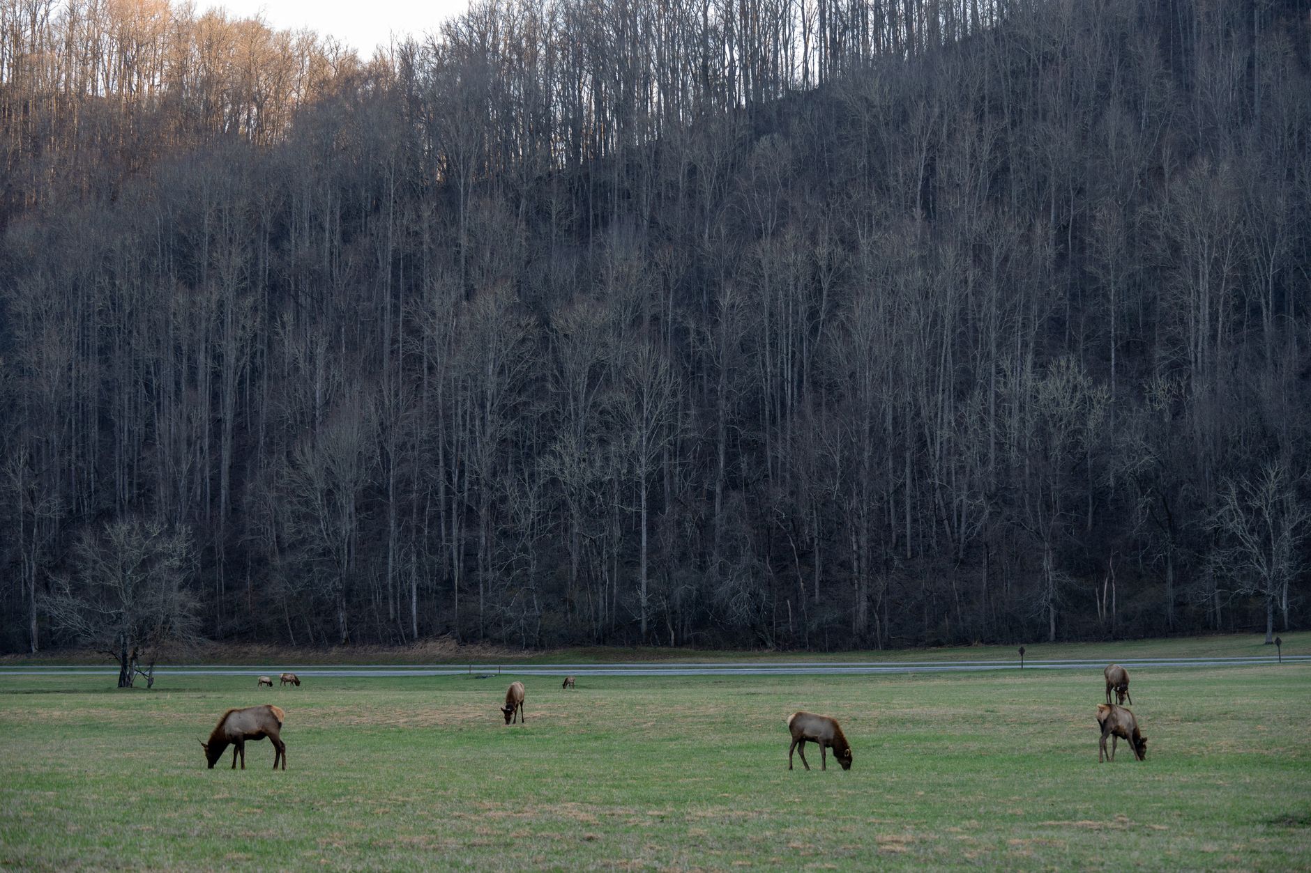
Cades Cove Loop — Western Park
An 11-mile valley loop where elk herds and 18th-century cabins share mountain-ringed meadows.
- Wildlife viewing: elk, white-tailed deer, wild turkeys, black bears
- Largest collection of historic log buildings in Eastern US
- Working Cable Mill grist mill (operational demonstrations)
- Valley surrounded by mountain peaks
- Prime wildlife viewing 6–9 AM and 5–7 PM
THE VALLEY
Cades Cove is a 6-mile-long valley surrounded by mountains, ringed by an 11-mile one-way loop road. The road is paved and generally flat, making it accessible for most vehicles. Pullouts and historic stops break up the drive. Allow 2–4 hours depending on stops and wildlife sightings.
WILDLIFE & HISTORY
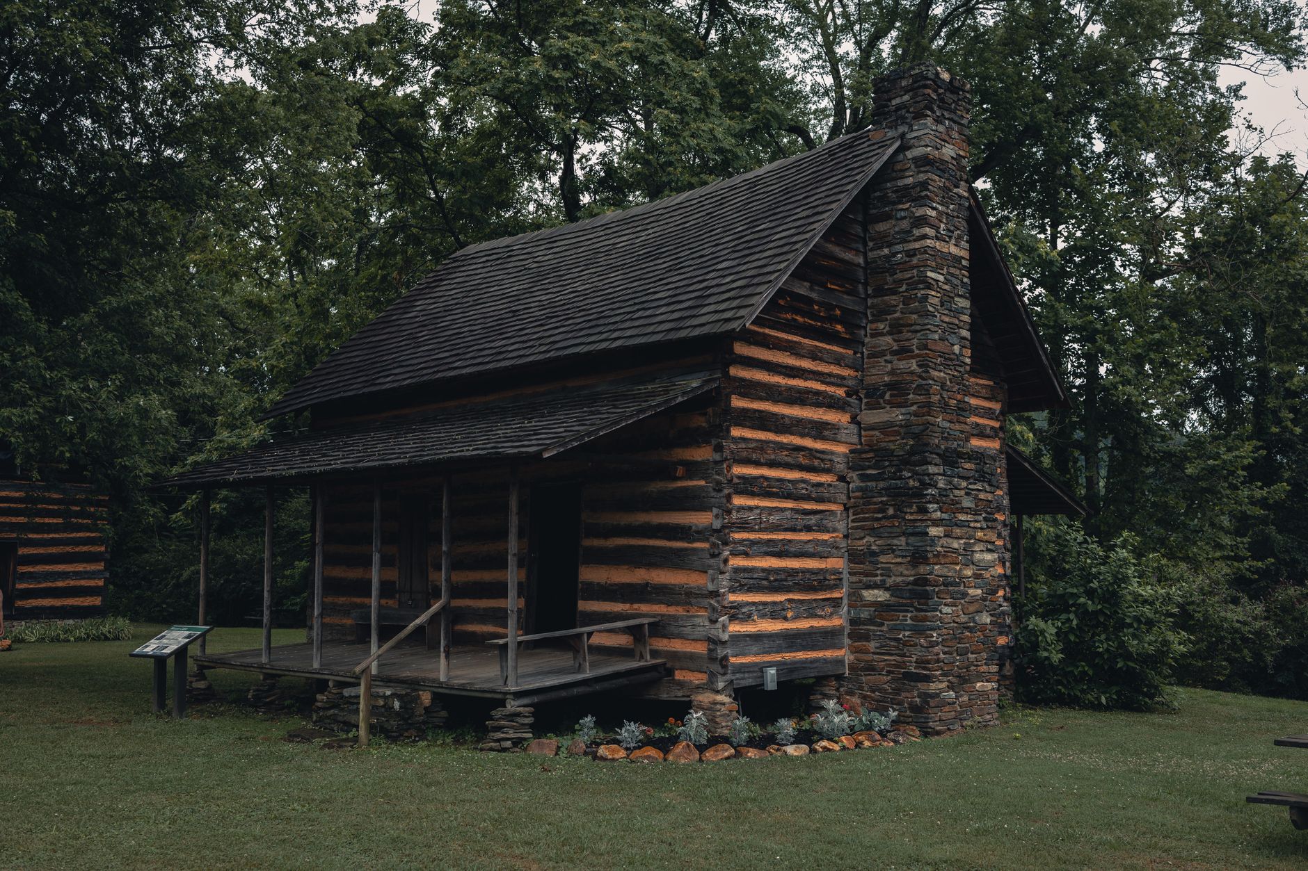
Cades Cove hosts the park's largest elk herd, reintroduced in 2001. Deer and turkeys are abundant; black bears appear seasonally. The Cable Mill Historic Area showcases 18th- and 19th-century log structures, mills, churches, and homesteads—the largest collection of historic buildings in the Eastern US. Park Rangers and volunteers provide living-history demonstrations at the grist mill.
BEST TIME
Early morning (6–9 AM) and dusk (5–7 PM) maximize wildlife sightings. Fall and winter bring larger elk herds. Spring offers wildflowers in the meadows. Summer is popular but hot and crowded by mid-morning. Check the NPS website for road closures (typically Wednesdays–Thursdays mornings for maintenance).
PARKING & ACCESS
The Cades Cove Visitor Center offers restrooms and picnic areas. Parking fills rapidly on weekends and holidays. Arrive before 9 AM or visit on weekdays to secure a spot. A bike path runs the perimeter, and numerous hiking trails branch from the loop.
Roaring Fork Motor Nature Trail — Central Park
A 5-mile one-way loop through old-growth forest canopy and Noah Bud Ogle's weathered log homestead.
- Old-growth forest with 350+ year-old trees
- Historic Noah Bud Ogle Place (log cabin, barn, farmstead)
- Roaring Fork stream paralleling the road
- Access to Grotto Falls trailhead (2.6 mi roundtrip waterfall hike)
- Passenger cars only (no RVs, buses, or trailers over 25 ft)
THE FOREST
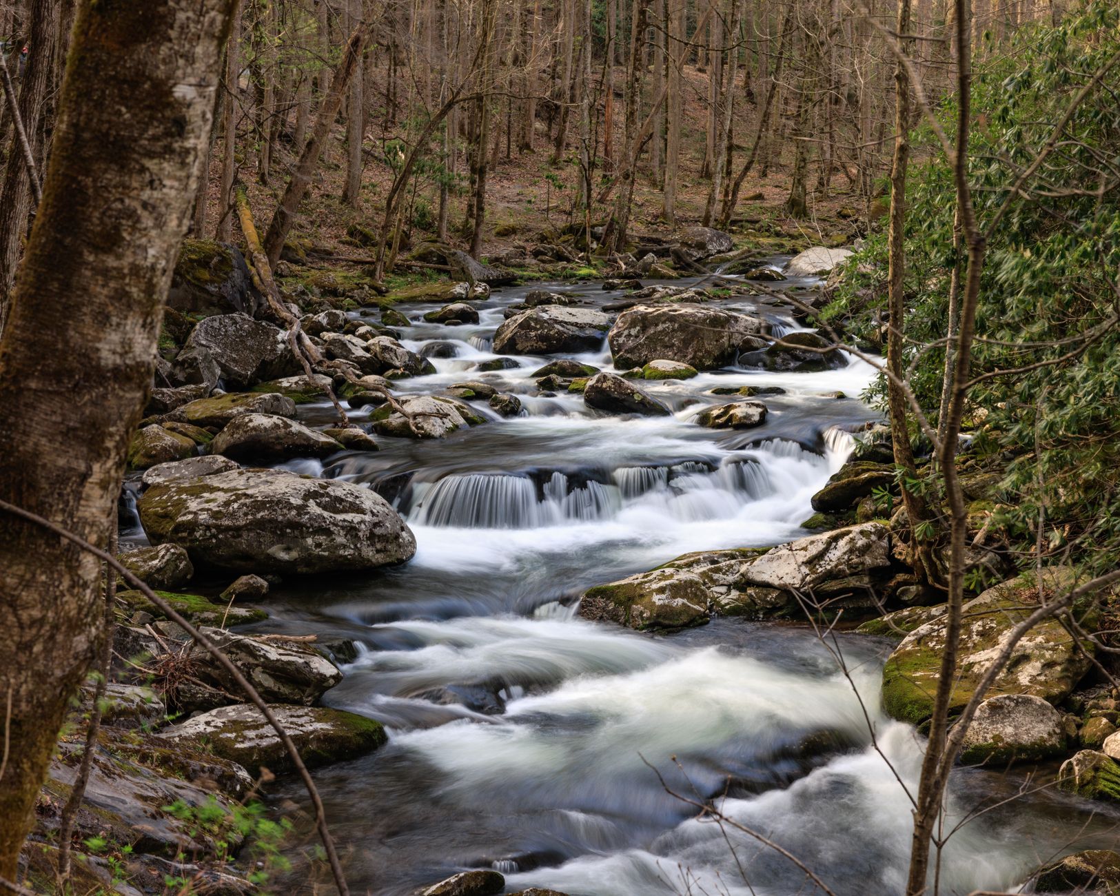
Roaring Fork Motor Nature Trail is a one-way, 5.5-mile loop through old-growth forest within a few miles of Gatlinburg. The canopy towers overhead—many trees exceed 350 years old. Roaring Fork stream flows alongside much of the drive, its rapids audible from pullouts. The road is narrow but paved; allow 45 minutes to an hour for a leisurely drive.
HISTORIC HOMESTEAD
The Noah Bud Ogle Place, a weathered log cabin, barn, and farmstead, sits at mid-trail. Ogle and his family homesteaded here in the early 1900s. The structures offer a glimpse into subsistence Appalachian life—farming, hunting, and preserving—before the park's creation.
HIKING OPTION
The Grotto Falls trailhead is accessible from the road. A 2.6-mile roundtrip hike leads to a 25-foot waterfall framed by rock overhangs. The waterfall's cool mist and sound complement the forest drive—many visitors combine both.
SEASONAL ACCESS
Open May 1 through November 29. The road closes in winter to protect the old-growth forest. Passenger cars and trucks under 25 ft only—no motorhomes, large vans, or trailers. Check NPS alerts before driving; rainy days can muddy pullout parking.
Cataloochee Valley — Eastern Park
A remote 11-mile valley drive where reintroduced elk herds graze among weathered log homesteads.
- Elk herd reintroduced in 2001; largest viewing populations fall–winter
- Historic log buildings: Palmer Chapel, Beech Grove School, farmsteads
- White-tailed deer, wild turkeys, black bears
- Remote valley setting with mountain backdrop
- Access from I-40 Exit 20 (North Carolina); 0.2 miles from interstate
THE VALLEY
Cataloochee Valley is accessed via a 0.2-mile detour from I-40 Exit 20 in North Carolina. From there, Cove Creek Road winds 11 miles into the valley—a mix of paved and gravel roads climbing gradually through pastures and forest. The drive feels remote despite the interstate proximity.
ELK & WILDLIFE
Cataloochee is home to the park's most accessible elk herd, reintroduced in 2001. Elk bugle in fall, adding drama to dawn visits. White-tailed deer are abundant year-round. Wild turkeys forage in the fields. Black bears appear seasonally. Viewing is best 6–9 AM and 5–7 PM when elk graze openly in meadows.
HISTORIC SITES
Palmer Chapel (1857) and Beech Grove School (1901) anchor the valley's history. Several farmsteads stand partially preserved, their log structures and stone chimneys evoking early-1900s Appalachian life. Interpretive signs explain the valley's settlement and the park's creation in 1934.
BEST TIME
Fall (September–October) brings elk bugling season and mild temperatures. Winter (November–February) sees the largest elk populations and clearest air. Spring brings wildflowers and newborn elk calves. Summer is hot and crowds increase. Weekdays are quieter than weekends year-round.
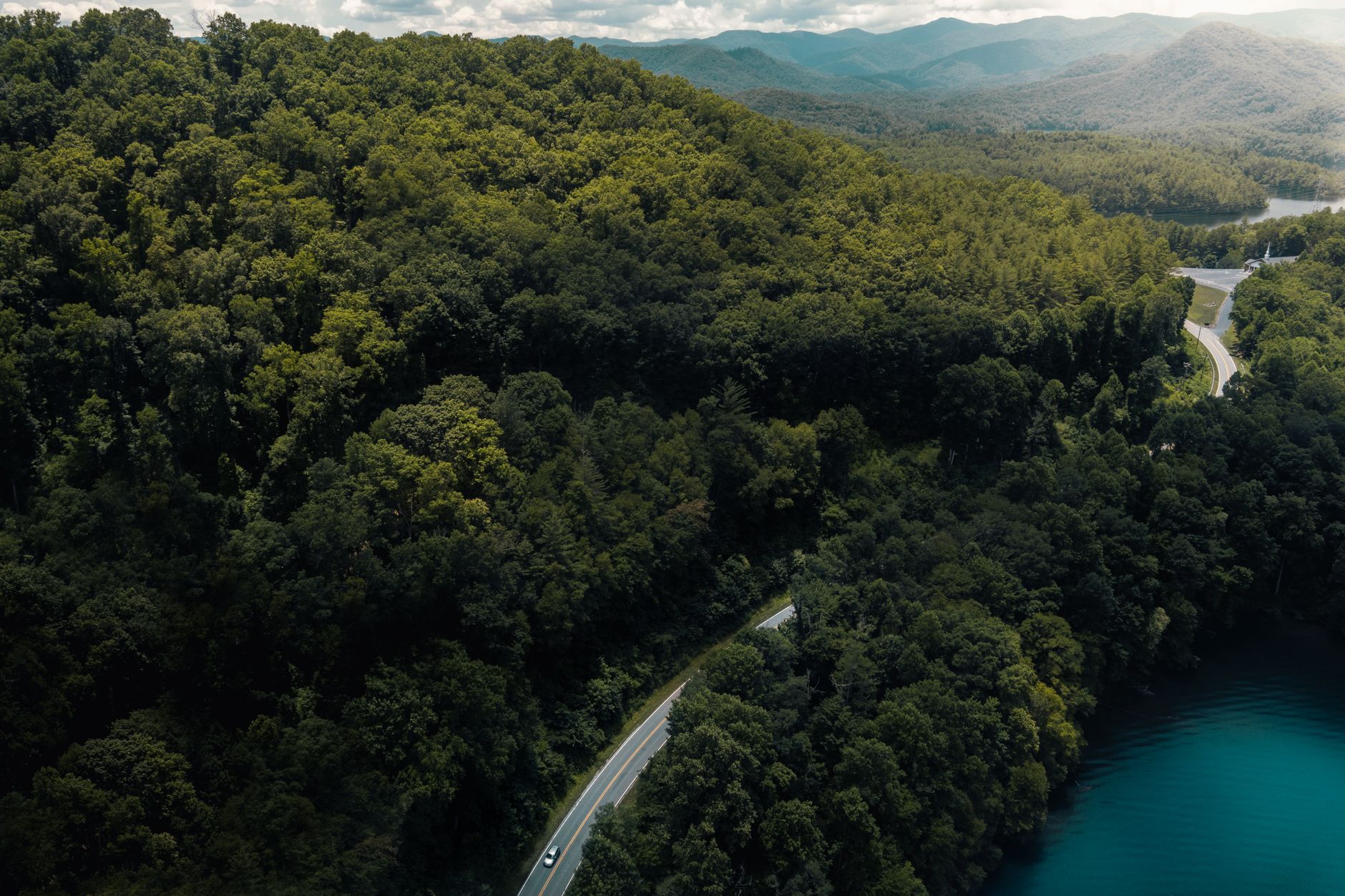
Lakeview Drive (Road to Nowhere) — Western Park
A recently reopened 6-mile lakeshore route with Fontana Lake vistas and a historic 1930s tunnel bypass.
- Fontana Lake panoramic views and multiple overlooks
- Historic tunnel (1930s-era road); bypass trail ADA-accessible
- Recently restored (Fall 2023) after 6-year closure
- Paved and well-maintained with scenic pullouts
- Access to Noland Creek and Benton MacKaye trail systems
THE ROAD
Lakeview Drive (also called 'Road to Nowhere') reopened in Fall 2023 after a comprehensive restoration costing $15.6 million. The 6.5-mile paved road climbs gradually from Bryson City, North Carolina, offering sweeping views of Fontana Lake, the park's largest artificial reservoir. Multiple pullouts and overlooks invite exploration.
FONTANA LAKE
Fontana Lake was created by a TVA dam in 1944. Its 238-mile shoreline is accessible mostly by boat or backcountry trails. Lakeview Drive provides the rare road-accessible overlook—a vantage point for photographing the water's reflections of surrounding ridges. The lake is popular with boaters, kayakers, and fishermen.
THE HISTORIC TUNNEL
A 1930s-era tunnel punctuates the route. Visitors can drive through or park and walk a bypass trail that is ADA-accessible, offering a unique detour without requiring a vehicle. The tunnel and its bypass illustrate Depression-era road engineering and modern accessibility retrofits.
HIKING & ACCESS
Noland Creek Trail and Benton MacKaye Trail branch from the drive. Backcountry permits are required for overnight camping. The drive is open year-round, though winter weather can occasionally close it briefly.
Foothills Parkway East — Northern Park
A quiet 6-mile ridge route with three overlooks spanning the Smokies crest and Appalachian vistas.
- Mount Cammerer Overlook with crest panoramas
- Stone Mountain and English Mountain overlooks
- 1,000-foot elevation gain along Green Mountain ridge
- Minimal traffic and no commercial development
- Connects I-40 (Exit 443) to Highway 321 in Cosby, Tennessee
THE ROUTE
Foothills Parkway East is a 6-mile scenic spur that climbs Green Mountain northeast of the main park. It begins at I-40 Exit 443 in Tennessee and ends at Highway 321 in Cosby. The route gains 1,000 feet gradually, offering sweeping mountain vistas with minimal traffic and no roadside development.
WHAT YOU'LL SEE
Three overlooks punctuate the drive: Mount Cammerer, Stone Mountain, and English Mountain. Each offers distinct panoramas of the Smokies crest, Cosby Valley, and the Raines Knob region. On clear days, the ridge stretches for miles in both directions.
WHY IT'S LESS KNOWN
Unlike Newfound Gap Road or Clingmans Dome, Foothills Parkway East doesn't connect to major tourist towns and lacks a dramatic signature feature. This obscurity is its strength—visitors seeking peace and panoramic views without crowds choose this road.
BEST TIME
Open year-round. Fall foliage (October–early November) brings brilliant colors and crisp air. Spring offers wildflowers and fresh green canopy. Winter reveals bare vistas and occasional snow. Weekday mornings are quietest; summer weekends draw more traffic.
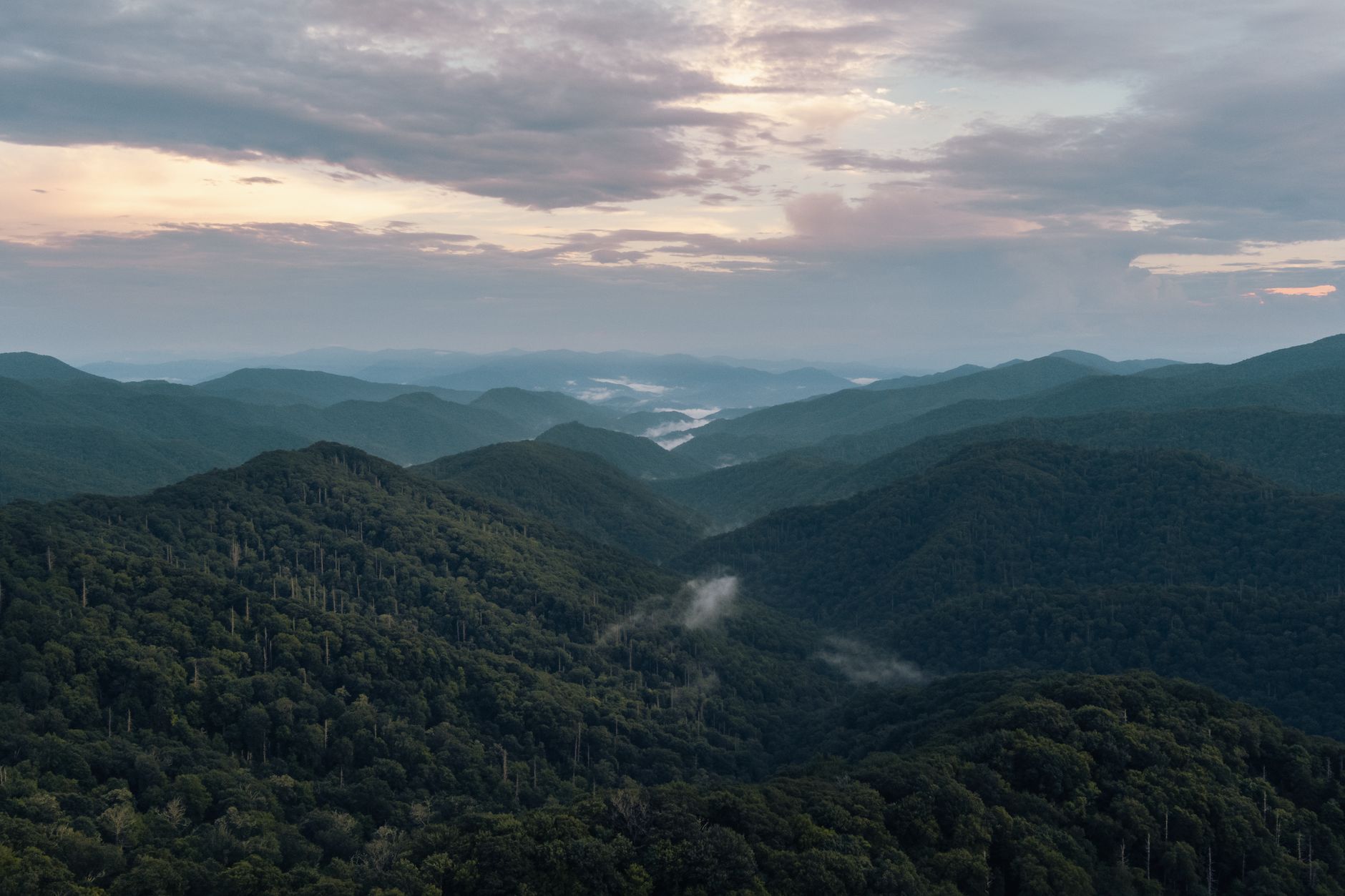
Heintooga Ridge Road (Balsam Mountain Loop) — Southern Park
A 9-mile high-elevation spur linking Blue Ridge Parkway to the Smokies with Clingmans Dome and Plott Balsam views.
- First 4 miles on Blue Ridge Parkway, 5 miles in park boundaries
- Clingmans Dome and Mount Le Conte views from ridge
- Plott Balsam Range panoramas
- Heintooga Overlook and picnic area
- 1938 Masonic monument at ridge junction
THE ROUTE
Heintooga Ridge Road (also called Balsam Mountain Loop) begins at Blue Ridge Parkway Milepost 458.2. The first 4 miles run on the Parkway; the final 5 miles enter Great Smoky Mountains National Park. The route follows a high-elevation ridge with numerous overlooks and a scenic picnic area.
WHAT YOU'LL SEE
From the ridge, Clingmans Dome and Mount Le Conte anchor views to the north. The Plott Balsam Range spreads to the east. On clear days, the panoramas span miles of continuous ridgeline. A 1938 Masonic monument marks a junction point.
SEASONAL ACCESS
Open late May through October. Snow and ice close the road in winter; spring mud can slow reopening. Afternoon fog frequently obscures the ridge; morning drives offer clearer vistas. Even in summer, temperatures are cool at elevation—bring layers.
COMBINES WITH
The Balsam Mountain Road section transitions to unpaved gravel after the paved Heintooga spur. A combination Blue Ridge Parkway–Smokies drive connects to Clingmans Dome Road and Newfound Gap Road for a scenic loop.
Parson Branch Road — Western Park
An 8-mile historic 1838 gravel road linking Cades Cove to mountain passes through flame azalea meadows.
- Historic 1838 construction; road rebuilt 1964 and after 2022 hemlock restoration
- Wildlife viewing: deer, turkeys, bears, occasional elk
- Gregory Bald trail access with summer flame azalea blooms
- One-way gravel experience through varied terrain
- Seasonal April–November; no motorhomes over 25 ft
THE ROAD
Parson Branch Road is an 8-mile one-way gravel road originally constructed in 1838. It connects the Cades Cove area to US-129 on the park's western boundary. The road was rebuilt in 1964 and closed for six years (2016–2022) during hemlock tree restoration. It reopened in May 2022 as a fully restored scenic drive.
WILDLIFE & HISTORY
Parson Branch Road winds through forests and meadows where white-tailed deer, wild turkeys, and black bears roam. Elk occasionally appear in open areas. The road's historic path through mountain passes offers glimpses of the Appalachian backcountry before the park's creation.
GREGORY BALD HIKING
The Gregory Bald trailhead is accessible via Cades Cove. This high-elevation meadow bursts with flame azaleas (rhododendrons) in mid-June, creating a stunning floral display. Many visitors combine a Parson Branch Road drive with a Gregory Bald hike for a full day in the western Smokies.
SEASONAL ACCESS
Open April through November. Winter closures protect the gravel surface. No motorhomes, vans, or trailers exceeding 25 ft are permitted. Check NPS alerts before driving; heavy rain can impact road conditions. Early morning and dusk are prime times for wildlife spotting.
Common Questions
Are all scenic drives open year-round?
Primary roads like Newfound Gap Road, Cades Cove Loop, and Foothills Parkway West stay open year-round. Seasonal routes include Clingmans Dome Road (April–November), Roaring Fork Motor Nature Trail (May–November 29), and Parson Branch Road (April–November). Check NPS alerts before driving secondary roads in winter.
Is there an entrance fee for the park?
No. Great Smoky Mountains National Park has no entrance fee, making it the only major national park with free entry and the reason it's America's most visited park.
When is the best time for wildlife viewing?
Dawn (6–9 AM) and dusk (5–7 PM) are prime viewing times. Fall and winter bring larger elk herds to Cataloochee Valley and Cades Cove. Spring offers wildflowers; summer is popular but crowded.
What should I bring for a scenic drive day?
Layers (temperatures drop 10–25°F at higher elevations), binoculars for wildlife spotting, a camera, and water. Gravel roads like Parson Branch require good tire condition. Bring a jacket even in summer for high-elevation drives.
Can large RVs and vehicles drive all routes?
No. Roaring Fork Motor Nature Trail and Parson Branch Road restrict vehicles to passenger cars and trucks under 25 ft. Foothills Parkway and other main routes accommodate most vehicles; check NPS guidelines for specific restrictions.
Sources & Further Reading
- Auto Touring - NPS — National Park Service
- Foothills Parkway - NPS — National Park Service
- Heintooga Spur Road - NPS — National Park Service
- Fontana Area - NPS — National Park Service
- Park Reopens Parson Branch Road After Six-Year Closure - NPS — National Park Service
- Newfound Gap Road Guide — Smoky Mountains Guide
- Cades Cove Scenic Drive Guide — Smoky Mountains Guide
- Roaring Fork Motor Nature Trail — Smoky Mountains Guide
- Guide to the Foothills Parkway — Smoky Mountain National Park Blog
- Clingmans Dome 2026 Guide — Parks Expert
- Into the Quiet Wild: Cataloochee Valley — Smoky Mountain National Park Blog
- Lakeview Drive Guide — Smokies Guide
- Heintooga Ridge Road, Balsam Mountain — Romantic Asheville
- Parson Branch Road Scenic Drive Guide — Visit My Smokies
- NPS Great Smoky Mountains Main Page — National Park Service