7 Top Photography Spots in Great Basin National Park
Seven iconic Great Basin photography destinations — from night-sky stargazing to alpine summits and ancient forests.
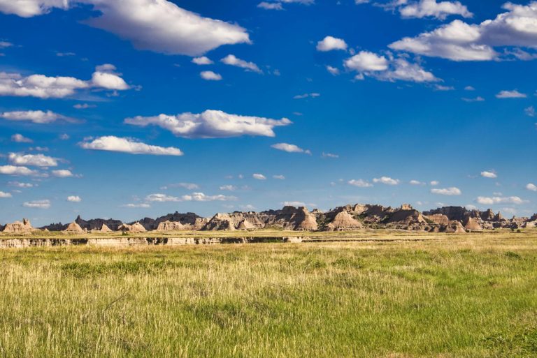
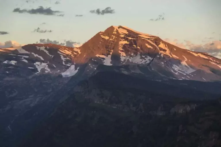
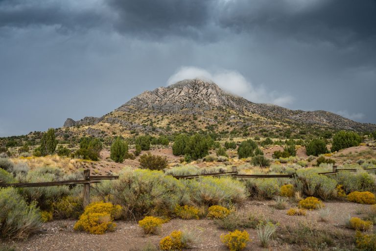
Great Basin National Park rises above Nevada's high desert plateau, home to Wheeler Peak (13,063 feet) and some of North America's darkest night skies. The park's isolation—surrounded by remote valleys—makes it a sanctuary for both landscape and astrophotography.
- 13,063 ft Highest peak (Wheeler)
- 13 million+ acres Surrounding region
- 10.6 miles Scenic drive elevation gain
- Dark Sky Park Designation
Wheeler Peak Summit — Wheeler Peak Scenic Drive
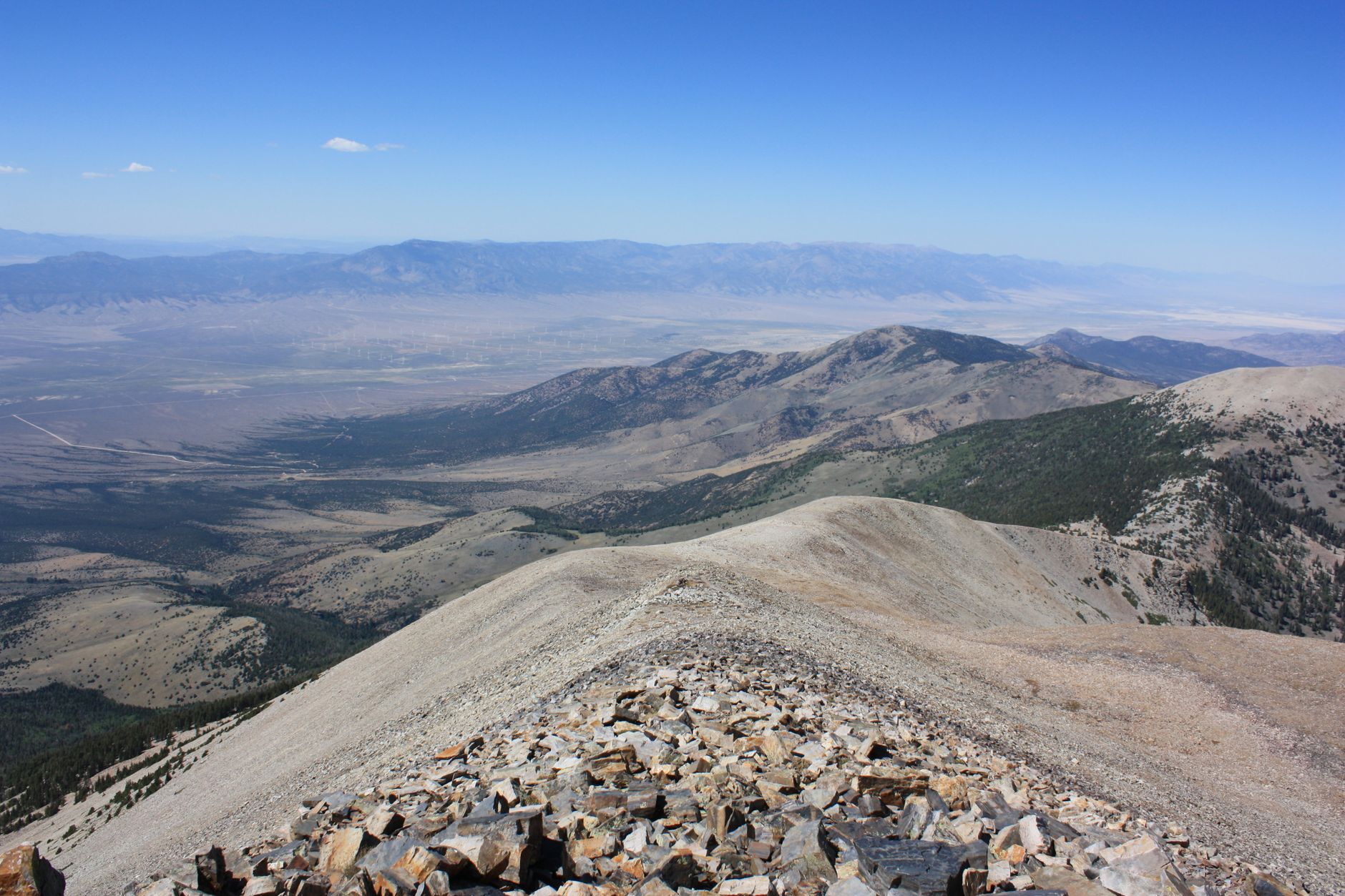
Panoramic mountain vistas stretch 100+ miles from Nevada's second-highest summit.
- 100+ mile panoramic views on clear days
- Second-highest peak in Nevada at 13,063 feet
- Alpine talus terrain and cirque formations
- Stella Lake visible during ascent
- Exposed high-altitude environment with dramatic weather
ROUTE
8.6 miles roundtrip from Summit Trailhead at 10,160 feet elevation. Gain 3,100 feet through talus slope and alpine terrain. The Stella Lake area appears mid-hike, offering an alternative stopping point. Trail becomes exposed and loose above treeline.
CONDITIONS
Strenuous; plan 6-10 hours roundtrip. Afternoon thunderstorms are common, especially July-August. Start before dawn, bring layers (high-altitude wind chill), and carry one gallon of water minimum. Rocky, uneven terrain demands quality footwear.
WHY PHOTOGRAPHERS CHOOSE IT
100+ mile panoramic views on clear days with Sierra Nevada and distant Utah mountains visible. Alpine light conditions at 13,063 feet deliver brilliant, long-lasting golden hour. The exposed summit catches first light and holds it longer than lower elevations.
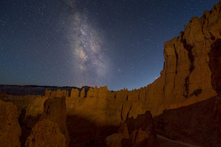
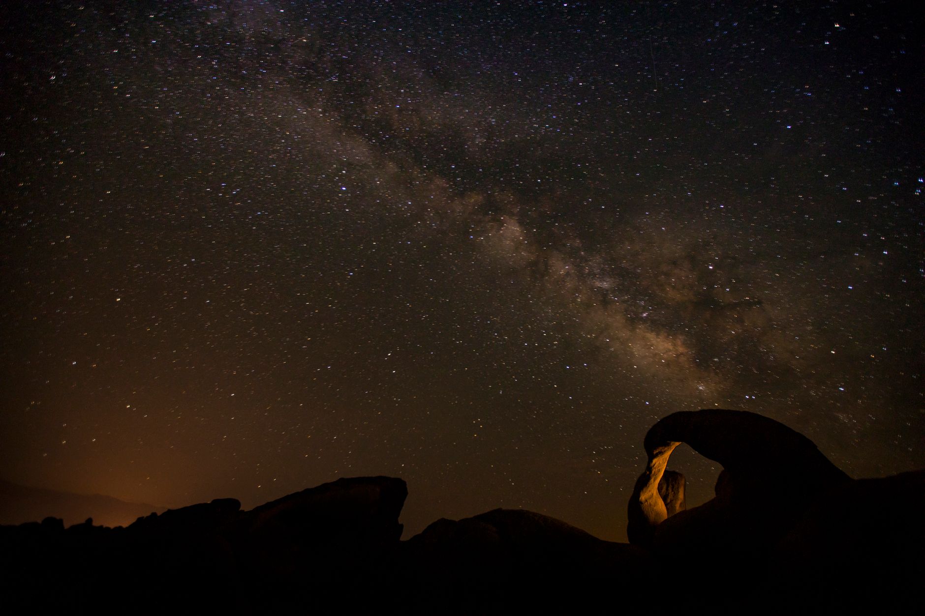
Stella Lake — Wheeler Peak Scenic Drive
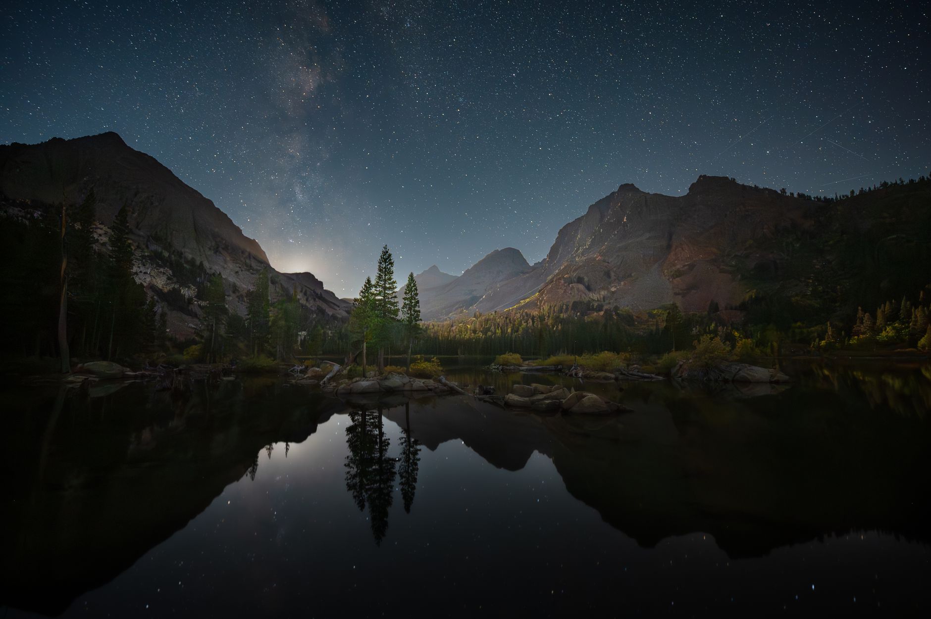
High-altitude alpine lake renowned for night-sky photography in dark-sky country.
- Excellent night-sky and astrophotography conditions
- Alpine environment at treeline
- One-mile easy approach from Summit Trailhead
- Minimal light pollution in designated Dark Sky Park
- Glacial cirque setting with dramatic peaks
ACCESS
One mile roundtrip from Summit Trailhead at end of Wheeler Peak Scenic Drive. Relatively flat trail, suitable for all hiking levels. Drive-accessible location keeps road time short.
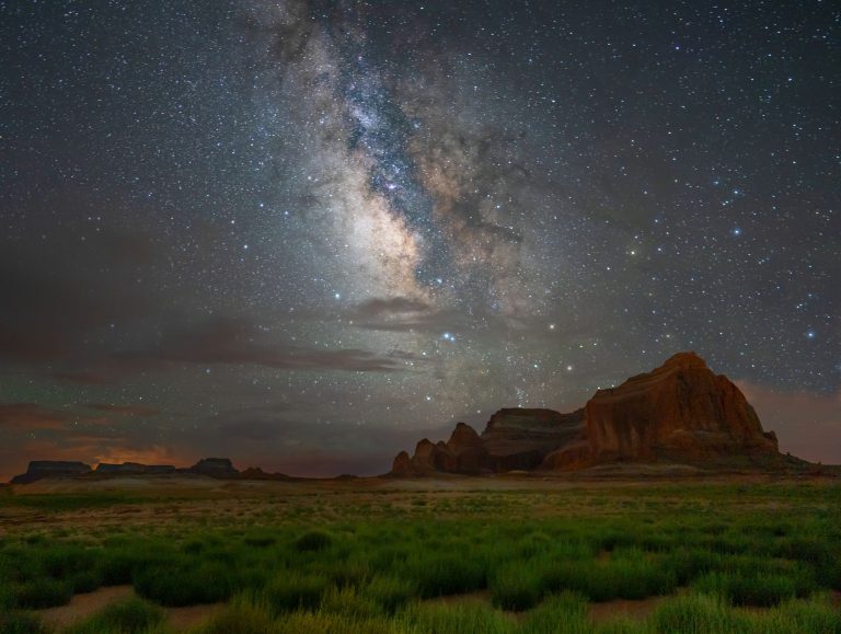
NIGHT-SKY CONDITIONS
Stella Lake sits in Great Basin National Park's designated Dark Sky Park area, providing some of North America's darkest skies. High elevation and remote location eliminate light pollution. Milky Way core dominates summer nights; winter offers deep-sky constellation clarity.
WHAT TO EXPECT
Alpine tundra environment with sparse vegetation. Evening temperatures drop rapidly; bring jacket and layers. Cold lake water reflects starlight. Limited wind protection; position yourself behind rocks for stability during long exposures.
Baker Lake — Baker Creek Trail
Glacial cirque lake with snow-clad rocky shoreline—dramatic alpine scenery at 10,630 feet.
- One of largest mountain lakes in Great Basin
- Snow frequently clings to rocky shoreline year-round
- Glacial cirque setting with surrounding bristlecone pines
- High-elevation pristine alpine environment
- Dense riparian forests and vibrant meadows on approach
ROUTE
10.4 miles roundtrip from Baker Creek Trailhead (off Highway 488). Starting elevation 8,020 feet; 2,610 feet elevation gain to lake at 10,630 feet. Dense forests and meadows dominate first half; terrain opens to alpine terrain near lake.
ALPINE FEATURES
Snow frequently remains on the rocky shoreline year-round, even in summer. Glacial cirque setting delivers dramatic vertical walls. Bristlecone pines frame the basin. High-altitude clarity provides exceptional long-distance photography across surrounding peaks.
LOGISTICS
Strenuous day hike requiring 5-10 hours; overnight backpacking option available with free backcountry permits from Lehman Caves or visitor centers. Baker Creek Road is gravel and may close seasonally. No water available on trail—carry substantial supply.
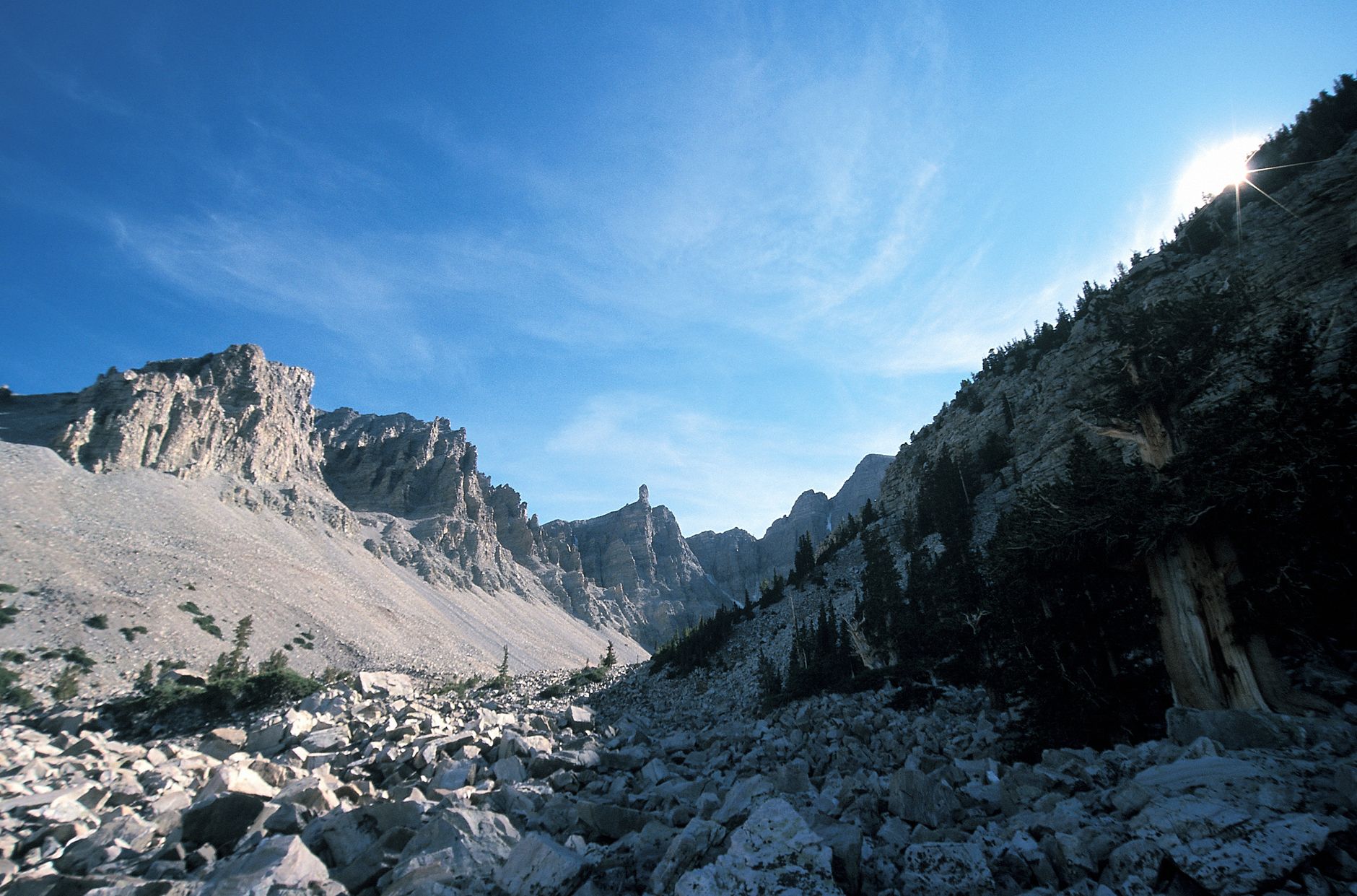
Wheeler Peak Bristlecone Grove — Wheeler Peak Scenic Drive
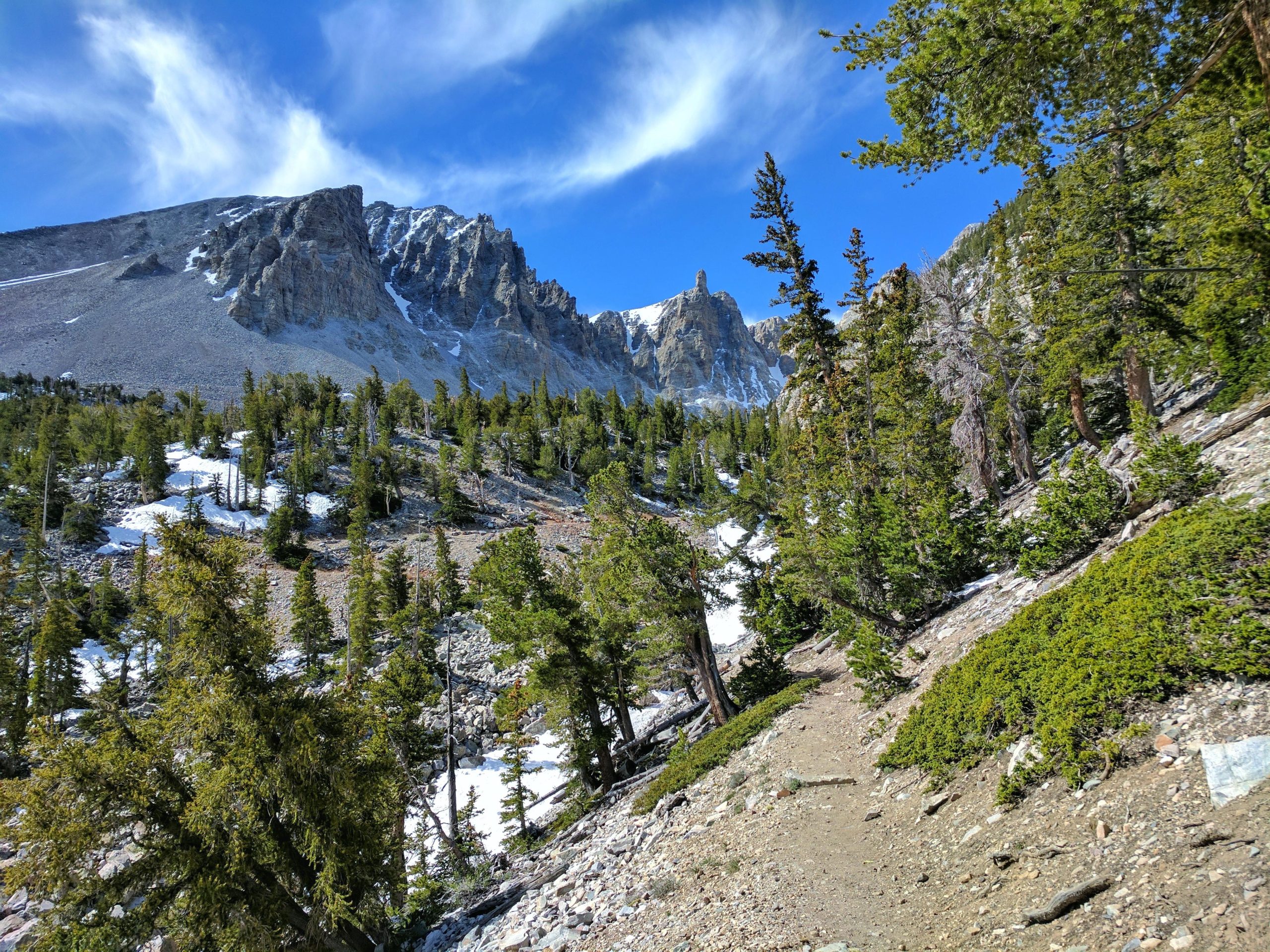
Ancient bristlecone pines—some 4,000 years old—photograph beautifully in harsh alpine light.
- Oldest living organisms in the world, circa 4,000 years
- Interpretive signage throughout grove explaining tree age
- Rocky alpine terrain with clear high-elevation skies
- Accessible bristlecone grove in Great Basin
- Starting elevation 9,890 feet with talus slope terrain
THE GROVE
Home to bristlecone pines approximately 4,000 years old—the oldest living organisms on Earth. Interpretive signage explains tree age dating and ecology. Ancient Prometheus Tree was 5,200 years old before being cut in 1964.
TRAIL CONDITIONS
2.8 miles roundtrip with 600 feet elevation gain. Starting elevation 9,890 feet. Rocky, narrow sections with steep areas. Talus slope terrain. Moderate difficulty; plan 1.5-3 hours.
PHOTOGRAPHY DETAILS
High-altitude clarity delivers excellent photography conditions. Weathered wood grain and twisted forms of ancient trees photograph well in directional morning light. Sparse alpine vegetation and rocky backdrop emphasize the trees' isolation and age.
Lexington Arch — South of Baker
One of world's tallest limestone arches—a rare six-story rock formation carved from a former cave system.
- Nearly 200 feet tall limestone arch (six stories high)
- Rare limestone formation; most US arches are sandstone
- Dramatic geological feature carved by ancient cave water
- Flowstone deposits visible at arch base
- Remote location requiring serious planning
GEOLOGY
Lexington Arch rises nearly 200 feet tall—one of the world's tallest limestone arches. Rare among US arches (most are sandstone). Flowstone deposits at the base reveal its origin as part of a former cave system, continuously reshaped by rainwater dissolution.
ACCESS & EFFORT
Approximately 7 miles of rough unimproved dirt road from Baker via NV 487 (becomes UT 21). 5.6 miles roundtrip hiking with 1,220 feet elevation gain. Starting elevation 7,050 feet. Moderate difficulty; plan 3-5 hours hiking. Only Great Basin trail permitting pets (6-foot leash).
WHAT TO EXPECT
Exposed hillsides with sparse shade (fire damage early 2010s). Bring substantial water supply—none available on trail. Weather changes rapidly in remote location. Dramatic white rock formation photographs well in warm morning light or evening side-light.
Mather Overlook — Wheeler Peak Scenic Drive
Drive-accessible overlook with 360-degree sky views—prime spot for night-sky photographers who prefer car access.
- 360-degree panoramic sky views
- Approximately 8,000 feet elevation
- Drive-to overlook; accessible at night
- Panoramic vista orientation
- High-elevation night-sky conditions
LOCATION & ACCESS
Drive-to overlook at approximately 8,000 feet elevation along Wheeler Peak Scenic Drive. No hike required; accessible by vehicle after sunset for night-sky photography.
SKY CONDITIONS
360-degree panoramic views with minimal light interference. High elevation places you above much ground-level light pollution. Particularly striking for wide-angle night-sky captures. No overnight camping allowed.
WHY PHOTOGRAPHERS PREFER IT
Combines accessibility with excellent dark skies. Ideal for photographers wanting night-sky shots without backcountry hiking. Vehicle access allows equipment transport and extended sessions. Panoramic orientation provides foreground options for night-sky compositions.
Astronomy Amphitheater — Lehman Caves Area
NPS-led astronomy programs at a dedicated venue—ideal for stargazing without solo night navigation challenges.
- Primary venue for NPS-led astronomy programs
- Tiered stone seating for organized stargazing events
- Dedicated astronomy programming with expert guidance
- Near Lehman Caves Visitor Center
- Community stargazing experience
VENUE & PROGRAMS
Primary NPS venue for astronomy programs. Tiered stone seating designed for group stargazing. Ranger-led programs provide celestial navigation, constellation identification, and discussion of deep-sky objects. No overnight camping allowed.
EXPERIENCE
Community-oriented stargazing with expert guidance. Ideal alternative to solo navigation in remote locations. Ranger expertise enhances understanding of what you're photographing. Programs typically run during summer months; check NPS website for current schedule.
DARK-SKY CONDITIONS
Located within Great Basin Dark Sky Park designation. Tiered seating provides stable positioning for tripod-mounted cameras. Group setting offers both photography and social stargazing. Professional-grade sky conditions without backcountry effort.
Common Questions
What's the best time of year for photography at these spots?
June–September offer accessible roads and stable weather for hiking to Wheeler Peak, Baker Lake, and Bristlecone Grove. Night-sky photography excels year-round; July–August provide longest dark hours. Spring (May) and fall (September–October) offer cooler temperatures and clearer alpine light. Winter closes Wheeler Peak Scenic Drive and Lexington Arch road access.
Do I need permits or reservations?
No permits required for day hikes. Overnight backcountry camping requires free permits from Lehman Caves or Great Basin Visitor Centers. Lehman Caves tours (separate from photography) require reservations 2–4 weeks in advance via Recreation.gov. Ranger astronomy programs are free.
Which spots are accessible without serious hiking?
Mather Overlook and Astronomy Amphitheater are drive-to locations requiring no hiking. Stella Lake is a one-mile easy walk from Summit Trailhead. All three offer night-sky photography opportunities with minimal physical effort.
How dark are the skies, really?
Great Basin National Park is an International Dark Sky Park with exceptionally low light pollution. Milky Way core is vivid in summer; winter constellation clarity is exceptional. Stella Lake and Mather Overlook (both 8,000+ feet) offer darker skies than lower elevations.
Sources & Further Reading
- Wheeler Peak (U.S. National Park Service) — NPS
- Hike to Wheeler Peak (U.S. National Park Service) — NPS
- Wheeler Peak Scenic Drive Trails (U.S. National Park Service) — NPS
- Stargazing - Great Basin National Park (NPS) — NPS
- Bristlecone Grove (U.S. National Park Service) — NPS
- Hike to the Wheeler Peak Bristlecone Grove (U.S. National Park Service) — NPS
- Bristlecone Pines (U.S. National Park Service) — NPS
- Baker Lake (U.S. National Park Service) — NPS
- Hike to Baker Lake (U.S. National Park Service) — NPS
- Lakes and Ponds (U.S. National Park Service) — NPS
- Baker Lake Trail, Great Basin National Park - Recreation.gov — Recreation.gov
- Lexington Arch (U.S. National Park Service) — NPS
- Hike to Lexington Arch (U.S. National Park Service) — NPS
- Lehman Caves Tours (U.S. National Park Service) — NPS
- Lehman Caves Tour (U.S. National Park Service) — NPS