5 Best Stargazing Spots in Capitol Reef National Park
Five exceptional Capitol Reef stargazing spots ranked from remote to accessible—where to see the Milky Way.
Capitol Reef protects extremely dark night skies across its remote red rock landscape. The park's low light pollution and high elevation create ideal conditions for viewing the Milky Way core, planets, and meteor showers throughout the year.
- $20 Entrance fee
- Open 24/7 Park access
- March–Nov Peak stargazing season
- 5,500 ft Average elevation
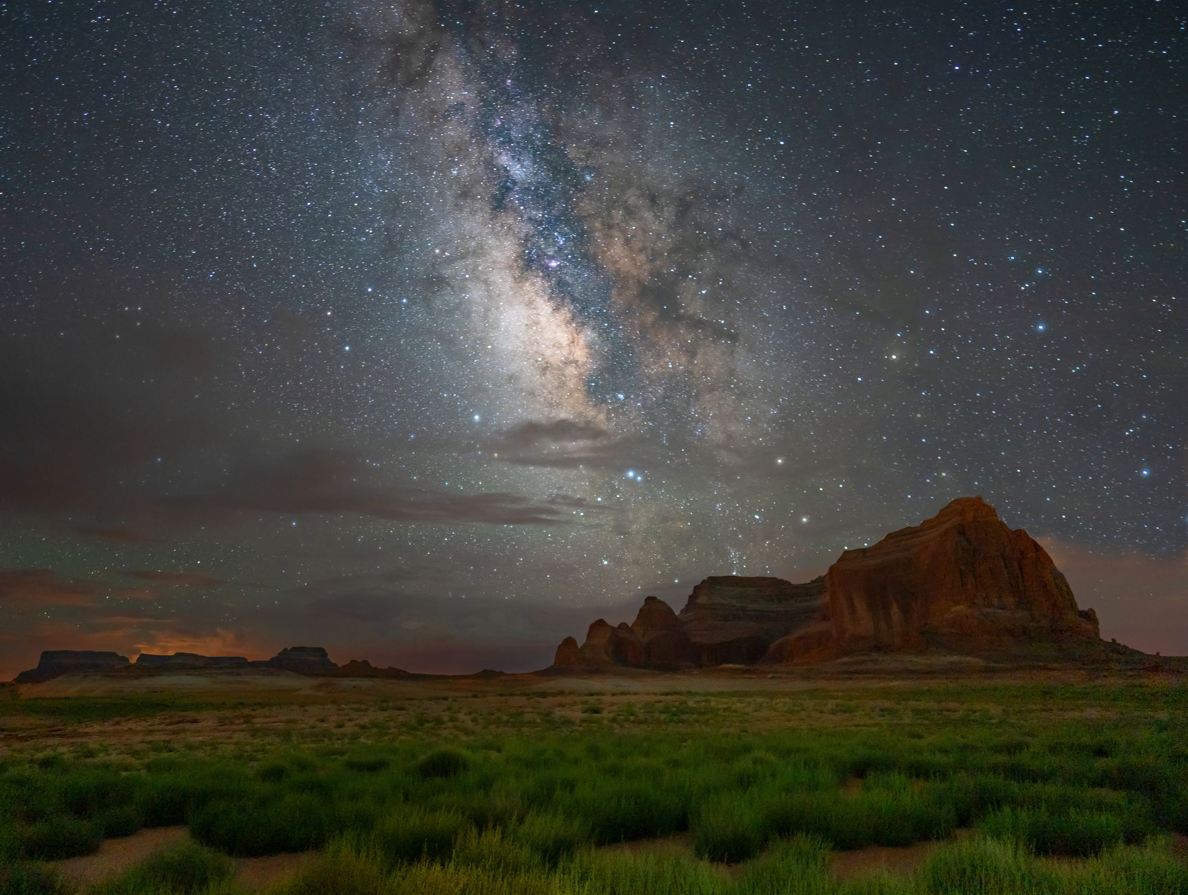
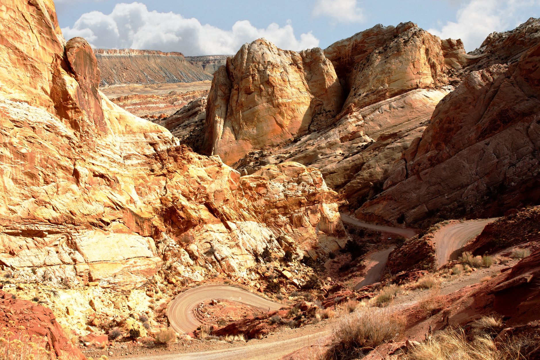
Cathedral Valley — North of Highway 24
The park's darkest stargazing location—a remote high-desert amphitheater framed by towering sandstone temples.
- Temple of the Sun and Temple of the Moon formations silhouetted against dense starfield
- Primitive campground with 6 free campsites for overnight astronomy
- One of the darkest and most secluded stargazing locations in the park
- Cathedral Valley Loop: 57.6 miles—plan 6–8 hours for scenic drive
- Exceptional Milky Way photography conditions once moon sets
ACCESS & LOGISTICS
Cathedral Valley requires a high-clearance or 4WD vehicle. The Hartnet Road entrance is 28.1 miles from Highway 24; the full Cathedral Valley Loop spans 57.6 miles and takes 6–8 hours to drive. A primitive campground offers 6 free campsites—first-come, first-served—but has no potable water. Bring all supplies and fill water before entering. Cell reception is poor or absent. Download offline maps and plan your route before arriving. The park is open 24 hours, so you can stargaze anytime.
Cooler nighttime temperatures (averaging 50–65°F in spring and fall) make camping comfortable for extended viewing sessions. Summer nights average 62–70°F; winter nights drop to 20–35°F and require insulated sleeping systems.
SKY CONDITIONS
Cathedral Valley sits far from artificial light sources, making it one of the park's premier dark-sky locations. The Milky Way core is visible and bright from March through November. Summer months offer extended evening hours, while fall and winter provide earlier nightfall and crisp air that makes stars appear sharper. New moon phases eliminate moonlight competing with faint constellations and deep-sky objects.
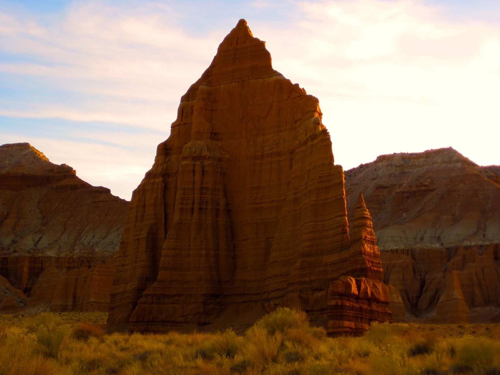
The distinctive Temple of the Sun and Temple of the Moon monoliths frame the southern horizon—ideal photography subjects when silhouetted against a star-filled sky. Bentonite Hills and Glass Mountain add layered color to compositions. Winter offers the sharpest star visibility due to exceptionally dry air.
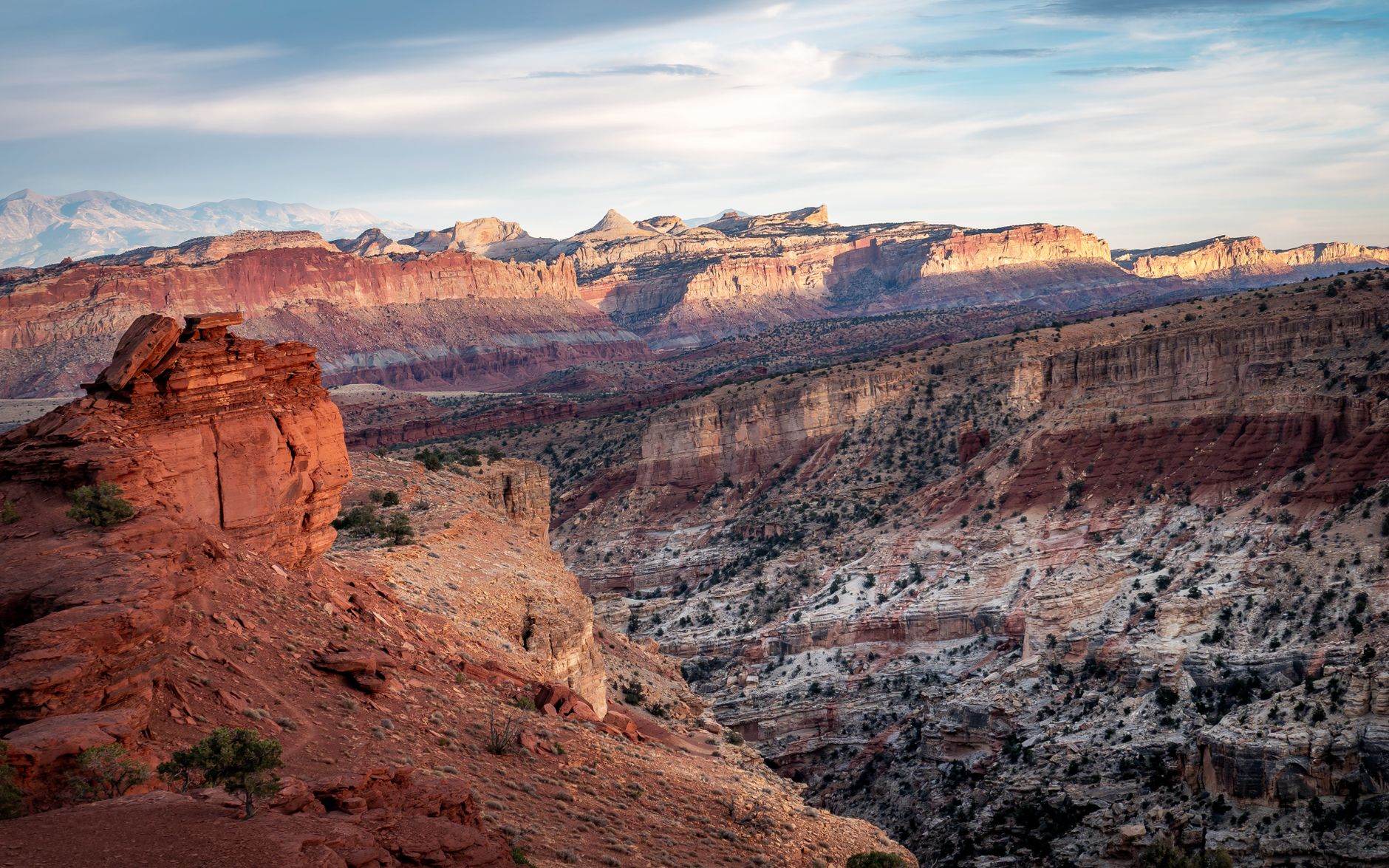
Halls Creek Overlook — South District
A remote backcountry viewpoint with exceptional dark skies overlooking the Waterpocket Fold's geologic heart.
- 56.1 miles from visitor center via Notom-Bullfrog Road and Burr Trail Road
- 4WD and high-clearance vehicle required; final 3 miles extremely rough
- Panoramic views of layered geologic periods and the Waterpocket Fold
- Extremely remote location—no light pollution for hundreds of miles
- Gateway to Halls Creek Narrows backcountry hiking
EXTREME ACCESS
Halls Creek Overlook is one of Capitol Reef's most remote destinations. Starting from the visitor center, drive 56.1 miles via Highway 24, Notom-Bullfrog Road, and Burr Trail Road—a journey that can take 4+ hours. The final 3 miles require high-clearance 4WD vehicles; sedan cars will not make it. Summer monsoon rains (July–August) often make this road impassable. Call the visitor center at 435-425-3791 before attempting this drive.
No services, water, or facilities exist at the overlook. Bring ample fuel, water, food, and emergency supplies. Cell reception is unreliable. This destination suits experienced backcountry travelers only. Avoid attempting the drive during or immediately after rain.
ISOLATION & DARKNESS
Halls Creek Overlook's extreme remoteness creates exceptional dark-sky conditions. Hundreds of miles separate you from significant light pollution. The Milky Way dominates the night sky with clarity often impossible at more accessible locations. The sweeping views of the Waterpocket Fold—visible during twilight and outlined by starlight—offer a unique geological and astronomical experience combined.
Best stargazing occurs during new moon phases, March through November. Winter months bring the clearest air but coldest temperatures (averaging 20–30°F at night). Summer evenings (June–August) offer warmth but distant wildfire haze may reduce visibility. Spring and fall deliver optimal conditions: clear skies, moderate temperatures (40–70°F), and excellent Milky Way positioning.
Burr Trail — South District
High-elevation switchbacks with pitch-black skies favored by night photographers and Milky Way seekers.
- Scenic switchbacks offer pullouts with panoramic southern sky access
- Featured in NPS dark sky monitoring program
- Primitive camping areas along Burr Trail Road for extended stargazing
- Excellent Milky Way photography opportunities from elevated vantage
- Picnic area at top of switchbacks with sunset and night-sky viewing
VISIBILITY & POSITIONING
The Burr Trail switchbacks climb to higher elevation, which lifts you above lower-altitude haze and improves atmospheric transparency. Pullouts along the switchback road provide vantage points with expansive southern sky views. The wide-open landscape offers 180-degree or greater sky exposure—ideal for Milky Way photography. Multiple pullouts allow you to choose position based on evening wind direction and comfort.
The road is a mix of paved and dirt sections. High-clearance vehicles are sometimes necessary, and the drive is impassable when wet. Plan to arrive before sunset and scout pullout locations before dark. Several primitive camping spots exist along the road, allowing overnight stargazing if you choose.
MONITORING & SCIENCE
The Burr Trail is part of the NPS Night Sky Monitoring Network. Park rangers and visiting scientists use Sky Quality Meter (SQM) data collection here to track light pollution trends over time. This designation confirms the location's dark-sky credentials and makes it a reliable choice for visitors seeking scientifically verified viewing conditions.
Spring through early fall offers the longest viewing windows, with the Milky Way core visible throughout the night. New moon phases provide the darkest skies. June through August brings warm temperatures (averaging 60–87°F) and extended daylight hours; March through May offers cooler, clearer conditions (40–65°F) with crisp air that sharpens star visibility.
Panorama Point — Fruita Historic District / Western Entrance
A high-elevation viewpoint with easy access and 360-degree red rock views ideal for first-time stargazers.
- Located 2.5 miles west of visitor center on Highway 24
- Parking area with short walk to 360-degree sweeping views
- Elevated location ideal for night sky observation above haze
- Cellular service available—ideal for families or less-experienced visitors
- Colorful sandstone formations visible at sunset and silhouetted by starlight
EASY ACCESS
Panorama Point sits just 2.5 miles west of the visitor center on Highway 24, making it one of the park's most accessible stargazing locations. A short walk from the parking area brings you to the viewpoint. The road is paved, suitable for all vehicles including RVs. Cellular service is available, which appeals to families or visitors new to backcountry stargazing.
The viewpoint opens onto a 360-degree panorama of sandstone cliffs, making it ideal for photography. Arrive before sunset to position yourself; parking can fill during clear-sky periods, particularly on weekends. The gentle elevation gain poses no physical challenge for most visitors.
TWILIGHT & STARLIGHT
The elevated location at Panorama Point positions you above lower-elevation haze, improving sky clarity. During twilight (the hour after sunset), colorful sandstone formations remain visible, creating stunning composition opportunities. As night deepens, the landscape is silhouetted against an increasingly dense star field.
The Milky Way is visible March through November, with summer offering the longest twilight window (sunset around 8:15 PM in June). Spring and fall bring cooler temperatures (averaging 40–75°F) ideal for comfort during extended viewing. Winter provides crystal-clear skies with bright-appearing stars, though nightfall arrives earlier (around 5 PM in December).
Gooseneck Overlook — Fruita Historic District / Western Entrance
A gentle, short walk to sweeping canyon views and dark skies—ideal for all fitness levels.
- Located 1 mile down unpaved road from Panorama Point, 600-foot walk from parking
- Named for the S-shaped meander (gooseneck) formation in Sulphur Creek gorge
- Short, easy access makes it suitable for visitors of all abilities
- Sweeping views of tight creek drainage and dramatic canyon curves
- Combines accessibility with genuine dark-sky viewing conditions
ACCESSIBLE HIKING
A 600-foot walk from the parking area brings you to Gooseneck Overlook—an easy stroll suitable for children, seniors, and visitors with limited mobility. The path is well-defined and gains minimal elevation. The unpaved road to the parking area is accessible to standard vehicles but may be rough after rain; the NPS recommends avoiding this spot immediately after precipitation.
The short distance makes this ideal for families or those new to stargazing. Visitors can combine Gooseneck Overlook with nearby Panorama Point in a single trip, creating a progressive evening: sunset at Panorama Point, then a twilight walk to Gooseneck Overlook for deeper-night stargazing.
CANYON & STARS
From Gooseneck Overlook, you gaze down into a dramatic S-shaped meander carved by Sulphur Creek. The narrow canyon walls frame the night sky, creating an intimate viewing experience despite the expansive overhead visibility. Light pollution is even lower here than at nearby Panorama Point, making fainter stars and deep-sky objects more visible.
The Milky Way is prominent March through November. Clear nights from October through March bring the sharpest star visibility. Summer months (June–August) offer the latest sunset times, extending the twilight window and allowing longer evening astronomy sessions. Spring and fall deliver optimal temperature comfort (50–70°F) for extended outdoor time.
Common Questions
When is the best time to stargaze at Capitol Reef?
March through November offers the most Milky Way visibility, with peak brightness April–September. New moon phases provide the darkest skies. Spring (March–May) and fall (September–October) deliver the clearest air and most comfortable temperatures (50–75°F). Winter brings exceptionally bright stars due to dry air, though nightfall arrives early (around 5 PM in December).
What stargazing gear should I bring?
Red headlamp (preserves night vision), binoculars, warm layers, and water are essentials. Advance to telescopes or astro cameras only if you've scouted your location and planned your setup. Bring a light jacket even in summer, as desert nights cool significantly after sunset.
Are all stargazing spots accessible by car?
Gooseneck Overlook and Panorama Point are easy car-accessible viewpoints. Burr Trail requires standard vehicle access. Cathedral Valley and Halls Creek Overlook require high-clearance 4WD vehicles and are impassable when wet. Call 435-425-3791 for current road conditions before attempting remote drives.
Can I camp overnight for stargazing?
Cathedral Valley offers a primitive campground with 6 free campsites and no water. Burr Trail has primitive camping areas. Other viewpoints are day-use only. Backcountry camping requires permits from the visitor center. Bring all water and supplies; no services exist at remote locations.
Do I need permits for stargazing or photography?
No permits are required for daytime or nighttime stargazing at designated viewpoints. Commercial photography or large group trips may require special use permits; contact the visitor center at 435-425-3791 for details.
Sources & Further Reading
- Capitol Reef National Park — National Park Service
- Stargaze - Things to Do — National Park Service
- Night Sky - Capitol Reef National Park — National Park Service
- Panorama Point - Capitol Reef National Park — National Park Service
- Guide to the Scenic Drive - Capitol Reef — National Park Service
- International Dark Sky Park - Capitol Reef National Park — Visit Utah
- Cathedral Valley - Capitol Reef National Park — National Park Service
- Halls Creek Narrows - Capitol Reef National Park — National Park Service
- Trail Guide - Capitol Reef National Park — National Park Service