6 Best Easy Hikes in Canyonlands National Park for Beginners
Start with Stone Storehouse, summit with Murphy Point—six easy Canyonlands hikes ranked from shortest to most scenic.
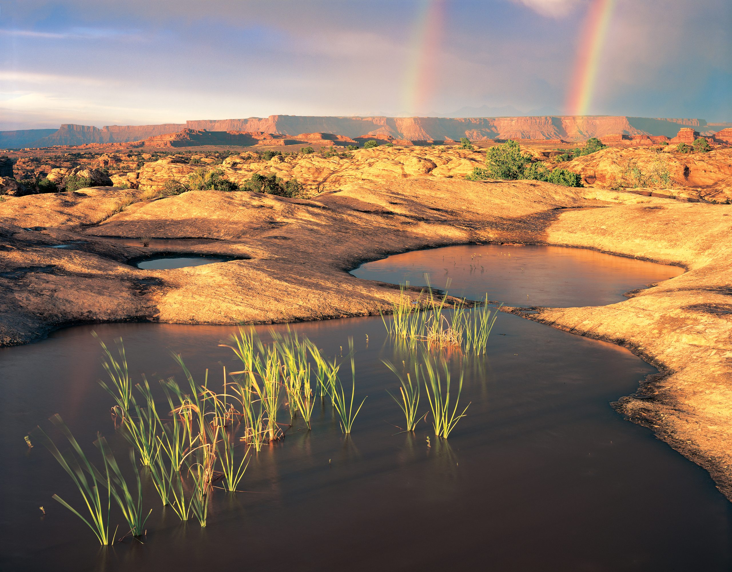
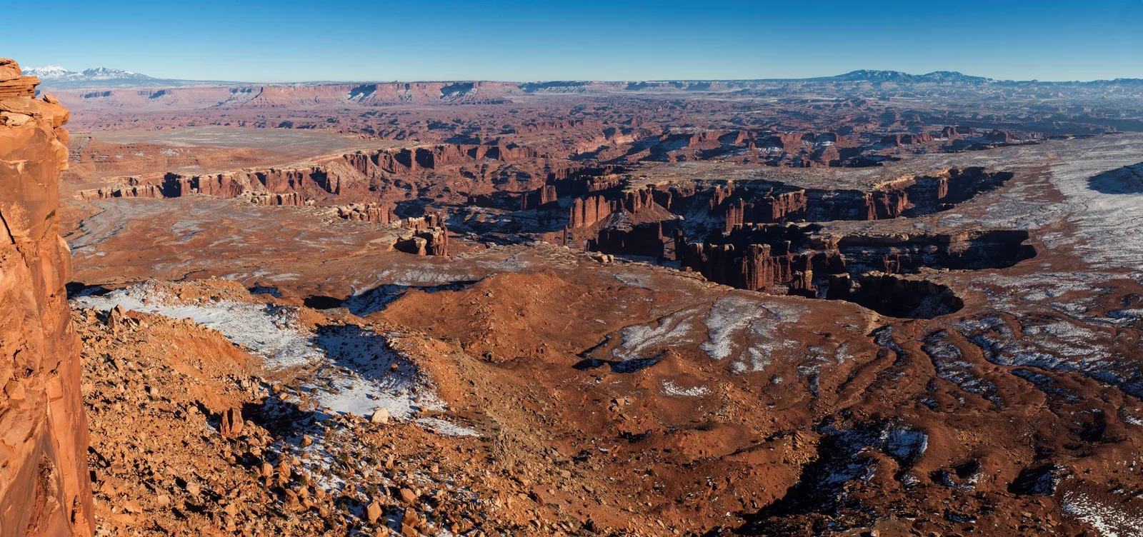
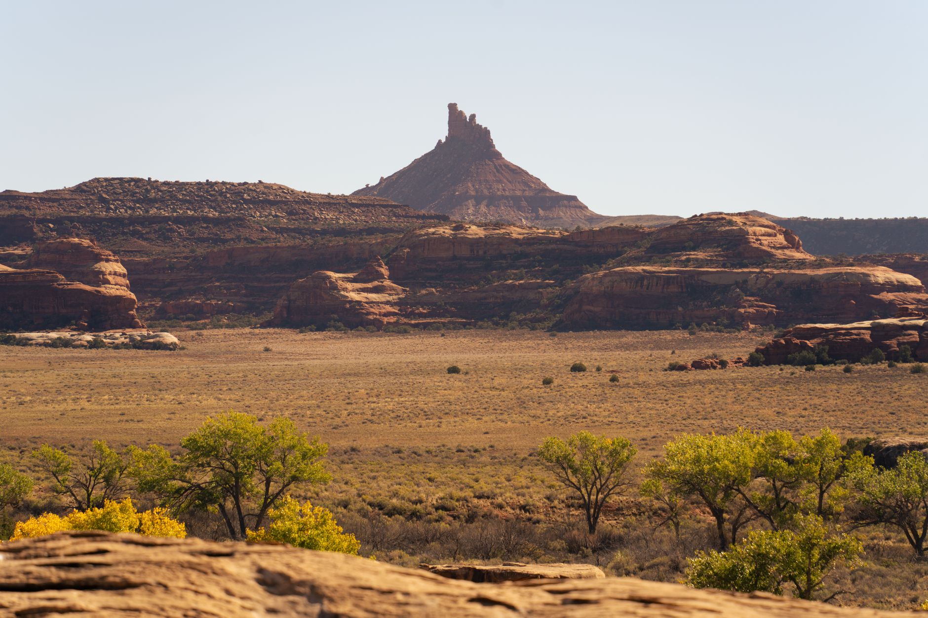
Canyonlands sprawls across four districts. Island in the Sky commands panoramic mesa views; the Needles offer sculptured rock spires and natural potholes; the Maze remains roadless wilderness; the Rivers corridor threads the Colorado and Green. For beginners, Island in the Sky and Needles hold the easiest entry points—short walks past arches, cultural sites, and geologic puzzles.
- $30 Entrance fee (7-day vehicle pass)
- 2 Hiking districts
- 0.3–3.4 mi Trail length range
- 11–142 ft Elevation gain range
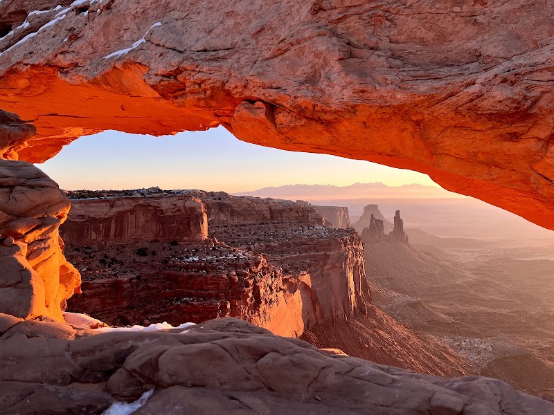
Mesa Arch — Island in the Sky
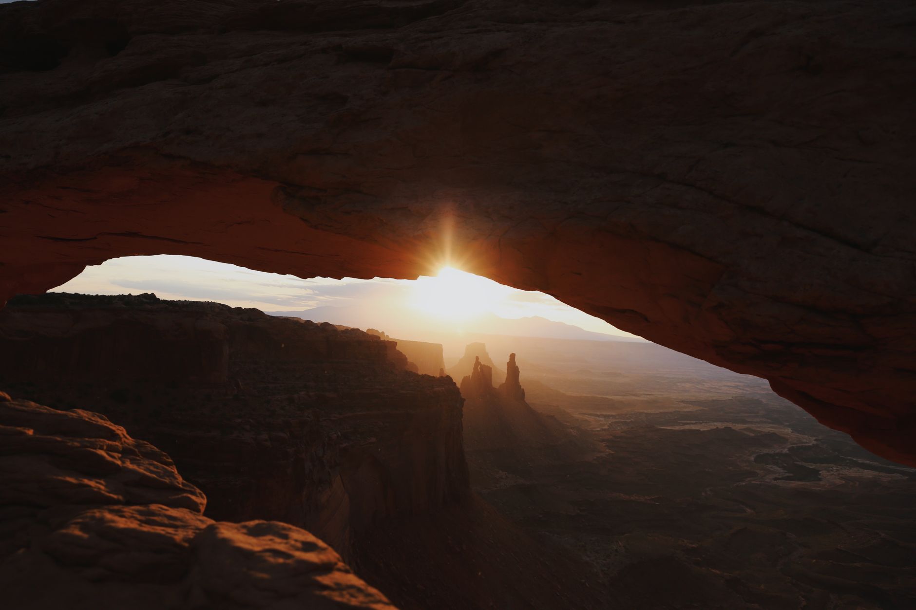
Thirty feet of stone frame sunrise light displays—the most photographed arch in southeast Utah.
- 27-foot arch frames canyon vistas and La Sal Mountains
- Iconic sunrise photography destination
- 0.6 mi loop, 56 ft elevation gain
- 30-minute roundtrip
- Stone steps and rocky terrain
ROUTE
A 0.6-mile loop over stone steps and rocky terrain. Photographers gather before dawn to capture light displays through the arch. The park notes that counterclockwise routes minimize crowded stair areas.
WHAT TO EXPECT
The 27-foot arch frames canyon vistas and views of the La Sal Mountains. Sunrise light creates iconic photography moments. Sunset offers opportunities with fewer crowds 30 minutes after sunrise. Winter requires traction devices on icy rock.
LOGISTICS
Roundtrip 30 minutes. Auto parking available at the trailhead. Dogs prohibited; service animals permitted. Not wheelchair-accessible.
Stone Storehouse Trail — Needles District
The park's shortest hike unlocks a 950 CE ancestral Puebloan storage structure in a protected alcove.
- Shortest trail in Canyonlands at 0.3 miles
- Ancestral Puebloan granary built around 950 CE
- Protected alcove setting
- Native plant interpretive garden
- 20-minute roundtrip
ROUTE
A 0.3-mile loop over rocky terrain and stone steps. The protected alcove setting preserves cultural resources. This is the most accessible entry to Canyonlands archaeology.
WHAT TO EXPECT
A well-preserved ancestral Puebloan storage structure (granary) built into a rock alcove around 950 CE. Interpretive plantings show the native plants historical inhabitants used—an adaptation to the desert landscape 1,000+ years ago.
LOGISTICS
Roundtrip 20 minutes. Auto parking available. Dogs prohibited; service animals permitted. Archaeological regulations strictly prohibit touching or climbing—view from distance only.
Pothole Point Trail — Needles District
Sandstone potholes host tiny ecosystems—follow cairns across slickrock with Needles views framing the way.
- Unique pothole ecosystem communities on slickrock
- Cairn-marked loop through geological formations
- Needles rock formation views
- Biological soil crusts worth protecting
- 45-minute roundtrip
ROUTE
A 0.6-mile loop following cairns across uneven slickrock and stone steps. The Needles rock formation creates visual frames throughout. Rocky terrain requires good foot placement.
WHAT TO EXPECT
Sandstone potholes (shallow depressions worn into slickrock) host diverse aquatic organisms, bacteria, and microbes. Each pothole is a tiny ecosystem sensitive to disturbance. Biological soil crusts—black, crusty growth on surrounding rock—take decades to form and minutes to damage from foot traffic.
LOGISTICS
Roundtrip 45 minutes. Auto parking available. Dogs prohibited; service animals permitted. Do not touch or step in potholes. Winter requires traction devices for slippery rock.
Cave Spring Trail — Needles District
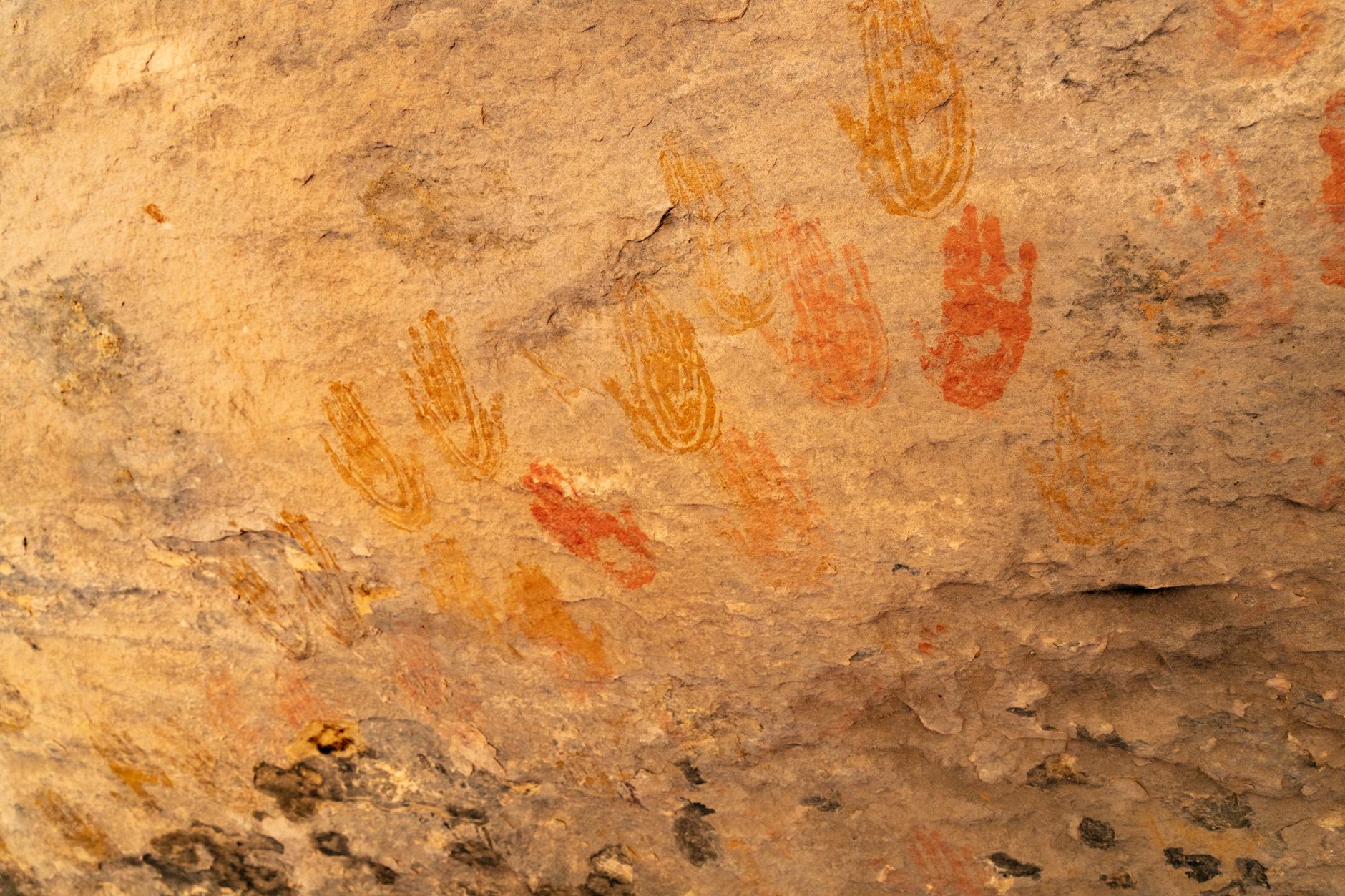
Climb two ladders to navigate prehistoric rock art and 1800s cowboy ruins on one compact loop.
- Two wooden ladder climbs on slickrock sections
- Historic cowboy camp artifacts from late 1800s
- Prehistoric ancestral Puebloan pictographs
- Natural spring seeps
- 45-minute roundtrip
ROUTE
A 0.6-mile loop with two short ladder climbs over slickrock sections. Rocky, uneven terrain and stone steps connect each historical site. The ladders add brief vertical exposure without technical climbing.
WHAT TO EXPECT
Cave Spring combines two eras: ancestral Puebloan pictographs (rock art) and late-1800s cowboy camp artifacts. Spring seeps create natural water sources in the desert. Interpretive signs explain how both groups adapted to this landscape. The spring itself is sacred to local descendants—view from distance only.
LOGISTICS
Roundtrip 45 minutes. Auto parking available. Dogs prohibited; service animals permitted. Do not touch, mark, or deface rock art. Do not enter the spring cave.
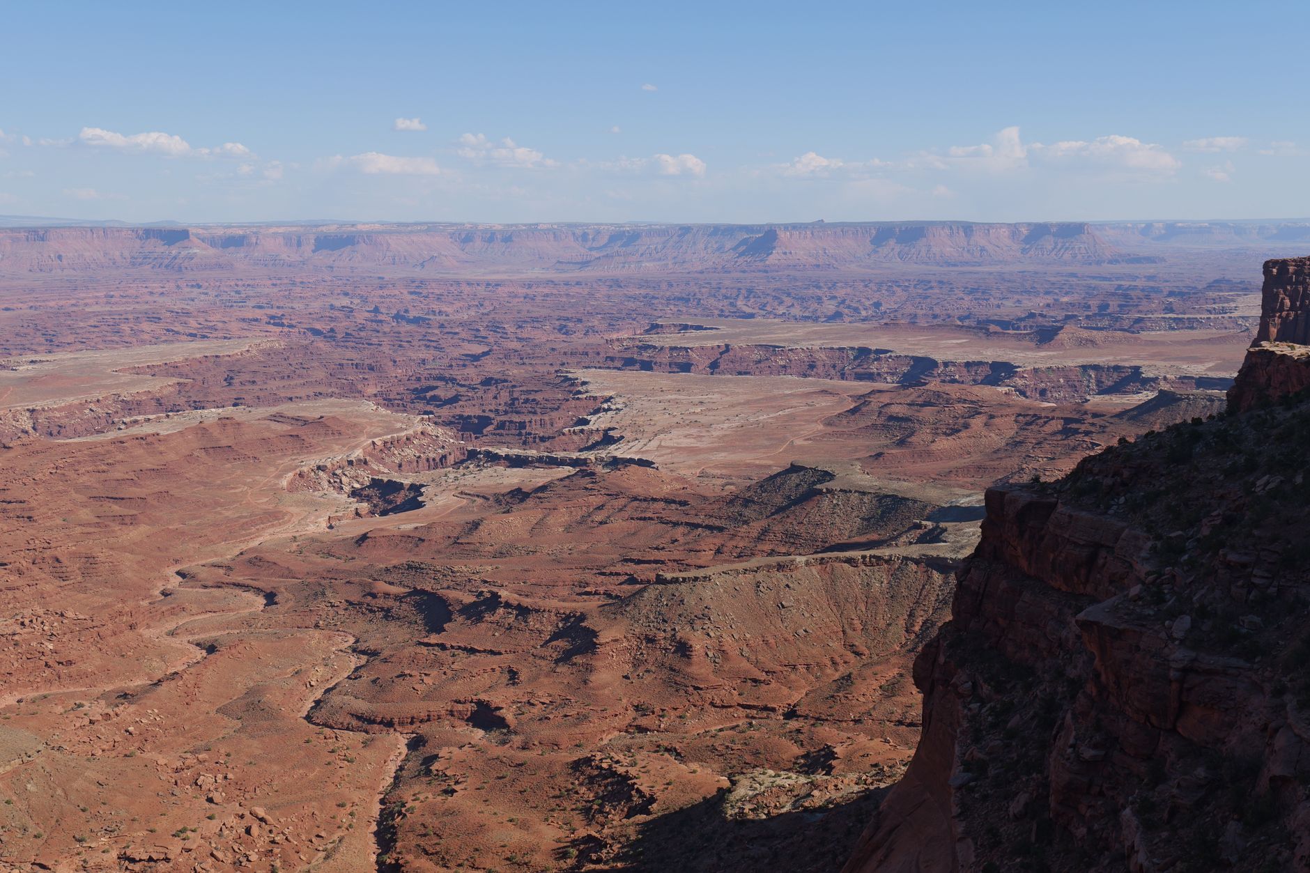
Grand View Point — Island in the Sky
From the Island in the Sky's southern tip, see four districts—Maze, Needles, and canyons beyond—at once.
- Views of multiple Canyonlands districts from one overlook
- Paved primary overlook plus optional 1.8-mile trail extension
- White Rim Road visible thousands of feet below
- Miles of corrugated canyons and rock layers
- Ranger geology talks spring–fall
ROUTE
Grand View Point sits at Island in the Sky's southern terminus. A short paved walkway reaches the primary overlook. An optional 1.8-mile trail with rocky terrain and stone steps extends to a second overlook for deeper canyon views.
WHAT TO EXPECT
From this single vantage, see miles of corrugated canyons, the White Rim Road etched thousands of feet below, the Needles and Maze districts, and distant mountains. The view encompasses some of the deepest geology in Canyonlands. Ranger geology talks (spring through fall) explain the layered rock strata and formation processes.
LOGISTICS
Roundtrip 1.5 hours for the full 1.8-mile hike. Primary overlook is accessible by short paved walk. Auto parking available. Dogs prohibited; service animals permitted. Winter requires traction devices for icy rock.
Murphy Point Trail — Island in the Sky
The longest easy hike climbs gently to panoramic vistas and a historic corral—fewer crowds than Mesa Arch.
- 3.4 miles mostly level terrain on mesa top
- Panoramic views of Candlestick Tower
- Green River and White Rim Road visible below
- Historic ranching-era corral
- 2-hour roundtrip, rarely crowded
ROUTE
An out-and-back trail of 3.4 miles over mostly level, but rough terrain with stone steps. The mesa-top setting means expansive views at every turn. Generally less crowded than Mesa Arch.
WHAT TO EXPECT
Panoramic vistas of Candlestick Tower, the Green River carved into canyons below, and the White Rim Road etched across the landscape. A historic corral (stone structure from the ranching era) offers a window into how desert settlement operated. Sunrise and sunset light transforms the views.
LOGISTICS
Roundtrip 2 hours. Auto parking available. Dogs prohibited; service animals permitted. Best at sunrise or sunset. Winter requires traction devices for frozen ground.
Common Questions
Do I need to reserve these trails or buy a permit?
No. Most trails are first-come, first-served. Check nps.gov/cany for alerts about seasonal closures (winter snow/ice) or maintenance. The park entrance is $30 per vehicle, valid 7 days.
What's the best time to visit these hikes?
Spring (March–May) and fall (September–November) offer mild temps and stable weather. Summer exceeds 90°F; winter brings snow and icy slickrock. Early morning or sunset visits beat crowds and heat.
Which trail should I start with as an absolute beginner?
Stone Storehouse (0.3 mi, 20 min) is the gentlest entry—flat, quick, and rewarding. Mesa Arch (0.6 mi) comes next if you want iconic sunrise photography. Both build confidence for longer hikes.
Are these trails safe for kids?
Yes. Watch kids near cliff edges (common on mesa-top trails). Stone Storehouse, Mesa Arch, and Pothole Point are most family-friendly. Cave Spring's ladder climbs need adult spotting. Murphy Point's 3.4 miles works for older kids.
What should I bring?
Water (2+ liters in summer), sunscreen, a hat, sturdy hiking boots, and a headlamp for dawn/dusk. Slickrock is slippery when wet. No water sources on these trails—carry all you'll drink.
Sources & Further Reading
- Mesa Arch - National Park Service — National Park Service
- Stone Storehouse Trail - National Park Service — National Park Service
- Pothole Point Trail - National Park Service — National Park Service
- Cave Spring Trail - National Park Service — National Park Service
- Grand View Point Overlook and Trail - National Park Service — National Park Service
- Murphy Point Trail - National Park Service — National Park Service