6 Best Four-Wheel Drive Routes in Canyonlands National Park
Six iconic backcountry routes — from technical descents to hundred-mile loops.
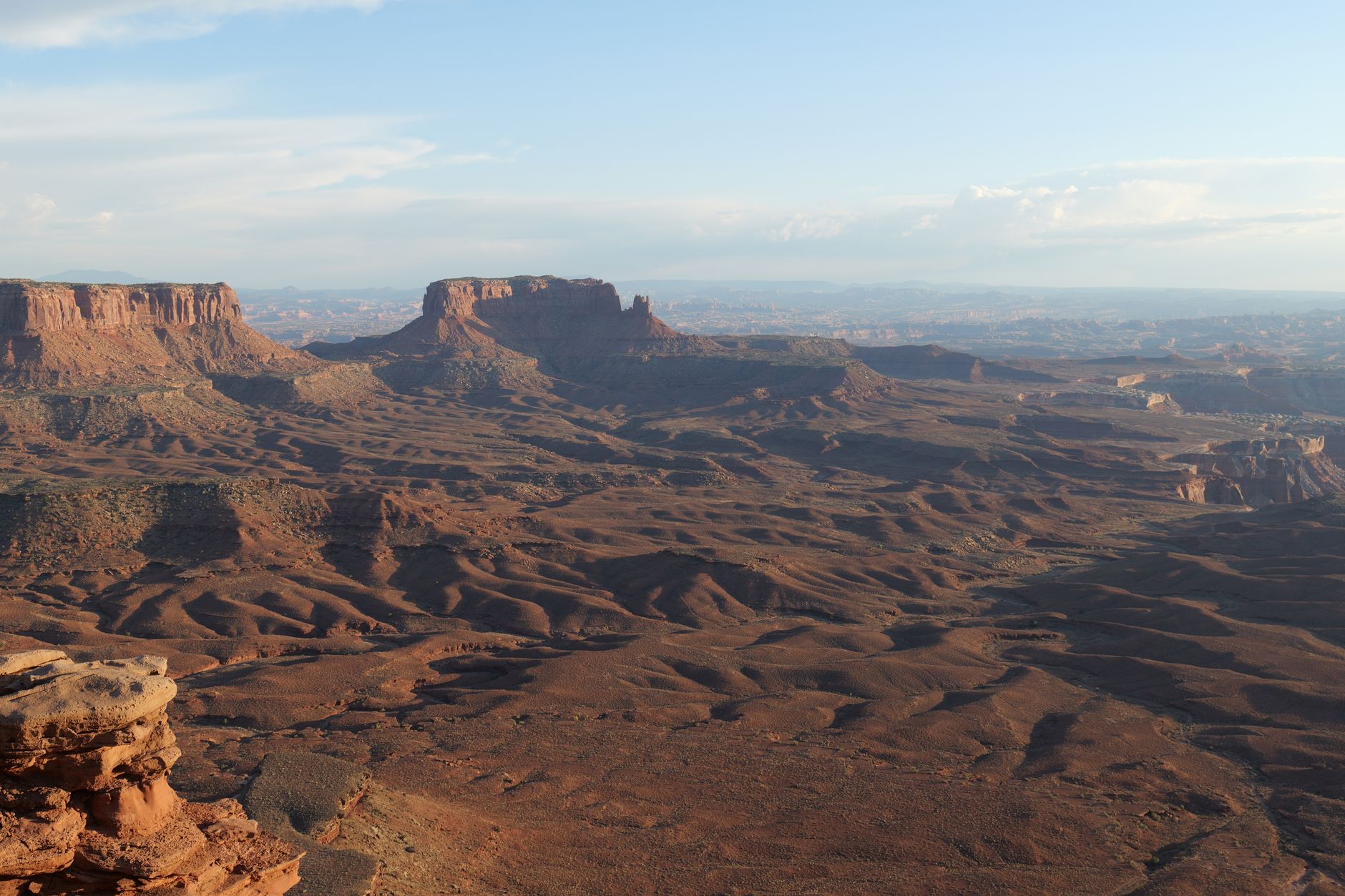
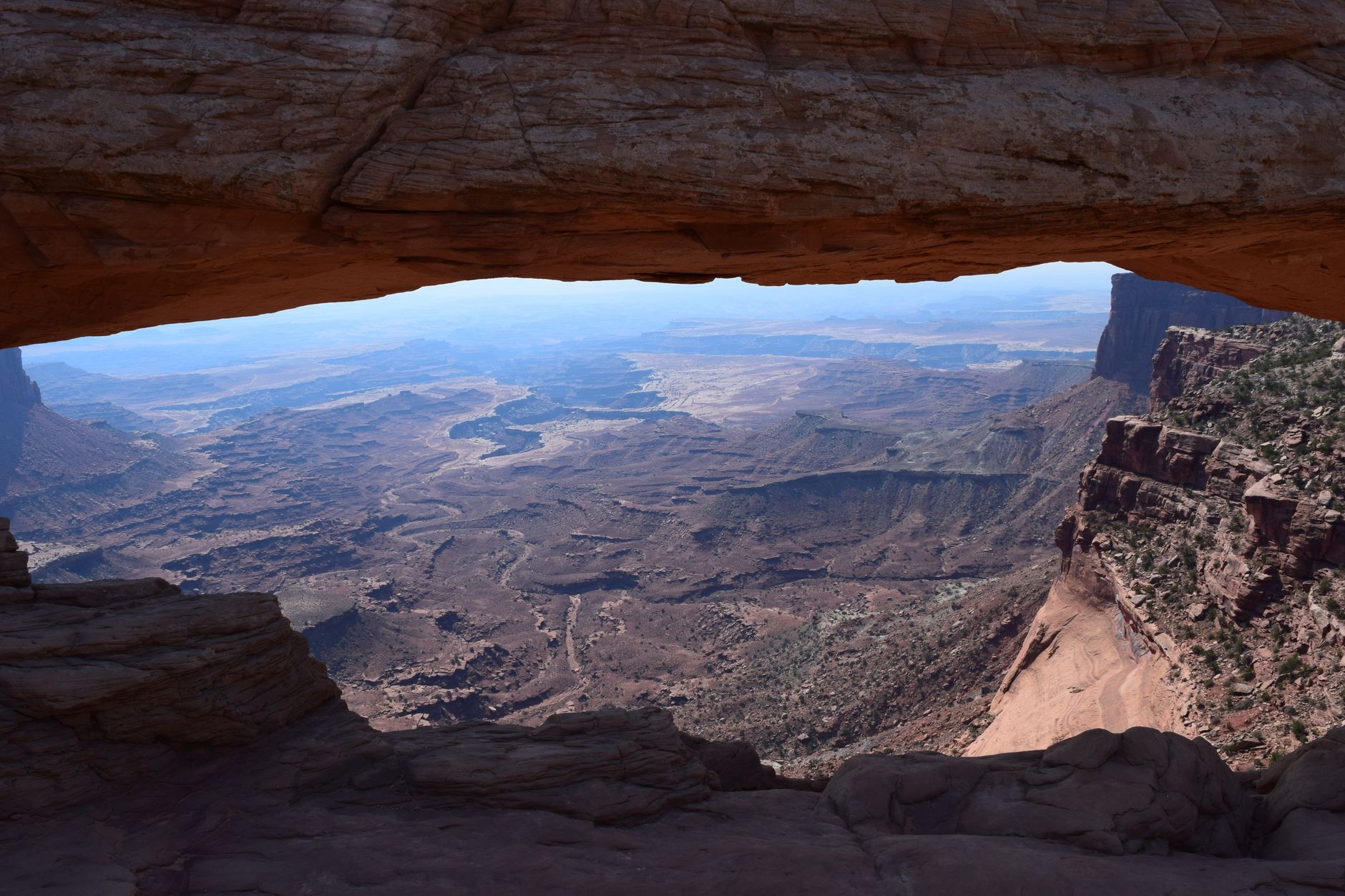
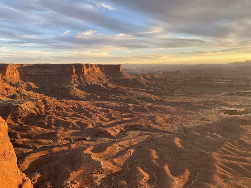
Canyonlands sprawls across four distinct districts carved by the Colorado and Green rivers, each offering hundreds of miles of remote 4WD-only roads through red rock canyons, mesas, and spires. High-clearance vehicles unlock access to backcountry viewpoints, historic campsites, and terrain that few visitors ever see.
- 337K acres Park area
- 8+ main routes 4WD road routes
- $30/vehicle Entrance fee
- 24/7 year-round Operating hours
White Rim Road — Island in the Sky
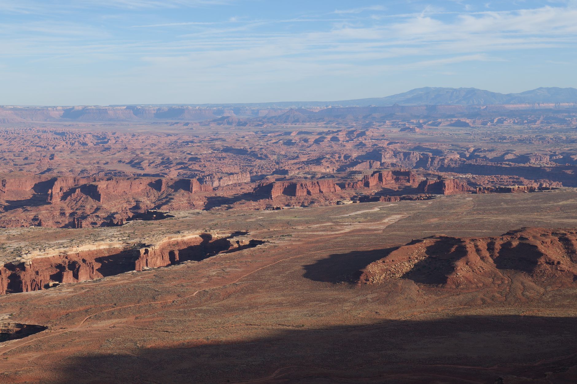
A hundred-mile loop encircling the Island in the Sky mesa with twenty campsites and four steep sections.
- 100-mile loop route with expansive Colorado River views
- Steep technical sections: Shafer Trail descent, Lathrop Canyon Road, Murphy Hogback, Hardscrabble Hill
- Twenty designated campsites for multi-day trips
- Requires high-clearance 4WD with low-range; max vehicle width 8 ft, height 9.5 ft
THE ROUTE
White Rim Road is a complete loop that circumnavigates the Island in the Sky mesa, descending from the rim and climbing back up. The route includes four technically steep sections: Shafer Trail (1,500 ft drop), Lathrop Canyon Road, Murphy Hogback, and Hardscrabble Hill. Total mileage is roughly 100 miles, typically driven over 2–3 days by 4x4 or 3–4 days by mountain bike.
Twenty designated campsites dot the loop, spaced to allow flexible multi-day trips. Each site offers water access and basic amenities. The route provides continuous views of the Colorado River, canyon walls, and red rock formations.
PERMITS & ACCESS
Day-use and overnight permits required. Advance reservations strongly recommended, especially spring (April–May) and fall (mid-September–October), when overnight slots fill weeks in advance. Contact the park at 435-719-2313 or visit the NPS website for current availability and reservation windows.
Vehicle restrictions: high-clearance 4WD with low-range gear mandatory. Maximum vehicle width is 8 feet, height 9.5 feet. ATVs, UTVs, and OHVs are prohibited.
GEAR & WATER
Bring 1+ gallon of water per person per day. Essential equipment includes full-size spare tires, extra gasoline, shovel, and high-lift jack. October–April: carry tire chains for all four tires. Towing costs outside park boundaries exceed $1,500, so self-sufficiency is critical.
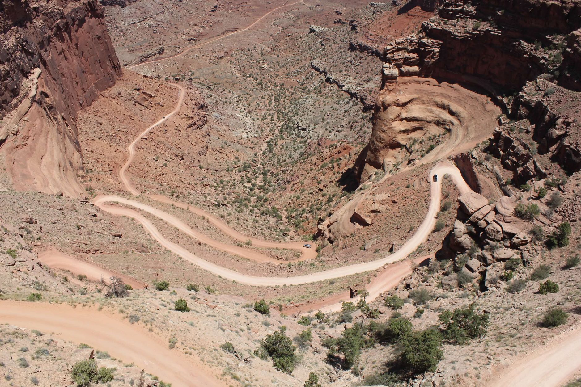
Shafer Trail Road — Island in the Sky
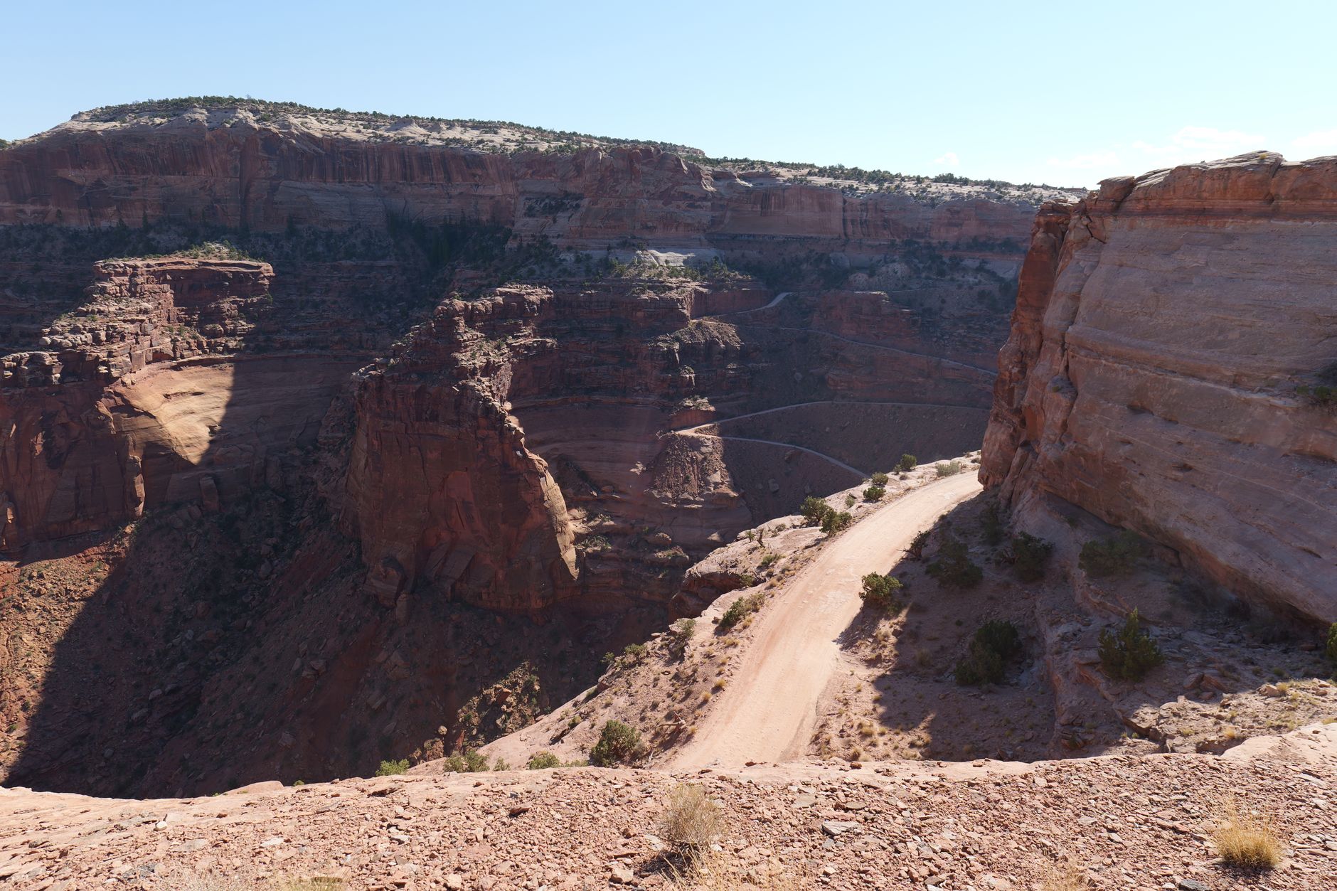
A historic 5-mile descent dropping 1,500 feet through colorful sandstone cliffs with Mormon-era heritage.
- Dramatic 1,500-foot elevation drop in 5.2 miles
- Colorful massive sandstone formations frame the entire descent
- Historic route: used by Mormon pioneers (1916), sheep herders, uranium miners
- Technical but drivable for experienced 4WD operators; often first half of White Rim Road trip
HISTORY & TERRAIN
Shafer Trail descends through a narrow corridor of colorful, massive sandstone. The route was originally created as a Native American footpath for accessing mesa resources, later used by Mormon pioneers in 1916, sheep herders, and uranium miners. Today it remains one of Utah's most iconic 4WD descents.
The trail is narrow and steep, with a 15 mph speed limit. The 1,500-foot drop occurs over just 5.2 miles, making it one of the steepest drivable descents in the park.
DRIVING TECHNIQUE
Use low gear (4LO) and descend slowly; excessive braking causes brake fade and damage. The road is typically passable year-round, but winter may require chains. No permit needed for day-use, making it accessible even for a half-day outing.
Shafer Trail often serves as the entry point to White Rim Road loop. After descending, drivers can turn north onto Potash Road or continue onto the White Rim loop.
Elephant Hill 4WD Road — The Needles
Utah's most technical 4WD road—stair-step drops and backups demand expert skill and precision.
- Extreme technical terrain: stair-step drops, steep grades, loose rock, and tight turns
- Requires backing maneuvers and pinpoint vehicle control
- Max vehicle length 21 feet; wider/longer vehicles impossible on sections
- Day-use permit required; provides access to four backcountry campsites
DIFFICULTY & PREREQUISITES
Elephant Hill is one of the most challenging 4WD roads in Utah. The road features stair-step drops, loose rock, steep grades, and tight turns that demand expert vehicle control. Backing maneuvers are required in multiple sections.
This route is not recommended for beginners or stock vehicles. Drivers must have extensive 4WD experience, mechanical knowledge, and recovery equipment. A high-lift jack, multiple recovery straps, and preferably a spotter are essential.
PERMITS & CAMPING
A day-use permit is required. The road provides access to four backcountry campsites: Devils Kitchen, New Bates Wilson, Bobby Jo, and Horsehoof. Overnight travel requires backcountry camping permits and a reusable toilet system.
Vehicle length is capped at 21 feet; larger vehicles cannot navigate the tight sections. Pre-trip vehicle inspection is mandatory—test brakes, suspension, and all recovery gear before starting.
Potash Road — Island in the Sky / Moab Area
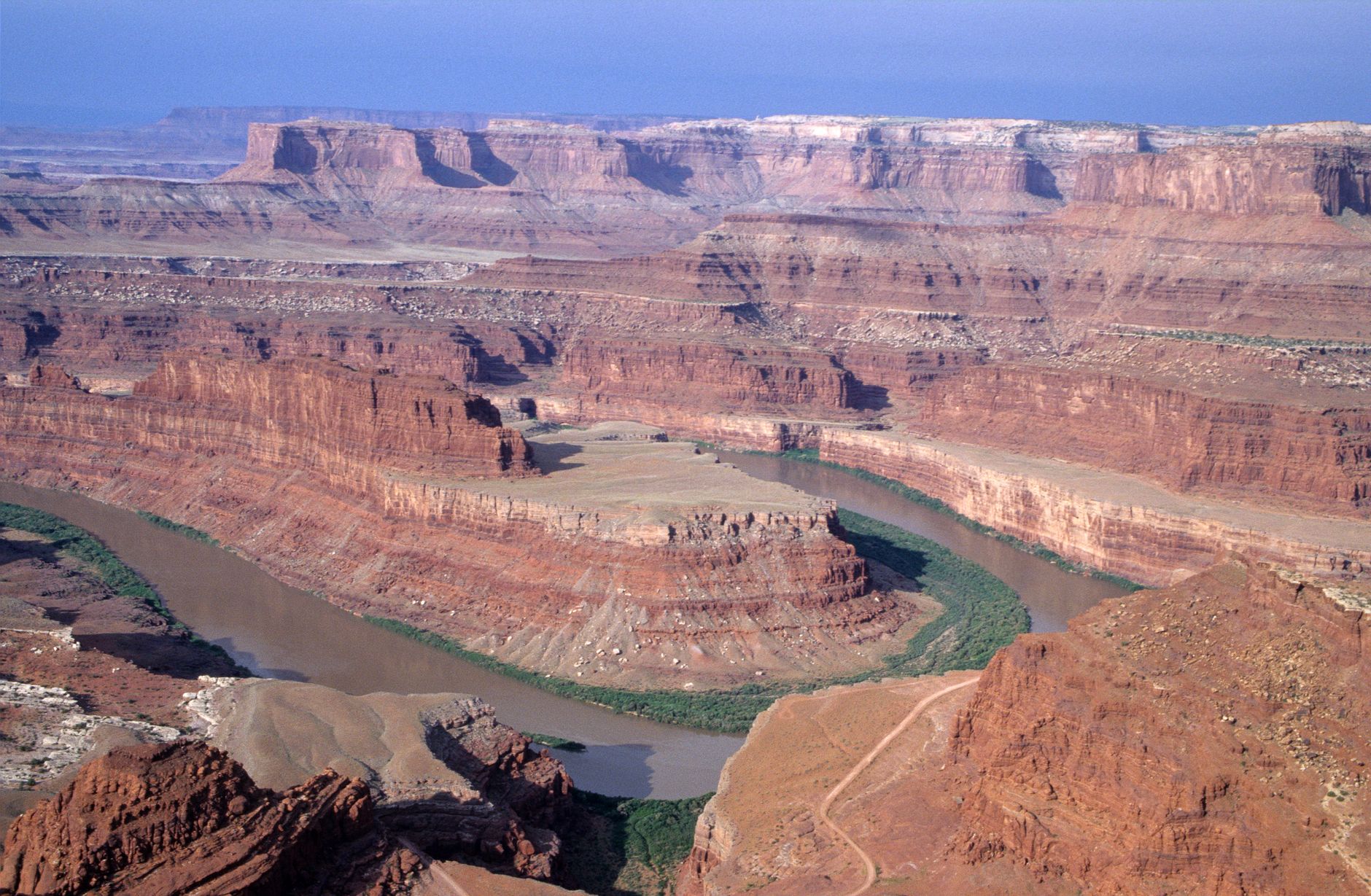
A scenic 37-mile route linking the Shafer Trail to Moab with dramatic Colorado River views throughout.
- 35–40 miles of Colorado River canyon scenery
- Connects Shafer Trail junction to Moab area, often used as White Rim Road approach
- Moderate difficulty suitable for intermediate 4WD drivers
- High-clearance 4WD required; no permit for most sections
ROUTE OVERVIEW
Potash Road runs approximately 35–40 miles from the Shafer Trail junction near Island in the Sky toward Moab, hugging the Colorado River canyon throughout. The route offers continuous views of sandstone cliffs, river bends, and desert terrain. Most drivers complete it in 3 hours.
ACCESS & CONDITIONS
High-clearance 4WD required, but the road is less technical than Elephant Hill or Shafer Trail. It is suitable for intermediate 4WD drivers with moderate vehicle preparation. No day-use permit is required.
The road is often used as a springboard into White Rim Road or as a connector from Moab to backcountry Canyonlands. Dust is common; carry extra water for vehicle cooling and personal hydration.
Lavender Canyon 4WD Road — The Needles
Deep sand and creek crossings lead to hidden arches and prehistoric rock art in remote terrain.
- Two major creek crossings with steep banks and deep water
- Numerous arches and natural bridges visible from road
- Archeological sites along route show human history in remote canyons
- Deep sand and quicksand sections demand high-clearance 4WD and experience
TERRAIN & HAZARDS
Lavender Canyon is a challenging route with deep sand, water crossings, and potential quicksand sections. Two major creek crossings have steep banks and deep water—avoid this route after heavy rain, as crossings become impassable.
The road passes through a landscape dotted with arches, natural bridges, and archeological sites. These cultural and geological features make the challenging drive worthwhile, but the terrain demands focus and experience.
PERMITS & PREPARATION
A day-use permit is required. High-clearance 4WD with low-range capability is essential. Bring traction aids (sand boards, recovery gear) in case of sand traps or water stalls.
Plan extra time; deep sand sections slow average speed significantly. The route is best undertaken in spring or fall when water levels are moderate and ground conditions are driest.
Colorado River Overlook 4WD Road — The Needles
A 7-mile out-and-back route to outstanding Colorado River views across exposed canyon country.
- Outstanding Colorado River canyon overlooks; unprotected views
- 7 miles one-way; accessible in 1–2 hours
- Moderate difficulty suitable for intermediate 4WD drivers
- No permit required; open for day-use anytime
ROUTE OVERVIEW
Colorado River Overlook Road is a 7-mile out-and-back route from The Needles district offering expansive, unprotected views of the Colorado River far below. The drive is shorter than most Canyonlands 4WD routes, making it ideal for a half-day excursion.
ACCESS & CONDITIONS
Moderate difficulty; suitable for intermediate 4WD drivers with high-clearance vehicles. No permit required, and no reservation system—drive anytime during park hours. Bring water and sun protection, as the overlook is exposed with no shade.
The route is also open to mountain bikes, attracting both vehicle and pedal-powered travelers. No facilities at the overlook; nearest services are in Moab.
Common Questions
What vehicles are allowed on Canyonlands 4WD roads?
High-clearance 4WD with low-range gear is mandatory. ATVs, UTVs, OHVs, and drones are prohibited. Vehicle dimensions matter: maximum width 8 feet and height 9.5 feet on White Rim Road; maximum length 21 feet on Needles and Maze routes. All operators must have a valid driver's license.
Do I need permits for these routes?
White Rim Road requires day-use and overnight permits, with advance reservations recommended spring and fall. Most Needles routes (Elephant Hill, Lavender Canyon, Salt Creek) require day-use permits. Potash Road and Colorado River Overlook do not require permits. Contact the park at 435-719-2313 for current availability.
What's the best time of year to drive these routes?
Spring (April–May) and fall (mid-September–October) are optimal: daytime highs average 60–80°F. Summer temperatures exceed 100°F, making heat a serious hazard. Winter is cold (lows averaging 0–20°F) and may require tire chains (October–April). Avoid these routes during heavy rain; water crossings become impassable and quicksand hazards spike.
What essential gear should I bring?
Mandatory items: full-size spare tire(s), extra gasoline, 1+ gallon water per person per day, shovel, and high-lift jack. October–April add tire chains for all four wheels. For remote Maze routes, also bring a second spare, recovery straps, and a communication device. Towing costs exceed $1,500, so self-sufficiency is critical.
Can I drive these routes with a stock SUV or truck?
Only if your vehicle has true high-clearance 4WD with low-range gearing. Most stock SUVs and trucks lack adequate ground clearance and ground-engagement capability. Potash Road and Colorado River Overlook are more forgiving for moderately lifted vehicles, but Elephant Hill and Maze roads demand specialized suspension, skid plates, and driver expertise. Consult with a local 4WD shop before attempting technical sections.
Sources & Further Reading
- White Rim Road - Canyonlands National Park — National Park Service
- Experience the Shafer Trail — National Park Service
- Four-Wheel-Drive Roads in The Needles — National Park Service
- Auto Touring in Canyonlands — National Park Service
- Four-Wheel-Drive Roads in the Maze — National Park Service
- Canyonlands National Park Official Site — National Park Service