5 Best Short Hikes at Black Canyon of the Gunnison National Park
Five rim walks and river-side strolls reveal Colorado's deepest, narrowest canyon without serious climbing.
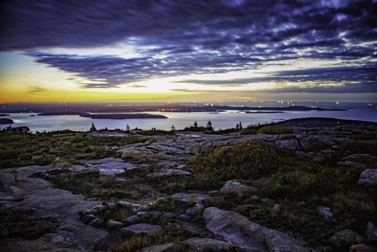
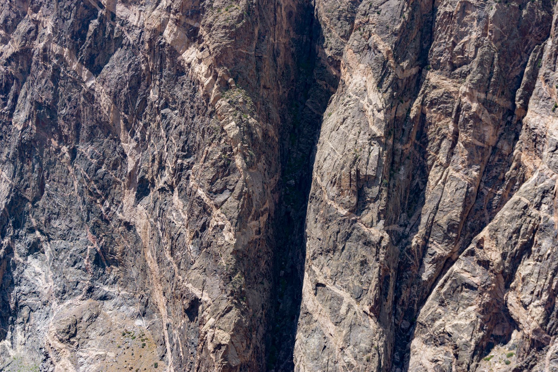
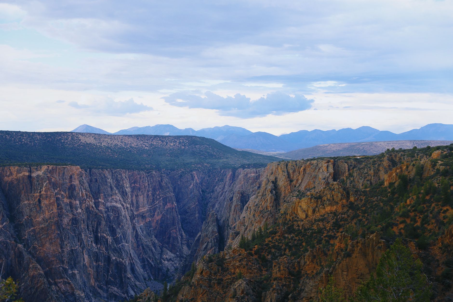
Black Canyon of the Gunnison punches a narrow gorge nearly 2,000 feet deep through Colorado's high desert. The Gunnison River carved these steep, tilted rock walls over millions of years, creating one of the steepest canyons in North America.
- $30 Entrance Fee
- 2,250 ft Painted Wall Height
- Up to 1,800 ft Canyon Walls
- 24/7 South Rim Access
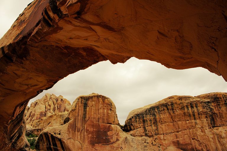
Painted Wall View Trail — North Rim
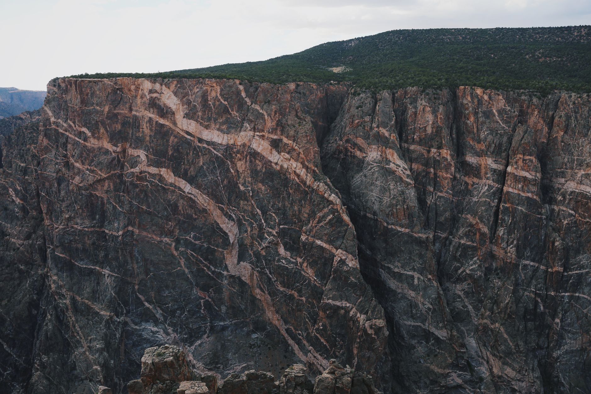
Colorado's tallest cliff at 2,250 feet looms over this pocket-sized nature walk.
- 200-yard roundtrip walk in 5–30 minutes
- Colorado's tallest cliff (2,250 ft from river to rim)
- Spring wildflowers March–October
- Dramatic tilted rock formations and color bands
THE WALK
The Painted Wall View Trail is Colorado's shortest way to the state's tallest cliff. A simple 200-yard stroll from the North Rim trailhead gains just 29 feet of elevation, making it accessible for families and visitors with limited mobility. Most people complete it in 5 to 30 minutes—enough time to grab photos and take in the 2,250-foot vertical sweep of tilted, color-banded rock.
WHAT TO SEE
Painted Wall dominates the skyline—a jumble of rose, cream, and gray rock stripes that climb sheer from the Gunnison River. Spring wildflowers (March through October) dot the adjacent juniper and mountain mahogany scrub. Morning light hits the southeast face and brings out the rock striations; late afternoon casts dramatic shadows across the wall.
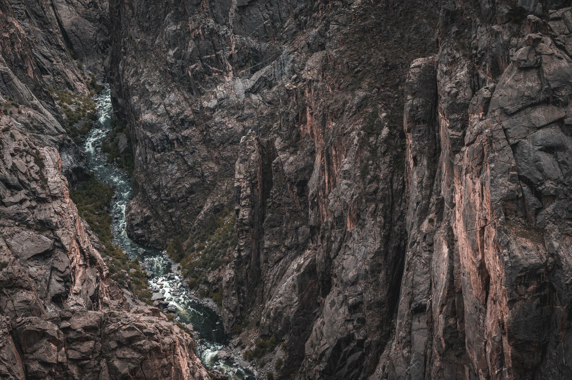
East Portal Trail — South Rim
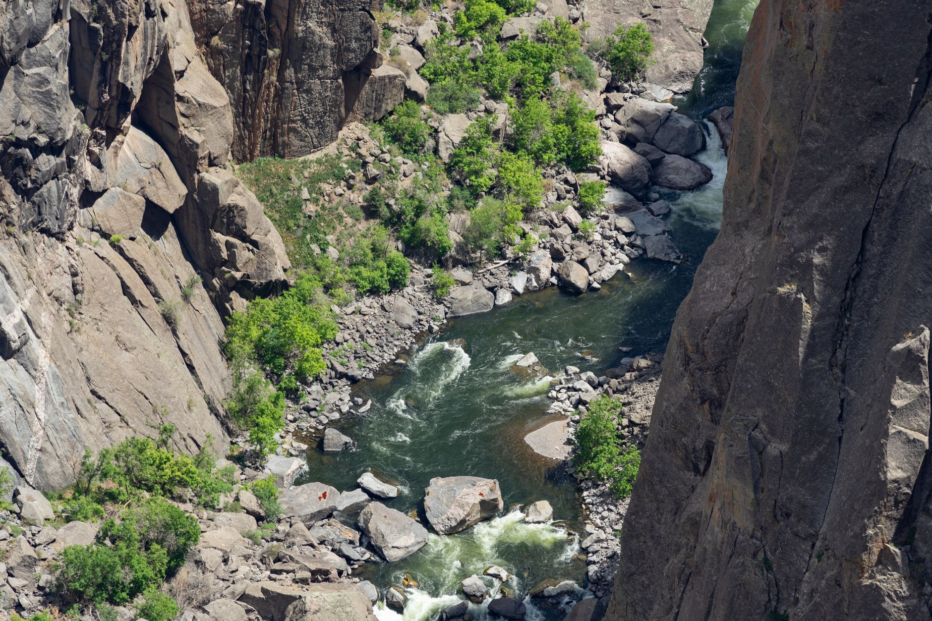
Easy riverside walk past tilted rock beds and sheer canyon cliffs.
- 0.8 mile roundtrip to the Gunnison River
- Dramatic cliff views from river level
- Geological rock formations and tilted strata
- Accessible photography angles for canyon steepness
ACCESS & CONDITIONS
East Portal Trail starts at the bottom of East Portal Road, which descends 2,000 feet off the South Rim. This scenic drive is only open May through October due to steep grades and winter snow. The trail itself follows a gentle stretch of the Gunnison River with minimal elevation change (just 13 feet).
WHAT TO EXPECT
The riverside walk lets you view the canyon from river level—a perspective that emphasizes the sheer height of the cliffs overhead. Tilted rock beds and geological layers frame the route. It's a short, peaceful stroll where you can photograph the canyon's dramatic vertical relief without scrambling or technical terrain.
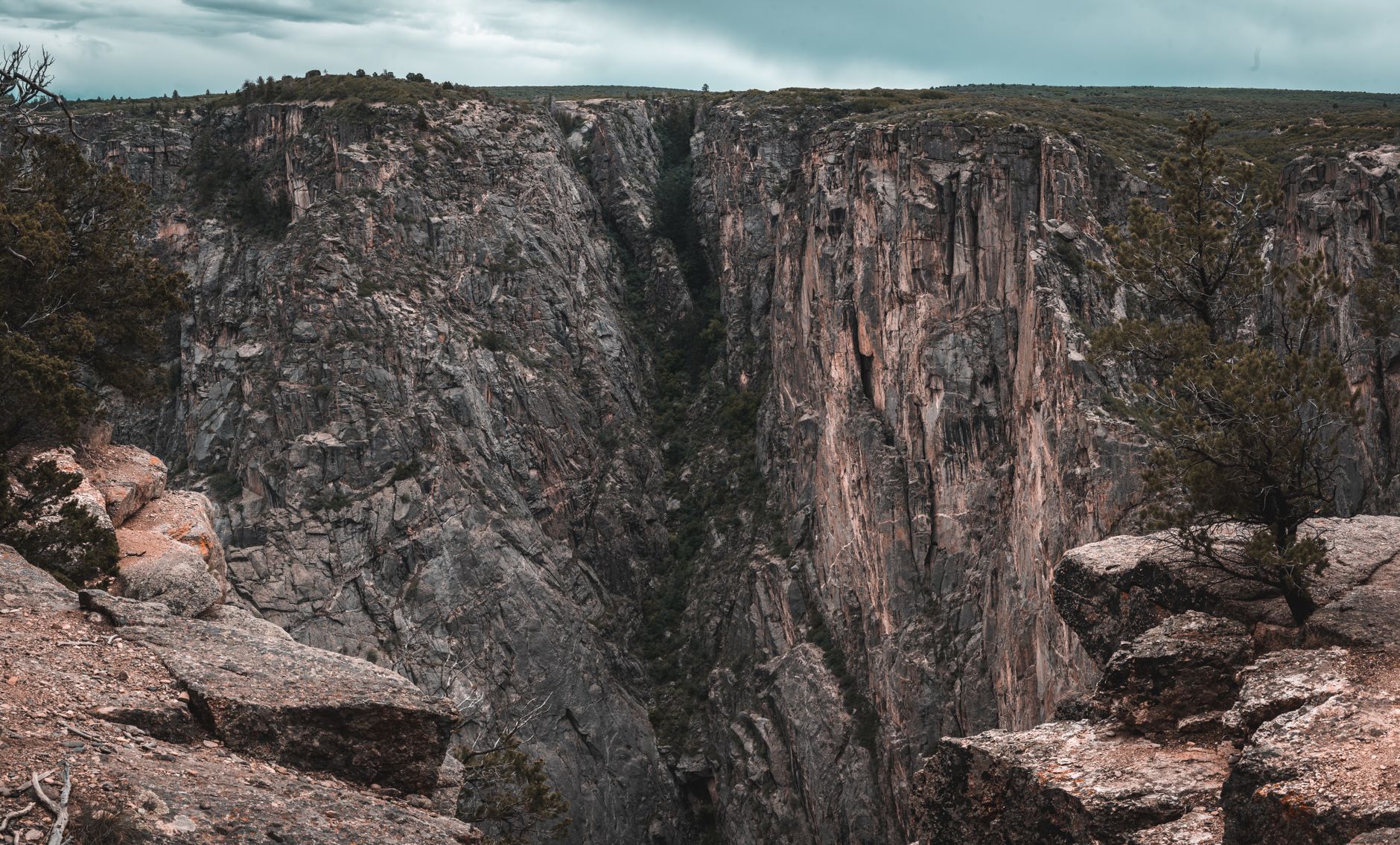
Exclamation Point — North Rim
Straightaway view of Black Canyon's deepest, narrowest section from an easy North Rim trail.
- 3 mile roundtrip with 334 ft elevation gain
- Dramatic canyon straightaway view at terminus
- 1–1.5 hour hike through forest
- Gunnison River sounds and canyon roar
THE HIKE
Exclamation Point is a 3-mile roundtrip on the North Rim that gains 334 feet of elevation—manageable for intermediate hikers and moderately fit families. The trail winds through pinyon-juniper forest and opens to a panoramic viewpoint looking straight down the Black Canyon's most dramatic section. Plan 1 to 1.5 hours for the full route.
THE VIEW
The payoff is a straightaway vista of the canyon at its narrowest and deepest. The Gunnison River's distant roar echoes up the walls. This North Rim vantage is distinct from South Rim overlooks and offers a fresh perspective on the canyon's scale and the geological drama carved by the river.
Warner Point Nature Trail — South Rim
Scenic ridge hike ending at a panoramic overlook of mountains and the Gunnison River gorge.
- 1.6 mile roundtrip with 423 ft elevation gain
- San Juan and West Elk Mountain views at terminus
- Canyon and river overlook from high point
- Unpaved trail ideal for landscape photography
THE ROUTE
Warner Point Nature Trail climbs 423 feet over 1.6 miles—the steepest ascent in this guide but still moderate for most hikers. The unpaved path winds through juniper and mountain mahogany scrub at the south end of the South Rim scenic loop. Trailhead parking is at High Point, at the terminus of South Rim Drive.
THE PAYOFF
At the overlook, you'll see the San Juan Mountains to the south and the West Elk Range to the west, framing the Gunnison River canyon below. The vantage is excellent for landscape photography and offers a different perspective than the crowded rim overlooks. On clear days, the distant mountain ranges provide context for the canyon's regional geology.
Rim Rock Nature Trail — South Rim
Canyon-rim ramble connecting the Visitor Center and Campground with stairs, canyon views, and mountain vistas.
- 1.7 mile roundtrip with 196 ft elevation gain
- Tomichi Point midway rest and viewpoint
- West Elk Mountains panoramas
- Connects South Rim Visitor Center to Campground
THE WALK
Rim Rock Nature Trail meanders 1.7 miles between the South Rim Visitor Center and South Rim Campground. It gains 196 feet of elevation through stairs and uneven sections, making it moderately strenuous. Tomichi Point, a midway rest area, offers a natural turnaround if you want a shorter outing and still enjoy canyon depth views.
CONDITIONS & ACCESS
The trail is fairly level overall with stunning canyon depth views and West Elk Mountain vistas. Pets are allowed on leash, except June 1 through August 15. Note: part of the trail beyond Tomichi Point was temporarily affected by the 2025 South Rim Fire—verify current access before planning the full route. This is an ideal pick for lodging guests staying at the South Rim Campground.
Common Questions
When's the best time to hike these trails?
June through September offers stable weather and full park access. Summer brings afternoon thunderstorms, but mornings are clear. September is a shoulder month with fewer crowds. East Portal Road closes November through April, so plan accordingly if you want that river-level experience.
Do I need a permit for these day-hikes?
No permits required. All five trails are day-use only. Pay the $30 entrance fee (per vehicle, valid 7 days) at the South Rim entrance station and go. Backcountry camping or descents into the canyon require permits.
What's the difference between North Rim and South Rim trails?
South Rim stays open year-round with visitor services (center, campground, picnics). North Rim closes in winter (typically November–April) but offers distinct canyon perspectives. Painted Wall View Trail and Exclamation Point are North Rim hikes; the others are South Rim.
What should I bring for these short hikes?
Water (the canyon reflects intense UV and you'll be exposed), sun protection, sturdy shoes for uneven terrain, and a camera. Most trails have no shade. Even short hikes in high elevation and direct sun warrant hydration and hat.
Is the Painted Wall visible from the South Rim?
Yes—Painted Wall Overlook and Cedar Point on the South Rim both see it. But the closest, best view is from Painted Wall View Trail on the North Rim, a 0.2-mile walk that gets you dramatically near the 2,250-foot cliff.
Sources & Further Reading
- East Portal - Black Canyon Of The Gunnison National Park — National Park Service
- Hike Rim Rock Trail - South Rim — National Park Service
- Hike Warner Point Trail - South Rim — National Park Service
- Painted Wall Overlook — National Park Service
- Weather - Black Canyon Of The Gunnison National Park — National Park Service
- Black Canyon Of The Gunnison National Park — National Park Service