7 Best Photography Locations at Black Canyon of the Gunnison National Park
Seven ranked photography locations—from steepest cliffs to darkest skies in Colorado.
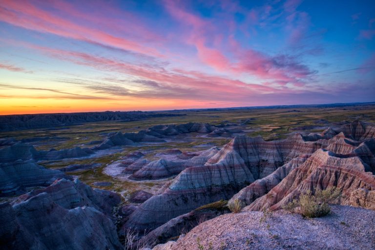
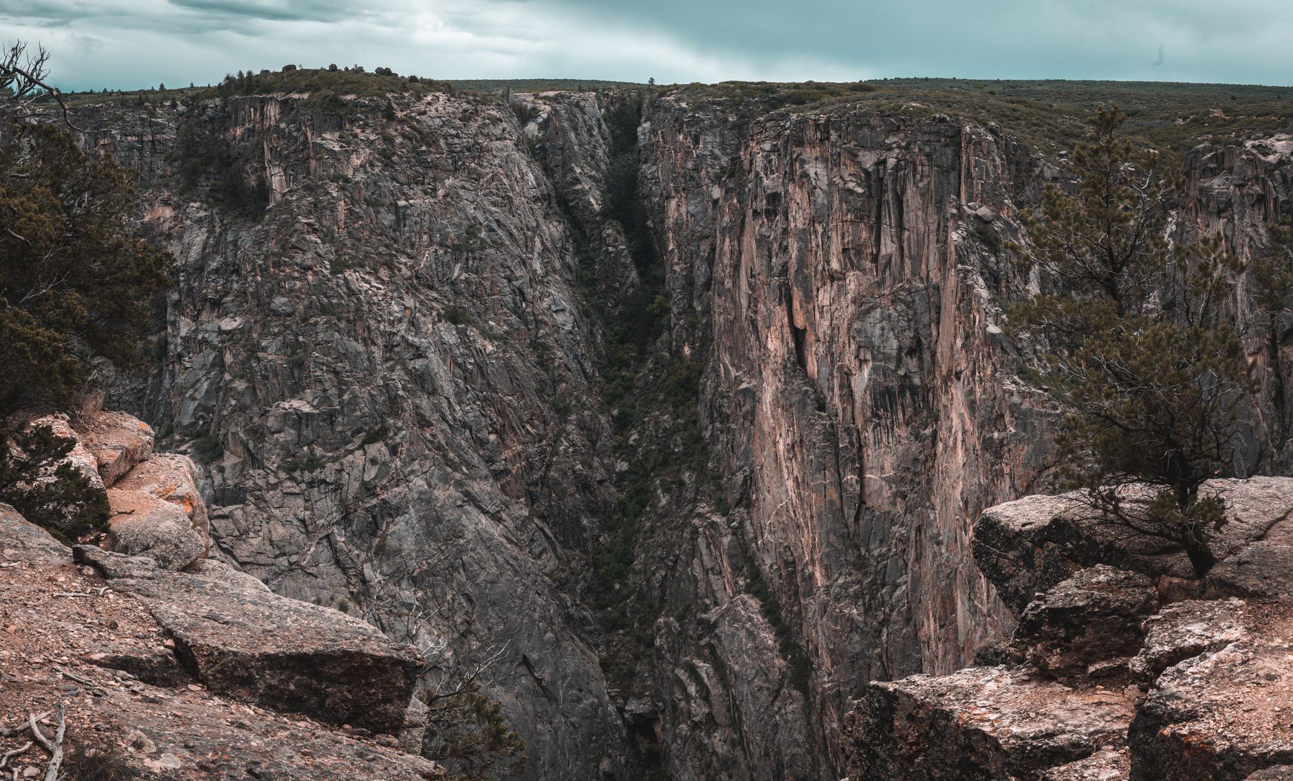
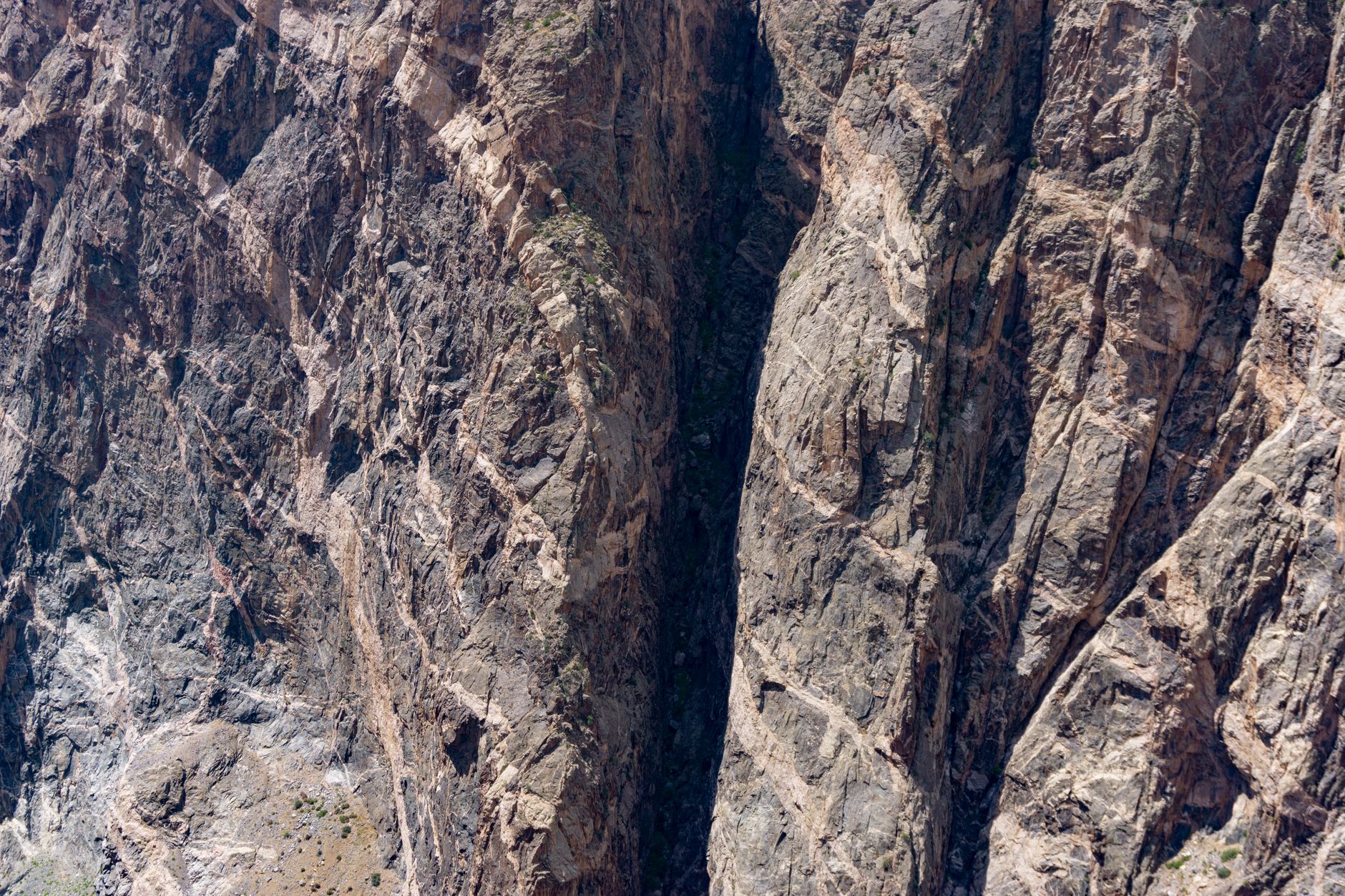
Black Canyon's 2,000-foot gorge and steepest cliffs in North America create dramatic vertical compositions. The Gunnison River carved this canyon over two million years, sculpting ancient Precambrian rock visible as colorful bands and geometric striations.
- $30 Entrance fee per vehicle
- 2,250 ft Tallest cliff (Painted Wall)
- 24 hours South Rim access daily
- Dark Sky Park Designated 2015
Sunset View Overlook — South Rim
Westernmost viewpoint with minimal light pollution—designated International Dark Sky Park location for astrophotography.
- International Dark Sky Park designation since 2015
- Up to 5,000 stars visible throughout the night
- Large parking with picnic tables and restrooms
- 24/7 access for multi-hour astrophotography sessions
- Summer astronomy programs and ranger telescope tours
STARGAZING EXCELLENCE
Sunset View Overlook is the westernmost viewpoint along South Rim Drive, positioned far from road traffic and designated as part of the International Dark Sky Park since 2015. With minimal light pollution and only starlight illuminating the canyon, you can photograph up to 5,000 stars throughout the night. Personal telescopes are welcome, and the park's summer astronomy programs include ranger talks and telescope viewing sessions.
TELESCOPE SETUP
Large parking area with picnic tables and restrooms provides a stable base for multi-hour astrophotography sessions. Bring a sturdy tripod rated for long exposures and a red-light headlamp to preserve night vision while composing shots. The 24-hour South Rim access allows you to photograph the Milky Way's movement across the sky throughout the night without time pressure.
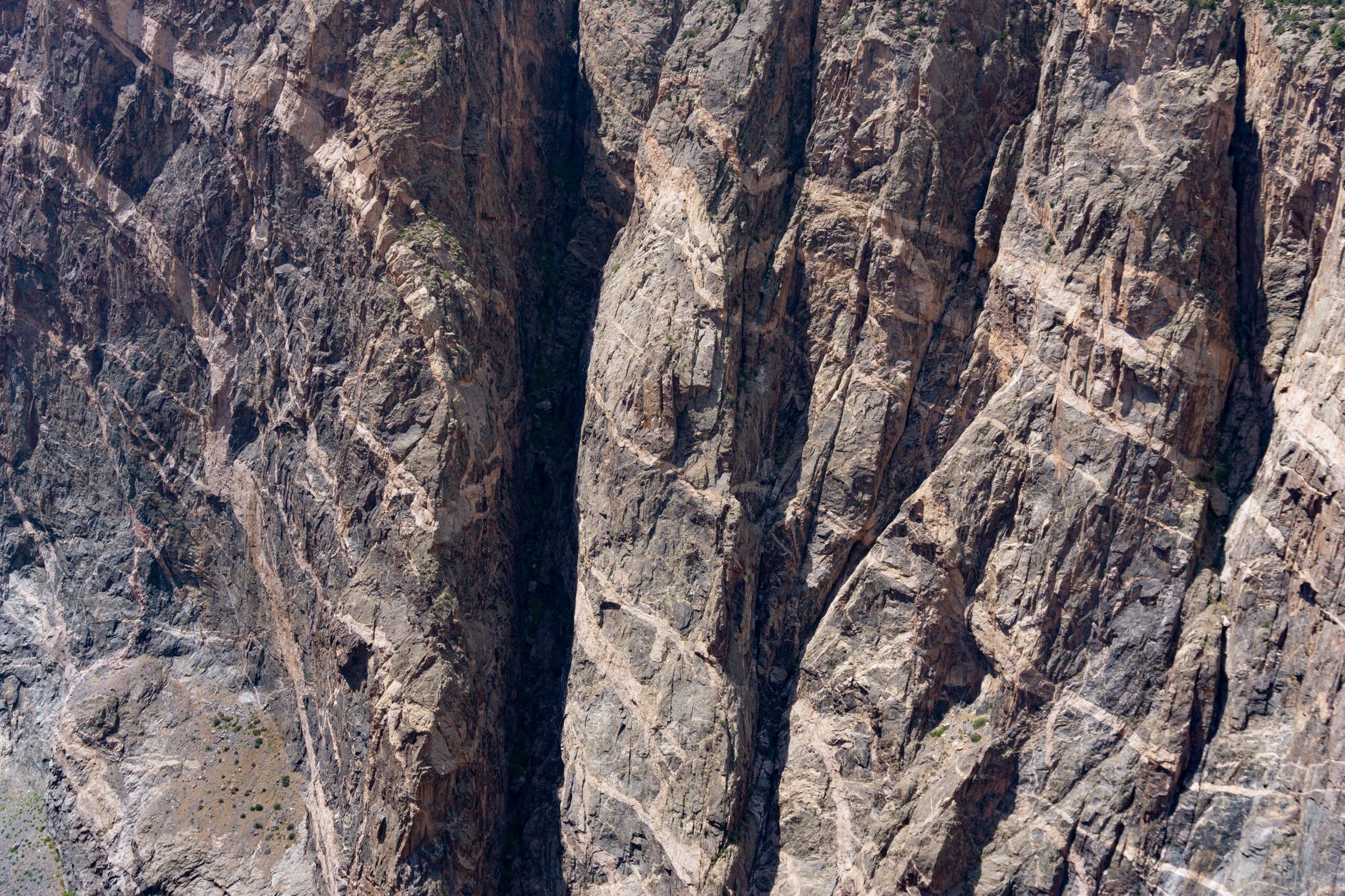
Painted Wall Overlook — South Rim
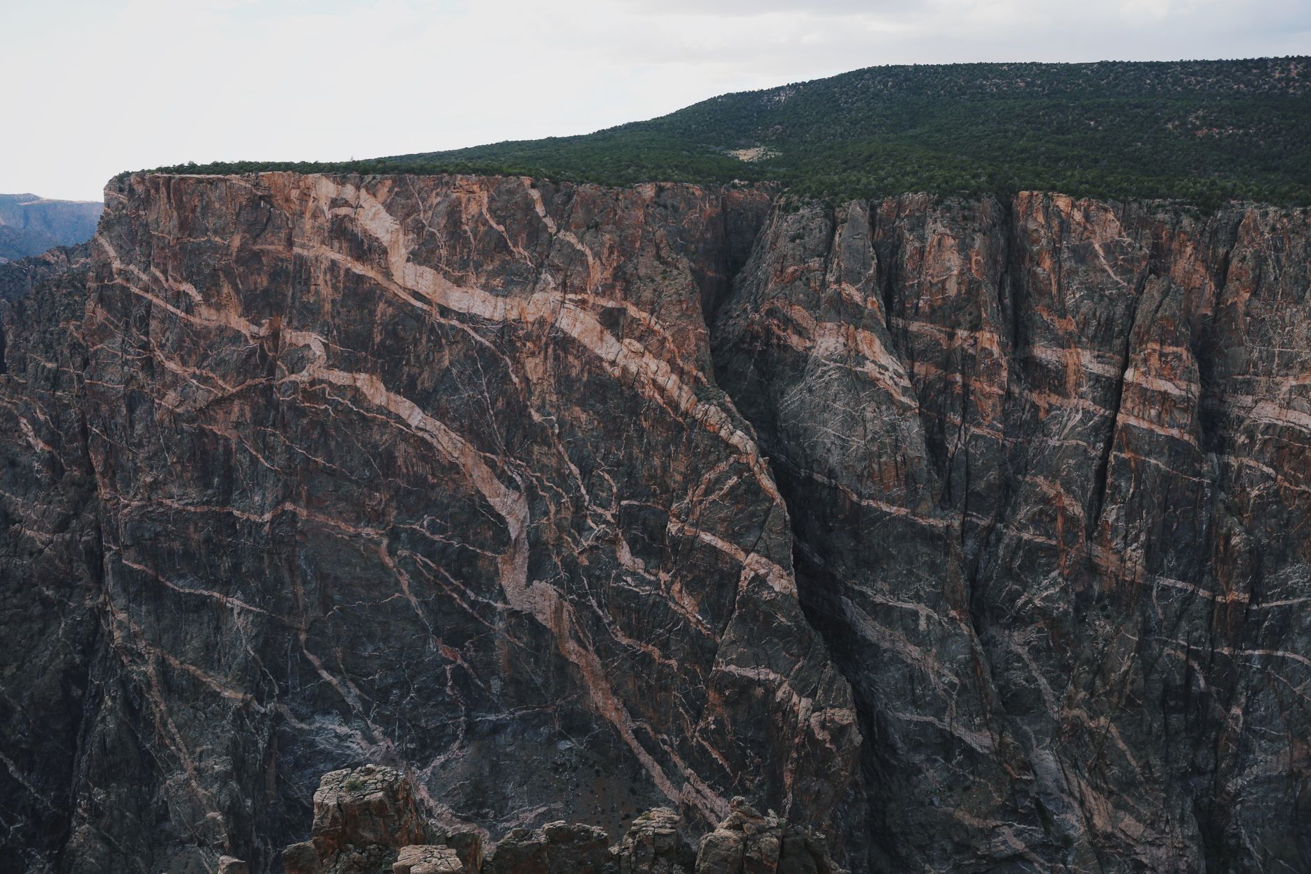
Colorado's tallest cliff at 2,250 feet—striped with colorful tilted rock bands and dramatic shadow patterns.
- 2,250 feet tall (tallest cliff in Colorado)
- Colorful tilted Precambrian rock bands with angular striations
- Distinct shadow play from directional sun angles
- Morning and afternoon light reveal different geological details
- Visible from multiple overlooks along South Rim Drive
ICONIC GEOLOGY
Painted Wall rises 2,250 feet above the Gunnison River—the tallest cliff face in Colorado. Distinctive colorful bands of tilted Precambrian rock create natural compositional lines in your frame. The cliff's ancient geology (approximately 1.7 billion years old) is revealed through the colorful mineral striations running at steep angles through the rock face.
OPTIMAL LIGHT ANGLES
Morning sun from the southeast creates deep shadows that accentuate the angular striations and add three-dimensional drama. Late afternoon light from the west produces silhouette contrast and warms the colored bands to golden tones. The overlook sits 8,000+ feet in elevation, giving you clarity and color saturation that lower-elevation parks cannot match.
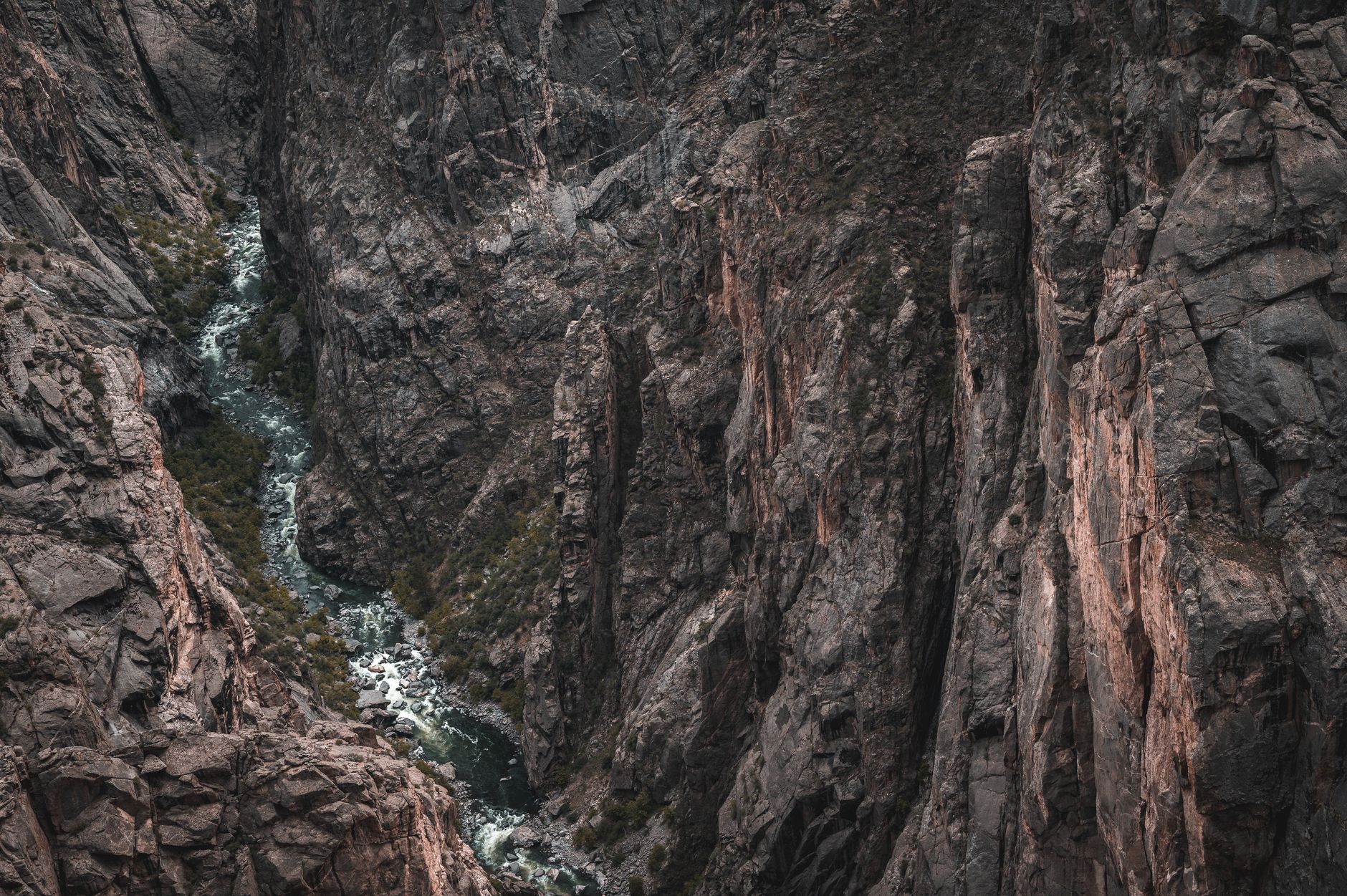
East Portal Trail — South Rim (East Portal)

River-level trail revealing dramatically tilted rock beds and sheer cliff walls from the canyon floor perspective.
- 0.8-mile easy walk to Gunnison River
- Directly below towering canyon walls thousands of feet tall
- Tilted rock formations reveal intense geological uplift
- River reflections show canyon scale from new angle
- Access via scenic steep road (vehicles over 22 feet prohibited)
UNIQUE PERSPECTIVE
This easy 0.8-mile trail descends 13 feet to the Gunnison River, offering perspectives unavailable from overlooks. You stand directly below canyon walls that rise thousands of feet, creating dramatic vertical compositions that emphasize the river's power as a landscape architect. The trail follows the river's gentle stretch, allowing calm-water reflections for composition.
GEOLOGICAL DRAMA
Tilted rock beds at steep angles reveal the intense forces of the earth's uplift and the river's persistent erosion over two million years. The East Portal Road features steep grades and is typically closed November through April due to winter snow. Vehicles over 22 feet are prohibited; plan for the narrow, winding descent and a short drive-time buffer.
North Chasm View — North Rim
0.3-mile nature trail to a 1,800-foot overlook framing Painted Wall and Serpent Point from the north.
- 1,800 feet above Gunnison River
- Pinyon-juniper forest creates natural foreground depth
- Painted Wall and Serpent Point frame the gorge from north perspective
- Birding opportunities add wildlife photographic context
- Seasonal access (May–November) when North Rim Road is open
NORTH RIM PERSPECTIVE
This 0.3-mile nature trail climbs from the North Rim Campground to an overlook 1,800 feet above the river. From the north side of the canyon, Painted Wall and Serpent Point frame the view differently than South Rim overlooks, revealing new angles on the same iconic features. Pinyon and juniper forest creates natural foreground elements and provides shaded rest areas during the hike.
SEASONAL ACCESS
The North Rim Road is unpaved and typically closed from mid-November through early May due to snow. When open (May–November), the remote location and dramatic canyon-wall geometry create outstanding landscape photography without the crowds at South Rim. The trail is rocky in places but not wheelchair accessible; allow 20–30 minutes for the full roundtrip.
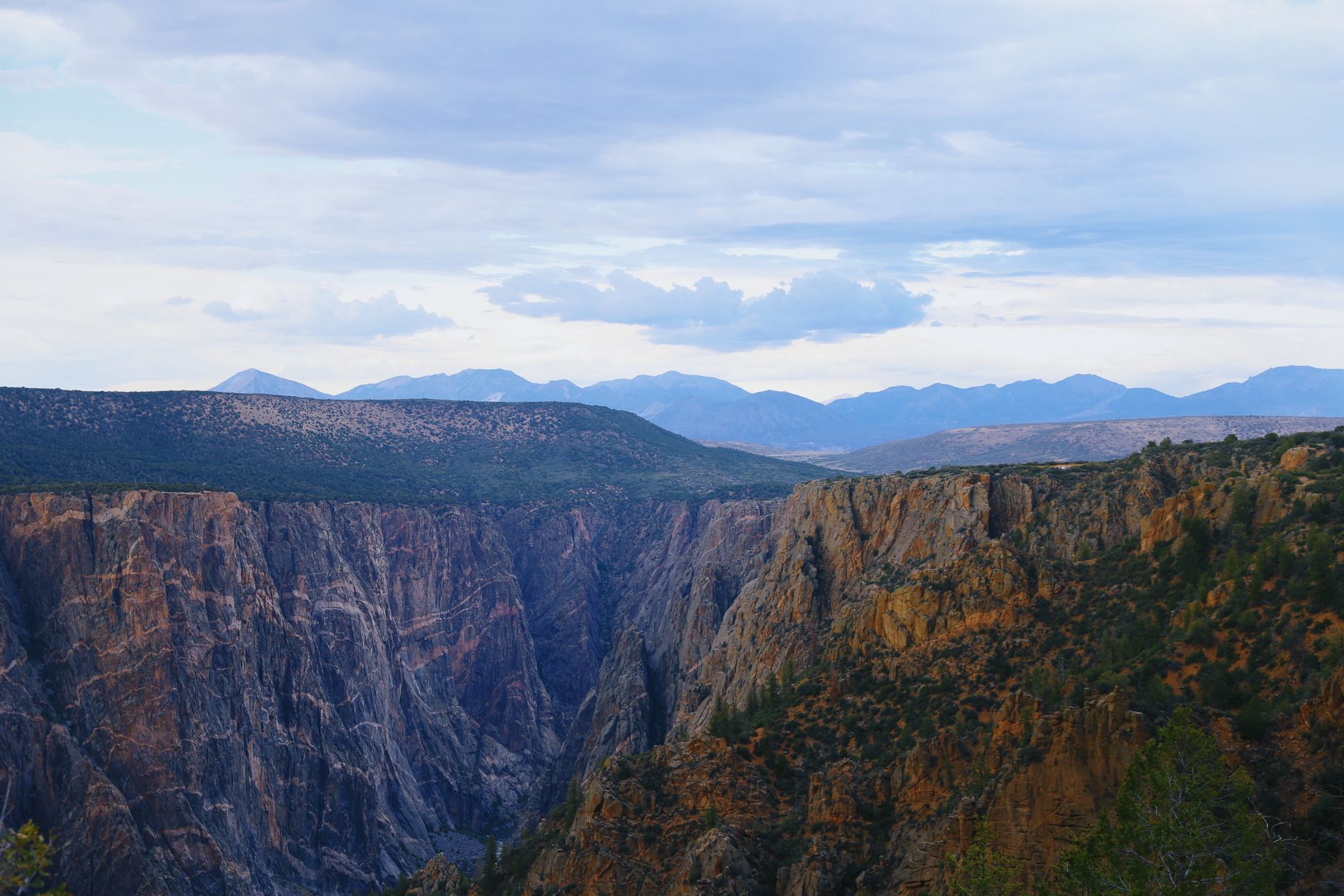
Warner Point Nature Trail — South Rim
1.6-mile hike to mountain range vistas and golden-hour canyon lighting from the highest South Rim trail terminus.
- 1.6 miles roundtrip with 423 feet elevation gain
- San Juan Mountains and West Elk Mountains visible from endpoint
- Mountain mahogany and juniper vegetation frame compositions
- Sunset light turns distant peaks golden 30–45 minutes before darkness
- Moderately strenuous route with steep sections and uneven terrain
MOUNTAIN BACKDROP
This 1.6-mile roundtrip hike climbs 423 feet to the highest trailhead point along South Rim Drive. From the endpoint, the San Juan Mountains dominate the southern horizon and the West Elk Mountains frame the north. Mountain mahogany, serviceberry, and juniper vegetation add texture to foreground compositions, and benches along the route provide rest and shooting positions.
GOLDEN HOUR TIMING
The trail's elevation (approximately 8,600 feet) positions you above much of the surrounding terrain, creating layered landscape compositions with the Gunnison River visible below and mountains beyond. Arrive in mid-afternoon to photograph the distant ranges turning golden before sunset. The trail is moderately strenuous with steep sections; use trekking poles for stability on the uneven terrain.
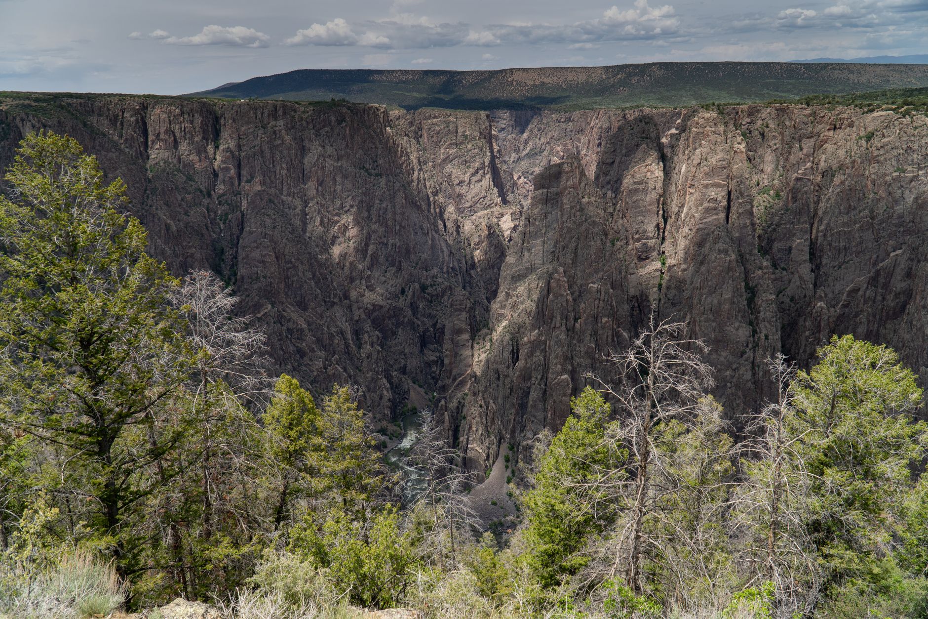
Cedar Point Overlook — South Rim
Two-overlook trail showing river-level canyon drama and Painted Wall from a southern approach angle.
- 0.2-mile unpaved trail to two distinct scenic overlooks
- Gunnison River views from multiple vantage points
- Painted Wall framed differently than from main overlooks
- Interpretive guideposts describe rock formations and geology
- Easy difficulty accessible to most fitness levels
DUAL OVERLOOKS
The 0.2-mile nature trail leads to two distinct overlooks, each framing the Gunnison River and Painted Wall from slightly different angles. The trail is unpaved but easy, featuring interpretive guideposts that explain the rock formations and explain the geology. Painted Wall appears from the south, revealing striations and color bands visible only from this viewing angle.
RIVER CONTEXT
The lower overlook provides river-level visibility showing how the Gunnison carved through ancient Precambrian rock. The river's scale relative to surrounding cliffs emphasizes the geological timescale—two million years of continuous water erosion. Bring a 24–70mm lens to capture both close details of the rock bands and wide compositions showing the canyon's vast depth.
Dragon Point Overlook — South Rim
Light-shielded overlook positioned away from vehicle traffic for clean night-sky compositions and astrophotography.
- Positioned away from main road to minimize vehicle headlight interference
- Part of South Rim Dark Sky network with minimal light pollution
- Canyon depth visible under starlight without glow
- 24/7 access for all-night astrophotography
- Excellent for Milky Way and deep-sky photography
LIGHT SHIELDING
Dragon Point Overlook is positioned away from the main South Rim Drive, minimizing vehicle headlight interference during night photography. Part of the park's International Dark Sky network, it offers excellent astrophotography without the background light wash of busier locations. The overlook remains accessible all year because the South Rim is open 24/7, and the road is paved.
NIGHT COMPOSITION
Position yourself to frame canyon silhouettes against the starfield overhead, using the dark cliff outlines as foreground anchors. Arrive 2 hours after sunset to allow full night vision adaptation and star emergence. A red-light headlamp preserves night vision while you compose shots; bring a sturdy tripod and a remote shutter release or timer to avoid camera shake on long exposures.
Common Questions
When is the best time to photograph Painted Wall?
Morning sun (southeast face) creates deep shadows that accentuate the rock striations and add three-dimensional drama. Late afternoon light from the west produces silhouette contrast and warms the colored bands to golden tones. A polarizing filter cuts glare and deepens color saturation, bringing out the distinctive colorful bands.
Is nighttime photography safe and permitted?
Yes, the South Rim is open 24 hours daily for all-night astrophotography without permits. Use a red-light headlamp to preserve night vision and be cautious on uneven overlook terrain. The park's International Dark Sky designation since 2015 makes it ideal for astrophotography with up to 5,000 visible stars on clear nights.
What permits do I need for photography in the park?
No permits are required for photography from overlooks or on rim trails. East Portal Road requires vehicles to be under 22 feet in length. North Rim access is seasonal (typically open May–November); call 970-641-2337 to confirm the road is open before visiting.
What are the best months for night sky photography?
May through September offer the most stable weather for astrophotography. Summer (June–August) provides the best Milky Way positioning with the galactic core directly overhead late evening. Plan shooting dates around new moon phases when starlight is least washed out by moonlight.
How do I reach each photography location?
All South Rim sites are within 7 miles on paved South Rim Drive from Montrose, Colorado (14 miles away). The North Rim requires unpaved road access from Crawford (11 miles) and is closed mid-November through early May. East Portal Road features steep grades and seasonal closures (typically November–April).
Sources & Further Reading
- Astronomy & Stargazing - Black Canyon Of The Gunnison National Park — National Park Service
- Night Skies - Black Canyon Of The Gunnison National Park — National Park Service
- Hike Chasm View Nature Trail - North Rim — National Park Service
- Hike Cedar Point Nature Trail - South Rim — National Park Service
- Hike Warner Point Trail - South Rim — National Park Service
- East Portal - Black Canyon Of The Gunnison National Park — National Park Service
- Painted Wall Overlook — National Park Service
- Sunset View Overlook at Black Canyon — National Park Service
- Dragon Point Overlook — National Park Service
- Directions - Black Canyon Of The Gunnison National Park — National Park Service