5 Days in Black Canyon of the Gunnison National Park
Two rims, endless switchbacks: South Rim overlooks meet North Rim solitude.
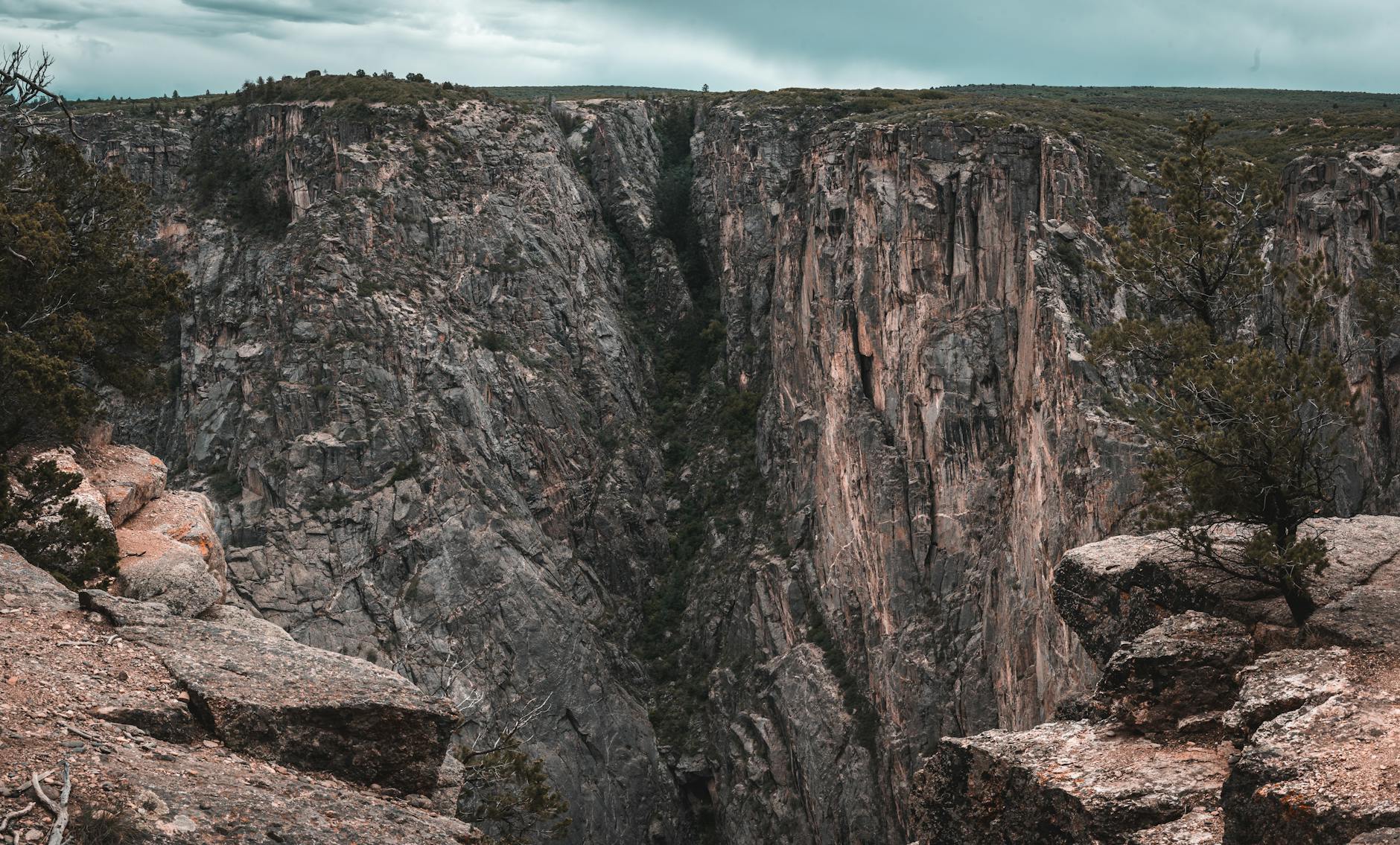
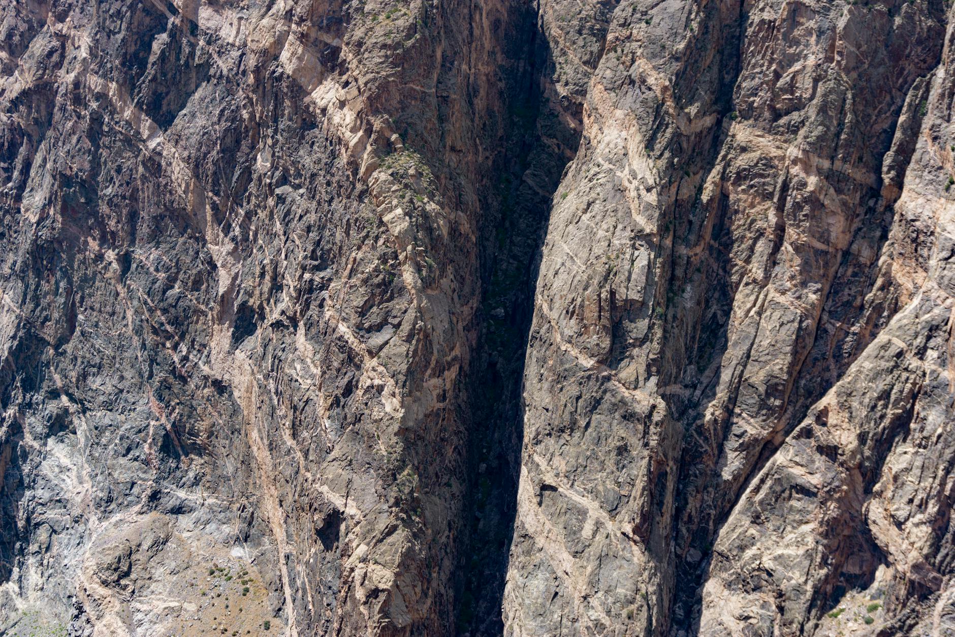
Black Canyon plunges 2,722 feet deep at its darkest point, where the 1.7-billion-year-old metamorphic rock walls rise so steeply that sunlight barely reaches the river. The Gunnison River carves through this narrow gorge with relentless force, dropping 43 feet per mile—the fifth-steepest mountain descent in North America.
- 30,750 Acres
- 2,722 ft Maximum depth
- 1.7B years Precambrian rock age
- 2 rims South & North divide
Day 1: South Rim arrival and short canyon views
Stay: Camp at South Rim Campground (Loop A only; Loops B & C closed for fire recovery). If full, stay in Montrose 15 miles south.
Settle in at South Rim and acclimate to the canyon's scale with easy, iconic walks.
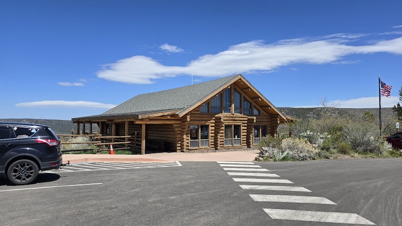
- Stop at the South Rim Visitor Center to pick up maps and learn about the 1.7-billion-year-old metamorphic walls that frame the Gunnison River.
- Walk the Rim Rock Nature Trail from the visitor center parking area—a rocky 1.7-mile out-and-back with views of Gunnison Point and the narrow gorge below.
- The trail passes interpretive signs explaining how the river carved this 2,722-foot-deep chasm in just 2.5 million years.
Day 2: Painted Wall and East Portal descent
Stay: Return to South Rim Campground or drive to Montrose for a hotel night if camping is full.
Experience both rim-level drama and river-level scale in a full day of South Rim exploration.
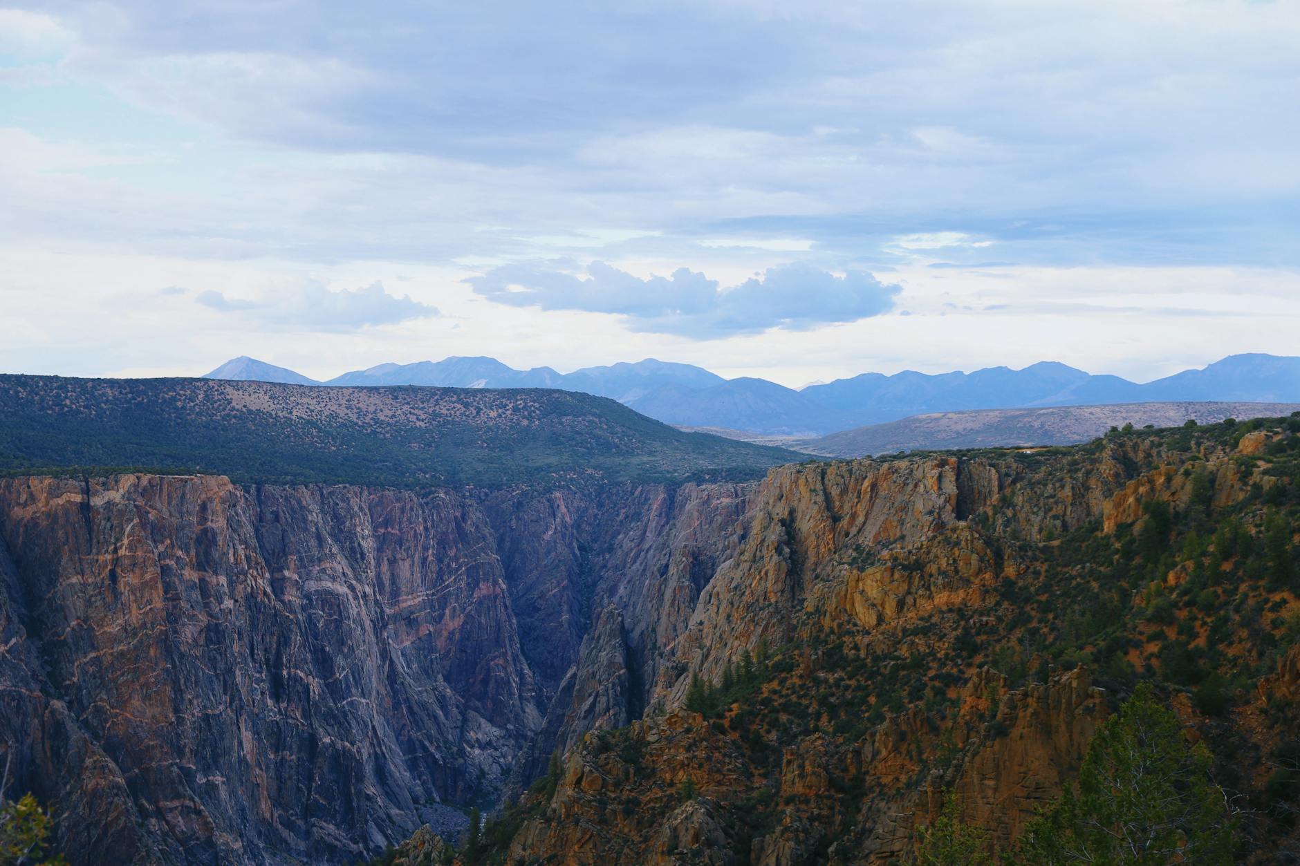
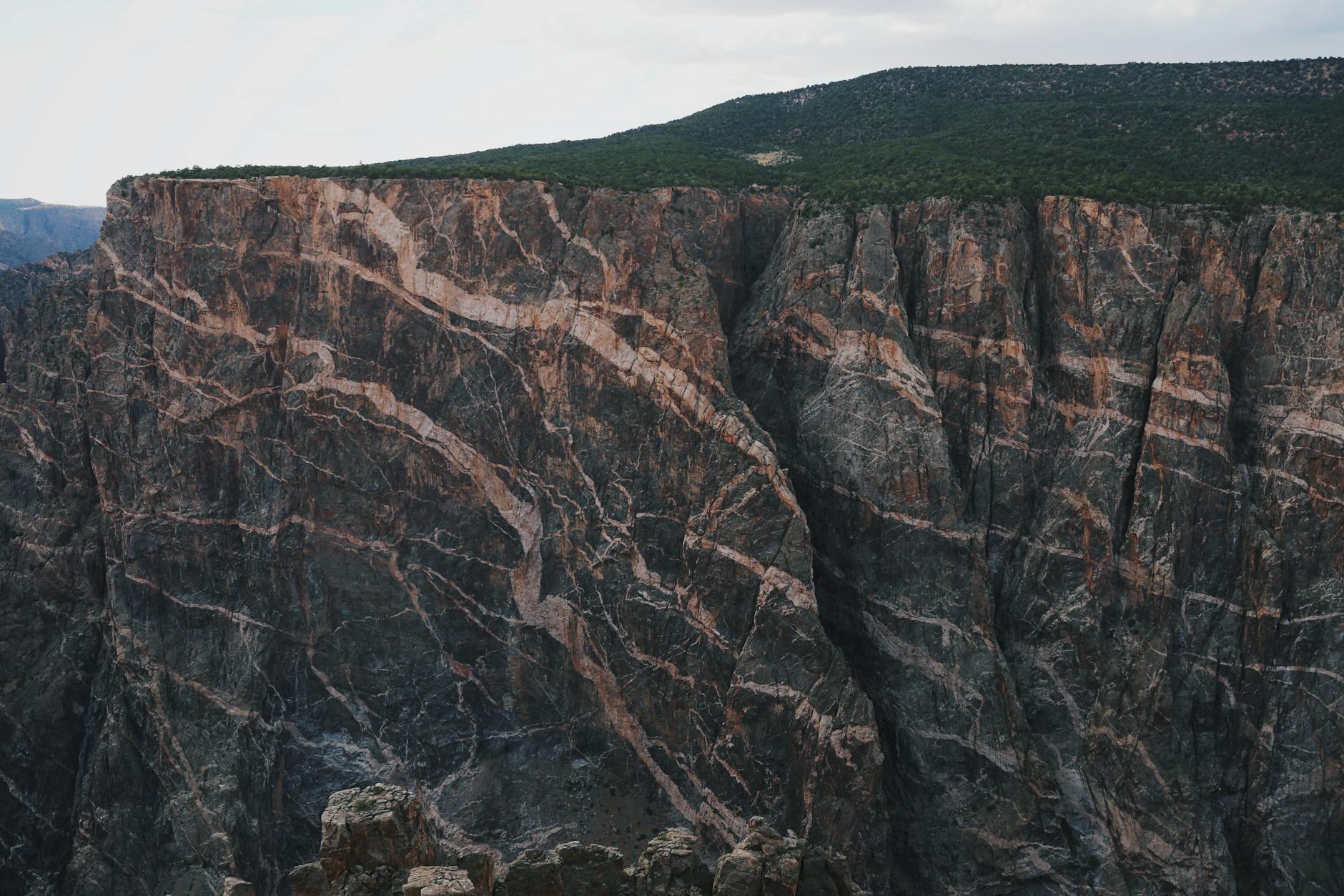
- Drive the full 7.3-mile South Rim Road, pausing at Painted Wall—the tallest cliff in Colorado at 2,250 feet—to photograph the striations of ancient pegmatite dikes.
- Stop at Tomichi Point near the entrance for first views and Chasm View for its sheer drop.
- Continue down the serpentine East Portal Road (16% grade, vehicles over 22 feet prohibited) for 2 hours round-trip to reach the riverside picnic area 2,000 feet below, where you can touch the Gunnison River and grasp the canyon's true depth.
Day 3: Warner Point and Oak Flat Loop
Stay: Camp at South Rim Campground or check into a Montrose hotel for more comfort.
Hike two distinct South Rim trails to understand the canyon's steepness and ancient rock formations.
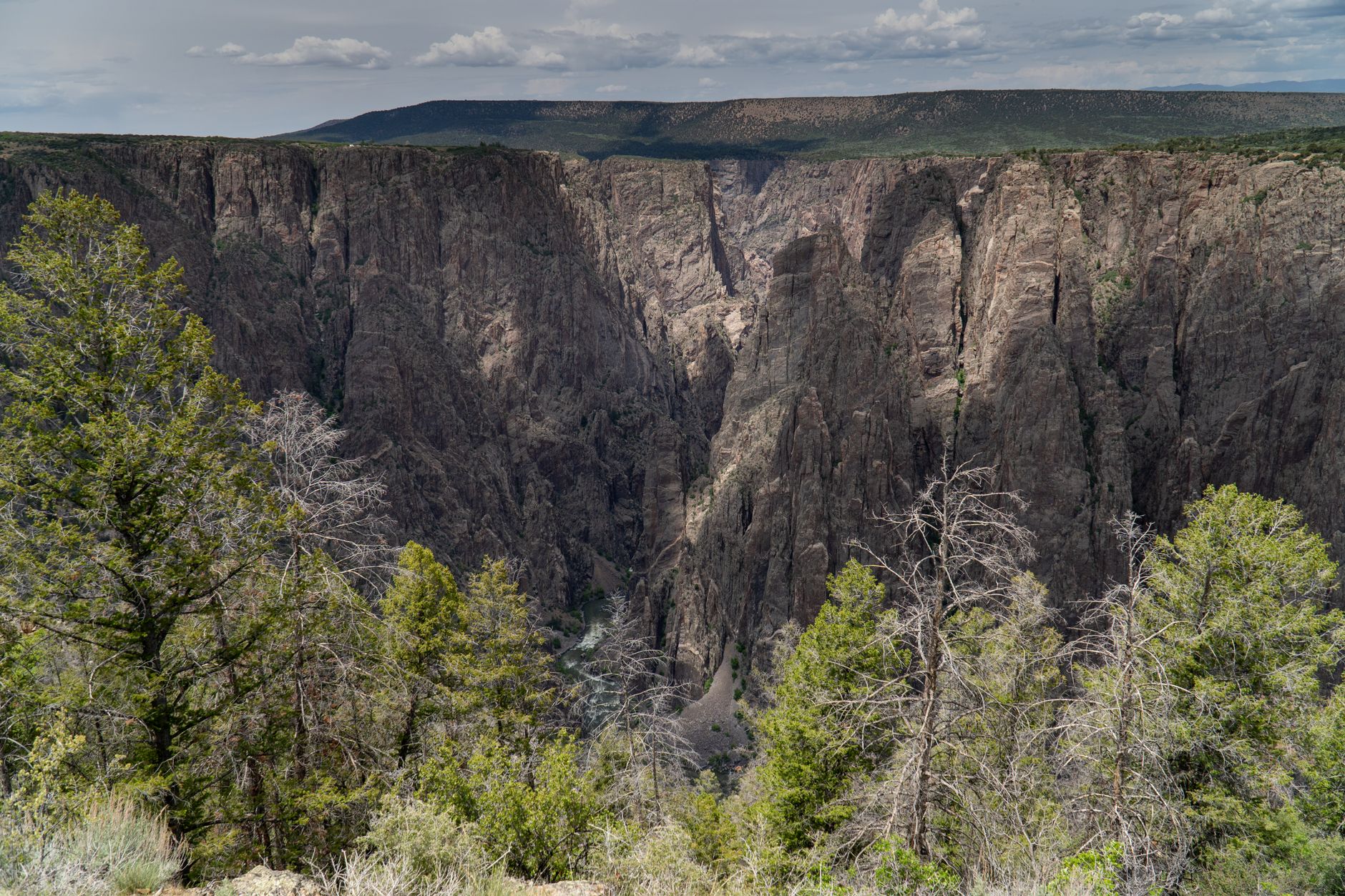
- Start with the Warner Point Nature Trail, a 1.6-mile round-trip that climbs 423 feet through sagebrush to a dramatic overlook.
- You'll stand at the rim's edge gazing into one of North America's steepest canyons, with the Gunnison River winding over a mile below and Painted Wall visible across the gorge.
- Follow up with the Oak Flat Loop (1.5 miles, 334 feet gain), which descends below the rim into a burned area recovering from the 2025 fire—watch for ash and uneven footing, but witness nature's resilience.
Day 4: North Rim excursion to Exclamation Point
Stay: Camp at North Rim Campground (13 first-come, first-served sites, $20/night). No facilities or food; bring everything you need.
Cross to the quieter, wilder North Rim to experience the canyon from a less-traveled perspective and camp amid juniper forest.
- Drive 1.5 hours from South Rim to reach the North Rim via Colorado Highway 92 and Black Canyon Road (last 7 miles unpaved).
- Hike the North Vista Trail, a 1.6-mile out-and-back climb through pinyon-juniper woodland to Exclamation Point, where you stand 1,840 feet above the river with a direct view down into the canyon's narrowest section.
- The North Rim feels remote—no shops, no crowds, just wind, rock, and the Gunnison far below.
Day 5: Deadhorse Trail and North Rim overlooks
Stay: Depart North Rim for Montrose or Gunnison; stay at Holiday Inn Express (15 mi from park) or Arrowhead Mountain Lodge (45 min) for your final night.
Finish on the North Rim's longest and most solitary trail, then depart with uncluttered high-desert vistas.
- Hike the Deadhorse Trail (2.6 miles one-way, 488 feet gain) from Kneeling Camel Overlook, traversing open sagebrush and oak to views of Deadhorse Gulch and the canyon's inner recesses.
- On return, drive the 4.5-mile North Rim Road stopping at Balanced Rock, Big Island, The Narrows, and Chasm View—each offers a distinct angle into the Black Canyon.
- Pack out by early afternoon to complete the drive south, or stay another night if camping space remains.
Common Questions
Is the North Rim worth visiting, or should I stick to the South Rim?
The North Rim is absolutely worth the drive. It's quieter, more remote, and offers a different geological perspective. The unpaved road feels primitive, and the sagebrush landscape contrasts beautifully with the South Rim's developed feel. If time is tight, focus on South Rim; if you have 5 days, split them between both rims.
When does the South Rim Road open, and is there a specific date I should plan around?
The South Rim Road typically reopens late April and closes mid-November, but exact dates vary annually based on snow and road conditions. NPS does not predict opening dates; plan for July–September as the safest window. Check current conditions at nps.gov/blca before booking your trip.
Can I camp inside the park, or do I have to stay in Montrose?
Yes, camp at South Rim Campground (reservations required via Recreation.gov) or North Rim Campground (first-come, first-served). However, South Rim Loops B & C remain closed in 2026 due to 2025 fire recovery, limiting availability. If full, Montrose hotels are 15 miles away and convenient.
Do I need a wilderness permit to hike the rim trails, or only for inner-canyon routes?
Rim trails (Rim Rock, Warner Point, Oak Flat, North Vista, Deadhorse) require no permit. Inner-canyon routes that descend below the rim (Gunnison, Warner, Tomichi) require a wilderness permit obtained in advance via Recreation.gov or at the park's ranger station.
What gear do I absolutely need to bring?
Sunscreen, a wide-brimmed hat, and 3+ liters of water per person per day—the high desert sun reflects off canyon walls and dehydrates quickly. Trekking poles ease the descent on loose rock. Layers for early morning and evening. The canyon catches wind, so bring a windbreaker even in summer.
Sources & Further Reading
- Black Canyon of the Gunnison National Park - Plan Your Visit — National Park Service
- South Rim - Black Canyon of the Gunnison National Park — National Park Service
- North Rim - Black Canyon of the Gunnison National Park — National Park Service
- Hiking Trails - Black Canyon of the Gunnison National Park — National Park Service
- Camping - Black Canyon of the Gunnison National Park — National Park Service
- Current Conditions - Black Canyon of the Gunnison National Park — National Park Service
- Permits & Reservations - Black Canyon of the Gunnison National Park — National Park Service
- Operating Hours & Seasons - Black Canyon of the Gunnison National Park — National Park Service
- Fees & Passes - Black Canyon of the Gunnison National Park — National Park Service
- South Rim Routes - Black Canyon of the Gunnison National Park — National Park Service
- East Portal Road - Black Canyon of the Gunnison National Park — National Park Service
- Painted Wall Overlook - Black Canyon of the Gunnison National Park — National Park Service
- Chasm View Nature Trail - Black Canyon of the Gunnison National Park — National Park Service
- South Rim Campground - Black Canyon of the Gunnison National Park — Recreation.gov
- North Rim Campground - Black Canyon of the Gunnison National Park — Recreation.gov
- Wilderness Permits - Black Canyon of the Gunnison National Park — Recreation.gov
- Geology of Black Canyon of the Gunnison National Park — U.S. Geological Survey
- North Vista Trail to Exclamation Point — American Southwest
- Arrowhead Mountain Lodge — Arrowhead Mountain Lodge
- How to Visit the Black Canyon of the Gunnison: North & South Rims — Earth Trekkers