Best Scenic Overlooks in Big Bend National Park
Seven scenic overlooks spanning desert, canyon, and mountain vistas at Big Bend.
At the end of the road in Far West Texas, Big Bend National Park sprawls across the Chihuahuan Desert, where ancient canyons carve through limestone mountains and the Rio Grande marks the international boundary with Mexico. Hundreds of bird species thrive in the solitary mountains, and the dark night skies rival any in the country.
- $30 Entrance Fee
- 7 Featured Overlooks
- 24/7 Hours
- 37–94°F Temp Range
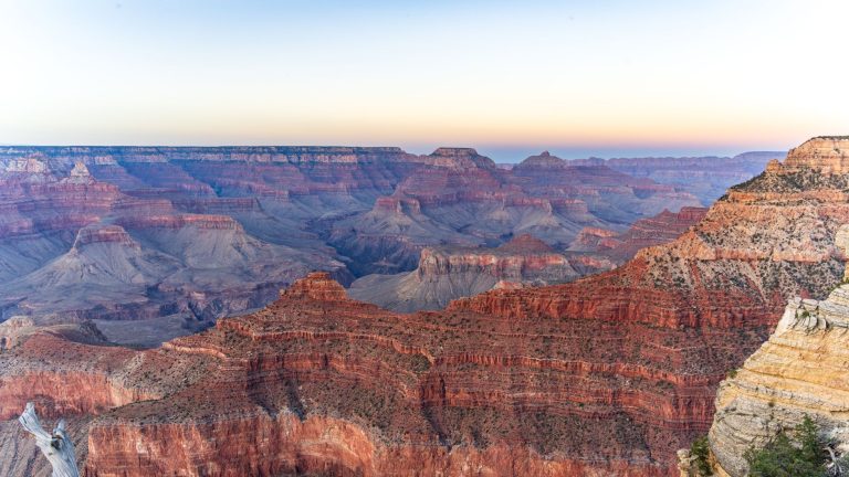
Sotol Vista Overlook — Ross Maxwell Scenic Drive
Far from city lights, this ranger-recommended overlook excels at stargazing and panoramic western views.
- Exceptional stargazing—ranger-recommended for dark sky viewing
- Panoramic western views visible from the loop road
- 15 total parking spaces plus wheelchair accessibility
- Vault toilet and cellular signal available
- 7.9 miles from Ross Maxwell Scenic Drive junction
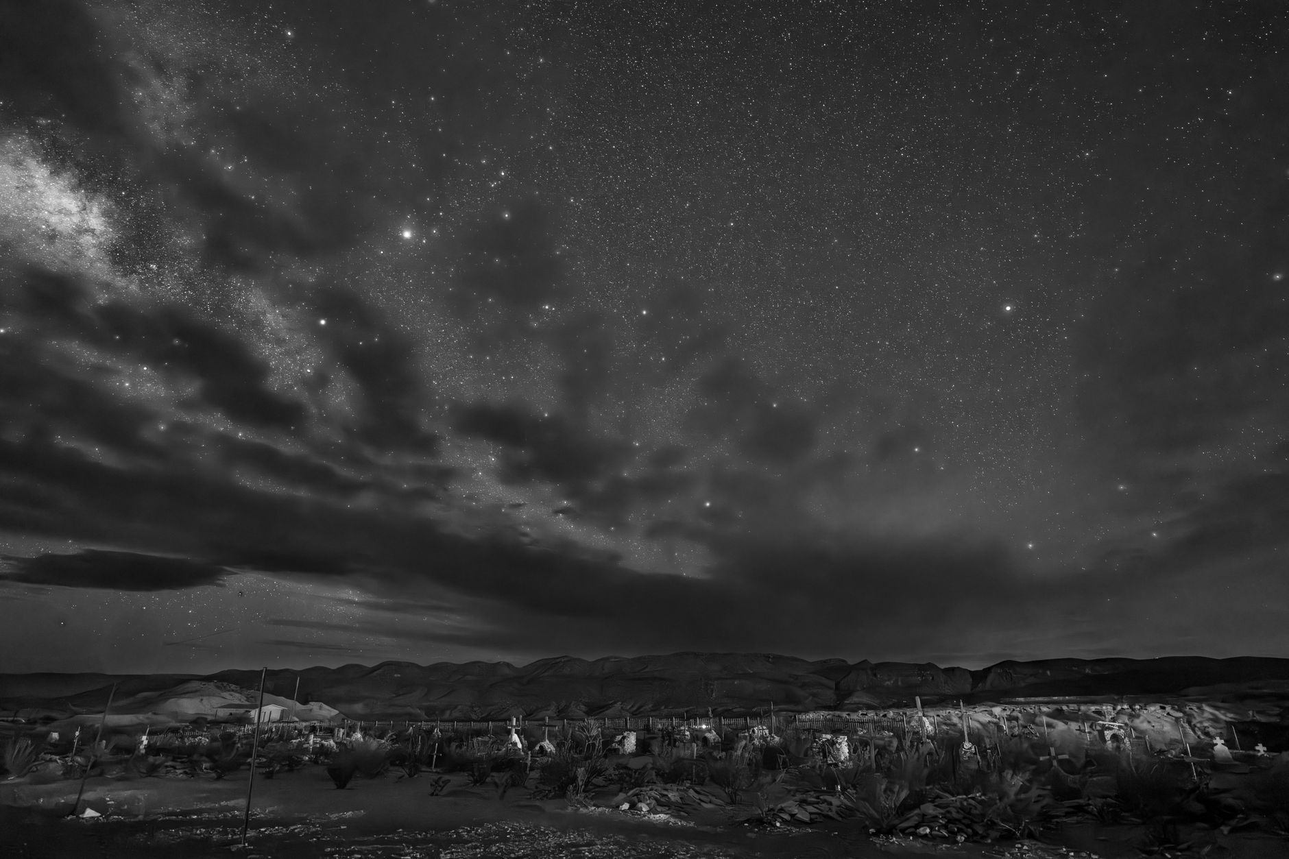
DARK SKIES
The Sotol Vista Overlook is consistently named by park rangers as the premier stargazing location in Big Bend. Far from artificial light, you can see approximately 2,000 stars on a clear night—roughly ten times what's visible from a medium-sized city. The Milky Way stretches overhead, and on clear evenings, the Sagittarius constellation dominates the southern sky.
ACCESS
The overlook is reached by traveling 7.9 miles from the junction of Ross Maxwell Scenic Drive. The final approach is a paved loop road, making access straightforward year-round. Fifteen parking spaces accommodate most visitors, with three additional spots for RVs and two for handicapped-accessible vehicles.
FACILITIES
A vault toilet and nearby cellular signal make extended stays comfortable. The site is fully wheelchair accessible, with paved surfaces and clear sightlines to the overlook. No additional fee beyond the $30 park entrance applies.
Mule Ears Overlook — Ross Maxwell Scenic Drive
Two distinctive rhyolite dikes pierce the desert horizon—a dramatic geological landmark and favorite photography perch.
- Mule Ears Peaks rise prominently above surrounding desert
- Excellent morning light for photography
- 21 parking spaces, wheelchair accessible
- Short 0.5-mile access road from main scenic drive
- White volcanic tuff and lava cap formations
GEOLOGY
The distinctive Mule Ears Peaks are eroded rhyolite dikes—hard volcanic intrusions left behind after softer surrounding rock wore away. The white volcanic tuff deposits and hard lava caps on the surrounding mountains reveal a landscape shaped by ancient volcanic violence. The formations are particularly striking in the morning light.
PARKING & ACCESS
The Mule Ears Overlook sits 14.8 miles from the northern end of Ross Maxwell Scenic Drive, accessible via a short 0.5-mile spur road. A curb ramp and sidewalk accommodate wheelchair users. Twenty-one parking spaces provide ample room for visitors, with cellular signal available at the overlook.
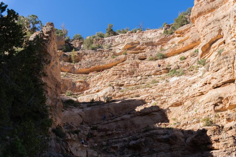
Tuff Canyon — Ross Maxwell Scenic Drive
An easy walk past three overlooks reveals how Blue Creek carved a 100-foot canyon through volcanic layers.
- Three viewing platforms span the canyon
- Blue Creek carves through 30-million-year-old volcanic ash
- 100-foot canyon walls of tuff and basalt
- Easy 0.5-mile walk with interpretive signage
- Paved pullout parking for 6 vehicles
GEOLOGY & VIEWS
Tuff Canyon showcases volcanic geology in a compact, accessible format. Three viewing platforms positioned along the canyon rim provide different vantage points of the 100-foot walls. The canyon was carved through layers of colorful volcanic tuff and basalt—sediments that fell as ash roughly 30 million years ago during intense volcanic activity.
EASY WALK
The 0.5-mile pathway is paved and negotiable for visitors of various abilities. Each viewing platform includes interpretive signage explaining the geological formations. A paved pullout provides parking for approximately six vehicles, making this a quick stop perfect for families or those with limited mobility.
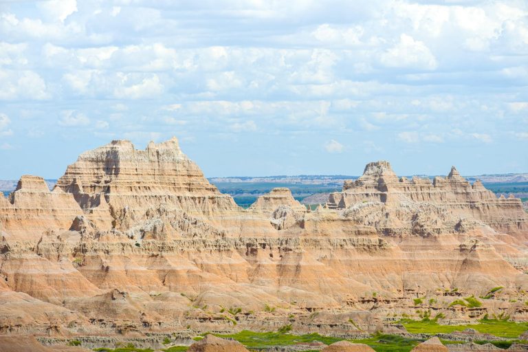
Lower Burro Mesa Pouroff — Ross Maxwell Scenic Drive
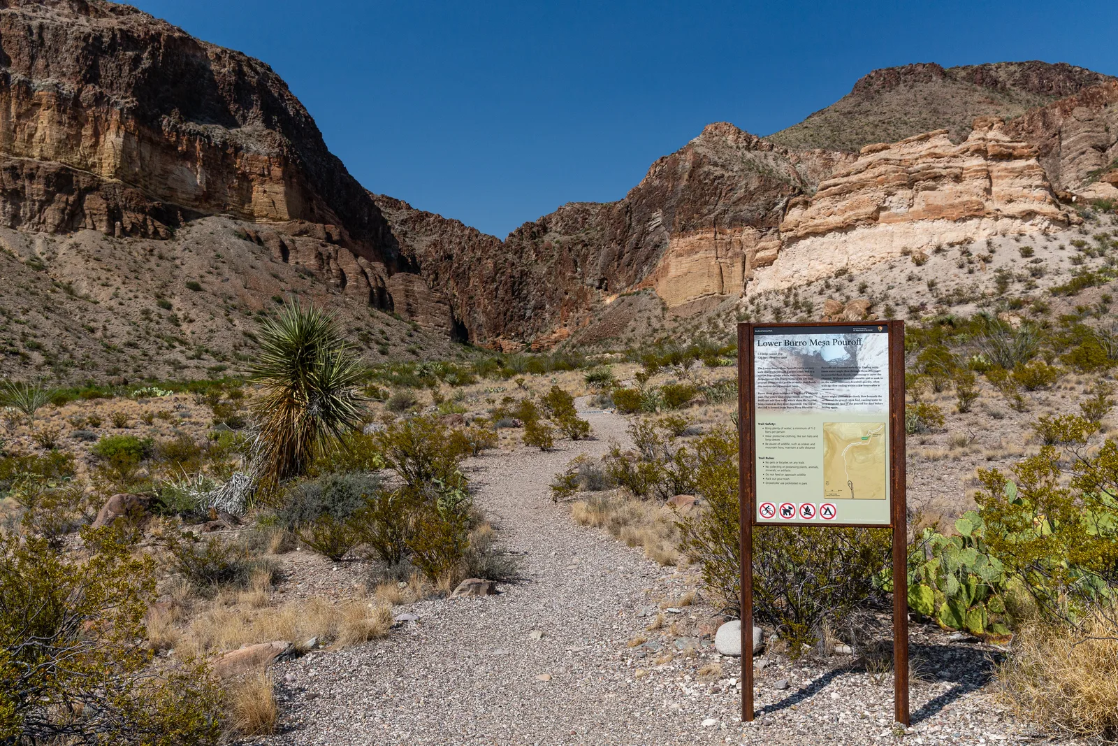
A short hike ends at a dramatic 100-foot vertical channel where water funnels through rock after rain.
- 100-foot vertical pouroff carved into solid rock
- Yellow and orange ash-flow tuff layers throughout
- Large conglomerate boulders create striking geological display
- 1-mile round-trip with 120 feet elevation gain
- Paved spur road access off Ross Maxwell
THE POUROFF
A pouroff is a narrow vertical channel carved into rock by flowing water over millennia. At Lower Burro Mesa, the 100-foot deep channel creates a striking geological feature. The surrounding layers of colorful ash-flow tuff—yellow, orange, and rust-toned—reveal the composition of volcanic sediments deposited 30 to 70 million years ago.
THE HIKE
The walk totals 1 mile round-trip with only 120 feet of elevation gain, making it accessible to most fitness levels. The trail begins from a paved parking area off Ross Maxwell Scenic Drive (11 miles from the northern trailhead). The first quarter-mile features a flat dirt surface, then the route descends via uneven stone steps into the wash.
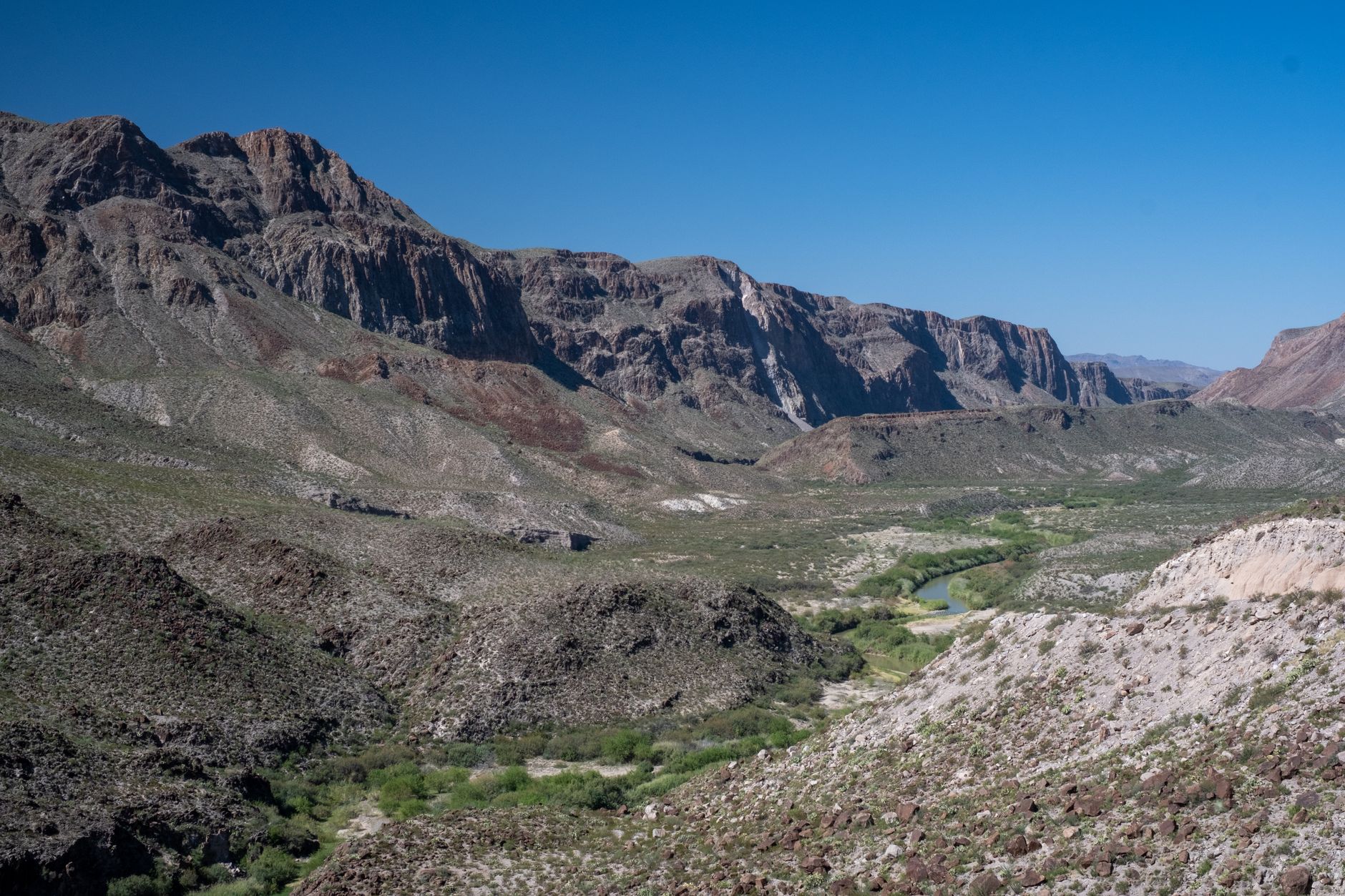
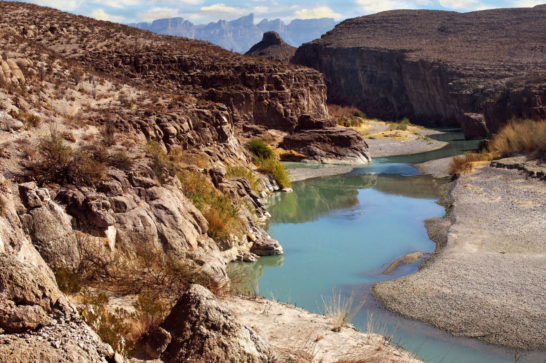
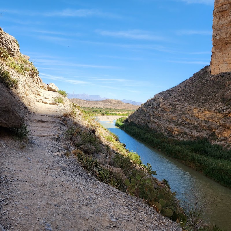
Rio Grande Overlook — Rio Grande Village Area
An elevated perch over the Rio Grande offers river views, international border perspective, and ranger-recommended stargazing.
- Direct views of the Rio Grande and international boundary
- Sierra del Carmen mountains visible across the river in Mexico
- Ranger-recommended dark sky location for evening viewing
- Historical exhibits explain the border's significance
- Short trail walk from parking area
RIVER & BORDER VIEWS
The Rio Grande Overlook provides an elevated vantage point directly over the river that forms the southern boundary of Big Bend and the international border with Mexico. The view encompasses the Sierra del Carmen mountains rising on the Mexican side. The location allows visitors to observe the Rio Grande's role in sustaining life in this otherwise arid landscape.
DARK SKY LOCATION
Park rangers recommend this spot for evening stargazing, as the remote location minimizes light pollution. Historical exhibits at the overlook explain the geopolitical and ecological significance of the border. The short trail walk from the parking area makes this an accessible option for visitors of varying abilities.
Boquillas Overlook — Eastern Rio Grande
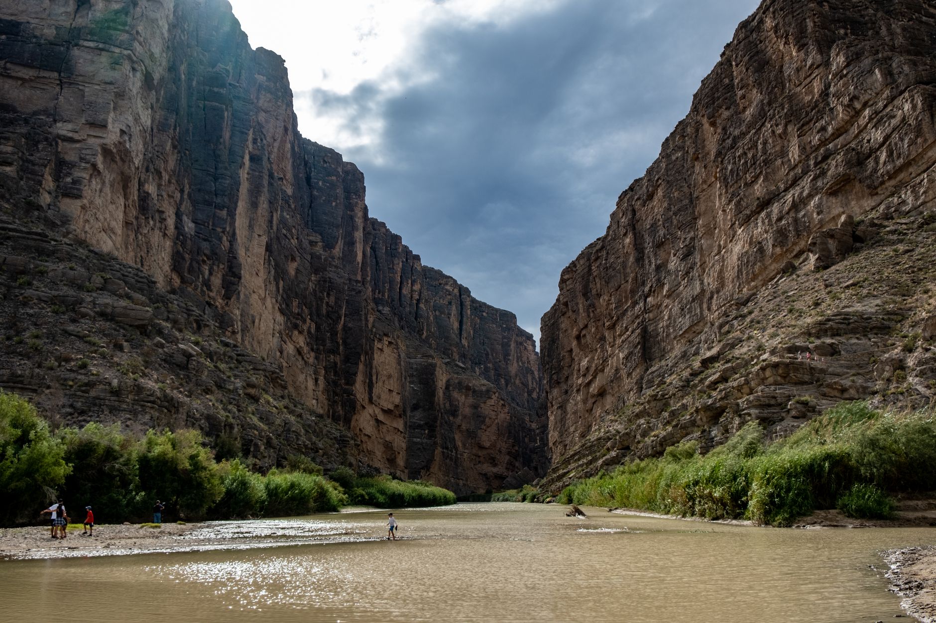
Gaze across the canyon to the mountain village of Boquillas, Mexico, under cover of Big Bend's dark skies.
- Views of Boquillas village directly across the Rio Grande
- Sierra del Carmen mountains rise above the landscape
- Boquillas Canyon is one of three major canyons
- Dark sky location for evening stargazing
- Paved road access with pullout parking
INTERNATIONAL PERSPECTIVE
The Boquillas Overlook provides a unique view into Mexico, with the small village of Boquillas visible directly across the Rio Grande. The Sierra del Carmen mountain range rises steeply behind the village, creating a dramatic border landscape. Boquillas Canyon is one of three major canyons that were central to Big Bend's establishment as a national park.
ACCESS & TIMING
Reach the overlook by traveling 2.5 miles down Boquillas Canyon Road on a paved surface. A pullout parking area accommodates visitor vehicles. The location is recommended by park rangers for evening stargazing in Big Bend's dark sky environment, making dusk and early evening ideal times to visit.
Homer Wilson Ranch Overlook — Ross Maxwell Scenic Drive
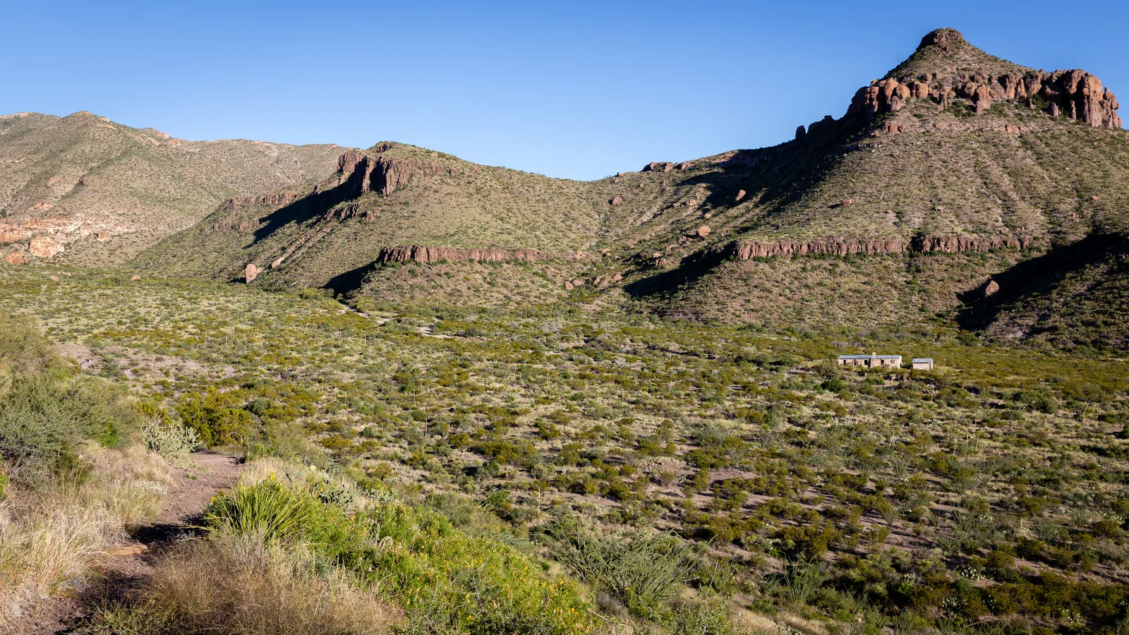
A wheelchair-accessible wayside overlooks the 1928 ranch headquarters where 45,000 acres of desert once ran sheep and goats.
- Historic 1928 ranching operation on National Register
- Spanned 45,000 acres at its peak
- Wheelchair-accessible wayside with historical exhibits
- Optional 0.5-mile hike to historic line camp remains
- 7.7 miles from northern Ross Maxwell trailhead
RANCHING HERITAGE
The Homer Wilson Ranch Overlook commemorates one of Big Bend's most ambitious ranching ventures. In 1928, the operation spanned 45,000 acres, supporting sheep and goat herds across the Chihuahuan Desert. Today, the site remains on the National Register of Historic Places, representing the cultural history of settlement in this remote region.
ACCESSIBLE HISTORY
The main overlook features a wheelchair-accessible ramp and wayside exhibits interpreting the ranch's place in Big Bend's past. For visitors seeking more immersion, an optional 0.5-mile hiking trail descends from the overlook to the historic line camp remains, where visitors can see a circular corral, snubbing post, and old dipping vats. The overlook sits 7.7 miles from the northern terminus of Ross Maxwell Scenic Drive.
Common Questions
Can I visit Big Bend overlooks if I don't have much time?
Yes. Tuff Canyon offers a 0.5-mile paved walk with three viewpoints, taking 20–30 minutes round-trip. Mule Ears Overlook is a 0.5-mile side drive with immediate views. Both require no hiking and provide quick scenic stops.
Which overlooks are best for sunset and sunrise photography?
Mule Ears Overlook has excellent morning light on the distinctive peaks. Boquillas Overlook provides dramatic sunset views over the Sierra del Carmen in Mexico. Rio Grande Overlook offers golden-hour light on the river.
Are Big Bend overlooks crowded?
Big Bend remains one of the least-visited national parks. Sotol Vista can be busy during optimal stargazing windows (moonless nights), but most other overlooks rarely see crowds.
What's the best time to visit for stargazing?
May through October offers the warmest nights and clearest skies. However, summer heat (90°F+) makes daytime challenging. March–April and November offer cooler weather and excellent stargazing conditions.
Can I combine overlook viewing with hiking?
Absolutely. Boquillas Canyon Trail (1.5 miles round-trip) starts near Boquillas Overlook. Santa Elena Canyon Trail and Lost Mine Trail are nearby on separate drives. Lower Burro Mesa Pouroff pairs a short 1-mile hike with dramatic geology.
Sources & Further Reading
- Sotol Vista — National Park Service
- Ross Maxwell Scenic Drive — National Park Service
- Night Skies and Stargazing — National Park Service
- Rio Grande Overlook — National Park Service
- Boquillas Overlook — National Park Service
- Mule Ears Overlook — National Park Service
- Tuff Canyon Trail — National Park Service
- Lower Burro Mesa Pouroff Trail — National Park Service
- Homer Wilson Ranch Overlook — National Park Service
- Find The Perfect Sunrise & Sunset — National Park Service
- View the Night Sky — National Park Service
- Lightscape / Night Sky — National Park Service