8 Most Challenging Trails in Acadia National Park
Eight strenuous and moderate-challenging trails ranked from vertical iron-rung ascents to rocky ridge scrambles.
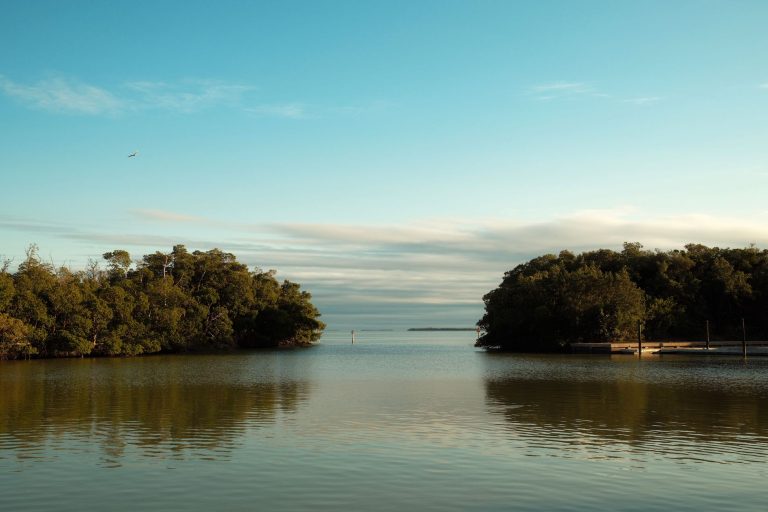
Acadia National Park sits on Mount Desert Island, Maine—the highest rocky headlands along the Atlantic coastline. While famed for easy carriage roads and coastal loops, Acadia harbors some of New England's steepest single-track climbs: iron rungs bolted into cliff faces, granite ridges with sweeping vistas, and rock scrambles where a single slip is serious.
- 49,075 Acres
- 158 Miles of trails
- 27 Miles of Park Loop Road
- 1,530 ft Highest point (Cadillac)
Beehive Loop Trail — Eastern Mount Desert Island
Steep granite staircases and iron rungs deliver the park's most technical summit challenge in just 1.4 miles.
- Iron rungs and overhead ladders on exposed cliff sections
- Sand Beach, Thunder Hole, and Gulf of Maine views from summit
- 450 feet elevation gain in steep, compact terrain
- Rung-ladder trails prohibit pets (safety hazard)
- 1.2-mile shortcut via Bowl Connector available
ROUTE
The Beehive Loop traces a steep, compact circuit with minimal distance but maximum exposure. The ascent relies heavily on iron rungs and granite staircases bolted into exposed cliff faces, with several ladder sections requiring overhead reach. Most of the climb is unprotected; hikers must be comfortable scrambling on near-vertical terrain.
Descent follows the same route (northbound on rungs), though a safer low-traffic option uses the Bowl Connector shortcut to bypass the worst sections. The shortcut drops the total to 1.2 miles round-trip but sacrifices the summit views.
EXPOSED SECTIONS
Beyond the iron rungs, the trail features long, steep granite slopes with minimal handholds and steep drop-offs. Sections of the route offer no protection; a slip on wet stone is a serious hazard. The NPS notes that over 70% of trail injuries in Acadia involve falls, and wet granite accelerates that risk.
Inclement weather (fog, rain, strong wind) renders this trail extremely dangerous. Do not attempt in wet conditions; abort and use the Bowl Connector if weather deteriorates mid-hike.
TIMING & CROWDS
This is one of Acadia's most popular trails. Arrive by 7 AM or hike on weekdays to find parking and avoid crowded rungs where passing is difficult and risky. Parking at Sand Beach requires advance vehicle reservations May 1–October 31.
Pets are prohibited on all rung-ladder trails in Acadia for safety reasons. Plan 1–2 hours for the full loop, 45 minutes for the shortcut.
Precipice Loop — Eastern Mount Desert Island
Iron ladders climb an open cliff to 1,000-foot Champlain Mountain summit, closed spring for nesting falcons.
- Iron rungs and ladders climbing an entirely open, near-vertical cliff face
- 1,000 feet elevation gain over 3.2 miles
- Champlain Mountain summit with Frenchman Bay views
- Seasonally closed March–August to protect peregrine falcon nests
- Mandatory descent via North Ridge Trail (alternate route downhill)
SEASONAL CLOSURE
Precipice Loop closes March 1 through August 31 (or later, depending on falcon nesting progress). Rangers strictly enforce this closure to protect peregrine falcons that nest on the cliff face. The parking lot is also gated during the closure. Always confirm the reopening date on the NPS website before planning a trip.
The closure affects the busiest hiking season (summer), shifting peak demand to September–October when Precipice is open, trails are less crowded, and weather is cooler.
THE ASCENT
The climb is relentless: a near-vertical scramble up open granite with long series of iron rungs and ladders bolted directly into the cliff. There are no guardrails or protection. The trail is not recommended for anyone with significant fear of heights, small children, or in wet conditions.
The granite face is fully exposed to wind and weather. Fog is frequent in early morning and cool seasons; visibility can drop fast. The ascent typically takes 1.5–2 hours.
DESCENT STRATEGY
You must descend via the North Ridge Trail (not the same route). North Ridge is longer and less technical but requires good footing on rocky slopes. The divergence point is clearly marked near the summit.
Plan an additional 45 minutes to an hour for descent. Total trip is 2–2.5 hours, including summit breaks.
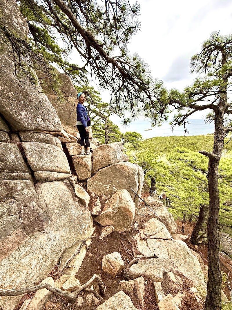
Dorr Mountain South Ridge Loop — Eastern Mount Desert Island
Steep iron-rung ascent over 0.4 miles gains 400 feet, then a long forest descent loops back across carriage roads.
- Steep initial 0.4-mile ascent with iron rungs and granite boulders
- 400-foot elevation gain in the opening pitches
- Panoramic Mount Desert Island views from the ridge
- Granite ridgeline with slippery exposed sections
- Long, shaded forest descent return route
STEEP OPENING PITCH
Dorr South Ridge begins deceptively mellow, then immediately ramps into a relentless 0.4-mile scramble. The route follows iron rungs, granite boulders, and short steps bolted directly into the slope. The pitch gains 400 feet in less than half a mile, making it one of Acadia's steepest per-mile climbs.
Wet granite is extremely slippery during and after rain. The opening pitch is where most hikers turn back or slip. Use trekking poles aggressively and wear high-traction shoes.
RIDGE WALK
Once past the initial pitch, the trail mellows onto the exposed granite ridgeline with panoramic views in all directions. The ridge crest offers open sky and long sightlines across Jordan Pond, the surrounding peaks, and the mainland. The ridge crossing takes 30–45 minutes. Wind exposure is significant; early morning is calmer.
DESCENT VIA FOREST
The return loop descends through shaded forest, crossing several carriage roads before returning to the trailhead. This is a much longer, less steep descent than the ascent. The full loop averages 2–2.5 hours.
The forest section is muddy after rain but offers easier footing than the ridge. No views on descent, but the shade is welcome in hot weather.
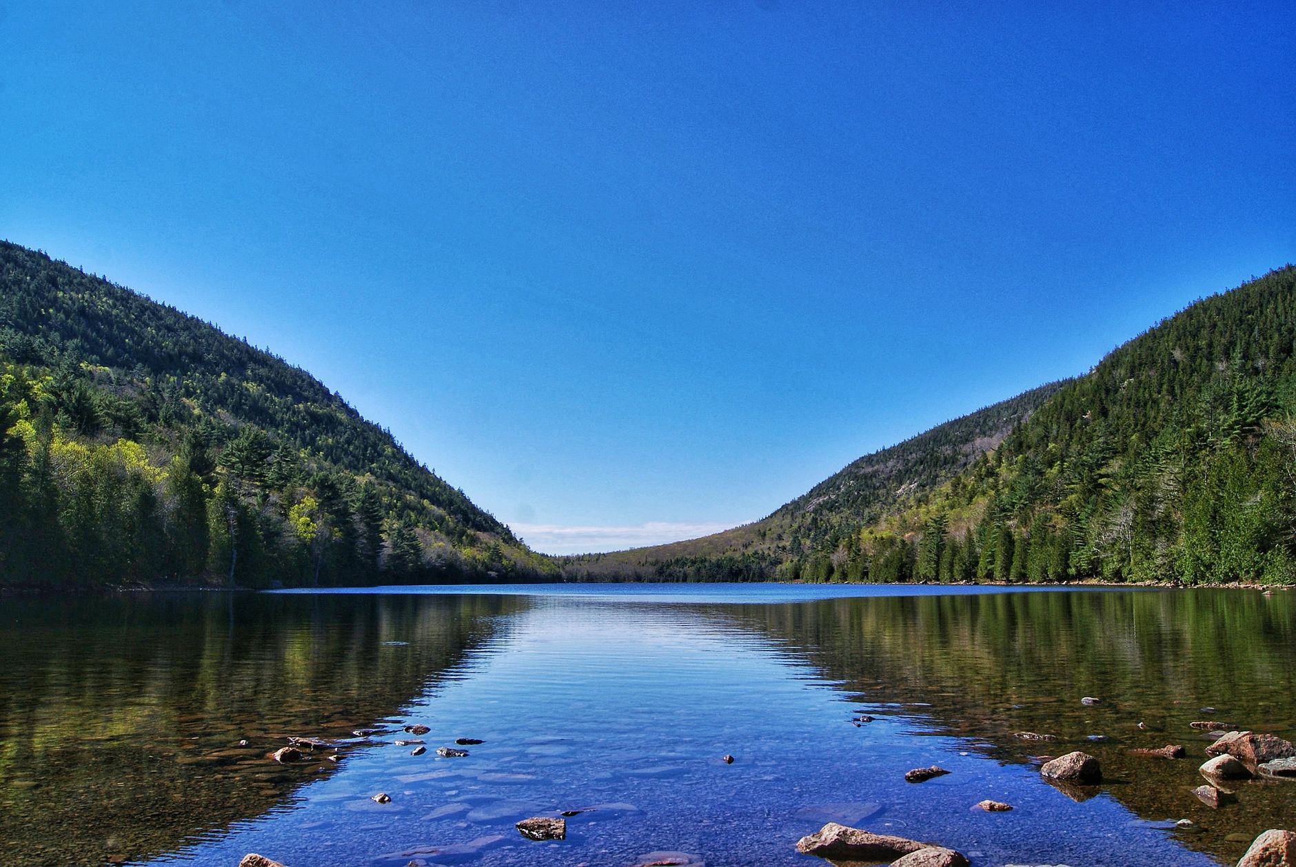
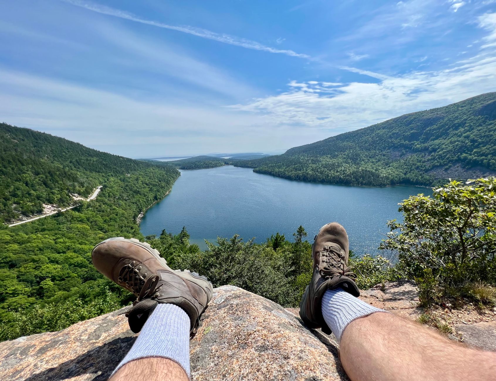
Pemetic South Ridge — Central Mount Desert Island
Rocky scrambles and granite terrain reach the 1,248-foot summit with Jordan Pond spread below.
- Rocky terrain with uneven footing throughout
- Short steep sections requiring rock scrambling
- 1,248-foot summit with panoramic views of Jordan Pond, Eagle Lake, and Cadillac Mountain
- Exposure increases near summit with dramatic vistas
- Not wheelchair accessible due to scrambling sections
ROCKY APPROACH
The South Ridge trail climbs through rocky terrain with uneven footing from the start. Most of the 4-mile round-trip crosses exposed granite or talus rather than packed earth. Trekking poles help with balance and reduce joint strain on uneven surfaces.
The trail is generally well-marked with cairns, but boulder hopping demands focus. The ascent takes 1.5–2 hours at a moderate pace.
SCRAMBLE SECTIONS
Short, steep sections near the summit require hands-on rock scrambling. These sections are brief but exposed; good foot placement and arm strength make a difference. The scrambles are not technical climbing but do require comfort with exposure.
The near-summit exposure reveals why Pemetic is ranked 'moderate-challenging' rather than purely moderate. These final pitches are where the trail's grade shows.
SUMMIT VIEWS
The 1,248-foot summit opens onto Jordan Pond directly below, framed by the Bubbles and the surrounding peaks. On clear days, the Maine coast stretches to the horizon. Eagle Lake and Cadillac Mountain dominate the eastern views.
This is a popular spot for sunrise and sunset photography. The descent retraces the ascent, with downhill footing trickier on rocky slopes.
Cadillac North Ridge Trail — Eastern Mount Desert Island
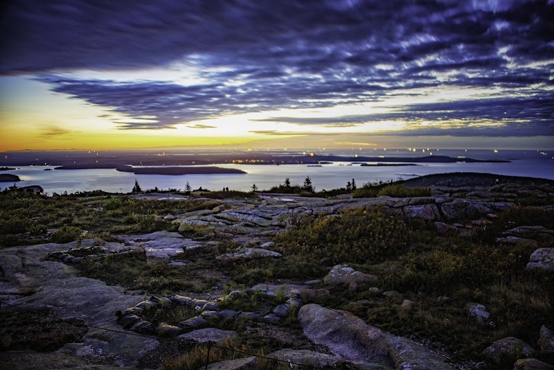
Mostly exposed granite slopes lead to the highest point in Acadia and on the eastern seaboard—1,530 feet.
- Highest point in Acadia National Park and the eastern seaboard (1,530 feet)
- Mostly exposed granite with sweeping vistas throughout
- Views of Bar Harbor, Frenchman Bay, and Schoodic Peninsula from summit
- Popular for sunrise and sunset hiking
- Steep sections throughout with uneven, slippery footing
EXPOSED GRANITE SLOPES
The North Ridge ascends mostly open granite slopes with minimal tree cover. The terrain is rocky and uneven throughout, with granite stairs and cairn markers guiding the way. Closed-toe, good-traction shoes are essential; most of the trail is unlevel granite that can be treacherous in wet conditions.
The exposure offers views immediately from the lower slopes. The granite is visually striking but slippery when wet or icy. Plan for 2–2.5 hours to the summit at moderate pace.
HIGHEST POINT SUMMIT
Cadillac's 1,530-foot summit is the highest point in Acadia and the first place the sun hits on the eastern seaboard. The views extend across Bar Harbor to the north, Frenchman Bay to the east, and the broader Mount Desert Island chain to the west.
The summit is a popular destination. Many hikers time arrival for sunrise (2–4 AM departure from parking) or sunset. On clear days, visibility extends 20+ miles.
LOGISTICS
The Cadillac Summit Road is closed to vehicles in winter. During peak season (May 1–October 31), a $6 per-vehicle timed-entry reservation is required for vehicle access. Hikers and cyclists on foot do not need reservations.
The trailhead is at the base of Cadillac Mountain, off the Park Loop Road. Allow extra time to secure parking or arrive before 7 AM to avoid crowds.
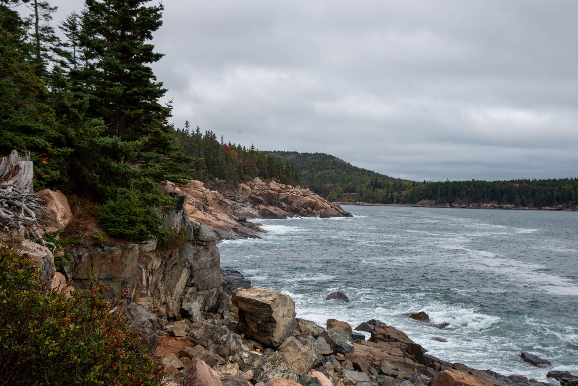
Gorham Mountain Loop — Eastern Mount Desert Island
Rocky south ridge with ocean vistas concludes at the 525-foot summit overlooking Thunder Hole and Cadillac Mountain.
- South ridge ascent with rocky, slippery-when-wet terrain
- 525-foot summit with views of Cadillac Mountain and the Atlantic Ocean
- Starts south of Thunder Hole, Acadia's most famous tidal feature
- 3.1-mile loop with consistent elevation gain
- Good traction shoes essential due to exposed rock
SOUTH RIDGE CLIMB
Gorham Mountain Loop begins with a steady climb up the rocky south ridge. The route follows the south ridge before descending. Much of the route across the ridge is slippery when wet; good traction shoes are essential.
The ascent is consistent with no exposed sections or technical scrambling, making it moderate despite the rocky footing. Trees provide some windbreak during the climb.
SUMMIT & VIEWS
The 525-foot summit offers views of Cadillac Mountain to the northeast and the Atlantic Ocean stretching south. Thunder Hole is visible below and to the east—Acadia's most famous tidal feature where waves surge into a narrow inlet.
The summit is smaller than neighboring peaks but offers excellent directional views. Plan 1.5 hours from trailhead to summit, 45 minutes additional for descent and return loop.
RETURN LOOP
The descent follows the same ridge path initially, then drops into forest for the return loop. The lower sections cross less rocky terrain and offer shade. Total loop time is 1.5–2 hours.
This is a quieter alternative to Cadillac or Beehive for day-hikers seeking ocean views with fewer crowds.
Great Head Trail — Eastern Mount Desert Island
Peninsula loop with 1915 tea house ruins and 145-foot ocean cliffs, plus rocky granite scrambles with offshore views.
- Historic 1915 tea house and observatory ruins at 145 feet elevation
- Large millstone (6 feet 10 inches diameter) artifact from early 1900s
- Rocky scrambles and granite steps on a peninsula circuit
- Ocean cliffs with steep drop-offs into the Atlantic
- Bronze monument to David Phillips McKinney
PENINSULA CIRCUIT
Great Head is a peninsula that juts into the Atlantic east of Sand Beach. The trail loops around the peninsula's perimeter, offering ocean views on three sides. Rocky granite steps and short scrambles make up most of the terrain; footing is uneven but not technical.
The loop is relatively short (1.9 miles) but compact, gaining 200+ feet through persistent rocky climbing. The full loop takes 1–1.5 hours.
TEA HOUSE & ARTIFACTS
Near the peninsula's highest point sit the ruins of a 1915 tea house and observatory. The stone foundation, stairs, and fireplace remain, offering a glimpse of Acadia's turn-of-the-century tourism. Nearby stands a massive millstone (6 feet 10 inches in diameter) salvaged from early 1900s operations.
A bronze monument memorializes David Phillips McKinney. These historic features are protected; stay on trail and do not remove artifacts.
COASTAL EXPOSURE
Much of the loop walks along ocean cliffs with steep, unprotected drop-offs. The granite and surrounding vegetation are extremely slippery when wet or in heavy dew. Children and anyone with significant fear of heights should exercise extreme caution.
The upper sections are exposed to wind and salt spray. Early morning or mid-afternoon visits offer best conditions and fewer crowds. Sunrise viewing is popular but the trail is very slippery with morning dew.
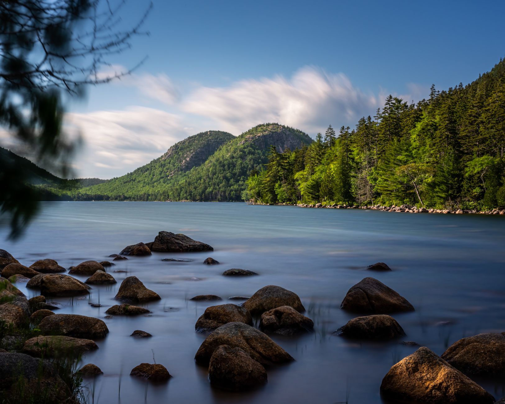
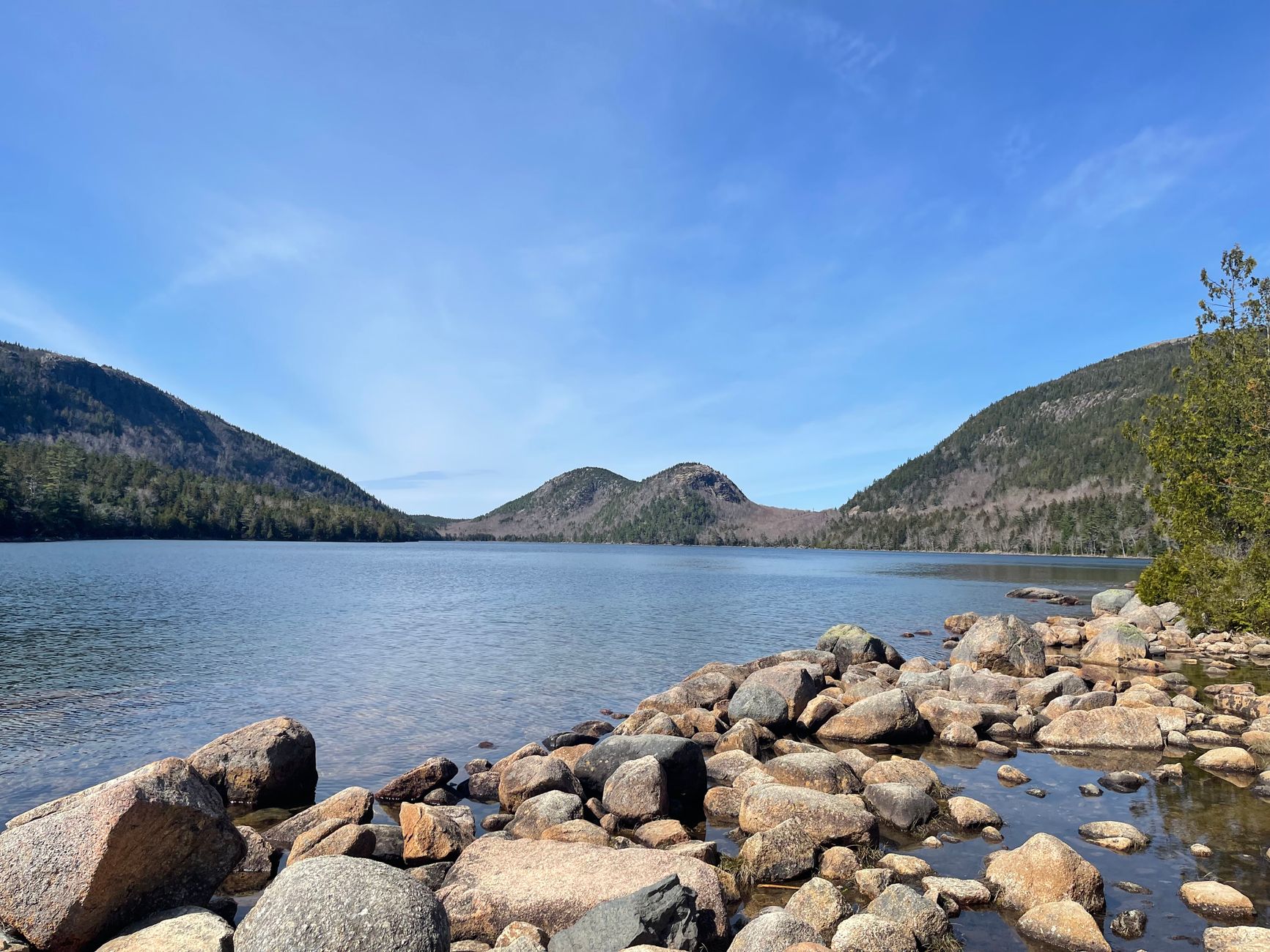
The Bubbles — Central Mount Desert Island
Twin summits and a glacial erratic above Jordan Pond, with wide granite stairs and exposed ridge views.
- North Bubble, South Bubble, and Bubble Rock summits
- Expansive views of Jordan Pond and surrounding mountains
- Glacial erratic rock formation (Bubble Rock) at summit
- Wide granite stairs and forested paths transitioning to open ledges
- Steep rocky sections with exposed granite near top
TWIN PEAKS & FORESTED START
The Bubbles trail climbs toward two rounded peaks separated by a saddle, then diverges to North Bubble and South Bubble. The lower sections ascend through forested terrain, with paths widening into exposed granite ledges near the summits.
Wide granite stairs mark the steeper pitches. The route is steep but short at 1.5 miles round-trip. Most hikers take 1–1.5 hours for the full climb.
BUBBLE ROCK FORMATION
Bubble Rock is a large glacial erratic—a boulder deposited by retreating ice age glaciers—perched dramatically on the Bubbles summit. The rock is a popular photo location and geologic teaching point. Walking on or near the rock is allowed but scrambling to the top is not recommended.
The erratic's balanced appearance prompted its famous name. It's one of Acadia's most recognizable features and a geologic highlight of the park.
JORDAN POND PANORAMA
The Bubbles summits command expansive views across Jordan Pond to the south and west, with surrounding peaks creating a dramatic bowl. On clear days, views extend to Cadillac Mountain in the east.
The trail is slippery when wet or covered in morning dew. Dogs are permitted on a maximum 6-foot leash. Avoid in rain and plan easy footing on rocky descent slopes.
Common Questions
Do I really need special gear for these trails?
Yes. High-traction hiking boots (or approach shoes) are non-negotiable on Acadia's rocky terrain. Trekking poles reduce injury risk and joint strain on uneven granite. For iron-rung trails like Beehive and Precipice, a fear-of-heights tolerance is essential. Many hikers use mountain scramblers (sticky rubber shoes) for added grip on wet rock.
When is the best time to hike the most challenging routes?
September–October offers ideal conditions: cooler air, clear skies, low humidity, and fewer crowds. Summer (July–August) is warm but extremely crowded, requiring early starts and reservations. Spring sees closure of Precipice Trail (March–August). Winter brings icy rungs and short daylight—avoid challenging routes.
What should I do if I encounter a crowd on an iron-rung trail?
Hikers on rungs must yield to uphill traffic (uphill hikers have right-of-way). If congestion is severe, consider turning back or trying a shorter variant (Beehive offers a 1.2-mile shortcut via Bowl Connector). Arriving by 7 AM or hiking on weekdays greatly reduces congestion.
Are there water supplies or bathrooms on the trails?
No. All water and bathrooms are at the trailhead or nearby parking areas. Carry at least one liter of water per person; bring more on hot days. The nearest services (restaurants, shops) are in Bar Harbor, 5 miles from the park entrance.
Can I hike with my dog?
Dogs are prohibited on iron-rung and ladder trails (Beehive, Precipice, Dorr) due to safety and pet stress. Dogs are allowed on leash (max 6 feet) on other trails like The Bubbles, Gorham Mountain, and Cadillac North Ridge. Always bring water for your pet.
Sources & Further Reading
- Hike Beehive Loop — National Park Service
- Hike Precipice Loop — National Park Service
- Hike Dorr Mountain South Ridge Loop — National Park Service
- Hike Pemetic South Ridge — National Park Service
- Hike Cadillac North Ridge Trail — National Park Service
- Hike Great Head Trail — National Park Service
- Hike Bubbles — National Park Service
- Hiking — National Park Service
- Hike Safely in Acadia — National Park Service
- Permits & Reservations — National Park Service
- Acadia National Park Home — National Park Service