10 Best Hiking Trails in Badlands National Park (Ranked by Difficulty)
Ranked by difficulty, from 20-mile backcountry loops to quarter-mile boardwalks.
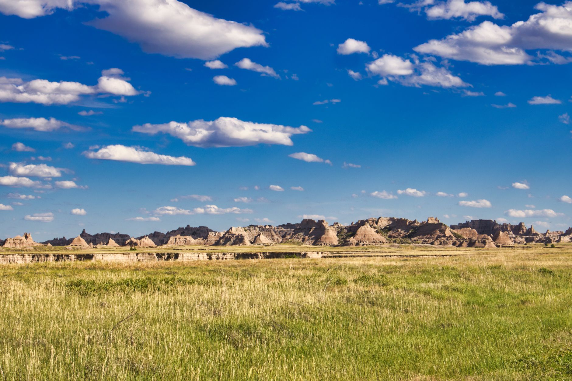
The Badlands sculpts a dramatic landscape of eroded spires, layered walls, and mixed-grass prairie across 244,000 acres. One of Earth's richest fossil beds, the park preserves 30 million years of mammalian history while hosting living bison, bighorn sheep, prairie dogs, and black-footed ferrets.
- 244,000 Acres Protected
- $30 Vehicle Entry Fee
- 10 Designated Trails
- Year-Round Park Access
Sage Creek Wilderness Loop — Sage Creek Wilderness Area
Three-day backcountry loop through pristine 64,000-acre wilderness with off-trail navigation and solitude.
- 20-mile mostly off-trail loop through sagebrush prairie and washes
- Frequent bison herds; zero other hikers create total wilderness isolation
- Natural wash travel routes minimize trail marking necessity
- Suitable only for experienced backcountry navigators with map, compass, GPS
ROUTE
The Sage Creek Wilderness Loop is a 20-mile three-day cross-country route through 64,000 acres of sagebrush prairie, washes, and low buttes. The route follows natural washes and ridgetops with minimal trail markings—map, compass, and GPS are essential. Most hikers move through sage-covered flats, using creek beds as natural lines of travel and navigation reference.
PERMITS & LOGISTICS
No permit is required for backcountry camping, but filing a voluntary trip plan with the ranger station is strongly recommended. Cedar Pass Campground fills quickly (May–October), so book accommodation before your visit. Plan dual overnights: camp at Cedar Pass before the loop, tackle the wilderness, and stay at Cedar Pass after for showers and food.
WHAT TO EXPECT
Expect total solitude, dramatic sunsets over tablelands, and frequent bison herds. Water is scarce and intermittent—carry 2+ gallon capacity and research wash sources beforehand. Nights drop to 40–50°F even in summer; October can be surprisingly cold. This hike is strictly for experienced backcountry travelers with advanced navigation and self-rescue skills.
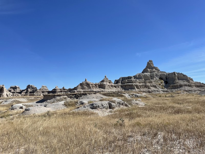
Deer Haven Trail — Southwest Badlands
Unmaintained game trail descending to juniper alcove campsites with dramatic base-of-wall geology.
- Worn but unmaintained path requiring off-trail navigation skills and route-finding
- Juniper alcove at 3 miles offers rare backcountry camping zone
- Close-up views of layered badlands formations reveal geological detail
- Extremely exposed landscape with zero shade and minimal water
ROUTE
Deer Haven is a 5-mile out-and-back descent following a worn game trail and washes to a small juniper alcove at the base of badlands formations. The path is not officially maintained—expect faint sections, route-finding, and stretches where you'll follow boot prints or washes. The elevation loss is gradual until the final push into the alcove.
PERMITS & LOGISTICS
No permit required for day hikes, but backcountry camping at the juniper alcove (around 3 miles) requires no advance reservation. Start early to maximize daylight. Winter (November–March) is not recommended; spring (May) and fall (September–October) offer the most stable weather. July heat makes this route brutal for most hikers.
WHAT TO EXPECT
The reward is solitude, intimate geology views, and a rare juniper camping zone. The exposed landscape offers zero shade and requires a full water supply. Hiking the alcove section at dawn or dusk maximizes otherworldly light on badlands walls. This trail is suitable only for experienced hikers comfortable with route-finding and minimal infrastructure.
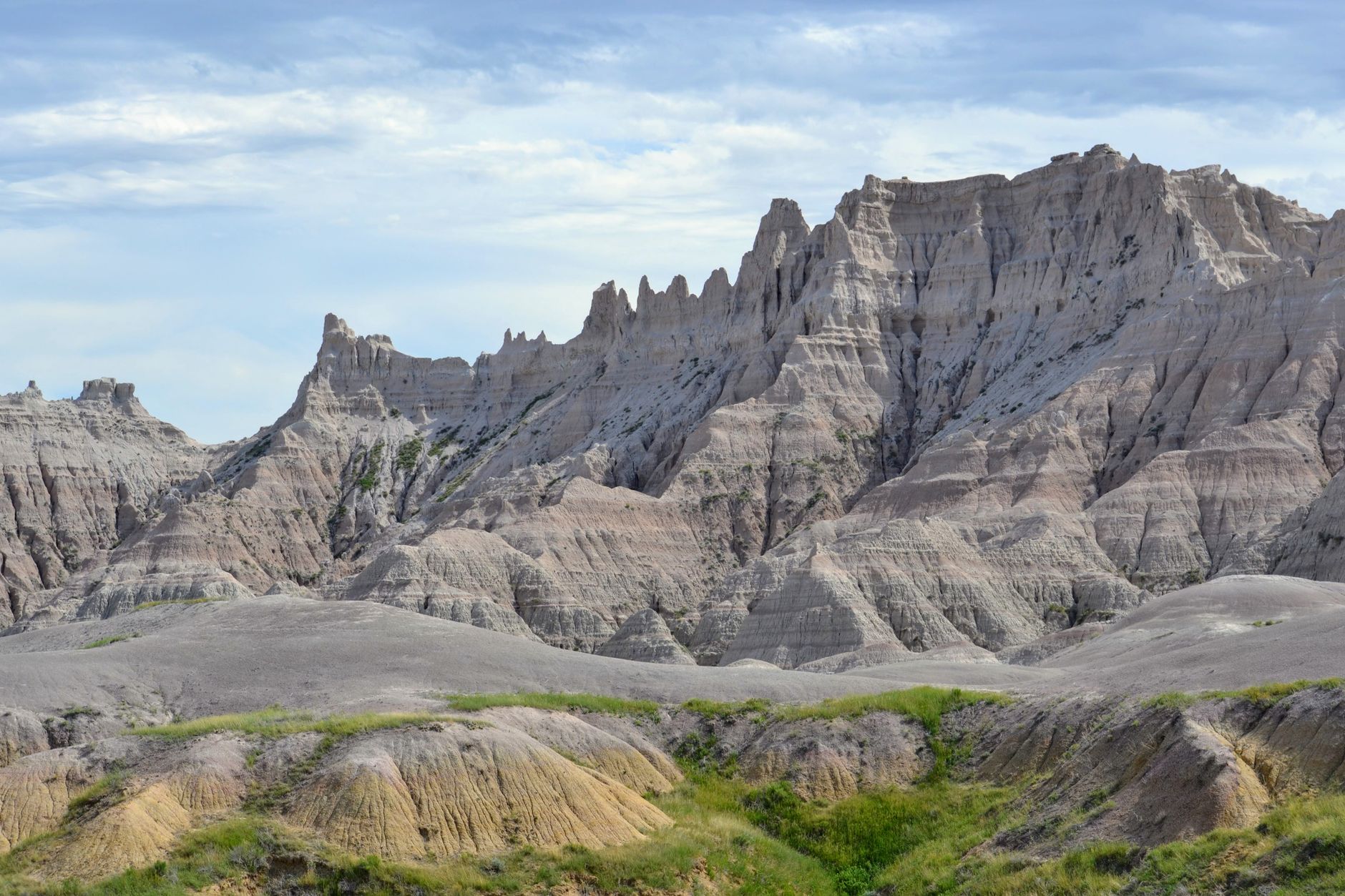
Saddle Pass Trail — Cedar Pass Area
Shortest and steepest trail in park—300 feet of elevation gain in a quarter-mile scramble.
- 300 ft elevation gain over 0.25 mi—intense but brief challenge
- Steep rock scramble up the Badlands Wall with boot-scrape handholds
- Connects to Castle Trail and Medicine Root Trail for loop options
- Panoramic White River Valley views from the saddle
ROUTE
Don't let the 0.25-mile distance fool you—Saddle Pass is the park's steepest climb, gaining 300 vertical feet in under a quarter-mile. The trail climbs a rocky staircase-like scramble directly up the Badlands Wall. Handholds and boot scrapes ease the ascent, but the exposure and steepness demand confidence and sturdy footwear.
COMBINE WITH CASTLE TRAIL
From the saddle, you can connect to Castle Trail and Medicine Root Trail, creating a longer loop hike. Many hikers use Saddle Pass as a quick warm-up or as the finale to a longer Cedar Pass circuit. The short distance makes it ideal for families with older kids or rounding out a half-day itinerary.
WHAT TO EXPECT
The views from the top reward the effort—panoramic White River Valley vistas and direct sight lines to Cedar Pass Lodge and surrounding formations. The scramble is brief, lung-burning, and confidence-building. Avoid Saddle Pass during wet or icy conditions; rain makes the stone face treacherous.
Notch Trail — Cedar Pass Area
Famous ladder scramble with ledge walks and chains—not for acrophobes or uncertain climbers.
- Iconic log ladder scramble section (about 30 feet) with chains for security
- Ledge walk along cliff edge with exposure and dramatic air
- 150 ft elevation gain with panoramic White River Valley views
- Popular and well-maintained despite technical scrambling nature
ROUTE
Notch Trail's 1.5 miles pack a punch—expect elevation gain, scrambling, and exposure. The trail climbs steeply through badlands formations, reaches a log ladder scramble (around 30 feet of climbing), and transitions to a dramatic ledge walk with chains bolted into the rock face for security. The notch overlook reveals the White River Valley far below.
PERMIT & HAZARDS
No permit required, but this trail demands respect. The ladder section is treacherous when wet, icy, or muddy—rain can make it unpassable. Acrophobia is a dealbreaker; the ledge has real exposure. Children should be strong, confident climbers. Summer afternoons can bring sudden thunderstorms; descend if lightning threatens.
WHAT TO EXPECT
The scramble is brief, intense, and enormously satisfying. Views from the notch rival those from much longer hikes. The ladder itself feels adventurous—a real climbing element in a hiking context. Morning hours offer the steadiest light and fewest people. Many hikers rate Notch Trail among their most memorable park experiences.
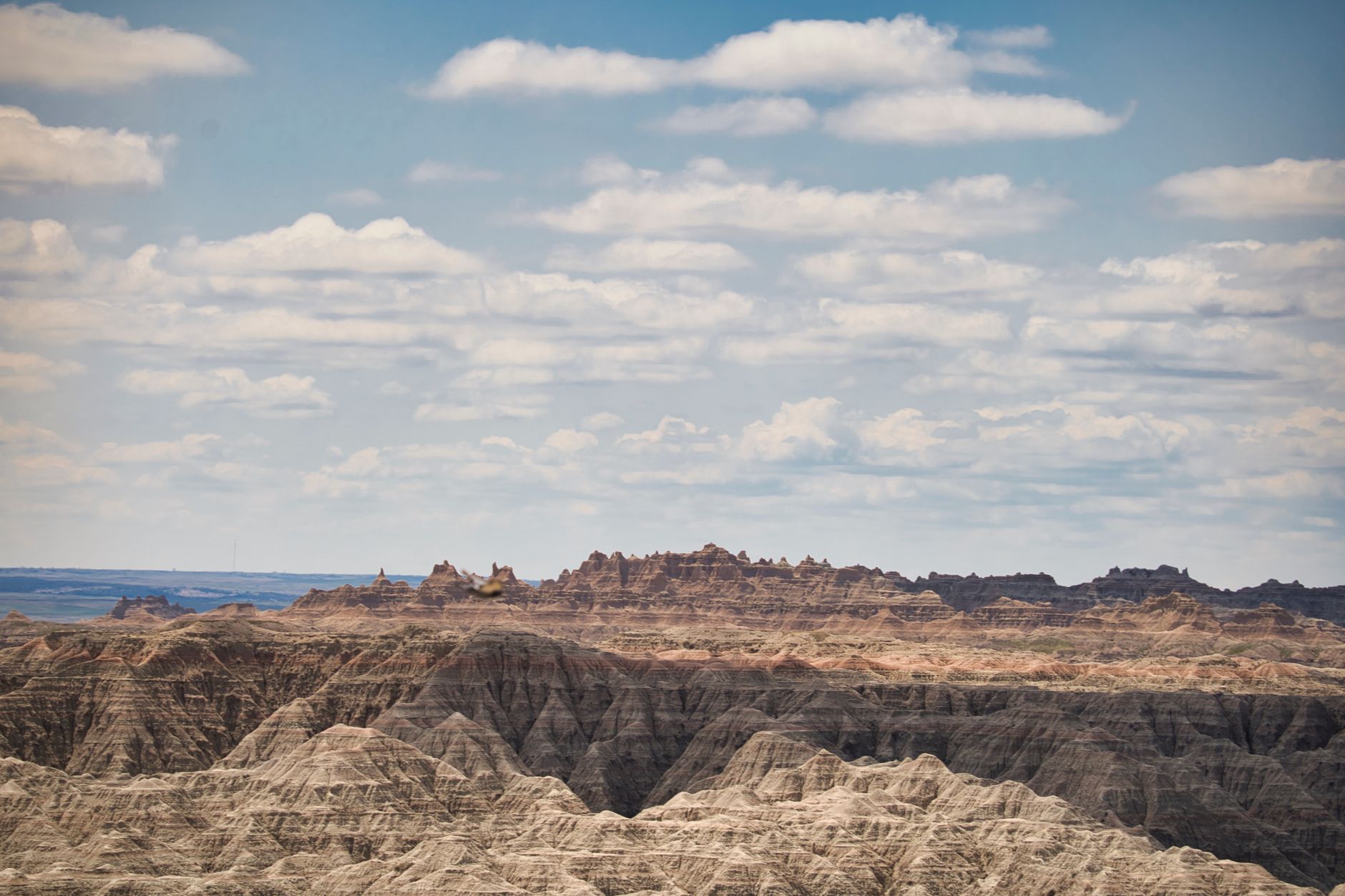
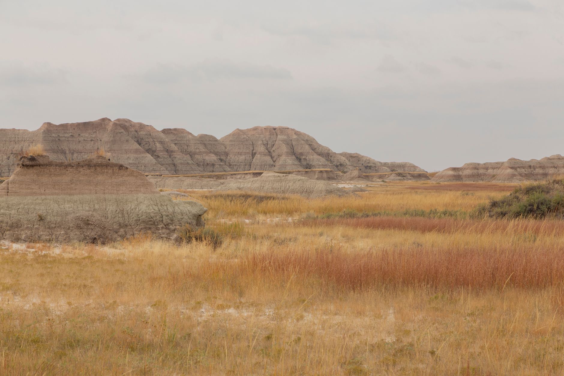
Castle Trail — Cedar Pass to Fossil Exhibit
Five-mile ribbon along the Badlands Wall—longest park trail, mostly flat but relentlessly exposed.
- Longest trail in park: 5 miles one-way (10 mi round-trip)
- Dramatic badlands formations tower overhead throughout the hike
- Mostly level terrain but with zero shade—bring ample water supply
- Mixed grass prairie with occasional wildlife sightings (bison, prairie dogs)
ROUTE
Castle Trail runs 5 miles one-way from Door/Window parking area to Fossil Exhibit Trail, following the base and crest of the Badlands Wall. The path is mostly level, following a gentle ribbon across mixed-grass prairie with badlands formations looming on one side. Despite modest elevation gain, the relentless sun exposure makes this hike physically demanding.
WATER & LOGISTICS
Bring 2+ quarts of water per person—there are no water sources along the route, and the exposed terrain offers almost no shade. Many hikers cover the full 10 miles as an out-and-back day trip, but this creates a long day. A better strategy: spot a car at each end or use Fossil Exhibit Trail as a turnaround point.
WHAT TO EXPECT
Castle Trail offers uninterrupted badlands scenery, intimate wall proximity, and a genuine sense of distance traveled. The mostly flat terrain is deceptive; heat and sun exposure tire legs more than elevation gain would. May–October is ideal; July averages 85–101°F and demands early starts. The trail's length and exposure make it the park's flagship moderate hike for endurance-building hikers.
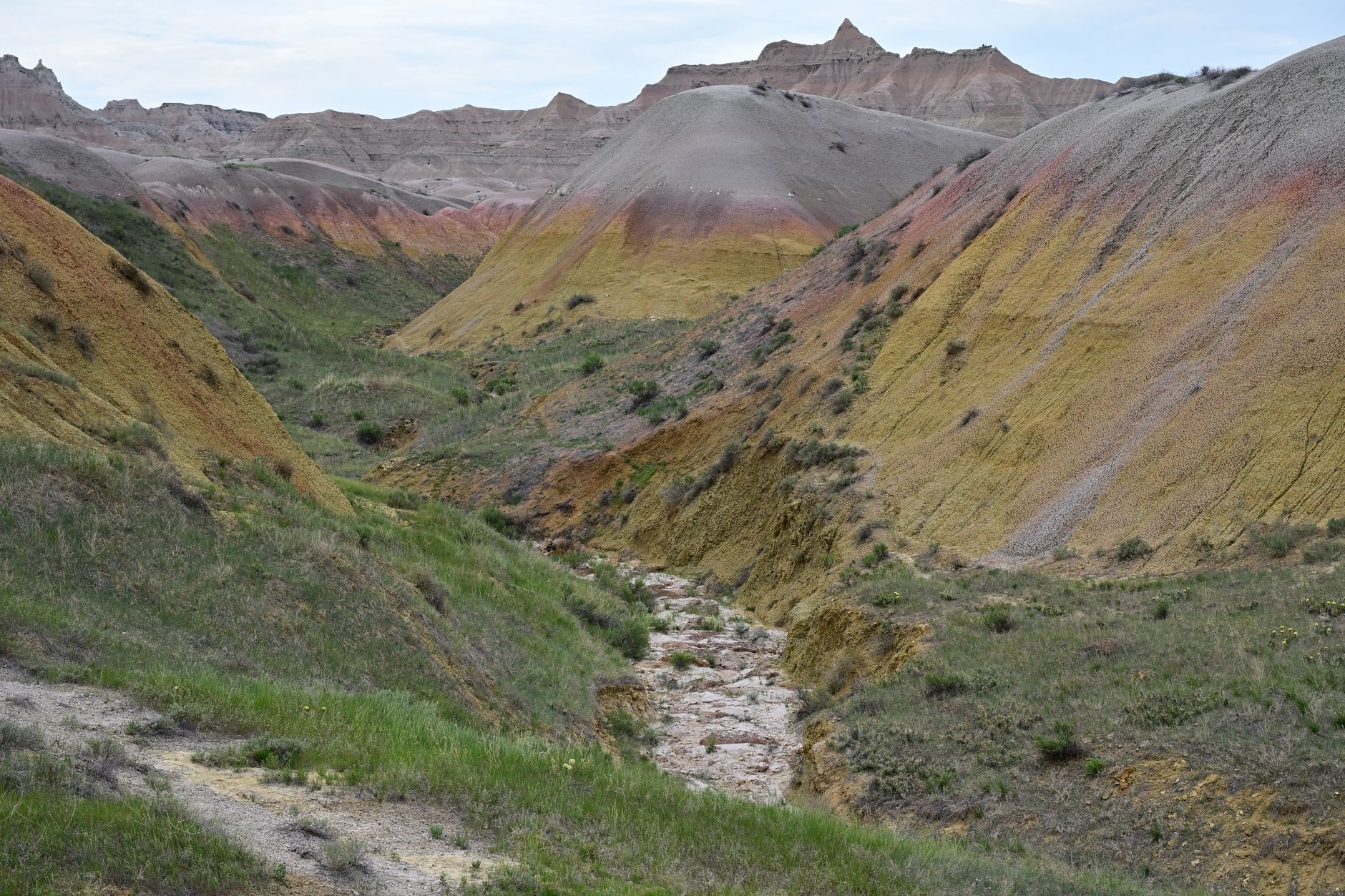
Medicine Root Trail — Cedar Pass Area
Rolling prairie path linking to Castle Trail—watch for prickly pear cactus in badlands grassland.
- 4 miles round-trip on rolling terrain through mixed grass prairie
- Badlands formations visible throughout the hike
- Prickly pear cactus dots the prairie; watch your step carefully
- Connection to Castle Trail and Saddle Pass creates loop options
ROUTE
Medicine Root Trail is a 4-mile round-trip spur that rolls through mixed-grass prairie, offering varied badlands views and genuine prairie-walking experience. The terrain is rolling but never steep, winding through grassland dotted with prickly pear cactus and occasional shrubs. The trail connects Saddle Pass and Castle trails, enabling loop combinations for longer explorations.
CACTUS & WILDLIFE
Prickly pear cactus thrives here, so watch for it along the trail edge. Long pants and gaiters reduce cactus spine risk. The prairie hosts bison, prairie dogs, and occasionally bighorn sheep in the distance. Early morning offers the best wildlife visibility and cooler temperatures.
WHAT TO EXPECT
This is a quieter alternative to busy Castle Trail, offering similar badlands scenery in a more intimate prairie context. The rolling topography provides visual interest without serious elevation gain. May–June wildflower blooms add color. The connection to Saddle Pass or Castle Trail allows hikers to build custom loops matching their fitness and interests.
Cliff Shelf Nature Trail — Cedar Pass Area
Easy shaded loop through rare juniper forest with stairs and boardwalks—Badlands' only oasis.
- 0.5-mile loop with boardwalks and stairs through juniper forest canopy
- Rare shade—nearly impossible to find elsewhere in exposed badlands
- Badlands Wall views and small pond visible from the trail
- Interpretive signage explains natural history and ecology
ROUTE
Cliff Shelf Nature Trail is a 0.5-mile loop beginning near the Ben Reifel Visitor Center. The path winds through a rare juniper forest oasis, climbing modest stairs and boardwalks through the canopy. The juniper provides genuine shade—a precious commodity in the Badlands—while interpretive panels explain the ecosystem, natural history, and geology.
NATURAL FEATURES
A small pond sits near the trail, creating a microhabitat that supports unique wildlife and plants. Badlands Wall views peek through the juniper canopy. The forest itself is ecologically distinct from the surrounding grassland and badlands—a pocket ecosystem shaped by water availability and elevation.
WHAT TO EXPECT
This is the park's easiest, most accessible trail and the only shaded hiking option. It's ideal for families, heat-refuge seekers, or recovering from longer hikes. The interpretive exhibits make it educational for all ages. July heat makes this trail especially appealing—the juniper shade can drop temperatures 10–15°F compared to open badlands trails.
Door Trail — Cedar Pass Area
Most popular trail: wheelchair-accessible quarter-mile boardwalk through a break in the Badlands Wall.
- 0.75 mi including optional primitive extension past boardwalk
- Wheelchair-accessible 0.25-mile boardwalk section with railings
- Natural opening in the Badlands Wall creates dramatic sightline
- Panoramic badlands vistas from the overlook platform
ROUTE
Door Trail is the park's most visited route, beginning at Door/Window parking area. The main section is a 0.25-mile wheelchair-accessible boardwalk that leads directly to a natural opening in the Badlands Wall—the 'door.' For the adventurous, an unmaintained primitive extension continues beyond the boardwalk, adding distance and off-trail exploration.
ACCESSIBLE & FAMILY-FRIENDLY
The paved boardwalk accommodates wheelchairs, strollers, and mobility devices. Interpretive panels explain badlands geology, fossil history, and ecology. This trail is perfect for visitors with limited mobility, families with young children, or anyone seeking a quick, high-reward hike. The modest 22-foot elevation gain is barely perceptible.
WHAT TO EXPECT
Expect crowds, especially mid-day and peak season (June–August). The door viewpoint delivers outsized scenic impact for minimal effort. The optional primitive extension offers adventurers a way to escape the main-trail bustle. Morning light through the 'door' is exceptional for photography.
Fossil Exhibit Trail — Cedar Pass to South
Family-friendly loop featuring replica fossils and interpretive exhibits on extinct Badlands fauna.
- 0.25-mile fully accessible boardwalk loop with interactive design
- Tactile fossil replicas and exhibits on ancient horses, rhinos, camels
- Braille signage and accessibility-focused interpretation for blind visitors
- Educational focus on 30-million-year fossil record
ROUTE
The Fossil Exhibit Trail is a 0.25-mile fully accessible boardwalk loop showcasing replica fossils of extinct Badlands fauna. The interpretive exhibits explain the region's rich 30-million-year fossil record, featuring ancient horses (much smaller than modern horses), rhinoceroses, camels, and other creatures preserved in badlands formations. The walk is nearly level, making it ideal for all mobility levels.
PALEONTOLOGY & LEARNING
Each exhibit station includes detailed panels and tactile replicas allowing visitors to feel fossil shapes. Braille signage makes the trail accessible to blind and visually impaired visitors. Kids love the fossil replicas and interactive design. The educational focus transforms a short walk into a geology and paleontology lesson.
WHAT TO EXPECT
Fossil Exhibit Trail is the park's most family-friendly option and a must-visit for paleontology enthusiasts. The boardwalk is quieter compared to Door Trail, offering a more intimate experience. The trail connects to Castle Trail, enabling families to extend their adventure. Early morning offers the best photography light and quietness.
Window Trail — Cedar Pass Area
Shortest Badlands hike: quarter-mile boardwalk to a natural window viewpoint in the wall.
- 0.25-mile out-and-back boardwalk trail with minimal elevation gain
- Natural window opening in badlands formation creates scenic frame
- Wheelchair accessible with railings for safety and stability
- Perfect for mobility-limited or very young hikers
ROUTE
Window Trail is the park's shortest hike, a 0.25-mile boardwalk stroll from Door/Window parking area to an overlook framing a natural opening in the Badlands Wall. The boardwalk is wheelchair accessible with railings and gentle slopes, making it accessible to visitors with limited mobility. The trail ends at a platform overlooking eroded canyon formations beyond the window.
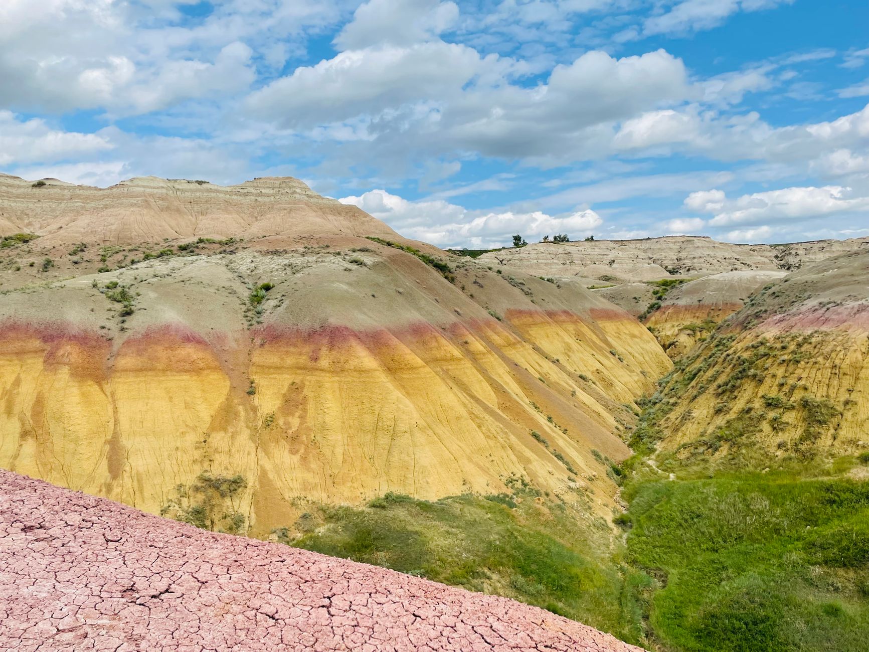
NATURAL WINDOW VIEWPOINT
The natural window formation creates a frame for viewing eroded formations beyond—a photographer's delight. The layered geology visible from the platform reveals the badlands' stratified history, with different colored bands representing different geological epochs. Interpretive signage explains the window formation and surrounding geology.
WHAT TO EXPECT
Window Trail is ideal for visitors with mobility challenges, very young children, or hikers short on time. The ten-foot elevation gain is negligible. The trail is quiet, with fewer crowds than the adjacent Door Trail. Sunset light transforms the window frame into golden artwork, making evening visits especially rewarding.
Common Questions
When is the best time to hike in the Badlands?
May through October offers the most stable hiking weather. May and September are ideal with moderate temperatures (60s–80s°F). July brings peak heat (average 94°F) and afternoon thunderstorms but sees peak visitor volume. October is cool and dry but early snowfall is possible late month.
Do I need a permit for day hikes?
No permits are required for day hiking on any Badlands trail. Backcountry camping requires no advance reservation but does require following NPS rules. File a voluntary trip plan at the ranger station for safety when backcountry camping.
What should I bring for Badlands hiking?
Water is non-negotiable: carry 2+ quarts per person per 2 hours of hiking. Trails are exposed with virtually no shade—bring sunscreen, hat, sunglasses. Sturdy hiking boots protect against cactus spines and rocky terrain. Layers handle temperature swings; winter hikers need cold-weather gear for sub-zero wind chills.
Are the trails family-friendly?
Yes. Fossil Exhibit Trail, Window Trail, and Cliff Shelf Nature Trail are easy accessible boardwalk loops suitable for young children and mobility-limited visitors. Door Trail offers the most popular easy-to-moderate option. Older kids can handle Saddle Pass (steep but brief) or Medicine Root Trail (rolling prairie).
Can I hike year-round?
The park is open year-round, but winter hiking is challenging. Cedar Pass Lodge and Campground close November 1 through late March. Winter snowfall (12–24 inches annually) and ice create hazardous conditions. Spring (April) and fall (October) present variable weather with rapid changes.
Sources & Further Reading
- Badlands National Park Official Site — U.S. National Park Service
- Door Trail - U.S. National Park Service — U.S. National Park Service
- Notch Trail - U.S. National Park Service — U.S. National Park Service
- Castle Trail - U.S. National Park Service — U.S. National Park Service
- Window Trail - U.S. National Park Service — U.S. National Park Service
- Deer Haven Trailhead - U.S. National Park Service — U.S. National Park Service
- Saddle Pass Trail - U.S. National Park Service — U.S. National Park Service
- Medicine Root Trail - U.S. National Park Service — U.S. National Park Service
- Fossil Exhibit Trail - U.S. National Park Service — U.S. National Park Service
- Cliff Shelf Trail - U.S. National Park Service — U.S. National Park Service
- Badlands Wall - U.S. National Park Service — U.S. National Park Service
- Badlands Backcountry Camping — U.S. National Park Service
- Wildlife Viewing in the Badlands — U.S. National Park Service
- Ben Reifel Visitor Center — U.S. National Park Service