Geology of Glacier National Park: Billion-Year-Old Rocks
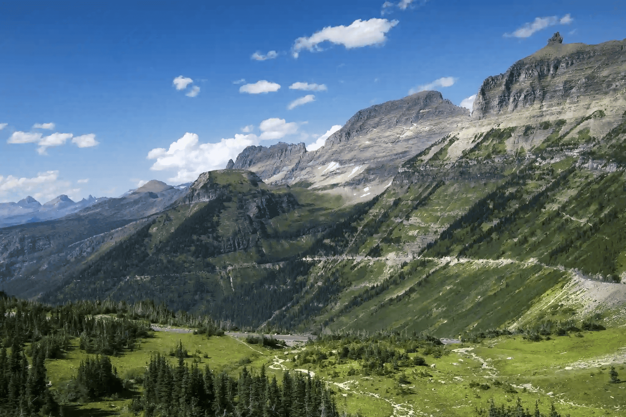
The mountains of Glacier National Park are made of sedimentary rocks deposited in an ancient sea 1.5 billion years ago — some of the oldest exposed Precambrian rock on Earth. Those layers were later pushed 50 miles eastward by the Lewis Overthrust fault and then sculpted by glaciers during the last Ice Age, producing the arêtes, cirques, and U-shaped valleys visitors see today.
The result is a park where every cliff face is a readable page of Earth’s history, and where 24 named glaciers are still actively reshaping the terrain — though far more slowly than they once did.
- The park’s primary rocks belong to the Belt Supergroup — sedimentary layers up to 1.5 billion years old and 18,000 feet thick.
- Red and purple rocks contain oxidized iron; green and blue rocks formed in oxygen-free underwater environments.
- The Purcell Sill is a dark diorite band ~100 feet thick, visible on Mt. Siyeh and Mt. Cleveland, formed 780 million years ago.
- The Lewis Overthrust pushed ancient rocks 50 miles (80 km) eastward over 90 million years, placing older rock on top of younger.
- Glaciation over the last 2 million years carved U-shaped valleys, cirques, and horns throughout the park.
- About 24 named glaciers remain today, down from roughly 80 when the park was established in 1910.
- Stromatolite fossils — 1.5 billion years old — are visible at Apikuni Falls, Logan Pass, and along Going-to-the-Sun Road.
The Belt Supergroup: 1.5 Billion Years of Sediment
Almost every rock you see above treeline in Glacier National Park belongs to the Belt Supergroup, per NPS.gov. This sequence of sedimentary rock accumulated over roughly 100 million years in a shallow inland sea — the ancient Belt Sea — that covered what is now eastern Washington, northern Idaho, and western Montana around 1.5 billion years ago.
The Belt Supergroup built up to a staggering 18,000 feet of sediment layers. The main rock types are quartzite, argillite, mudstone, limestone, and dolomite. Most of what you observe on Glacier’s cliffsides, canyon walls, and ridgelines is this ancient marine deposit, compressed and uplifted over geologic time.
Some links below are affiliate links.

The park’s rock record is so well-preserved because the Belt Sea was remarkably calm, producing flat-lying sediment layers with almost no volcanic disruption. This made Glacier’s rocks internationally significant for understanding Precambrian Earth — geologists travel from around the world to study them.
Why Are Glacier’s Rocks Red, Green, and Purple?
The striking colors of Glacier’s argillite — a fine-grained sedimentary rock — directly reflect oxygen conditions in the ancient Belt Sea, per NPS.gov. The color pattern follows a simple chemical rule:
| Color | Cause | Ancient Environment |
|---|---|---|
| Red / Purple | Iron oxidation (rust) | Sediments exposed to air as the Belt Sea retreated |
| Green / Blue | Iron bonded to silica (chlorite mineral) | Oxygen-free underwater conditions — deep sea |
| Tan / Gray | Limestone or dolomite (calcium carbonate) | Shallow reef-like environments |
This color-coding makes Glacier’s cliffs almost like a geological timeline you can read with your eyes. Red layers above green layers typically indicate the ancient sea was retreating, exposing sediment to the atmosphere. Green layers beneath red ones suggest the sea was deepening, cutting off oxygen at the seafloor.
The most accessible place to see this color variation is at the Going-to-the-Sun Road cuts, where the road sliced directly through exposed Belt Supergroup strata. Logan Pass at 6,646 feet offers panoramic views of multicolored ridge faces that display the full argillite spectrum.
The Purcell Sill: A 780-Million-Year Dark Stripe
Running horizontally across several of Glacier’s highest peaks is a distinct dark band known as the Purcell Sill — a roughly 100-foot-thick layer of dark igneous diorite intruded between the lighter Siyeh Limestone layers approximately 780 million years ago, per NPS.gov.
Unlike the surrounding sedimentary layers, the Purcell Sill formed when magma forced its way horizontally between rock strata without erupting at the surface. The intense heat of this intrusion recrystallized the surrounding limestone into white metamorphic marble, leaving a visible white band immediately above and below the dark diorite stripe.
| Feature | Detail |
|---|---|
| Age | ~780 million years |
| Rock type | Diorite (dark igneous) |
| Thickness | ~100 feet |
| Best viewing peaks | Mt. Siyeh, Mt. Cleveland, Mt. Blakiston |
| Surrounding alteration | White metamorphic marble directly adjacent |
The Purcell Sill is one of the easiest geological features to identify without a guide. On Mt. Siyeh and Mt. Cleveland — Glacier’s highest peak at 10,466 feet — the dark horizontal stripe breaks up the otherwise pale limestone faces in a way that’s visible from miles away. The Siyeh Pass Trail offers one of the best close-up views of this formation.
The Lewis Overthrust: When Mountains Travel 50 Miles
The single most dramatic geological event in Glacier’s history was the Lewis Overthrust — a collision between tectonic plates that pushed an enormous stack of ancient rocks approximately 50 miles (80 km) eastward over rocks that were 70 million years younger, per NPS.gov.
This process began approximately 150 million years ago and continued for 90 million years, with movement occurring in millimeter-per-year increments during earthquake episodes. The result is one of the most famous geological anomalies in North America: older Precambrian rock sitting directly on top of younger Cretaceous rock — the opposite of the normal sequence where older rocks lie below younger ones.
Chief Mountain, at 9,080 feet near the park’s northeast corner, is one of the most striking examples of the Lewis Overthrust. The mountain is an “outlier” — an isolated remnant of the overthrust sheet that erosion has cut away from the main block. It sits on top of much younger shale, creating a geological monument visible for miles across the plains.
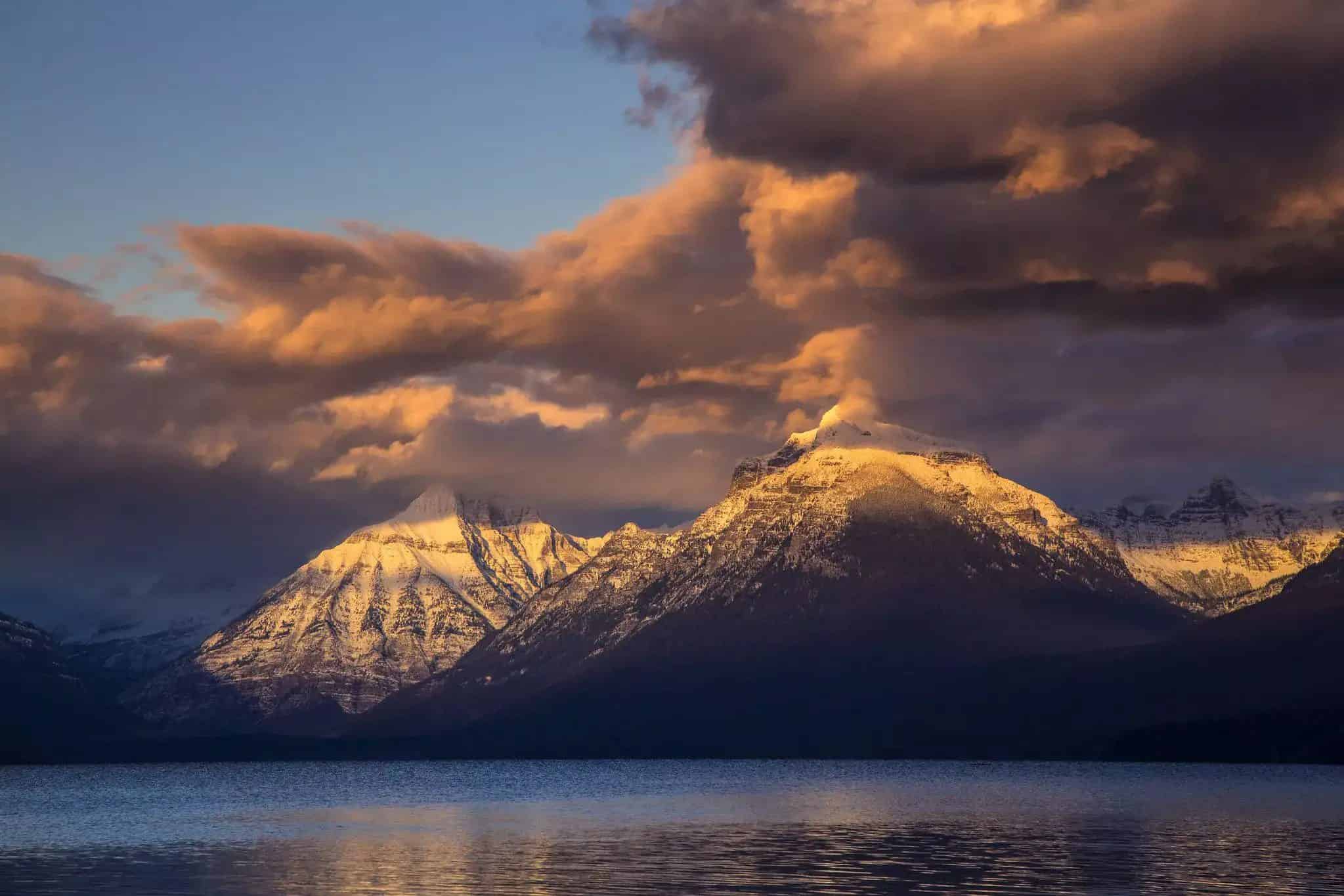
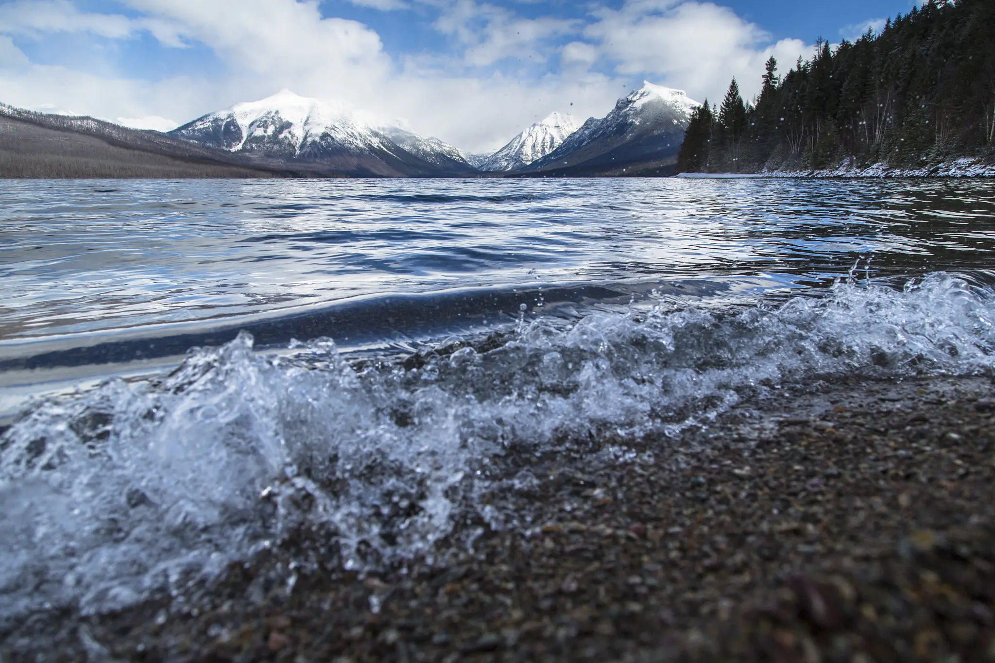
How Glaciers Carved the Park’s Iconic Terrain
Although the park’s rock dates back 1.5 billion years, its dramatic topography is far more recent. The Pleistocene Ice Age, which began approximately 2 million years ago, sent massive glaciers flowing through the region, carving the park’s signature terrain before finally retreating about 10,000 years ago, per NPS.gov.

The key glacial landforms visible throughout the park include:
- U-shaped valleys — Wide, flat-bottomed valleys carved by glaciers moving through river canyons. McDonald Valley and the Many Glacier valley are classic examples.
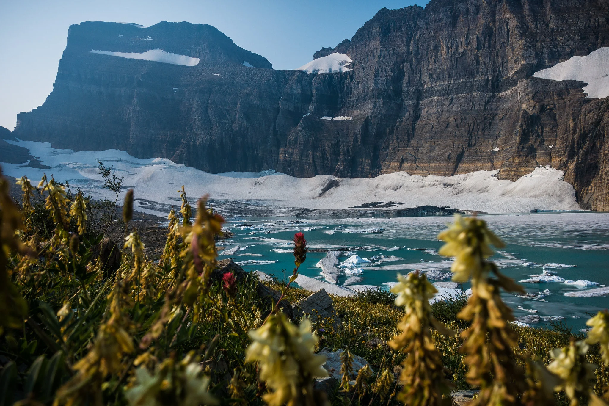
- Cirques — Bowl-shaped basins at the heads of glaciers, often containing a lake (tarn). Grinnell Lake and Iceberg Lake sit in glacial cirques.
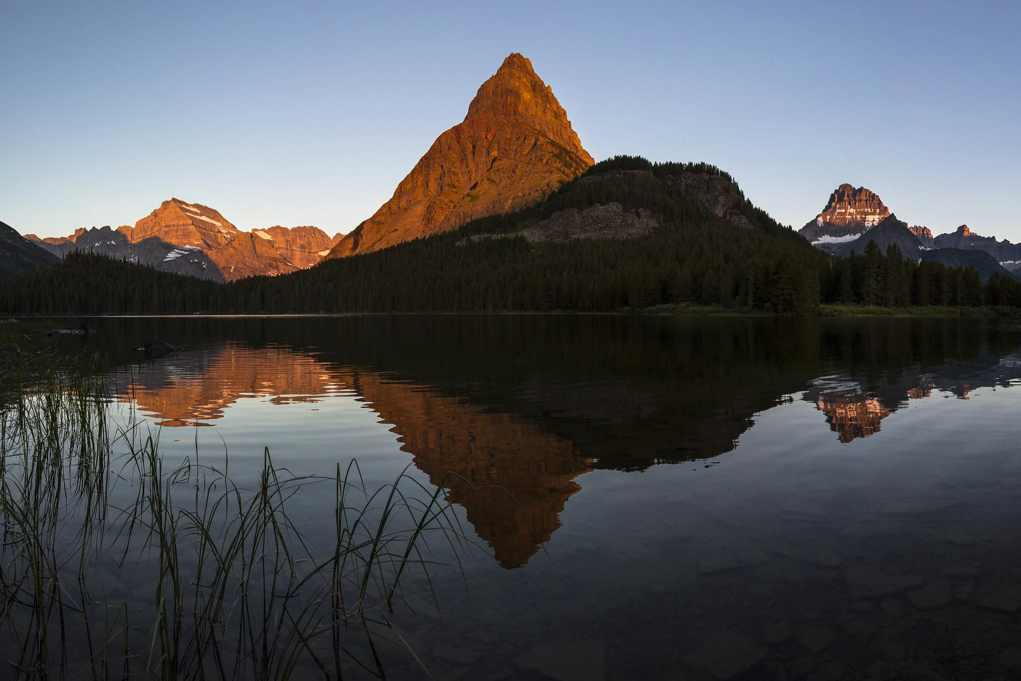
- Arêtes — Knife-edge ridges formed where two cirques eroded toward each other from opposite sides. The Garden Wall along the Continental Divide is one of the park’s most famous arêtes.
- Horns — Pyramid-shaped peaks created by three or more cirques eroding toward a central point. Mt. Reynolds near Logan Pass is a textbook horn.
- Moraines — Ridges of rock debris deposited at the edge or end of a glacier. The terminal moraines at the foot of Grinnell Glacier mark maximum ice extents from the Little Ice Age.
The vertical relief in Glacier — with elevations ranging from 3,150 feet at the lowest valley floors to 10,466 feet at Mt. Cleveland’s summit — is a direct product of glacial erosion accelerating the uplift that had already occurred through the Lewis Overthrust.

How Many Glaciers Does Glacier National Park Have Today?
When Glacier National Park was established in 1910, it contained approximately 80 named glaciers. As of 2026, approximately 24 named glaciers remain, per NPS.gov.
The current glaciers are relatively young — they likely formed during the last 6,000 to 8,000 years, grew substantially during the Little Ice Age (roughly 400 to 500 years ago through 1850), and have been retreating since. Retreat accelerated significantly during the mid-to-late 1920s and has continued through the present day.
| Period | Estimated Glacier Count | Status |
|---|---|---|
| 1850 (Little Ice Age maximum) | ~150 | Peak extent |
| 1910 (park established) | ~80 | Retreat underway |
| 1966 | ~35 | Accelerating loss |
| 2026 | ~24 | Ongoing retreat |
To qualify as an “active glacier” under standard glaciological definitions, a body of ice must be at least 25 acres (0.1 km²). Several of the park’s named glaciers are near or below this threshold. Grinnell Glacier, Harrison Glacier, and Sperry Glacier are among the most-studied. The Many Glacier area remains the best hub for glacier viewing.
Stromatolites: Fossils From 1.5 Billion Years Ago
Glacier National Park contains some of the best-preserved stromatolite fossils on Earth — mound-like structures created by blue-green algae (cyanobacteria) that lived in the Belt Sea approximately 1.5 billion years ago, per NPS.gov.
Stromatolites are found in the Altyn Formation limestone and dolomite throughout the park and appear as rounded, layered structures in cross-section. Living stromatolites exist in only a handful of places globally — including the tidal channels of the Exuma Cays, Bahamas — which shows just how little these organisms have changed in over a billion years.
| Fossil Location | Access |
|---|---|
| Apikuni Falls | 2-mile round-trip trail from Many Glacier Road |
| Logan Pass area | Along the Hidden Lake Trail |
| Grinnell Glacier Trail | Exposed limestone at upper elevations |
| Going-to-the-Sun Road (west side) | Roadside exposures |
In addition to stromatolites, the park contains Horodyskia moniliformis — a string-of-beads fossil that may represent an evolutionary link to eukaryotic (complex-celled) life. Cretaceous fossils including mollusks, bivalves, and plant material also occur in the park’s younger rock formations near the eastern foothills.
Where to See the Best Geology in Glacier National Park
Entrance fee: $35/vehicle (valid 7 days), $20/person on foot or bike, $30/motorcycle, per NPS.gov.
| Location | What to See | Access |
|---|---|---|
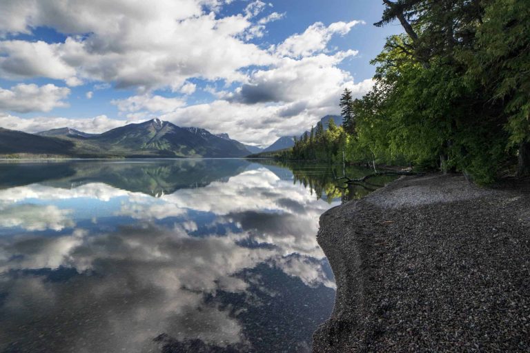
| Lake McDonald shoreline | Belt Supergroup argillite pebbles (red, green, purple) | Drive-in, year-round |
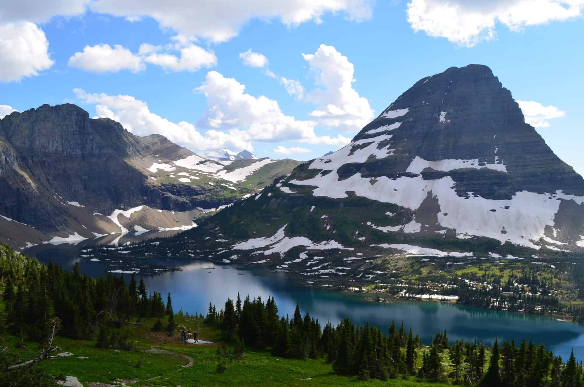
| Logan Pass (6,646 ft) | Arêtes, horns, exposed Belt Supergroup, stromatolites | GTSR open typically June–Oct |
| Hidden Lake Overlook | Classic glacial cirque, mountain goats on rocky slopes | 3-mile round trip from Logan Pass |
| Grinnell Glacier Trail | Active glacier, moraines, glacial lake, stromatolites | 7.6 miles RT from Many Glacier |
| Apikuni Falls | Stromatolite fossils in Altyn limestone | 2-mile RT from Many Glacier Road |
| Marias Pass (Hwy 2) | Lewis Overthrust contact zone on Summit Mountain | Roadside pull-off, year-round |
| Siyeh Pass Trail | Purcell Sill dark diorite band on Mt. Siyeh | Strenuous; accessible when GTSR open |
Frequently Asked Questions
How old are the rocks in Glacier National Park?
Why is older rock sitting on top of younger rock in Glacier National Park?
Why are the pebbles at Lake McDonald so colorful?
Can I find fossils in Glacier National Park?
Will Glacier National Park still have glaciers in the future?
How We Researched This Guide
- NPS.gov Glacier — Geologic Formations (Belt Supergroup, Purcell Sill, Lewis Overthrust data)
- NPS.gov Glacier — Fossils page (stromatolite locations and ages)
- NPS.gov Glacier — Fees and Passes (entrance fee verification)
- NPS.gov Glacier — Geology overview (formation processes)
- NPS.gov Glacier — Glaciers overview (current glacier count and retreat history)
Glacier counts and retreat data are updated periodically by USGS monitoring. The figure of ~24 named glaciers reflects available NPS data as of early 2026. Trail access and GTSR opening dates change seasonally — verify at NPS.gov before visiting.
Ready to explore Glacier’s billion-year-old rocks in person? Plan your visit