Day Glacier National Park Itinerary — Best One-Day Plan
Day Glacier National Park Itinerary: Explore the BEST areas of the park! Glacier National Park recorded 2,893,996 visitors (per NPS) and Going-to-the-Sun Road reaches Logan Pass at 6,646 feet, per NPS.gov, so a well-timed one-day plan is practical in 2026.
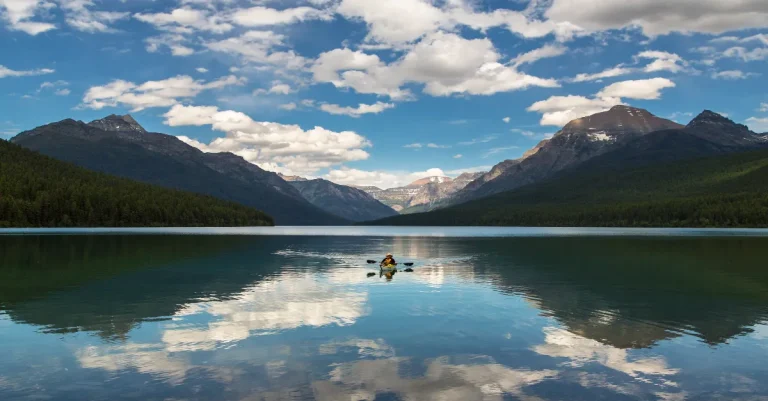
A realistic one-day visit can include Logan Pass, a short Highline/Hidden Lake hike, scenic stops on Going-to-the-Sun Road, and an easy lakeside walk at Lake McDonald. We present a minute-by-minute plan with arrival windows, shuttle/parking constraints, short-hike choices, and practical know-before-you-go tips. Per NPS.gov and park records, shuttle tickets and parking limits shape the day in 2026.
Glacier National Park — Quick Facts and Crowd Signals
- Park area
- 1,013,322 acres
- Annual visitors
- 2,893,996 (2025)
- Documented species
- 1,507 species
- Campgrounds
- 13 total
- High season
- July – September
- Going-to-the-Sun Road
- Seasonal; full crossing typically mid-June to mid-October
- Crowding index
- 2,855.9 visitors per 1k acres
- Phone
- (406) 888-7800
Plan a timed one-day trip: 7-9 hour fast or 9-12 hour scenic window
One-Day Itinerary – Fast (West-to-East)
- 6:00 AM Arrive at Apgar Transit Center; buy shuttle tickets if needed or park at Apgar
- 7:00 AM Shuttle express to Logan Pass (ticket required July 1 onwards) or drive if GTSR open
- 7:30 AM Hidden Lake Overlook hike (1.3 mi one-way to overlook; 2.6 mi RT).
- 10:30 AM Return to Logan Pass; quick roadside stops on Going-to-the-Sun Road
- 12:00 PM Lunch at Lake McDonald or packed picnic at Trail of the Cedars
- 1:00 PM Trail of the Cedars and Avalanche Lake short hike if time allows
- 3:30 PM Drive to Apgar; late-afternoon shoreline photo stops
- 5:00 PM Depart park or stay overnight
One-Day Itinerary – Scenic (East-to-West)
- 6:00 AM Arrive at St. Mary Visitor Center; confirm shuttle ticket windows for Logan Pass
- 7:00 AM Sun Point and Virginia Falls short loop (0.4–1.5 mi options)
- 9:00 AM Drive Going-to-the-Sun Road with multiple overlooks and 10–20 minute stops
- 11:30 AM Logan Pass, Hidden Lake Overlook hike (2–3 hours total)
- 2:30 PM Return via Going-to-the-Sun Road; stop at Trail of the Cedars
- 4:30 PM Sunset at Lake McDonald or Apgar Village
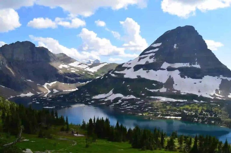
Hidden Lake Trail
5.1 miles round trip (to Hidden Lake)
1,335 ft total gain
Moderate
2-4 hours
July – September
Per NPS.gov, Hidden Lake Trail starts at Logan Pass Visitor Center and totals 5.1 miles round trip to the lake. The one-way distance to the overlook is about 1.3 miles, with roughly 529–551 feet of elevation gain to the overlook. The full walk to Hidden Lake drops nearly 795 feet from the overlook and raises total gain to about 1,335 feet.
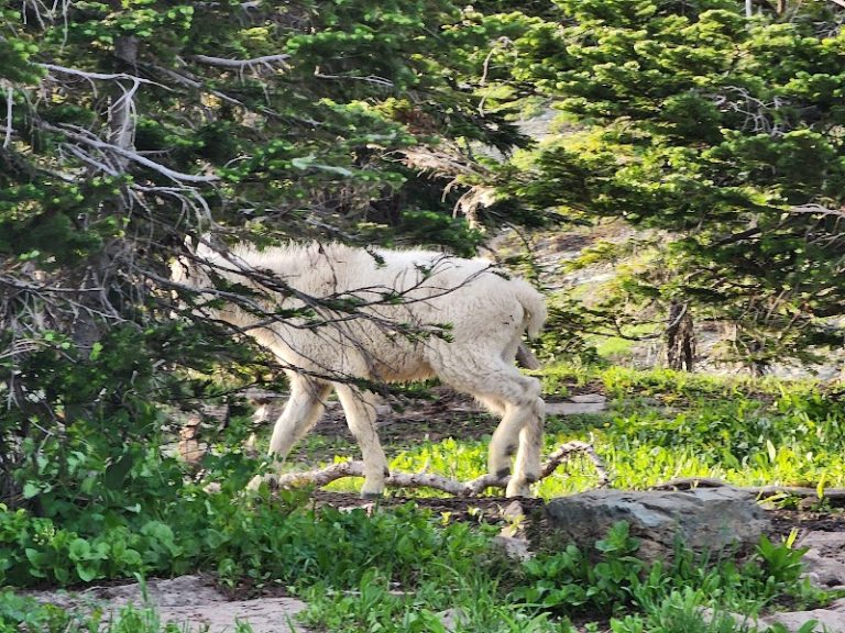
The route begins on a boardwalk and more than 200 stairs, then moves to gravel switchbacks. Views include alpine meadows, talus slopes, and turquoise glacial water. Expect mountain goat or bighorn sighting opportunities in talus fields. Trail times vary; park data lists 1.5 to 4 hours for typical parties. For our one-day itinerary, start this hike by 7:15 AM if you drove or hold a morning shuttle slot to avoid Logan Pass parking limits.
Visitors frequently mention strong winds and afternoon storms at the pass. Bring layers, start early, and factor in Logan Pass–s three-hour parking pilot during high season. Per NPS.gov trail notes, check current conditions before leaving a transit hub.
Sun Point Trail to Virginia Falls
0.4 mile loop (nature trail); 0.2–1.5 miles for extended options
50–103 ft (route dependent)
Easy
12 minutes to 1 hour
Sun Point parking lot (St. Mary area)
June – September
Sun Point Nature Trail offers quick lake overlooks and a short spur to Virginia Falls. Per park trail pages, the shortest loop is about 0.4 miles with minimal elevation gain. The longer route to Virginia Falls and the St. Mary Lake overlook extends to roughly 1.0–1.5 miles, with modest climbs totaling around 100 feet.
The trail suits photographers and quick-stop visitors. Expect sweeping views of St. Mary Lake and three waterfall waterfalls on the extended route. Review themes suggest families favor the paved short loop while photographers use the longer spur for sunrise shots. If Logan Pass or Hidden Lake is your main goal, consider limiting Sun Point to 20–0 minutes so you reach the pass before midday crowds.
Per NPS.gov, the Sun Point parking area fills quickly in July and August. If your schedule is tight, skip the falls option to save 30–9 minutes and use that time at Logan Pass or Avalanche Lake.
Avalanche Lake Trail
4.5 to 6 miles round trip
575 to 730 ft
Easy to Moderate
2 to 6 hours
Trail of the Cedars / Avalanche Creek Trailhead (Going-to-the-Sun Road)
June – September
Per NPS.gov, the Avalanche Lake route begins at Trail of the Cedars and ranges from 4.5 to 6 miles round trip depending on routing. The trail gains roughly 575 to 730 feet and features an accessible boardwalk portion for the first half-mile. After the boardwalk, the path climbs through old-growth cedar and hemlock to a steep moraine and the lake basin.
Visitors praise the waterfall and basin scenery. Expect cliff walls, hanging meadows, and tall firs framing the turquoise lake. Trail time varies; park trail stats list 2 to 6 hours depending on stops. For single-day visitors, Avalanche Lake fits if you can spare two to four hours. Compared with Hidden Lake, Avalanche Lake is lower elevation and often less windy. The trade-off is longer driving and potentially more crowding near Lake McDonald in peak months.
Per NPS trail advisories, the boardwalk is wheelchair accessible for a short stretch. Check current trail reports on NPS.gov before planning this hike into a one-day loop.
Trailheads, parking windows, and shuttle rules
Logan Pass parking is limited and now includes a three-hour limit in peak season, per park records and NPS.gov. Shuttle tickets to Logan Pass are ticketed-only pilots, with tickets sold on Recreation.gov, and a $1 processing fee per ticket. Plan arrival windows using these constraints.
From Apgar Village to Logan Pass, park records show the drive time is roughly 45–120 minutes depending on stops and traffic. From St. Mary Visitor Center to Logan Pass is about 30–100 minutes. These drive-time ranges assume Going-to-the-Sun Road is fully open. If sections are closed due to snow, you must alter timing or use local shuttle windows.
Per NPS.gov and Recreation.gov, shuttle tickets release in two windows. A portion releases 60 days ahead starting May 2, 2026, at 8 a.m. MDT. Remaining tickets drop nightly at 7 p.m. MDT for the next day from June 30, 2026. All passengers aged two and up need a ticket. For parking, park data and visitor patterns indicate arriving before 7:00 AM at Logan Pass yields the best chance of a lot spot. Consider staging at Apgar or St. Mary and using the express shuttle to avoid circling for parking.
Check the NPS conditions page for the latest road opening status and shuttle updates.
Which hikes are right? Compare time, distance, and scenery
| Name | Time | Distance | Gain | Scenery Type | Wildlife Chance |
|---|---|---|---|---|---|
| Hidden Lake Trail | 2-4 hrs | 5.1 miles RT | 1,335 ft | Alpine meadows, glacial lake | High (mountain goats) |
| Sun Point / Virginia Falls | 12 min – 1 hr | 0.4 – 1.5 miles | 50 – 103 ft | Lake overlooks, waterfalls | Moderate (birds, deer) |
| Avalanche Lake | 2-6 hrs | 4.5 – 6 miles | 575 – 730 ft | Old-growth forest, waterfall basin | Moderate (moose, bears occasionally) |
| Trail of the Cedars | 20-45 min | 0.6 mile loop | Minimal | Ancient cedar forest, accessible boardwalk | Low – moderate |
Decision grid to pick the best short hike for your one-day plan
When Should You Visit? Monthly access and road odds
Best time: July – September · Avoid: November – April (most high roads closed)
Moderate — noticeable crowds, short waits
High — busy, expect parking and trail congestion
Very High — peak season, reservations essential
Closed — area inaccessible or seasonally closed
Glacier one-day packing list: 20-35L daypack tempo options
Essentials (both tempos)
- Daypack (20–25L recommended; 35L for photography gear)
- 2 liters water per person
- Bear spray (read label and know how to use it)
- Sunscreen SPF 30+ and lip balm
- Snacks and a packed lunch
- Basic first-aid kit
Clothing
- Light base layer and insulating mid-layer
- Windproof rain shell
- Hiking socks and sun hat
- Warm hat and thin gloves for Logan Pass
Viewing & Photography
- Binoculars (8×42) for wildlife viewing
- Telephoto lens (recommended for photos)
- Spotting scope or tripod if photographing wildlife
- Spare batteries and memory cards
Safety & Navigation
- Park map or downloaded offline map
- Fully charged phone and power bank
- Headlamp if you may finish after dusk
- Permit copies or shuttle ticket confirmation
Park Entrance & Shuttle Tickets
All visitors entering Glacier National Park
$35.00 per private vehicle (7-day pass); $20.00 per person on foot/bike (summer)
Shuttle tickets release windows begin May 2, 2026, and nightly drops start June 30, 2026 on Recreation.gov
Shuttle pilot active during summer season (July–September peak)
Limited for Logan Pass shuttles; vehicle entry remains first-come except select managed closures
Buy shuttle tickets through Recreation.gov. Have alternate arrival windows and consider staging at Apgar or St. Mary to avoid lot closures.
Glacier National Park key stops map (optimized layers)
Markers show St. Mary Visitor Center, Logan Pass, Hidden Lake trailhead, Apgar Village, Avalanche Lake trailhead, and Lake McDonald Lodge. Toggle east–west order to pick fastest or most scenic.
Locations shown on this map:
- St. Mary Visitor Center
— Seasonal visitor center; shuttle pickup point on east side - Logan Pass / Hidden Lake Trailhead
— High-elevation trailhead; shuttle ticket required in summer pilot - Apgar Village
— West-side transit hub, lodging and boat tours start here - Avalanche Lake Trailhead (Trail of the Cedars)
— Boardwalk access; route to Avalanche Lake - Lake McDonald Lodge
— Historic lodge and access point for western shore stops
Visitor FAQs for a single-day plan
What can you do in Glacier National Park in 1 day?
Is Glacier worth visiting for one day?
What is the best way to see Glacier National Park?
How many days do you need in Glacier National Park?
Are dogs allowed on trails?
Is there water and cell coverage?
How do I handle parking if Logan Pass is full?
How We Researched This Guide
- NPS.gov – official park data, fees, trail pages, and conditions
- Recreation.gov – shuttle ticketing and reservation windows
- Weather.gov – monthly climate and forecast datasets
- NPSpecies / IRMA – documented species and biodiversity records
- Park visitation statistics – NPS IRMA visitor counts and campground records
Road openings depend on snow and avalanche control. Shuttle ticket windows shifted in 2026; fees may change. Always verify current conditions for your planned date.
Key takeaways for a one-day plan
Start very early and pick an east-to-west or west-to-east plan. Park data shows Logan Pass parking is limited, and shuttle tickets govern access during the summer pilot. Aim for a 7–9 hour fast day or a 9–12 hour scenic day.
If pressed, do one thing well: Hidden Lake at Logan Pass is the single best stop for high-alpine scenery in a day. Per NPS.gov, the Hidden Lake round trip takes 2–4 hours. Buy shuttle tickets via Recreation.gov for July–September travel.
- Best start time: arrive at staging hub by 6:00 AM to beat crowds and parking limits.
- Permit must-dos: carry a 7-day vehicle pass ($35.00 as of 2026) or individual entry fee.
- Packing priorities: 2 liters water, bear spray, layers, binoculars for wildlife.
- Seasonal caveat: full GTSR crossings typically open mid-June to mid-October; August has peak crowds.